
| 北欧諸国: デンマーク, フィンランド, アイスランド, ノルウェー, スウェーデン ヴァイキングと古ノルド語 • 歴史 • サーメ文化 • 冬 • アクセスする権利 • ボート遊び • ハイキング • 料理 • 音楽 • ノルディックノワール |
の中に 北欧諸国 の フィンランド, アイスランド, ノルウェー そして スウェーデン に適した大規模なまばらに人口の多いエリアがあります 荒野のバックパッキング 数日間のロッジからロッジへのハイキング、そしてノルウェーのほとんどの町や村の近くでさえ、高山へのハイキングを含む日帰りハイキングのエリア。北欧諸国には、アイスランドの火山からフィンランドの東部の森、ノルウェーのアルプス山脈からデンマークの穏やかな低地、スウェーデン南部まで、さまざまな風景があります。ザ・ 自然享受権、 とも呼ばれている アクセスする権利 または、スウェーデン語/ノルウェー語で allemansrätten/ allemannsretten (「すべての人の権利」)は、ほとんどの自然へのアクセスを誰にでも与えます。
冬には、目的地に応じて、1月から2月または10月から5月を意味する場合があります。 クロスカントリースキー 少なくとも多くの地域で長距離を移動する方法です。荒野のバックパッキングとバックカントリースキーは、多かれ少なかれ同じ活動と見なされています。ハイキングコースのある目的地では、冬にスキーコースがよくあります。
以下のアドバイスのいくつかは、自然の景観を探索する他の方法にも関連しています。
にとって フェロー諸島, グリーンランド そして スバールバル、彼らの主な記事を参照してください。
デンマークの原野地域は他の北欧諸国に比べて非常に狭いですが、国にはまだアウトドアライフの機会がいくつかあります。見る デンマークでの原始的なキャンプ.
| COVID-19(新型コロナウイルス感染症 情報: 予約なしでノルウェーの荒野の小屋に到着することはできなくなりました。フィンランドでは、施設は2020年春に閉鎖されましたが、再開されました。訪問者は、混雑した休憩場所を避け、衛生、距離などの推奨事項に注意深く従うように求められます。石鹸と消毒剤は提供されないため、自分で携帯する必要があります。 | |
| (情報の最終更新日は2021年2月2日) |
理解する

| “ | 彼は今来ている火の必要性を持っています、 ひざまで冷たくしびれました。 放浪者が切望する食べ物と服 リミーが倒れたのは誰だ。 | ” |
—ハヴァマール | ||
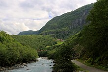
ノルウェー、スウェーデン、フィンランドを合わせると、100万平方キロメートルをはるかに超える面積をカバーし、オーストリアとスイスを合わせた面積の10倍になります。ハイキングエリアには、湿気の多い穏やかな大西洋のフィヨルドとノルウェーの海岸があり、スカンジナビア山脈の野生の高山の高峰から、広い高原と内部の深い森まであります。
ほんの数世代前、北欧諸国のほとんどの人々は田舎に住んでいました。人口が少なく、畑が乏しいため、林業、漁業、ベリー狩りは多くの人々に重要な補助収入をもたらしました。今日、ハイキング、釣り、ベリー摘みは、主に夏のコテージでの娯楽として、多くの地元の人々にとって休暇の不可欠な部分です。誰もが真面目なバックカントリーハイカーというわけではありませんが、かなりの数がいます。
北欧のアウトドアの伝統の1つである狩猟は、これが土地所有者である上流階級のために予約されていた国の多くの人々にとって奇妙です。北欧諸国では、森の大部分は常に農民によって所有されており、これらは時には重要な補完的な食料源として狩猟を行ってきました。田舎では地元の狩猟クラブの一員であることは普通です。荒野を表すフィンランド語、 erämaa、また、狩猟や釣り場を意味します。昔、人々は食べ物や毛皮を手に入れるために正確にトレッキングに行きました、そしてハイキングは少なくとも何人かのハイカーにとってこの伝統の痕跡を含みます。
遠隔地でさえ、本当に手つかずの状態になることはめったにありません。北部では、ほとんどの地域がトナカイの飼育に使用されています。ほとんどの保護されていない森林は林業に使用されます。実際には、ほとんどの人はこれにたまにしか気付かないでしょう。
特に北部では人口が少ないため、主要な観光地の近くを除いて、トレイルは非常に静かになります。トレイルの外では、都市の近くでもほとんど人が見えません。幹線道路の近くでは交通が聞こえるかもしれませんが、人口がまばらな地域ではすぐに無音だけが聞こえます。
気候と地形

地形の種類と気象条件は、ノルウェーの急な山からフィンランドのオストロボスニアのほぼ平坦な平原まで、大西洋岸の穏やかで雨の多い気候からフィンランド内陸のほぼ大陸性気候まで、そして南部の温暖な温暖な気候まで、大きく異なります。山の氷河と最北のツンドラへ。
ノルウェーの土地面積(農地、道路、都市)の5%未満が開発されており、その割合は他の国でも同様です。ノルウェーでは、面積の約50%が森林のないある種のオープンスペースであり、堅固な樹木のない地面や裸の岩が含まれます。30%以上が森林で、約5%が湿地と沼地です(特に東ノルウェー、トロンデラーグ、フィンマルク) 、5%は淡水(川と湖)で、1%は恒久的な氷または雪です。フィンランドでは、70%が森林であり、オープンスペースは主に湖と沼地で構成されていますが、最北端には大きな落ちたヒースエリアもあります。スウェーデンでも湿地が一般的です(面積の約20%)。アイスランドの約63%は不毛の風景であり、23%はある種の植生があり、12%は氷河に覆われ、3%は湖です。
天気予報サービスは一般的に質が高いですが、それを解釈するには現地の経験が必要な場合があります。風の状態は地域のトポロジーによって異なり、気温については多くの予報で平均日の最大値のみが示され、変動と夜間の気温を推定する必要があります。風は一般的に高くて不毛の山々と外海岸に沿って強くなります。特定の日の最高気温と最低気温の差は、天候に大きな変化がない限り、通常3〜15°C(5〜30°F)の範囲です。澄んだ空は通常、寒い夜を意味します。 7月の平均最高日気温は、場所に応じて約15°C(60°F)から約23°C(75°F)の範囲で、1月の高山では約氷点下から約-10°C(15°F)の範囲です。カウントされません。極端な気温は、夏の35°C(95°F)から北の内陸の冬の-50°C(-55°F)まで変化する可能性があります。
フィンランドの天気予報サービスと気候に関する情報は、 気象研究所 (スマートフォン)または フォレカ、ノルウェーの場合 気象庁と天気予報 アイスランドの場合 アイスランド気象庁.
この地域は偏西風と亜寒帯の国境地帯にあります。天気は特定の気象システムによって支配される場合があります。または、交互の天気を予測するのが難しい場合があります。大西洋岸の近く(つまり、アイスランドとノルウェーの近く)および高地では、天候の急激な変化が一般的です。

高山や氷河は一年のうちに訪れるのが難しい時期があります。標高を判断するときは、フィンランドとノルウェーの最北端の樹木限界が400mをはるかに下回る可能性があることを忘れないでください。ノルウェーとアイスランドの高山では、冬から6月にかけて雪が残り、夏の間は大きな雪が残ることがあります。徒歩で、ノルウェーの高山は一般的に夏の後半と初秋にしか訪れることができません(通常、7月から9月まで、訪問者は各地域の特定の情報を入手する必要があります)。
高山の表面はほとんどが非常に険しく、岩、岩、雪、氷河が緩んでいることがよくあります。ハイキングは通常激しいものであり、優れたブーツが必要です。この険しい不毛の表面は、ノルウェーではヨーロッパ大陸や米国のロッキー山脈よりもはるかに低い高度に現れます。海抜1000〜1500メートルでも高山の状態があり、夏の間は植生や雪原がほとんど残っていません。

標高が低いが樹木限界線より上では、歩きやすい落ちたヒースがよくあります。これは、フィンランドの最北端やスウェーデンの高山と森の間など、「低山」(lågfjäll)の典型的な地形です。樹木限界近くの湿った地形は、しばしばヤナギで厚く覆われています(サリックス)低木、通り抜けるのはかなり面倒です。谷はしばしば森林に覆われ、主に白樺の伐採がありますが、松や少し低い場所、松やトウヒの森もあります。
松林とトウヒ林は、北ユーラシア大陸のタイガ地帯の最西端にあります。タイガベルトは、フィンランドとスウェーデンの大部分とノルウェーの一部(特に東ノルウェーと一部の国境地域)をカバーしています。低地、特にフィンランドとスウェーデンの一部の地域では、広大な泥沼や沼地もあります。氷河期はエスカーを残し、それは風景にいくつかの地域で独特のローリングキャラクターを与えます。氷が去ったとき、南フィンランドとスウェーデンの多くは海面下にあり、岩盤は低い丘でもしばしば見られ、十分な土壌が蓄積した場所に木が生え、丘の頂上にまばらな森を与えています。一部の地域を除いて、土地のごく一部だけが農地です。森林が優勢ですが、その多くは林業に使用されており、多くの伐採地があります。古い森はあちこちに見られ、困難な地形や道路や川から十分に離れた広い地域によって救われています。
標高と地形


標高が最も高いのは、ノルウェーの最南端からノルウェー中部、スウェーデンとの国境地帯を通り、スカンジナビア半島の西部にあります。 トロムス そして フィンマルク 最北端の郡。これらの標高は、しばしばスカンジナビア山脈と呼ばれます。最高の頂上はノルウェーの ヨートゥンヘイム、最高峰は2469mです。ノルウェーの約200のピークは、2000mを超えています。主にヨートゥンヘイムにありますが、 ロダン そして Dovrefjell。スウェーデンの最高峰は ラップランド ノルウェーとの国境近くにあり、2000mを超える山がいくつかあります。アイスランドの最高峰は アイスランドのインテリア そして 南アイスランド、2000mを超える1つのピーク。ノルウェーの低地は主に谷と海岸に限定されています。一般的に、標高が高いということは、特にノルウェーの大西洋岸に沿って、巨大なフィヨルド( ソグネフィヨルド)とのように海から直接上昇するそびえ立つピーク ロフォーテン。ただし、標高が高く、地形がより穏やか(高原)である場合があります。 ハルダンゲル高原 高原、 Dovrefjell、東ノルウェーの大きな谷とフィンマルク高原(内部)の間の長い高地 フィンマルク 高原)。最北端の気候は寒いため、フィンマルク高原やその他のフィンマルクの標高は、海抜300〜500メートルでもかなり不毛です。
西部とは異なり、 フィンランド 森林やオープンレンジのある穏やかな地形が特徴です。フィンランドの最高標高は約1300mのみで、海抜1000mを超える山々は、フィンランドの北西端にある「腕」にのみ見られます。東部のいくつかの例外を除いて、南に300mを超える山に遭遇することはめったにありません。 ラップランド。一方、フィンランドの多くは湖や小川に覆われています。
フィンランドと比較して、 スウェーデン 丘陵地帯であり、ストックホルム-オスロ線の北にあるものの多くは、主要都市のない森林に覆われた荒野です。最後に スカニア、スウェーデンの最南端は、デンマーク、オランダ、またはドイツ北部を思い起こさせます。基本的にはパンケーキのように平らで、その多くは農地です。
アイスランドはノルウェーと同様に不毛です。アイスランドの最も高い標高は、アイスランドの内部と北アイスランドのTröllaskagi山脈にあります。アイスランドの他の場所では、標高は600メートル未満です。
山

ノルウェー語では、「山」(「fjell」)は主に樹木限界線より上に達する標高を指します。はっきりとしたピークのない、それほど急ではなく、比較的水平な、樹木のない高原は、しばしば「vidde」と呼ばれます(以下のリストには、たとえば北の広いフィンマルク高原などの高原が部分的に含まれています)。
スカンジナビアの山々は、地図のように大まかに細分化することができます。
- A&B:北極の山々
- ケブネカイセを含む、 サレク国立公園, リンゲン アルプス、 ロフォーテン、スヴァルティセン氷河、 ナルビク, Käsivarsi荒野エリア
- C:中央国境高地(ノルウェーとスウェーデン)
- D:フィヨルドの範囲
- E:中央の山
- 含む ロダン-Dovrefjell, ヨートゥンヘイム (北ヨーロッパで最も高い)
- F:サザンハイランズ
季節
夏のハイキングシーズンは、北部と高山を除いて、通常5月中旬から9月上旬で、6月に始まり、一部の地域では7月に始まります。この時期のハイキングはほとんど簡単で、準備、スキル、装備の必要性は他の時期よりも少なくなりますが、目的地によっては依然として厳しいものもあります。夏の蚊や小虫のほとんどは、多くの地域、特に6月下旬から8月にかけての北部の樹木限界線の下で迷惑になります。 8月の夜は暗くなり、子供たちは学校に戻り、いくつかの観光施設は冬の間閉鎖されます。
初秋(主に9月)は ルスカ、葉が赤と黄色に変わるとき、特に美しい光景 ラップランド そして フィンマルク (しかし、期間はしばしば短いです–冬は早く来ることができます)。多くの地元の人々は、キノコとリンゴンベリーを選ぶために出かけます。これは多くの場合、素晴らしいハイキングシーズンです。霜が夜に現れ、最初の降雪が月の終わりに現れるかもしれませんが、日は一般的に穏やかです。虫はほとんどいなくなり、空気は通常サクサクしています。一方、晩秋(10月〜11月)は、ほとんどの訪問者にとって最適な季節ではありません。暗くて雨が多く、降雪量は少ないですが、確実な積雪はありません(スキーリゾートは営業していますが、人工雪に依存することがよくあります)。 。 11月には、フィンランド南部でも気温が-15°C(5°F)以下に下がることがあります。
真冬には、北には日の出がまったくなく、極寒になる可能性があります。南でも日が短い。ファーザークリスマスの故郷で北極の夜やクリスマスを体験したいと思うかもしれません(フィン人は彼がラップランドに住んでいて、英国人の大群が彼を訪ねてくると信じています)。それ以外の場合は、冬のハイキングに南の2月または北の早春を好むかもしれません。スキーリゾート施設を利用する場合は、冬休みのピークに注意してください。あなたはいくつかのタイミングで掘り出し物を得るかもしれません。も参照してください 北欧諸国の冬.
春は多くの地元の人々にとても愛されている季節です。日は明るく、太陽は強く、自然は目覚めています。荒野でのハイキングは厳しいものになる可能性があり、ここには深い雪があり、裸地があり、水がたくさんありますが、多くの目的地は問題ありません。北と高山では、6月はまだ小川の雪と高水が溶ける時期であり、高山では7月以降も雪が続く可能性があります。腐った雪と高水は、他の場所で初夏に影響を受けた地域でのハイキングを困難にします。その後、残りの雪はしばしばコンパクトになり、歩くのに十分な硬さになります。
ノルウェーの高山では春が特に遅く、6月でも一部の地域はスキーでしかアクセスできません。これはノルウェー語などの山に当てはまります ヨートゥンヘイム そして ハルダンゲル高原、6月まで雪が続く可能性があり、夏の終わりまで雪の大きな斑点が残る可能性があります。フィンランドでも真夏のスキー大会があります( キルピスヤルビ)。ノルウェー人は、スキーを続けられる場所までスキーを持って徒歩でハイキングをします。
自然享受権

基本的なすべての人の権利(アクセスする権利、自由に歩き回る権利)は、徒歩、スキー、またはボートで自由に歩き回る権利、テントに一晩滞在する権利、食用のベリーやキノコを選ぶ権利です。荒野以外の地域では、権利が適用される地域は国によって多少異なります。アイスランドでは、道路から離れた閉鎖区域への立ち入りには、土地所有者の許可が必要です。詳細も同様です。権利(より正確には、土地所有者が禁止する権利の欠如)には、思いやりがあり、特定の法律に違反したり、危害を加えたり(作物が育っている畑を歩いたり、ゴミを残したり、門を開けたりするなど)を許可しないという期待が伴います。邪魔な住民や野生生物。一部の詳細は法律で成文化されていますが、多くは解釈次第です。訴訟はまれです。
国立公園やその他の「公式」の目的地を訪れるときは、特定の地域の説明を読んでください。ほとんどの場合、提供されるサービス(指定されたキャンプファイヤーやキャンプ場など)は、地域の制限を補います。トレイルが提供されている場合は、トレイルをたどることをお勧めします(必須の場合もあります)。
見る アクセスする権利 より徹底的な議論とおそらく特定の国のガイドへのリンクについては。
火
- 参照: キャンプファイヤー
火をつけるときは常に注意する必要があります-それが何を意味するかを知っていることを確認してください。常に監視し、注意深く消火する必要があります。特に北欧諸国で普及しているスプルースは、多くの可燃性物質を生成します。可能であれば、指定されたキャンプファイヤーサイトを使用してください。岩(ひびが入る)や泥炭(確実に消火するのが難しい)に火をつけないでください。スウェーデンでは、注意している限り、許可は必要ありません。アイスランドでは、山火事やその他の被害のリスクがない保護地域の外での火災が許可されています(ただし、薪はほとんどありません)。ノルウェーでは、4月15日から9月15日まで、森林、建物、その他の可燃性物質から十分に安全な距離にある場合、または公式に指定された場所を除いて、火災の発生は一般に禁止されています。フィンランドでは、直火には常に土地所有者の許可が必要ですが、北部では、国有地の多くに一般的な許可があります(対象地域と条件を確認してください)。火事を許可されているからといって、必ずしも薪をとる権利があるとは限りません。木や美的または生態学的に価値のある丸太を傷つけないでください。アイスランドでは、木材は特に希少な資源であり、正式には許可されていないが、他の国で害を及ぼさない(したがって受け入れられる)ものは、そこでは間違いなく悪い可能性があります。緊急時には、あなたはあなた自身の判断を使用します。
特に乾燥した状況では、屋外での直火(使い捨てグリルなどを含む)が全面的に禁止される場合があります。フィンランドでは、このような禁止は夏に一般的であり、ほとんどの天気予報で「森林火災の警告」として地域(ラップランド:自治体)によって宣伝されています(metsäpalovaroitus/varningförskogsbrand)。春には、山火事の警告が出される可能性があります。これはそれほど深刻ではありませんが、それでも注目に値します。キャンプ用ストーブは直火とは見なされませんが、山火事を起こす可能性が非常に高いため、(および使用済みのマッチに)注意してください。スウェーデンでは、禁止は一元的に宣伝されていません。禁止は、通常、地域または地方自治体レベルで、緊急サービスによって決定されます。
国立公園などには、薪が無料で提供されているキャンプファイヤーサイトがあります。一部の大規模な国立公園や荒野では、近くにキャンプファイヤーの場所がない場所で発火が許可される場合があります(その地域の規則を確認してください)。過度に大きな火を起こさないでください、しかし薪を控えめに使用してください。薪の中には既製のものとそうでないものがある場合、または屋外にあるものがある場合は、使用するものではなく、新しい薪を作って屋内に持ち込む必要があります。あなたは通常、自然から補充するべきではありません。特にもっと離れた場所では、その目的のために斧とおそらくのこぎりがしばしばありますが、あなたは自分のものを持ち歩きたいかもしれません。優れたナイフは基本的なサバイバルギアであり、マッチするように、防水パックされたスペアを使用して、これ以上のハイキングで運ぶ必要があります。

困難な状況で火をつけるために、3種類の火口のいくつかが通常森で利用可能です:トウヒの木の低い死んだ乾燥した小枝(簡単に折れるものだけを取ります-トウヒは簡単に感染します)、樺皮(樹皮に似ていない)他の木のそれ)または樹脂の松の木。 3つは異なる技術を必要とするので、それらを使用する前に、材料を取ることが害を及ぼさない場所で訓練してください。トウヒの小枝を使用するには、十分な量の細かい材料と、十分な空気と十分な熱の間の適切な妥協点が必要です(手を使用する必要がある場合があります。火を尊重する必要がありますが、恐れることはありません)。白樺の樹皮を使用するのは簡単ですが、それがどのように動作するかを確認してください。ナイフはそれをより大きな断片で木から取り除くのに役立ちます。松の場合、重要なのは十分に細かいスライスを用意することです。火口として使用できる松は、新鮮なカットの香りと、長く死んでいるが腐っていないことによって認識されます。多くの場合、崩壊した苔で覆われた切り株の硬い部分として認識されます(目を訓練してください!)。乾燥した木材がない伐採された白樺の森では、白樺の木材を十分に薄く分割し、火を起こすために非常に薄くする必要があります(より厚い薪を使用して蚊を寄せ付けず、乾燥させた後足りる)。樹木限界より上では乾いた小枝を使うことができますが、十分な乾いた薪を手に入れるのは難しいかもしれません。
光
北緯のため、太陽は一年のほとんどの日と夜の両方で地平線のかなり近くをさまよっています。トワイライトは赤道近くよりもはるかに長く続き、南では30分以上、北極の夜(日光なし)では数時間続く可能性があります。
晩秋と初冬の日光は限られており、ハイキングに利用できる時間は、少なくとも密林、起伏の多い地形、オリエンテーリングが難しい場所、特に晩秋には空が曇ることが多いため、非常に限られています。冬には、雪は星でさえ夜にいくらかの光を与えるのを助けます、それはあなたがそれに慣れれば簡単な開いた地形で十分かもしれません–月光は十分に感じるかもしれません。
5月から7月まで、この地域全体の夜はかなり明るくなります。有る 真夜中の太陽 極北では1か月半、真夏の南でもほんの数時間の(比較的)暗闇でした。 8月までに夜は暗くなり、晩秋には雪が降る前に非常に長い暗い夜があります。
夏の高地では、きれいな空気、湖や雪原からの反射、植生が少ないため、太陽光線が非常に強くなる可能性があることに注意してください。
人
.jpg/220px-Amanda_Delara_(29519019388).jpg)
インフォメーションセンターやホテルなどのスタッフは通常英語に堪能で、観光客向けの情報はほとんど英語でも利用できます。大規模な観光名所やホテルなどでは、通常、複数の言語に堪能な人員がいますが、家業では、高齢者は母国語を除いて必ずしも流暢であるとは限りません。ただし、ほとんどの場合、英語で生き残ることができます。ゴアティで生まれたサーミ人に出会うかもしれませんが、いくつかの外国語を流暢に話します。
スカンジナビア諸国の北は、 サーミ人;彼らはいくつかの自治体では過半数であり、他の自治体では大きな少数派です。半世紀前の言語政治のために、多くのサーメ人は話しません サーミ人、しかし多くの人がそうします、特にフィンランド最北端とスウェーデンのラップランド、そしてノルウェーのほとんどで フィンマルク。彼らはまた、国の大多数の言語を話し、国境によって、おそらく隣国の言語を話します(スウェーデン語とノルウェー語も相互に理解できます)。スウェーデン語でフィンランド語の方言(メアンキエリ、クヴェン語、大多数の言語に加えて)を話す大規模なグループがあります トルネダレン フィンマルクの一部で。
の群島で ウーシマー、南部 群島海, 土地 との海岸 ポフヤンマー スウェーデン語は伝統的な言語です。あなたはフィンランド語または英語で生き残るでしょうが、スウェーデン語を話す人々はあなたがフィンランド語で彼らに挨拶しようとしていることにあまり感銘を受けないかもしれません。
ラップランドやフィンランド列島など、人口の少ない地域では、観光は多くの人にとって重要な補助収入です。小規模な家族経営の企業は、必ずしもインターネットや観光パンフレットに広告を掲載しているわけではありません。あなたは目を開いたままにして、地元で尋ねなければなりません。
目的地

- 新参者は火が必要です
- その膝はしびれ凍っています。
- 男性が必要とする肉と清潔なリネン
- 誰が山を越えてやってきたのか... – ハヴァマール
自然享受権により、多かれ少なかれどこにでも行くことができます。国のすべての地域で一般に公開されている森林または他の種類の自然があります。荒野のバックパッキングが好きな人や、数日間道路を離れたい人は、フィンランド北部の内陸部、ノルウェー、スウェーデン、ノルウェー中部の山々(Jotunheimen、Hardangervidda、Dovre)のすぐ東など、人口の少ない地域を探すかもしれません。 )、フィンランド東部とアイスランドの内部。いくつかの場所では、道路を見ずに一方向に多かれ少なかれ百キロ歩くことができます。
ノルウェーには、国中に日帰りハイキングやより長いトレッキングのためのトレイルがあります。他の国では、森の中を散歩したり、ベリーを摘んだりするのに適した未開発のエリアもどこにでもありますが、より長いトレッキングに適したトレイルや他のルートについては、通常、地図をもう少し勉強するか、ある程度の距離を移動する必要があります適切なトレイルヘッド。
北欧諸国の荒野のバックパッキングは、インフラストラクチャがまったくない状態でのハイキングを意味する可能性があることに注意してください。これは多くの人が求めるものですが、自分のスキルに疑問がある場合は、適切なルートを選択してください。利用可能な妥協のすべてのレベルがあります。
最高のハイキングや風景は、必ずしも国立公園や自然保護区にあるとは限りません。ただし、最初に「公式」またはその他の有名な目的地を検討する価値があるかもしれません。これらの目的地は、最も価値のある自然のいくつかと最高の風景のいくつかをカバーしています。これらの情報やサービスを見つけるのも簡単です。
異なるタイプの保護地域が互いに混ざり合うことがあります。たとえば、国立公園内に厳しい制限のあるエリアや、公園外の制限の少ない境界ゾーンが存在する場合があります。ハイカーにほとんど影響を与えない保護地域もあり、主に土地所有者と計画当局の行動を制限しています。
フィンランドでは、国立公園、原野地域、その他の目的地のいくつかは、目的地とハイキング全般に関する情報を持っているフィンランドの林業局であるメッツァハリトゥスによって維持されています。 Nationalparks.fi。情報はカスタマーサービスポイントや国立公園のビジターセンターでも提供されており、小屋のベッドを予約したり、釣り(または狩猟)許可証を購入したりできる場合があります。また フィンランド国立公園 ほとんどの「公式」目的地に関する情報があります。
ノルウェーでは、 トレッキング協会 全国各地の多くの小屋(山小屋)の間にトレイルを維持しています。
国立公園

ノルウェーでは、「国立公園」は主に未開発地域の保護された状態を示します。公園の外では、ハイキングや景色も同様に素晴らしいことがよくあります。国立公園はしばしば「保護された風景」のゾーンに囲まれています。これはハイカーの観点から、最も興味深く、通常は最もアクセスしやすい荒野です。
そうでなければ、国立公園が最も明白な目的地です。それらは特に見る価値のある性質をカバーし、サービスは通常簡単に利用可能であり、ほとんどは大騒ぎせずに到達可能です。通常、ビジターセンターの近くには短いトレイルがあり、日帰り旅行や経験の浅いハイカーにとって、典型的な自然のいくつかをすばやく見るのに適しています。大きなものには、自分の道を歩きたい人のための遠隔地もあります。他のいくつかの国での慣習とは異なり、国立公園には道路、柵、警備員がありません。ノルウェーでは、トレイルとロッジしかありません。
国中に国立公園があり、ほとんどの種類の野生の(そしていくつかの耕作された)風景をカバーしています: フィンランド国立公園, スウェーデン国立公園, ノルウェー国立公園, アイスランド国立公園.
ビジターセンター(「naturum」、「nasjonalparksentre」)は、公園自体からかなり離れている場合があり、地域の自然や文化を紹介するのに役立ちます。事前に確認する価値のある映画、ガイド付きツアーなどがあるかもしれません。一部のセンターは、シーズン外に閉鎖されているか、まったく人員が配置されていません。
レクリエーションエリア
多くの場合、レクリエーションエリアは国立公園よりも簡単にアクセスでき、制限が少ない場合があります。それらの多くはハイキングに適していますが、ほとんどの国立公園よりも小さく、最も雄大な景色を提供することはめったにありません。
フィンランドでは 国立ハイキングエリア メッツァハリトゥスによって維持されています。
ほとんどの町には少なくともいくつかのレクリエーションエリアがあり、通常はローカルバスまたは町の中心部から徒歩で行くことができます。いくつかの町の外には、広範囲にわたるハイキングの可能性があります。例えば周り オスロ 地下鉄や市内バスの到達範囲内に、手入れの行き届いたトレイルや小道(一部はライト付き)のある広い森があります。 ベルゲン 市内中心部の隣にはいくつかの山があります。
ほとんどのスキーリゾートなどの周辺には、ハイキングやスキーのルートがあります。時々彼らは国立公園のトレイルネットワークに接続します。
自然保護区

自然保護区は一般的に最も厳格な保護形態を持っており、特定の保護区の規則を事前に確認する必要があります。それらは、自然を保護するために、それ自体のために、そして研究のために作成されています。通常、大きなものを通るハイキングトレイルがあり、保護地域の外にいくつかの宿泊施設やキャンプ施設がある場合があります。それらは非常に特別なまたはよく保存された性質を包含するかもしれません。それらはほとんど国立公園よりも小さく、(トレイルのあるもの)通常は日帰り旅行や1日のハイキングに適しています。トレイルからの逸脱は、冬季または営巣期外に許可されることがよくあります。
荒野地域
フィンランドの荒野地域 法律で定義された遠隔地であり、インフラストラクチャの構築や、従来の取引(トナカイの飼育、狩猟、家庭のニーズのための木材の採取など)以外の搾取には厳しい制限があります。ステータスはハイカーに直接的な影響はほとんどありませんが、既製のトレイルを望まない人にとっては興味深い目的地です。この地域はトナカイの飼育にとって重要であり、漁師がいるかもしれませんが、ほとんどの場合、おそらく数日間は一人でいるでしょう。この地域にはいくつかの小道や荒野の小屋があり、通常は近くにいくつかの観光サービスがあります。小さなゲーム(シーズン中)を狩るためのライセンスは通常利用可能です。例については、を参照してください。 Käsivarsi, Pöyrisjärvi そして Muotkatunturit.
非公式の目的地
あなたはあなたが望むどこでも多かれ少なかれハイキングするかもしれません。 「公式」の目的地を使用しない通常の理由は、他の方法で滞在している場所や通りかかった場所の近くでハイキングやローミングをしたいということです。大きな町の近くでさえ、通常、かなり手付かずの自然がたくさんあります。地元の人々は、国立公園やその他のハイキングエリアなどの「公式」の目的地を区別しないことがよくあります。自然享受権は、庭や耕作地などから離れている限り、楽しむことができます。人に会うときは思いやりと礼儀正しく、他人の邪魔をしないようにしましょう。
ほとんどの国(ノルウェーの約95%)は、一般の人々がハイキングを許可されているある種の荒野です。 Even in such wilderness there may be occasional roads reserved for logging, hydro power construction or power line maintenance. In Finland such roads are common in unprotected areas and provide easy access for berry pickers and hikers alike, while ruining the feel of wild nature – choose routes where the forestry roads (and clearings) are not too common. In Norway there are in addition many roads to summer farms (seter) in the forests or mountains or to abandoned farms. Such roads may not be open to public traffic and are usually dead-end roads with minimal traffic. Seters are usually hubs for hiking trails in the area.
ハイキングコース

Trails are often meant for use either in summer or in winter. When using them outside the intended season it is important to check the viability of the route. Winter routes are usually meant for cross-country skiing and may utilise the frozen lakes, rivers and bogs, while summer routes may have all too steep sections, go through areas dangerous in wintertime or simply be difficult to follow when marks are covered with snow. When evaluating the route, make sure you understand whether any descriptions are valid for the present conditions. Local advice is valuable.
Usually deviating from trails is allowed, except in nature reserves and restricted parts of national parks, although not encouraged in sensitive areas or areas with many visitors. Many experienced hikers prefer terrain without trails, at least for some hikes.
In addition to hiking trails at separate destinations there are some long distance hiking trails and hiking trail networks connecting nearby protected areas and recreational areas. They usually follow minor roads some or most of the distance, going through interesting natural surroundings wherever possible and sometimes passing by villages and tourist attractions, where you might be able to replenish. Lengths vary from suitable for a one day hike to the extreme European long distance paths. The longest routes are usually created by combining trails of different trail networks, which increases the risk of some parts not being well signed or maintained. There may even be parts missing. As hiking on other persons' land is perfectly allowed, you can make your own adjustments to the routes, but this may sometimes mean walking by a road or through unnecessarily difficult terrain.
On combined trails or trails that pass borders (between countries, municipalities or areas with different protection status), it is quite common that the markings or the maintenance standard change. Check that the same agent is responsible for the trail all the way or be prepared for it to change character. This is no problem if you have the equipment and skill to continue regardless, but can be problematic if you made your decision based on what the first part looked like. The character of the trail can change also for other reasons, such as leaving for the backwoods, reaching higher mountains or crossing mires.

In contrast to many trails in continental Europe, the hiking trails seldom go from village to village, but tend to mostly keep to non-inhabited areas. There is usually no transport (for instance for luggage) available. Where the trails follow traditional routes (from the time before the cars), they usually do so in the wilderness, where few villages are to be found. Newer trails have usually been made for exploring the natural landscape, not to connect settlements. Many trails lead from permanent settlements to shielings (summer farms, seter in Norwegian, fäbod in Swedish, karjamaja in Finnish) in the forest or in the high valleys, then onwards to pastures further into the uplands, high plateaus or high valleys. In Norway, such shielings are often starting points for hiking trails at higher altitudes, DNT lodges are often found at old shielings.
There are trails usable with wheelchair or prams, but this is not typical. Many trails follow quite narrow and rough paths. Even trails that start wide and smooth may have sections that are muddy (possibly with duckboards) or narrow, steep and rocky. This is true also for some very popular trails, such as the one to Trolltunga. Check, if this is important for you.
DNT maintains some 20,000 kilometres of summer trails in Norway. In the fells these are usually marked with cairns, some of which are marked with a red "T". In woods, markings are often red or blue stripes painted on trees. Winter routes and routes where the cairns would be destroyed in winter often have poles instead, also these usually with a red mark. Note that new or little used trails may be less worn than other paths leading astray. Winter routes are often marked with twigs instead of permanent marking, before the main season in spring. Markings in Finland and Sweden follow somewhat different standards.
The DNT trails are also classified: green trails do not require special skills and are often short (those suitable with wheelchair or pram are specially marked as such), blue trails require some fitness and basic skills, red trails require experience, fitness, good footwear and adequate equipment, while black trails can also be hard to navigate. Metsähallitus in Finland has some years ago started with a similar classification (with red and black combined and less emphasis on fitness, as the terrain is less demanding there).
In addition to the classification, DNT gives height profile and estimated time for the trails. The times are calculated for a fit and experienced hiker, excluding breaks – add considerable time to get a realistic estimate of total time needed.
There are three hiking routes in the Nordic countries that belong to the European long distance paths network (long sections are missing or unmarked at least in the Finnish parts):
- E1 hiking trail runs from Italy through Denmark and southern and middle Sweden to ノールカップ in Norway
- E6 hiking trail runs from Turkey through Denmark, southern Sweden and Finland to キルピスヤルビ (the north-west tip of Finland by the Swedish and Norwegian border). You can continue by the Nordkalottleden.
- E10 hiking trail runs from Spain through Germany and Finland to Nuorgam (the northern tip of Finland, by the Norwegian border).から Koli National Park に Urho Kekkonen National Park in Finland the route is known as the UKK route.
ザ・ Nordkalottleden/Nordkalottruta trail (800 km) goes through Sweden, Norway and Finland offering versatile northern fell landscape, with easy to travel fell highlands, lush birch forests, glaciers and steep-sided gorges.
ザ・ Padjelantaleden trail (140 km) and Kungsleden trail (440 km) meander through the national parks of Swedish Lappland, one of Europe's largest remaining wilderness areas.
Some Finnish trails are described by Metsähallitus. For trails at specific destinations, see that destination. There are also trail networks maintained or marketed by municipalities and other entities, such as the Walks in North Karelia 通信網。
Gear

For a basic idea about what to pack, have a look at packing for a week of hiking, 荒野のバックパッキング そして 寒波.
Good quality hiking equipment is available in many specialist shops, the largest probably being Partiovaruste / Scandinavian Outdoor Store, owned by a non-profit Finnish Girl and Boy Scout foundation. Such specialist shops should also be able to give good advice. Some equipment is available for rent at some destinations, especially if you are using a guide.
Every hiker must be familiar with the proper equipment for various seasons and areas as well as their style of hiking. In the Nordic area, choosing the right equipment may be particularly challenging outside the warmest summer and for the higher mountains.
Pack so that your spare clothes and outs won't get wet in rain and moist. Most backpacks are water repellent, but few if any are water resistant. Many have an integrated "raincoat", for others one is available as an add-on. Using plastic bags or similar inside the backpack is wise.
通年
- Map – 1:50,000 standard topographical maps with trekking info are generally recommended; 1:25,000 are available for some areas and give greater detail, necessary for hikes in forests, where sight is limited; 1:75,000 and 1:100,000 are usable for good trails but may not give enough details in rough or steep terrain
- Compass – you want robust, low-tech navigation
- First aid kit
- Bottle(s) for water – e.g. used mineral water bottles
- Sunglasses – in summer, on snow and at high altitude
- Sunscreen – particularly at high altitude and where there is sun and snow
- Sleeping bag, hiking mattress and tent – on overnight hikes, unless you know you will get by without
- Food, snacks
- Camping stove – on any longer hike
- Cutlery etc.
- 一致する
- ナイフ – carrying a knife in a public place is illegal, unless you have a good reason, carrying it together with camping equipment is acceptable.
- Repair kit covering any essential gear (by your definition of essential on the hike in question – knife, rope and tape will get you a long way)
- Fabric in bright colour, such as a reflexive vest, to aid finding you if need be. Can be your tent, backpack or similar.
- オプション
- satellite navigator (GPS) – not a substitute for map & compass
- Mobile phone (pack watertight and keep off most of the time)
- Binoculars
- Torch, candles: seldom needed in the white nights, but at least in autumn and winter a light source may be needed in the night; many wilderness huts lack electricity
- Towel (light)
- Nordic walking poles, walking staff or similar, to aid in keeping the balance in rough terrain and while fording
夏

On short hikes or in easy terrain you may get by without some of these. The right foot wear is the most important for a successful hike.
- Foot wear:
- Jogging shoes are acceptable on tractor roads and other smooth trails in the lowland
- Rubber boots are good in wet terrain, unless the terrain is too rough for them
- Hiking boots with ankle support and a sturdy sole on rougher trails and in some terrain off trails; some people prefer lighter footwear also on rough ground, do as you wish if you are sure-footed and have strong ankles
- Gaiters or tall (military style) boots useful in muddy areas, after snow fall or in areas with dense low bushes
- For steep hills, on very rocky surface, with crampons or heavy backpacks, stiff, durable mountain boots often needed
- Trousers:
- Flexible, light hiking/sport trousers in synthetic material is useful for most conditions, preferably water repellent, if you have two pairs one pair should probably be suitable for hot weather
- Shirt on body:
- Cotton or synthetic on warm days
- Wool or similar on cool days/high altitudes
- Walking staff can be useful in rough terrain and for fording, Nordic walking sticks also serve some of these needs
- In the backpack
- Mosquito repellent (for the warm season, particularly in the interior), in some areas a mosquito hat is very much recommended
- Wool underwear
- Shirt/jumper (wool or microfleece)
- Wind proof, water repellent jacket
- Raingear (on short hikes the jacket may be enough, on some hikes the raingear should be heavy duty)
- Head cover (for rain, warmth, sun and mosquitoes)
- Neck cover (in high altitude for all but the shortest hikes, otherwise probably not necessary)
- Light gloves/mittens (high altitude, also otherwise if weather can become cold)
- Light footwear for the camp (to let the foots rest and the heavy duty boots dry), possibly also for fording
冬


Already 15 cm (half a foot) of snow makes walking arduous, and much more is common also in the south, in some areas more than two metres (6 feet) is possible. Walking is thus a serious option only around your base or camp, at much used trails (do not spoil skiing tracks!) or if you know there will be little snow. In addition, in early Winter (November-December) there is little or no daylight. On Norway's Atlantic side heavy snowfalls are common, particularly a bit inland and uphill. Several metres of snow has been recorded along the Bergen railway (near Hardangervidda)。 In the city of トロムソ the record is more than two meters, in the month of April, more than a metre heavy snow is common. The deep snow typical in Western Norway and Troms county is often heavy and sticky, making hiking really difficult.
Snowshoes probably work as well here as in Canada, and there are snowshoe trails at some destinations, but they are much slower than skis in most Nordic conditions.
This means クロスカントリースキー are necessary for most Nordic winter hiking. Depending on conditions you may get away with skis meant for track skiing, but if you are going to ski off tracks, "real" cross-country skis are much better. There are many options though, mostly depending on whether you are going to mountainous terrain and whether deep loose snow is to be expected. Also check what possibly breaking parts there are, and whether the skiing boots are suitable for all conditions (warm enough etc.).
For clothing, advice for 寒波 適用します。 You should have light enough clothing not to get too sweaty going uphill (especially important when it is cold, as you will not get dry easily), but also warm enough when having sought shelter for a snow storm.
いくつか portable stoves fare badly in really cold conditions. Check that for yours.
Some mobile phones fare worse in cold weather than others. Having the phone off in a sealed bag close to your body protects it and its battery, but it might still not work when needed.
When the sun comes out in earnest, i.e. after midwinter, be careful about snow blindness and sunburn. Mountain goggles are good also in some windy conditions (the snow carried by strong wind sometimes feels like needles).
Most people hiking in winter in the north or in the mountains stay overnight indoors, at wilderness huts. In severe weather it may however be hard to get to the hut, and in some areas there simply are no huts where you would need them. If you might have to sleep outdoors, make sure your equipment is good enough. Some tools for digging snow can come handy. In the south, where temperatures are comparably manageable, even quite cheap winter sleeping bags are enough, at least in mild weather or when sleeping by a fire at a shelter.
Remember that the unmanned huts are usually heated by wood, and it may be as cold indoors as outside (even colder, if temperatures have risen) when you arrive. It will take some time and labour before it gets warm – and if your matches got wet you won't be able to light the fire (unless you find some hidden away in the hut). A good knife, matches, torch and candles are important equipment.
For areas where avalanches are possible, and on glaciers, special equipment is needed.
入れ

From most towns there is some hiking terrain in reach by local bus and by foot. Here is some advice for more remote destinations, such as most national parks.
コーチによる
There are usually coach connections with stops near your destination. Watch out for express coaches that may not stop at your stop. Connections that start as express may stop at all stops in the far north.
Some destinations do not have direct coach connections. There might be a school bus, a regular taxi connection or other special arrangements to use for the last ten or twenty kilometres.
車で
- 参照: スウェーデンでの運転, ノルウェーでの運転, アイスランドでの運転

There are usually parking areas near the starting points of hiking routes in national parks and at similar destinations. You might, however, want to consider leaving your car farther away and use local transports, to be freer to choose the endpoint of your hike. On the other hand you can drive your car on minor roads without coach connections and stop at your whim – and for planned hikes you often can have a local business drive your car to a suitable location near the endpoint.
You are allowed to drive on some private roads, but not all. In Finland and Sweden roads that get public funding are open for all to use. Generally, unless there is a sign or barrier you are OK (watch out for temporarily opened barriers, which may be locked when you return). Parking may be disallowed in Norway except in designated places, in any case you should take care not to block the road or any exits. Some private roads are built for use with tractors, all-terrain vehicles or similar (or maintained only before expected use) and may be in terrible condition. In Iceland also many public roads (with numbers prefixed with "F") require four wheel drive cars and many mountain roads are closed in winter and spring.
冬の運転 requires skills and experience, and should be avoided unless you are sure you can handle it. Nordic roads are regularly covered in ice, slush or hard snow during winter. Not all minor roads are ploughed in winter. In Norway even some regional roads are always closed in winter and there is a telephone service (ph 175 in Norway) to ask about temporarily closed roads and road conditions.
船で
Some destinations are best reached by boat. There may be a regular service, a taxi boat service or the possibility to charter a boat (crewed or uncrewed).
タクシーで
Taxi rides are expensive, but they may prove worthwhile to avoid hiring a car or bringing your own, and to allow you to choose starting and ending points of the hike more freely.
Sometimes there are special arrangements that can be used, such as a reduced rate or shared regular taxi service, or a possibility to use a taxi transporting children to or from school (minivan taxis are common for these services).
Although taxis in the towns are usually ordered via a calling centre, in the countryside you might want to call the taxi directly. Numbers may be available from the yellow pages of the phone catalogue, from tourist information centres, visitor centres or tourist businesses.
電車で

In Norway and Sweden there are train connections to some hiking destinations. Also in Finland train can be a good option for part of the voyage. Iceland has no railways. Long-distance trains often run 一晩。 There may be combined tickets, where you get a reduction on ferries or coaches by booking the voyage in a special way.
In Finland trains are especially useful for getting from the south (Helsinki, Turku, Tampere) to Lapland (ロヴァニエミ, Kemijärvi, コラリ)。 The overnight trains on this route also take cars (loaded quite some time before departure, and not to all stations, check details). Nearly all trains take bikes. There is usually a smooth transfer to coaches or minibuses to get farther.
スウェーデンで アビスコ に ルレオ–ナルビク 鉄道(マルムバナン, "Iron Ore Railway") and Porjus on インランドバナン provide railway access into the ラポニア national park complex or nearby destinations, such as Abisko National Park, Kebnekaise そしてその Kungsleden そして Nordkalottleden トレイル。 Bikes are not allowed on mainline SJ trains, except foldable ones.
In Norway Hardangervidda can be reached directly from the spectacular Bergensbanen railway between オスロ そして ベルゲン, and some stations are available by train only. The Nordlandsbanen (Trondheim–Bodø) railway runs across the Saltfjellet plateau, while the Dovrebanen (Lillehammer–Trondheim) runs across the Dovrefjell plateau. The Malmbanan runs through the Narvik mountains and passes the wild areas at the border between Norway and Sweden.
飛行機で

Some destinations are remote. There may be an airport near enough to be worth considering. The airport probably has good connections to the area.
If you want to spend money you might be able to charter a seaplane or helicopter to get to the middle of the wilderness – but part of the joy is coming there after a tough hike and few areas are remote enough to warrant such a short-cut other than in special circumstances. There are flights for tourists to some destinations especially in Sweden, where also heliskiing is practised near some resorts, while such flights are available but scarce in Finland, and air transport into the wilderness generally is not permitted in Norway.
By bike
Most destinations are reachable by bike. If the destination is remote you might want to take the bike on a coach or train or rent a bike nearby. In Sweden only some trains take bikes. Foldable bikes can be taken also on the others.
By snowmobile
There are networks of snowmobile routes in parts of the countries, e.g. covering all of northern Finland. Rules for driving differ between the countries. Driving around by snowmobile is forbidden at many destinations, but routes by or through the areas are quite common. Ask about allowed routes and local regulations (and how they are interpreted) when you rent a snowmobile.注意 avalanche そして ice safety implications and do not disturb wildlife. Maximum speed is about 60 km/h on land, with trailer with people 40 km/h, but lower speed is often necessary.
に フィンランド driving snowmobile (moottorikelkka, snöskoter) on land requires landowner's permission. Driving on lakes or rivers is free, unless there are local restrictions. There are designated snowmobile routes and tracks especially in the north, leading by national parks and wilderness areas. The snowmobile routes maintained by Metsähallitus ("moottorikelkkareitti", "snöskoterled") are regarded roads and thus cost nothing to use, while snowmobile tracks ("moottorikelkkaura", "snöskoterspår") require buying a permit, giving "landowner permission". Beside Metsähallitus, also e.g. some local tourist businesses make snowmobile tracks. Snowmobile "safaris" (i.e. tours) are arranged by many tourist businesses. Minimum age for the driver is 15 years and a driving licence is required (one for cars or motorcycles will do). Helmets and headlights must be used. Check what tracks you are allowed to use; driving on roads is not permitted, except shorter stretches where necessary, as in crossing the road or using a bridge.見る Finnish Lapland#By snowmobile for some more discussion on snowmobiles in Finland.
Snowmobiles are extensively used by the local population in the north, especially by reindeer herders (permits are not needed for using snowmobiles in reindeer husbandry or commercial fishing).
に スウェーデン snowmobiles may in theory be driven without permission, where driving does not cause harm (there has e.g. to be enough snow), but local regulations to the contrary are common, especially in the north. In the fell area driving is generally restricted to designated routes. Minimum age is 16. A driving licence is needed, a separate snowmobile licence unless the licence is from before 2000 (foreigners might be treated differently, ask). Headlights must be used.
に ノルウェー all use of motor vehicles in the wilderness is generally forbidden unless specific permission is obtained. A driver's licence covering snowmobile (snøskuter) is needed. Helmets and headlights must be used.
に アイスランド driving a registered and insured snowmobile is allowed when the ground is frozen enough and there is enough snow not to cause harm. Driving in national parks and cultivated lands however is forbidden. A driving licence for cars is needed.
料金と許可
There are no entrance fees to national parks, wilderness areas or other hiking destinations, and entry is usually allowed from anywhere. There may however be service available for a fee, such as lodging in cabins (which is highly recommended at some destinations) – and of course fees for transportation, fishing permits and the like. Many services of visitor centres are free.
In most nature reserves only marked trails may be used; entry is entirely forbidden for the public to a few nature reserves and to a few restricted areas of national parks. The rules often vary by season: more severe restrictions when birds and mammals have offspring, often April–July, or when there is no snow cover. Otherwise you are mostly allowed to find your own paths.
Picking 食用 berries and mushrooms is allowed even in most nature reserves, with limitations in non-protected areas varying by country. Non-edible species are usually protected in nature reserves. Collecting anything else, including invertebrates, stones or soil is usually forbidden in the reserves, often also in national parks.
Camping in nature reserves is usually forbidden, but there may be a suitable site (with toilet etc.) by the trail just outside the reserve.
釣り

There are several systems for fishing permits. Normally you pay for a permit for fishing in general and separately to the owners of the waters or an agency representing them. Some fishing is free. Salmon waters (many inland waters in the north) are often not covered by the ordinary fees, but use day cards instead. Make sure you know the rules for the area you will be fishing in; there are minimum and maximum sizes for some species, some are protected, and there may be detailed local regulations. Note that there are parasites and diseases that must not be brought to "clean" salmon or crayfish waters by using equipment used in other areas without proper treatment (be careful also with carried water, entrails, which can be carried by birds etc.). Tourist businesses and park visitor centres should be happy to help you get the permits and tell about needed treatments.
In Finland, fishing with a rod and a line (with no reel nor artificial lure other than a jig) is free in most waters. For other fishing, people aged 18–64 are required to pay a national fishing management fee (2016: €39 for a year, €12 for a week, €5 for a day). This is enough for lure fishing with reel in most waters, but streams with salmon and related species, as well as some specially regulated waters (not uncommon at the "official" hiking destinations), are exempted. For these you need a local permit. Fishing with other tools (nets, traps etc.) or with several rods always requires permission from the owner of the waters, in practice often a local friend, who has a share. There are minimum sizes for some species, possibly also maximum sizes and protection times. The restrictions are published online at kalastusrajoitus.fi (national restrictions by species and local exceptions by water area), but in practice you probably have to check from a visitor centre, suitable business, local fisherman or the like.
In Norway fishing with a rod and a line is free in salt water (living bait and fish as bait are prohibited). Norway's rivers and lakes are generally private and landowner permission is required. In water with salmon and related species a state fishing licence is also needed.
In Sweden fishing from the shore with hand-held tools (rod-and-line, lure and similar fishing) is generally permitted in the biggest lakes (Vänern, Vättern, Mälaren and Hjälmaren in southern Sweden, Storsjön in Jämtland) and in the sea. For fishing with nets etc. or from a boat, check the regulations. Other waters are mostly private property and a permit is required. The permits can often be bought from e.g. a local petrol station or fishing shop, for some waters also on Internet or by SMS.
In Iceland fishing does require buying an permit from the land owner. This also applies to fishing within national parks.
狩猟
The additional meat got by hunting has always been welcome in the countryside, and hunting has remained a common pastime. Especially the hunt on elk get societies together, as the hunt is usually by driving. Among city dwellers hunting can be much more controversial.
For hunting yourself, you need general hunting and arms licences, and a permit for the specific area, time and intended game. Check the regulations well in advance. Some tourist businesses arrange hunting trips. If you are going to use such a service, they can probably help also with preparation and may enable hunting without licences, under their supervision.
The licences are usually easily obtained if you have such in your home country, but regulations are strict and some bureaucracy needed. You should of course acquaint yourself with local arms and hunting law, the game you are going to hunt and any similar protected species.
The permit is usually got either as a guest of a hunting club (which has obtained rights to hunting grounds), through a governmental agency (for state owned land; Finland: Metsähallitus, mostly for the wilderness areas) or through an association administering renting of private land (common in Norway).
Big game hunting in Norway (moose and red deer) is generally reserved for landowners and most forests are private. Reindeer hunting is possible in some areas of Southern Norway, largely on government land in the barren mountains. In Finland big game (including also wolves and bears in small numbers) requires special permits, usually acquired by the hunting club in an area. You may get a chance to join, but probably not to hunt independently.
移動する

Freedom to roam is mostly about getting around by foot or ski, but you may also want to use other equipment. There are often trails but seldom roads inside the protected areas.
You are allowed to use nearly any road, also private ones, unless you use a motorized vehicle. With a motorized vehicle you may drive on most private roads, but not on all (see 車で above), and use of motorized vehicles off road is restricted: usually you at least need landowner's permission. In Norway and Iceland there are also restrictions on the use of bicycles outside trails or tractor roads.
As all Nordic countries are members of the Schengen Agreement (and have far-reaching cooperation), border controls are minimal. Unless you have something to declare at customs, you can pass the border wherever – and if you have, visiting any customs office before you go on your hike may be enough. This is especially nice on the border between Sweden and Norway, on Nordkalottleden near キルピスヤルビ, where Norway, Sweden and Finland have common land borders, in Pasvik–Inari Trilateral Park 近く キルケネス and (for the hardcore backcountry hiker) if combining visits to Lemmenjoki National Park そして Øvre Anárjohka National Park。 The border to ロシア is quite another matter, paperwork is needed to visit that border area.
あなたが持っている場合 犬, be sure to check the procedures: there are some animal diseases that need documented checking or treatment before passing the border.
Dogs should be on leash at all times, except where you know you are allowed to let them free. They can easily wreck havoc among nesting birds and among reindeer. They are disallowed altogether in some areas. In any case you must be capable of calling your dog back if it e.g. finds a wild animal, livestock or another dog.
Orienteering
.jpg/220px-In_the_forest_(Tromsø,_Norway).jpg)
At least on longer hikes you will need a compass, a suitable map and the skill to use them. Official trails are usually quite easy to follow, but there might be signs missing, confusing crossings and special circumstances (for instance fog, snow, emergencies) where you can get lost or must deviate from the route. Finding your way is your own responsibility. A GPS navigation tool is useful, but insufficient and prone to failure.
Magnetic declination is roughly in the range −15° (western Iceland) to 15° (eastern Finnmark), usually – but not always – negligible on land and in the inner archipelago. Finnish compasses often use the 60 hectomil for a circle scale; declination may be given as mils ("piiru"), i.e. 6/100 of degrees. One mil means about one metre sideways per kilometre forward, 10° about 175m/km.
As anywhere, compasses are affected by magnetic fields, and magnets have become common in clothing and gear, e.g. in cases for mobile phones. A strong magnet, or carrying the compass close to a weaker one, can even cause the compass to reverse polarity permanently, so that it points to the south instead of to the north. Check your gear.
にとって フィンランド, Maanmittaushallitus makes topographic maps suitable for finding your way, in the scale 1:50,000 (Finnish: maastokartta、 スウェーデンの: terrängkarta) for all the country, recommended in the north, and 1:25,000, earlier 1:20,000 (peruskartta, grundkarta) for the south. You can see the map sheet division and codes at Kansalaisen karttapaikka by choosing "order" and following directions. The former map sheets cost €15, the latter €12. For national parks and similar destinations there are also outdoor maps based on these, with huts and other service clearly marked and some information on the area (€15–20). Some of these maps are printed on a water resistant fabric instead of paper. For some areas there are detailed big scale orienteering maps, available at least from local orienteering clubs. Road maps are usually quite worthless for hikers once near one's destination.
Newer maps use coordinates that closely match WGS84 (EUREF-FIN, based on ETRS89), older ones (data from before 2005) a national coordinate system (KKJ/KKS/ISNET93; difference to WGS84 some hundred metres). In addition to coordinates in degrees and minutes (blue), metric coordinates are given in kilometres according to some of the old KKJ/YKJ grid, the local ETRS-TM grid and the national ETRS-TM35FIN grid. Old maps primarily show the metric (KKJ/YKJ) coordinates.
The data is free (since spring 2012) and available in digital form, packaged commercially and by hobbyists (but maps included in or sold for navigators are sometimes of lesser quality). The data is used by OSM and thus by OSM based apps. The map sheets are also available for 無料ダウンロード as png files (registration mandatory) at the National Land Survey; topographic raster maps 1:50,000 are about 10 MB for 50×25 km.
Online maps for all the country with Metsähallitus trails and services marked (most municipal and private ones missing) are available for general use そして モバイルデバイス.
Explanatory texts are usually in Finnish, Swedish and English. Maps can be ordered e.g.から Karttakeskus.
にとって アイスランド がある sérkort in 1:100,000 scale with walking path information. Online map from the national land survey.
にとって ノルウェー がある Turkart (including trail and hut information etcetera; 1:25,000, 1:50,000 and 1:100,000) and general topographic maps by Kartverket (1:50,000, 1:100,000 and 1:250,000). Maps at 1:50,000 give enough detail for navigation in difficult Norwegian terrain (standard maps in Norway), maps 1:100,000 tend to be too course for hiking. Maps at 1:250,000 can be used for general planning, but not for navigation in the wilderness. Maps can be ordered e.g.から Kartbutikken または Statens Kartverk[リンク切れ]。 Electronic maps are available from Norgesglasset。 Online map for general planning is provided by the Trekking Association (DNT)。 The DNT maps also have information on huts and routes. Although the info is in Norwegian, it is in a standard format, quite easy to grasp. Note that walking times are given as hours of steady walk, you have to add time for breaks, and you might not be able to keep the nominal speed.
Lantmäteriet, the Swedish mapping, cadastral and land registration authority, used to publish printed maps of Sweden. Since 1 July 2018 they only publish maps on their website, where it is possible to download maps in the scales of 1:10 000 and 1:50 000.
For fell areas in スウェーデン there were two map series by Lantmäteriet, Fjällkartan 1:100 000 covering all the fell area, and Fjällkartan 1:50 000 covering the southern fells. The maps included information on trails, huts, weather etcetera, were adapted to the trails and overlapped as needed. They were renewed every three to five years.
For most of the country there is Terrängkartan (1:50 000, 75 cm x 80 cm). The road map, Vägkartan (1:100 000), covers the area not covered by Fjällkartan and includes topographic information. It may be an acceptable choice for some areas.
Lantmäteriet has an online map.
Maps are often for sale in well equipped book stores, outdoor equipment shops and park visitor centres. Maps for popular destinations may be available in all the country and even abroad, maps for less visited areas only in some shops. Ordering from the above mentioned web shops is possibly restricted to domestic addresses.
Note that maps, especially when based on older data, can have coordinate systems other than WGS84.
に border areas you often need separate maps for the countries. Some electronic maps handle the situation badly (the device showing blank areas of one map instead of information of the other map).
Polaris (North Star) is high in the sky, often seen also in sparse forest, but low enough that the direction is easily seen.その他 natural orienteering aids include ant nests (built to get as much warmth from the sun as possible, thus pointing to the south), moss preferring the shadow and the boundary between grey and red of pine tree trunks, being lower on one side.
Fording

On marked routes there are usually bridges or other arrangements at any river, but at least in the backcountry in the north, in the mountains and in Iceland there are often minor (or "minor") streams too wide to jump over. In times of high water fording may be difficult or even impossible. Asking about the conditions beforehand, being prepared and – if need be – using some time to search for the best place to ford is worthwhile. Asking people one meets about river crossings ahead is quite common.
In Norway and Sweden it is common to have "summer bridges", which are removed when huts close in autumn. Off season you have to ford or take another route unless there is strong enough ice or snow cover. It is not always obvious from the maps what bridges are permanent (and permanent bridges can be damaged by spring floods). Not all bridges are marked at all on the maps, so you can have nice surprises also.
At some crossings there may be special arrangements, such as safety ropes. At lakes or gentle rivers there may be rowing boats, make sure you leave one at the shore from where you came.
Often the streams are shallow enough that you can get to the other side by stepping from stone to stone without getting wet (at some: if you have rubber boots or similar). The stones may be slippery or may wiggle; do not take chances.
In a little deeper water you will have to take off boots and trousers. Easy drying light footwear, or at least socks, are recommended to protect your feet against potential sharp edges. If you have wading trousers, like some fishermen, you can use those to avoid getting wet. A substitute can be improvised from raingear trousers by tying the legs tightly to watertight boots (e.g. with duct tape). Usually you get by very well without – avoiding drenching boots and raingear would your construction fail.
When your knees get wet the current is usually strong enough that additional support, such as a walking staff or rope, is needed. Keep the staff upstream so that the current forces it towards the riverbed, make sure you have good balance and move only one foot or the staff at a time, before again securing your position. Do not hurry, even if the water is cold. Usually you should ford one at a time: you avoid waiting in cold water or making mistakes not to have the others wait. People on the shore may also be in a better position to help than persons in the line behind.
Unless the ford is easy, the most experienced one in the company should first go without backpack to find a good route. If you have a long enough rope he or she can then fasten it on the other side. A backpack helps you float should you loose your balance, but it floating on top of you, keeping you under water, is not what you want. Open its belt and make sure you can get rid of it if needed.
The established place to cross a river is often obvious. Sometimes an established ford is marked on the map (Finnish: kahlaamo, Swedish, Norwegian: vad, vadested), sometimes it can be deduced (path going down to the river on both sides), sometimes you have to make your own decisions. Always make a judgement call: also established fords can be dangerous in adverse conditions, especially when you lack experience. 危険な可能性のある川を川に流し込むことができることに決して頼らないでください。代わりに、流しが難しすぎるように見える場合は、必要を回避するために十分な時間を確保してください。
川を渡る場所を探すときは、最も狭い場所を探さないでください。それは、流れが最も強い場所です。適度な電流と適度な深さの広いセクションが優れています。あまり一般的ではありませんが、川床の固い砂は良いです。峡谷や急流の石の上で川を飛び越えることができる場合もありますが、人生でギャンブルをしないでください(小刻みに動く岩や滑りやすい岩、緩い苔など)。
一部のフォードでは、タイミングが重要になる場合があります。大雨の場合は、できるだけ早くフォードをするか、あきらめる必要があります。雪や氷河が上流にある川は、寒い夜の後の朝に楽になります。
一部の川では、十分に小さくなるまで上流に行かなければなりません。これは、橋がない場合、または高水位のときにハイキングをしている場合に発生します。川がいくつかの支流のある湖から来ている場合、湖の上のルートを見つけることが解決策になることがよくあります。個々の小川で上下するのを避けるために、川の谷ではなく尾根のルートをたどることもできます。
まれに、川を渡る最良の方法は、即興のいかだを使用することです。あなたのバックパック、防水シート、ロープ、そしていくつかの若い木から。機器がビニール袋にしっかりと詰め込まれていること、および電流が危険にさらされていないことを確認してください。
冬には雪と氷の上で川を渡ることがよくありますが、これは両刃の剣です。流れの速い川の氷の厚さは大幅に異なり、極端な冬でも、開放水域またはスノーブリッジだけで覆われた水が存在する可能性があります。以前の会社が渡ったスノーブリッジはあなたのために崩壊するかもしれません。経験が足りない場合は、判断に頼りすぎないでください。
徒歩で

短いハイキングの場合、特別な機器は必要ないかもしれません。
ほとんどの地域では、濡れた地形が予想されます。維持管理されているハイキングコースには、最悪の場所にすのこがありますが、必ずしも十分ではありません。
一部の山岳地帯では、地形が岩だらけで、丈夫な靴が必要です。
遠隔地の伐採地域では、橋がほとんどなく、地図上にマークされている橋が欠落している可能性があります(川の氾濫によって破壊されるか、冬に削除されます)。フォードとおそらく即興のいかだを使用する準備をしてください。春(氷河の下流:夏)または長時間の大雨の後、水位が非常に高くなる可能性があり、それ以外の場合はマイナーな小川でも水遊びが危険になります。通常、公園のビジターセンターやハイカー向けの観光事業から、少なくともマークされたトレイルや地域の一般的な状況に関する情報を入手できます。マークされたルートでは、川の交差点は危険ではなく、通常の状態では特別なスキルを必要としませんが、常に自分の判断で行ってください。
一部の地域には広大な沼があります。外出する前に、必ず降りてください。主な問題は道に迷うことです。あきらめて引き返すと、そこにも難しすぎる場所が見つかります。これらを回避すると、元のルートからどんどん外れてしまいます。使用したルートを正確に覚えるのは驚くほど難しいです。
スキーで

冬のハイキングは通常によって行われます クロスカントリースキー。より経験豊富なハイカーは、人が触れていないように見える風景の中で、荒野ツアーを可能にするトラックの外でも使用することを目的としたスキーを持っています。また、通常のクロスカントリースキーでは、準備されたトラックに沿って、またはベースの近くで、トラックのない長いツアーでも、いくつかの条件で驚くべき景色を体験できます。
ハイキングコースがある場所では、冬にはクロスカントリースキーのルートがマークされ、スキーコースが維持されます。ルートは夏のルートとは異なることがよくあります。急勾配のセクションを避けたり、凍った湖や沼を利用したりするため。基準は異なります。都市やスキーリゾートの近くでは、ルートにダブルトラック、フリースタイルレーン、ライトがありますが、バックカントリーの一部の「スキートラック」は、たまにスノーモービルで運転するだけで維持されます。いくつかのスキールートは維持されていません。つまり、誰かがすでに行っていない限り、それらをたどるときでも自分のトラックを作成する必要があります。ほとんどの場合、トラックは定期的に整備されていますが、降雪直後とは限りません。観光事業者が手配するツアーでは、あなたのために特別に作られたトラックがある場合があります。
スノーモービルのトラックがある場合は、緩い雪の中でスキーをするよりも、それらをたどる方が簡単な場合があります。ただし、スノーモービルは非常に高速でルートをたどり、独立したドライバーが作成したトラックはあなたを迷わせる可能性があるので注意してください。
北部の内陸部では、冬のほとんどの期間、気温が低くなる可能性があります。つまり、雪は乾燥して緩んでいます(手入れの行き届いた線路や風で固まる場所を除く)。ある日(そして夜)は信じられないほど寒くなることがあります。これは北極の夜のスキーの価格です。
北の最高のスキーシーズンは、日中の気温が氷点下を超えて上昇し、氷点下の夜の後の朝に良い硬い表面を与えるときです。気をつけて 雪の失明 そして 日焼け。早起き:強い日差しとしばしば暖かい日は雪を和らげ、手入れの行き届いたトラックでスキーをすることは午後に困難になる可能性があります。
北や山で晴天を楽しみながら、天候は急速に変化する可能性があることを忘れないでください。樹木のない地域で吹雪に巻き込まれることは、特に訓練と準備ができていない場合は危険です。また、遅刻して夜(の一部)を屋外で過ごす必要がある場合は、日中よりもはるかに寒くなります。
北の春の終わり、夜が十分に寒くなくなると、朝も雪が柔らかくなります。雪が残っているからといって、必ずしもスキーが楽になるとは限りません。同時に、溶ける雪がすべての小さな小川に氾濫します。最後の雪での旅行を計画するときは、条件を理解していることを確認する必要があります。
スケートで

多くの場合、湖、川、海の氷の状態により、長距離のアイススケートやハイキングが可能になります スケートで。氷の状態を予測するのは難しいかもしれないので、自分で行くのは悪い考えですが、クラブやいくつかの観光事業はツアーを手配します。浅い湖が早く凍り、内群島がやや遅くなり、海がかなり遅くなると(風、海流、局地的な降雪などによって大きく異なります)、通常、氷が落ち着いてから降雪がないか、わずかしか降らない場所があります。 。地元の愛好家は、どこで運試しをするか、誰に尋ねるかを知っています。この種のスケート用の特定の安全装置を必ず持参してください(ガイドが提供していない限り)。
自転車で

フィンランド、スウェーデン、ノルウェーの山々では、自転車は一般的に自由に歩き回ることができますが、自転車は痕跡を残し、浸食を引き起こす可能性があります。危害を加えることは許可されていません。あなたは敏感なまたは手付かずの性質を避けたいかもしれません。樹木限界線より下にあるノルウェーの低地では、サイクリングはトレイルと道路でのみ許可されています。低地の一部の小道ではサイクリングも禁止されています。アイスランドでは、トレイル、道路、小道でのみ自転車に乗ることができます。
一部の国立公園や荒野では、一部のトレイルでのサイクリングが許可および推奨されていますが、保護地域でのサイクリングは暗黙的または明示的に禁止されている場合があります。
また、アクセス権を利用して、村を通る小さな道路を使用し、テントで夜を過ごして、普通の田園地帯で自転車に乗ることもできます。見つけるためのいくつかの研究 B&B:sなどは価値があるとわかるかもしれません。素敵な環境でお茶やパンを手に入れ、地元の人とおしゃべりします。 B&Bは、手工芸品や山羊チーズなど、独自の製品を販売することがよくあります。事前の電話が必要な場合があります。
ザ・ Rallarvegen (Navvy road)は人気のある自転車ルートで、もともとはオスロ-ベルゲン鉄道沿いの建設道路です。
馬で
少なくともフィンランドとスウェーデンでは、乗馬は一般的に自然享受権に含まれていますが、乗馬がカジュアル以上のものである場合、それはより小さな道路や地形に影響を与えます。馬を雇う場合、馬小屋はおそらく地元の地主や道路管理者との取り決めを持っています。使用することになっているルートを尋ねてください。
船で

ボートで最も体験できる目的地や、カヌーが価値のあるさまざまな体験を提供する目的地はたくさんあります。いくつかの場合、あなたは川船であなたの距離の一部をあなたに輸送させてそして徒歩で続けることができる地元のビジネスを持っていることができます。
ノルウェーでは、すべての内水域での自動車輸送が禁止されており、他の国では特定の海域での輸送が禁止されています。専用桟橋を無断で使用することはできません。それ以外の場合は、思いやりがある限り、ボートでの移動に制限はほとんどありません。
カヌーや小型ボートは、目的地の近くで借りることができます。ヨットは多くの場合、より大きな町でチャーターすることができます。大きなものや速いものを使いたい場合は、通常の規制を知っておく必要があります。も参照してください バルト海でのボート遊び.
あなたが降りるなら 急流 あなたは何を尋ねるべきかを知るために十分な経験を持っているか、あなたのガイドがあなたが初心者であることを知っていることを確認する必要があります。喜んでお手伝いしてくれる観光事業がたくさんあります。その他のオプションもたくさんあります 静かなカヌー、特にフィンランドでは。
カヌー、カヤック、その他のボートは、汚染を避けるために適切な消毒を行わずに水システム間を移動しないでください(サーモン寄生虫やザリガニペストなど。ボートを完全に乾かすだけで十分な場合があります)。特定の場合は、これを確認する必要はありません。
海岸沿い、大きな湖、群島には、 シーカヤック。目的地には、 群島海、の湖システム フィンランドのレイクランド とメーラレン群島の スヴェアランド.
見る

国立公園の説明をざっと見ると、見たいものがわかるかもしれません。
極北の冬の夜、時には南で、あなたは見るかもしれません オーロラ (オーロラ)。アイスランドのほとんど、トロムス、フィンマルク、ノールランド最北端、フィンランド北部のラップランドでは、夜の50〜75%が晴天で発生し、荒野ではトーチ以外に光害はありません。暗視を損なうことはありません。 。確率は、通常の1日が終わる深夜から最も高くなりますが(空が晴れている場合は、夕方にしばらく外出したい場合があります)、日照時間が短く、運が良ければ、道を照らすことができます。 、これはさらに強力な魔法になります。
あなたが見るかもしれない他の現象は、幻日や光柱などのハロー現象です。これらはすべて、太陽や月の光が大気中の氷の結晶を通して反射されるときに現れます。
もあります 真夜中の太陽 北極圏の北、太陽がまったく沈まないとき、ラップランド北部とフィンマルクで数週間。太陽が公式に沈む場所でさえ、スウェーデン南部を除いて、それはまったく暗くなりません。一方、冬の真っ只中は、一日の大半が暗くなります(ここでも、北極圏の上には、 極夜 クリスマス前後の最大数週間)。これは、曇りでない限り、オーロラを見る良い機会になります。日中の数時間はまだ一種の「夜明け」があり、雪は存在する小さな光を増幅します。雪に覆われた樹木のない地域での特に晴れた月のない夜は、魔法のような感覚を提供します。星から提供される小さな光(および潜在的なオーロラ)は、実際には道を見つけるのに十分かもしれません。目が暗闇に完全に順応するのに約1時間かかるので、トーチ(懐中電灯)の使用は避けてください。
雪 冬の数か月間定期的に発生します。このシーズンも、北に行くほど早く始まり、遅く終わります。湖とある程度の海(ボスニア湾とフィンランド湾のほとんど、時にはバルト海のほぼすべて)が凍りつき、スキー、スケート、アイスフィッシュ、さらにはドライブすることも可能です。 氷 冬に(ただし、氷が十分に厚い場合にのみ、地元の人に聞いて見てください!)。クロスカントリースキーは、移動するための最良の方法かもしれません。ザ・ 北欧諸国の冬 温暖な国からの訪問者にとっては、まったく新しい体験になる可能性があります。大西洋岸と南3分の1では、天候が暖かく、雪はそれほど多くないかもしれませんが、前者ではかなりの雨が降る可能性があります。
冬の風景は気象条件によって大きく異なります。霜が植物を繊細な構造で覆っている状況もあれば、大雪が木を覆っている状況もあれば、風や雪解けのために木がむき出しになっている状況もあります。特に北極のクラウンでは、雪の負荷は、雪の上に固い縁を形成する湿気によって作成されます。北のトウヒは、負荷に対処するために南のトウヒとは異なって成長します。

たくさんの 森林 この地域では、アイスランドを除いて、実質的に何も成長しない高山、北部の高地、ツンドラにあります。タイガ–主に松とトウヒ、白樺とマイナーなパッチなどがあります。アスペン、アルダー、ナナカマド–この地域の大部分を占めています。南部には、例えばブナとオークの森は、はるか北にあり、樹木限界近くに落ちたが、白樺が優勢である。
秋の葉は落ちる前に黄色、オレンジ、赤に変わります。この地域の最北端では、1日の長さと気温が急速に低下するため、色が濃くなります。フィンランドでは、ラップランドに旅行して、 ルスカ (タイミングがずれてもハイキングシーズンはいいです)。

最大のいくつか 群島 ヨーロッパではスカンジナビアで見つけることができます。もし、あんたが ストックホルムからトゥルクまたはヘルシンキまでボートで移動、ほとんどの場合、いくつかの島が表示されます。ザ・ 群島海 トゥルクの外には約40,000があります(小島も数えられる場合)。非常に長く、より山岳地帯の群島がノルウェーの海岸に沿って伸びています。この群島を完全に体験するには、 フッティルーテン。もちろん、島から島へとあなたを連れて行く小さなフェリーもあります。ノルウェーの海岸沿いには、ヨーロッパの他のどの国よりも多い約30万の島があります。注目すべき小さな群島は、クヴァルケンの両側にあります。 ハイコースト 近く ウメオ 近くのクヴァルケン群島 ヴァーサ、一緒に形成します ユネスコ世界遺産。さらに別の群島はで見つけることができます ブーヒュースレーン すぐ北 ヨーテボリ。見たいなら 群島湖、 フィンランドのレイクランド、特に サイマー、間違いなく行く場所です。
がある 氷河期の痕跡;最終氷期には、約10、000年前まで、すべての地域が1キロメートルを超える氷に覆われていました。エスカーは、成長する氷河によってマテリアが押しのけられ、氷河が溶けてできた水が砂、砂利、石を運んだ場所に形成されました。巨大な岩は氷によって運ばれ、その起源から遠く離れたままになりました(多くの場合、地元の民間伝承における巨人の行為に起因します)。刻まれた乱流の緩い石 巨大なやかん。多くの海岸の滑らかな岩盤から見られるように、氷河によって押された石と砂利が岩盤を手入れしました。小規模の同じ現象が既存の氷河で進行中です。コルバナヌウロ自然保護区で Kontiolahti 2億5000万年前(原文のまま!)の氷河期の痕跡があります。フィンランドの岩盤は世界で最も古いものの1つです(山が欠けているのはそのためです。山はすり減っていて、スカンジナビアの山ははるかに若いです)。

に 文化的側面、フィンランド、ノルウェー、スウェーデンの最北端で体験できます サーメ文化。ペトログリフ、ルーンストーン、境界マーカー、記念碑など、あちこちで見られる興味深い石や彫刻もあります。大物(トナカイとムース)を狩るために使用される古代の落とし穴は、不毛の高地で見ることができます。古代のアーティファクトはデフォルトで法律によって保護されていることに注意してください。ノルウェーの高地と山の谷は今でも家畜の放牧に使用されており、ハイカーは牛、山羊、羊、そして一部の場所では馬に会う準備をする必要があります。かつては何千もの「夏の農場」(「セッター」、シーリング)が夏の間に山羊と牛からチーズとバターを生産したミルクメイドでした。一部の地域では、そのような羊飼いは、夏の間に家族全員が移住した半遊牧生活の一部でした。これらのシールドは廃墟として存在するか、休日の小屋として維持されており、ほんの一握りはまだ乳製品として運営されています。
野生動物
- 参照: ユーラシアの野生生物
伐採地域と北部には多くの北極圏の種がいます。タイガ、特に東と北には、西ヨーロッパや中央ヨーロッパには見られない東の種がたくさんあります。広大な森林地帯やその他の未開発地域が残っているため、ヨーロッパの人口密度の高い地域では希少種や絶滅種が多く見られます。
ほとんどの哺乳動物にとって、最も一般的な哺乳動物でさえ、それらを見つけるにはある程度の運が必要です。キャンプで騒音が多すぎず、おそらく風に逆らって静かに歩くことは、チャンスを増やすのに役立ちます。また、気付く前に近づきすぎるリスクもあります。 危険な動物。多くの動物は夕暮れと夜明けに活動しているので、そのときは目を開いておいてください。また、動物を適切に見るよりも、特に適切な新雪の中で、糞便や足跡を見つける可能性が高くなります。
特定の野生生物を見たいと真剣に考えているなら、ガイドを雇うことは価値があります。彼らはチャンスがどこでいつ最高であるかを知っており、彼らの痕跡を示すことができ、おそらくあなたがする前にそれらを見つけることができます。餌を持って隠れ家に泊まるなどの近道があります。ガイドが同じ波長にあり、あなたの希望を知っていることを確認してください。
大きな肉食動物

4つの大きなもの(クマ、オオカミ、クズリ、オオヤマネコ)は恥ずかしがり屋で、ハイカーが痕跡に出くわしたとしてもめったに見られません。ノルウェー、スウェーデン、フィンランドは、ヨーロッパ(ロシアを除く)でウルヴァリンを使用している唯一の国です。ウルヴァリンとオオヤマネコは数日で広い地域を歩き回ります。彼女の子を保護するクマの母親を除いて、大きな肉食動物はどれも人間にとって脅威ではありません。
有る くま (ユーラシアヒグマ、 Ursus arctos arctos)スウェーデン北部、フィンランド全土およびノルウェーの一部。それは主に針葉樹林に生息し、最大の集中は 北カレリア。冬には眠ります。ビルベリーが優勢な季節には、糞はしばしば簡単に識別できます。北米のクマとは対照的に、彼らはハイカーの食べ物を追いかけることを学んでいません。
ザ・ 狼 スカンジナビアでは絶滅しましたが、フィンランドとロシアからの移民オオカミは、国境によって多かれ少なかれ持続可能な人口を確立しました 東ノルウェー スウェーデン中部 ヴェルムランド。トナカイの飼育地域の南のフィンランド中には、かなりまばらにオオカミがいます。オオカミ自身を見るよりも、オオカミの声を聞いたり、雪の中で彼らの足跡を見る可能性がはるかに高くなります。足跡は大きな犬の足跡に似ており、ほとんどの場合、行動を研究することで識別されます。オオカミは迂回することなく長距離を移動することが多く、前足を左から右に、そしてそれらの長距離で後ろに定期的に変更します。パックでは、オオカミはしばしば、たった1匹のオオカミのように見える共通の道を使用します。
最も クズリ スカンジナビアの墜落地域と、フィンランド湖とフィンランド北部の間のスオメンセルカ流域に見られます。ラップランド北部と東部にもまばらな個体群があり、南海岸でも個々のクズリが発見されています。彼らはオオカミの帰還から大きな恩恵を受けています。ザ・ リンクス スカンジナビア半島とフィンランドのほとんどを歩き回っていますが、適度な数のクズリのように、恥ずかしがり屋でめったに見られません。オオヤマネコは北米のボブキャットの約2倍の大きさです。
赤狐 すべての地域で比較的多数で一般的です。ザ・ ホッキョクギツネ 重大な危険にさらされていますが、ノルウェーの取り組みは良好な結果をもたらし、スカンジナビアの高山のいくつかの地域とフィンランド最北端の非常にまばらに見られます。
有蹄動物
ハーフワイルド トナカイ トナカイの飼育地域、つまりフィンランド北部、ノルウェー、スウェーデンでよく見られる光景です。の人口があります 野生の落ちたトナカイ 南ノルウェーの森林線の上などの地域 ハルダンゲル高原、Reinheimen、Setesdal-Ryfylke、および Dovrefjell-ロダン。野生があります 森のトナカイ に カイヌー そしてスオメンセルカで(現在はその地域の外にも広がっています)。トナカイはかつて非常に重要なゲームでした、そして先史時代の落とし穴は今でも北部でかなり一般的な光景です。フィンランド語で森のトナカイ(peura)は多くの地名の一部であり、その重要性を示しています。ハイカーはトナカイを邪魔してはいけません。

エルクス (アメリカ人:ムース;ノルウェー人: エルグ、フィンランド語: hirvi)、「森の王様」は、すべての森林地帯に存在し、野原や開拓地で最も簡単に見られます。ムースは、アカシカよりも恥ずかしがり屋ではないため、ハイカーが最もよく見かける大物です。 アカシカ ノルウェー西部とスウェーデン南部に多数住んでいます。 ノロジカ 北を除くすべての地域の適切な生息地で。アカシカは主に森林に生息し、夏と秋には森林地帯でもよく見られます。ノロジカは低地の農場や集落の周りで頻繁に見られます。アメリカン オジロジカ フィンランドでは一般的です(1930年代に導入されました)。運が良ければ、これらのいくつかが表示されますが、少なくとも糞便が表示されます。
Mysk oxen 1940年代にDovrefjellで再導入され、9000年間ヨーロッパに不在でしたが、現在は他のいくつかの地域にも群れがあります。
イノシシ (スウェーデンの: イノシシ)は非常に一般的です イェータランド そして スヴェアランド スウェーデンとフィンランド南部で。そこから移住するイノシシは、他の地域(ノルウェーのエーストフォールやヘドマルクの国境地帯など)でも見られることがありますが、北の厳しい冬を乗り切るのに問題があります。
他の陸生哺乳類

ヨーロッパアナグマ 非常に一般的ですが、夜行性です。寒い地域では、彼らは冬の間ずっと眠ります。それらは最北端の地域には存在しません。
ザ・ カワウソ フィンランドでは再びかなり一般的になっていますが、ノルウェーとスウェーデンではまだ珍しいでしょう。ザ・ ビーバー フィンランドとスウェーデンでは絶滅しましたが、フィンランドではアメリカビーバーも使用して再導入されました(当時は同じ種であると考えられていました)。

レミングス 数年のうちに、伐採された地域とその近くで膨大な数が発生しますが、それ以外ではめったに見られません。レミング人口のピークは「レミング年」として知られています(lemenår)そして時々山や高地で混雑につながる可能性があります。この変動は、フクロウや鳥の巣にも大きな影響を与え、げっ歯類がまばらな場合、一部は移動したり、営巣しなかったりします。レミングは小さなハムスターほどの大きさで、脅迫された場合の攻撃的な態度で有名です。
ザ・ リス タイガと南部では一般的で、伐採された白樺の森ではめったに見られません。 シベリアのモモンガ族 主に、脅威にさらされているビオトープである古い混合林に住んでおり、夜行性であるためほとんど見られませんが、フィンランドではかなり一般的である可能性があります(適切な生息地で糞を探すことで見つかります)。
の2つの種があります 野ウサギ:ユキウサギはほとんどの地域で一般的ですが、ヨーロッパのノウサギは南フィンランドで一般的であり、スウェーデンでは導入された個体数が少なくなっています。前者は小さく(ただし、足は大きく、深い雪に適応します)、冬は耳のてっぺんを除いて白く、紛らわしいトレイル(前後に走る、横にジャンプするなど)を作るのが得意です。
他の肉食動物 タヌキ(フィンランド、北極圏の南)、マツテン、ミンク(元々は毛皮農場から脱出したが、現在は一般的)、ヨーロッパケナガイタチ(ラップランドを除くフィンランド、スウェーデン南部、ノルウェー南東部)、エルミン、イイズナ。ヨーロッパミンクは、アメリカ人とあまり密接に関係していないが、ここでは絶滅したと分類されており、一部はアメリカ人に打ち負かされている。
鳥

また、多くの異なるに遭遇します 鳥、そして春と初夏にはカッコウがよく聞こえます。鳥を見るには、良い双眼鏡が必要になることがよくあります。
アイスランドとノルウェーには、何千羽もの水鳥が巣を作る海岸沿いに急な崖があります。ノルウェーの海岸では鳥の数が最も多く、内陸の高地では鳥の数が少なくなっています。多くの場合、シロフクロウやケアシノスリなどの珍しい鳥です(後者は北部の伐採地に遍在しています)。
ノルウェーの海岸線には、ヨーロッパの大きなウミワシ(オジロワシとも呼ばれます)が最も多く生息しています。ビッグバードは法律で保護されており、遠くからしか観察できません。特にボド周辺のワシの数が多いということは、ワシが頻繁に見られることを意味します。ワシは、特にDDTや水銀などの化学物質が1970年代にほぼ絶滅した後の大規模な保護プログラムのおかげで、フィンランドの海岸でも一般的になりました。フィヨルドのそば、スカンジナビアの山々、フィンランド北部の内陸部(主にスオメンセルカから北へ)には、イヌワシ(フィンランド語とスウェーデン語では「キングイーグル」と呼ばれます)もあります。
ケアシノスリは、伐採された地域に遍在しています。シロフクロウは落ちたヒースにまばらに巣を作ります。また、シロハヤブサ、ハヤブサ(どちらも北欧諸国で絶滅の危機に瀕している)、マーリンなどのハヤブサもここで見ることができます。カラフトフクロウは北の森に巣を作り、オナガフクロウは白樺の森や他のまばらな北の森に巣を作り、ウラルフクロウはタイガに巣を作ります。 。モリフクロウは南部の森林でよく見られます。オオタカとハイタカは、この地域のほとんどの森林でよく見られます。一般的なノスリは農業地域で一般的です。
多くの鳥が湿地に巣を作ったり餌を与えたりします。多くの鳥類保護区には、すのこや見晴らしの良い塔があり、見晴らしが良いですが、バックカントリーの湿地は、定義上、何百万もの蚊を通り抜けて生息するのが難しいため、かなりの献身が必要になることがよくあります(方法に注意する必要があります)営巣する鳥を邪魔することがたくさんあります)。海岸から、または湿地自体の外側から、いくつかの湿地のまともな景色を見ることができます。
コブハクチョウは南部でよく見られます。オオハクチョウはフィンランドの国鳥であり、ノールランドの鳥であり、北欧の協力の象徴であり、環境にやさしい製品の象徴です。フィンランド中部とスカンジナビア南部に広がっていますが、主に北部の荒野の小さな湖に巣を作っています。ユルィヨ・コッコのそれが消えたという本は、1950年代の重要な目を見張るものであり、自然保護に貢献しました。
荒野の湖の中または近くに営巣する他の荒野の鳥には、赤と黒のオオハム、アカエリヒレアシシギ、オナガガモ、コガモ、マガンなどがあります。
水
水域には、特にクジラ、アザラシ、魚、そして海に生息するさまざまな小さな生き物を見ることができる大西洋など、見つけるべき動物がいます。カモメからオジロワシまで、海鳥も見ることができます。まれな出会いの1つは、絶滅の危機に瀕しているサイマーワモンアザラシです(サイマーワモンア)、サイマー湖にのみ生息するアザラシ。
行う

水泳 この地域の数十万の湖、または海や川のほぼすべての場所で許可され、可能です。家、コテージ、個人の仲間(ノルウェーでは住宅から少なくとも50メートル)まで適度な距離を保つ必要があります。多くの地域で砂浜はまれですが、フィンランドとスウェーデンの海岸では海岸沿いの滑らかな崖が一般的です(rundhäll)およびノルウェーの一部の地域(svaberg)、そして時々地元の人に好まれます。流れ、半分水没した丸太、滑りやすい岩に注意してください。夏の後半になると、湖や海(特にバルト海)にシアノバクテリアが蔓延する可能性があります( "アオコ")、神経毒を生成します。その場合、そこで泳ぐべきではありません。そうでなければ、水は通常きれいです(茶色がかった色は多くの地域で一般的であり、心配する必要はありません)。
北に行くほど水は冷たくなり、北極海や極北の湖や小川で泳ぐのは夏でもやや寒いでしょう。それでも、凍った冬でも、地元の人の中には冷たい水で泳ぐのが好きな人もいます。氷に穴が開けられます(スウェーデン語: vak、フィンランド語 アヴァント)その後、氷点下の水で泳ぐことが可能になります。冬をテーマにしたイベントがたくさんあります 冬の水泳.
フィンランドでは、これはしばしば サウナ サウナに行くことは一年中一般的ですが、前後にあなたを暖めるための風呂。ほとんどのフィンランドのホテルやコテージ、そしていくつかの小屋(スウェーデンにもあります)には、有料または無料でサウナがあります。より原始的な施設では、あなたはしばしば自分でサウナを暖め、水を運び、薪を作ることになっています。
可能です あなた自身の食べ物を集める 荒野で。真夏から秋にかけて、ベリーやキノコを選ぶことができます( 食べる セクション)。きのこは、実際には森で見られる最も危険なものである可能性があることに注意してください。あなたが選んでいるキノコと可能な地元のドッペルゲンガーを知っていることを確認してください。狩猟と 釣り 田舎で非常に人気のある活動ですが、特定の状況下での釣りを除いて、通常は地主、当局、またはその両方からの許可が必要になります( 料金 セクション)。冬には氷釣りが一般的です。
ハイキングは徒歩で行うものですが、他の方法でも移動できます。その中には、それ自体が体験であるものもあります。雪が降っているときに森の中(または他の場所)を移動したい場合は、 クロスカントリースキー 良い選択肢になる可能性があります。川、湖、海は カヌー, カヤック そして ヨット (を参照してください 移動する セクション)。もし良かったら 登山、あなたの最高の機会はノルウェーまたはスウェーデンのノルウェー国境近くです。このアクティビティでは、通常のハイキングよりも多くの装備が必要です。場合によっては、にとって 氷河 ツアー–ガイドも。他の場所では、山は一般的に低く、それほど急ではないので、歩くだけで山頂に到達することができます。 ロック・クライミング エリアのほとんどであちこちで可能です。
での金の椰子のような他の目的地固有の活動もあります レメンヨキ そして タンカヴァーラ フィンランドのラップランドで。
食べる

あなたは許可されています ベリーとキノコを選ぶ (いくつかの自然保護区を除いて)そしてあなたは釣りの許可証を買うことができます(いくつかの釣りは無料ですが、これは地域によって異なります)そして時には狩猟のためにさえ(必要な書類を事前に完了してください)。あなたが得るものはあなたの食事をより多様にするために使用することができ、時にはあなたに余分な日を与えることができますが、それを当てにしてはいけません。他の人の近くのベリーやキノコ、または彼らの家やコテージを選ぶことは失礼と見なすことができます。
どこでもそうですが、数日間の食べ物は非常に簡単に運ぶことができますが、それより長い旅の場合は慎重に計画する必要があります。旅のほとんどが荒野を通り抜けるときでさえ、あなたはあなたが補充することができる場所を通過するかもしれません。食べ物は多くの小屋で売られています: selvbetjent hytte (乾燥食品と缶詰食品を含む)および betjent hytte ノルウェーと多くの fjällstuga スウェーデンで。 In Finland, Iceland and northernmost Norway such "huts" are rare, you will have better luck trying to pass by a camping ground with a well equipped kiosk or a village with a shop, the smallest ones sometimes serving you on request outside normal hours as well, some even delivering purchases to or nearby the trail on agreement.
You can also get meals at some destinations: food is served in the fjällstation in the Swedish fells and betjent hytte in the Norwegian outdoors. In Finland some tourist businesses serve meals also in the wilderness on request (if not too far from usable roads or off-road routes; you could ask them to bring replenishment as well), otherwise you could at least have a good meal before or after your hike – or have a guide catering for the meals. The normal way is to cook one's own food, though, at least most of the time.
You should keep your food (and edible waste) away from rodents, especially at wilderness huts, campfire sites and similar, where they might get accustomed to finding food of hikers, and when staying a longer time at some location.
料理 food over an open fire is nice and you may have plenty of opportunities, but open fires are not allowed when there is a risk of forest fire, and not everywhere. Wilderness huts have stoves, where you can cook your meals, but you are advised to also carry your own camping stove. Check in advance that fuel is available for your stove, in the right package if you use gas; locals typically use denatured alcohol (Sweden: "T-sprit", Finland: "marinoli" or "sinoli", note that also other products sold under the last name) or propane (or propane/butane/whatever), in Iceland mainly the latter [check!].


If you plan picking mushrooms, do make sure you pick only edible ones and treat them correctly, and if you have any doubt in your ability to avoid eating poisonous mushrooms, don't pick any. Beware that some deadly mushrooms may resemble edible ones growing where you come from. Be especially cautious about anything that can be mixed with テングタケ species such as Death cap and European destroying angel or with Deadly webcap. The false morel シャグマアミガモ is regarded a delicacy, but is potentially deadly unless carefully prepared the right way. "Safe" mushrooms that are often picked include chanterelles (Cantharellus cibarius) and many species of ceps (ポルチーニ), e.g. porcini (ヤマドリタケ)。 Most mushrooms are extremely perishable, so handle them with care. Mushroom picking trips with an expert guide are arranged at many locations, or you might have a knowledgeable friend who could give you advice.
Commonly picked berries include bilberry (Vaccinium myrtillus), bog bilberry (V. uliginosum), strawberry, raspberry, lingonberry (cowberry), cranberry, cloudberry and crowberry. There are also poisonous berries, but they should be easy to distinguish from these. The berries can be eaten untreated, although some of them are at their best as juice or jam. Picking cloudberry may be restricted in northern Norway and northern Finland, so check before picking large quantities (eating as much as you want on the spot is always allowed). In Iceland berries may be picked only for immediate consumption.
Choice of food varies very much depending on the length of the journey and possibilities of replenishment – and personal preferences. Also, the season affects choices: in cool weather you might not need a fridge, but many fruits and vegetables dislike freezing temperatures (heard at a winter camp: "may I have a slice of milk, please").
In Finland, a common choice for hiking breakfasts is oat porridge with soup made from berry powder (kissel, fruit soup; Finnish: kiisseli、 スウェーデンの: kräm)。 Lunch should be easy to prepare, an extreme variety being to heat water at breakfast and put soup powder in it at lunch. Sandwiches are common on shorter hikes. If weather and terrain permits, a somewhat more time-consuming lunch can be made. The heaviest meal is usually eaten in the evening (contrary to local practice at home) — often freeze-dried stews or meals with dehydrated mashed potato or pasta combined with e.g. suitable tins. On longer hikes crispbread (näkkileipä/knäckebröd) is often used as snack and accompaniment. Fresh fish made by open fire is a luxury, as is self-made bread or wild herbs as complement. Some prefer to avoid the industrialised food altogether, using home-dried ingredients.
Wash up dishes some distance from the water source and pour used water on land, not in the stream (there is no bear problem here). Washing-up liquids are often unnecessary if you can use hot water. Have somewhere to put used tins and other packages.
ドリンク
.jpg/220px-Øye_waterfall_(cropped).jpg)

In the wilderness you can usually drink good-looking 水 from springs and streams without treatment, and most hikers do. In the Norwegian mountains above the forest line one can often see where water is coming from which makes it easy to assess quality. There is no guarantee, however. A dead elk or reindeer upstream can make you severely ill with no warnings. In general, streams from high ground have the best water, particularly from areas too high for animals to graze. In the high mountains, free-flowing streams offer superb water quality, and lakes in the high mountains also have good water. However, water directly from glaciers including glacial melt water rivers has lots of particles and should be avoided. In periods of warm weather, water in minor slow-running streams can easily become unhealthy. Heavy rains, although they increase the flow, also increase the amounts of unhealthy elements from the ground. Massive reindeer movements, such as at the round-ups in June, can make water in the affected area unhealthy for a few weeks – check your map and take your water upstream.
You might be advised to boil your water for a few minutes unless tested (and it is wise to do so if you have any doubts about the quality; boiling seems to be more effective than filtering) – but drinking the water fresh from a stream is one of the pleasures. Water with visible amounts of cyanobacteria is unusable also as boiled, but you would probably not drink that anyway.
Where natural water (or snow) can be used, you do not want to carry excess water. Half a litre to one litre per person is usually enough for breaks between water sources. On the Norwegian mountains there is generally plenty water throughout summer, except on ridges and high plateaus. In wintertime you might prefer a thermos bottle.
When planning where to eat or stay overnight, remember that the smaller streams running off fells without glaciers may be dry in hot summers. Have a backup plan with more reliable sources if in doubt.
In populated areas the water is more likely to be unhealthy, e.g. because of roads, settlements or grazing cattle upstream. Also in some boggy areas, and in certain types of terrain in Iceland, good water is hard to find. Tap water is nearly always potable (except in trains, boats and similar); you can expect there to be a warning if it is not.
At lodgings and cooking sites there are usually wells, unless a nearby stream can be used. The water may or may not be usable untreated. If the water is supposed to be good, there should be official test results confirming the quality. The snow is usually clean if it looks so, and can be melted on the stove (if there is both a gas stove and a wood heated one, the wood stove should mostly be used for this, to save gas).
Private wells may not be used without permission, but if you are polite, people at any house will probably be happy to give you water.
睡眠

You are probably going to carry a tent, at least as a safeguard. Using it is free in the wilderness, but when camping at a site with facilities, you may have to pay for the service.
There are also lodging facilities of varying standards, especially at "official" destinations and maintained trails. In northern Finland there are open wilderness huts (in the south lean-to shelters are more common), where small parties can stay overnight for free. In Sweden and Norway you usually have to pay for the lodging, but the huts have a more hostel like standard, sometimes B&B or hotel like. The "huts" are usually cottages, but some resemble the traditional goahti (kota, kammi, gamme, kåta)。 Some facilities are meant only for those moving by foot or ski (check separately, if you e.g. are using a snowmobile).
In many wilderness huts there is a wood fired stove for heat and a gas stove for cooking. Do not use gas for warming or for melting snow for water. It takes some time to get the cabin warm in the cold season, but you have warm clothes, don't you.
If you have a dog, check where it is allowed. Usually it is allowed in Finnish wilderness huts if the other users agree, but not in the reservation huts. In Norway there usually is a separate apartment for those with dogs, or a special place for the dogs.
In Finland most wilderness huts are maintained by Metsähallitus, the governmental forestry administration. Many huts in Norway are maintained by "dugnad" (common work) by local clubs of the non profit DNT, Den Norske Turistforening, or administered by DNT. Within the Norwegian DNT-system there are more than 500 lodges available. Svenska Turistföreningen (STF) administers many of the huts in Sweden. There are often discounts for members of the tourist associations involved, and possibly of their sister organisations in other countries. You will also need the key of DNT to access its unmanned huts (deposit of 100 kr for members of DNT, STF, Suomen Latu そして Ferðafélag Íslands).
Nowadays most Metsähallitus wilderness huts have a page at the nationalparks.fi site, most huts in or near Norway have one at the DNT site ut.no (in Norwegian, but the summary information is in a consistent format), often with links to the official page if any, and many huts in Sweden have a page at the operators site, sometimes also elsewhere. These pages provide basic information, but are sometimes generic. "Overnatting: lite egnet" ("hardly suited for overnight stay") on ut.no may just mean that the hut is not up to DNT standards – the reason may e.g. be lack of mattresses and blankets as in the Finnish open huts. A somewhat more comprehensive description is provided (e.g. "... med sovepose ... er det greitt å overnatte": with sleeping bag ... fine), but may require proper knowledge of Norwegian. STF appends a general description of their huts, which may or may not apply.
In Iceland wilderness huts are maintained by Icelandic travel clubs, with most of them being maintained by The Icelandic touring association そしてその icelandic travel club útivist.
You might want to stay at a hotel or some other non-wilderness facility before or after your hike. There is also the possibility to rent a cottage as a ベース for your hikes, either by the roads, with service in reach, or in the backwoods.
Sleeping bags
There are accommodations with sheets and pillows in some areas, but unless you know you are going to get to use such service every night, you will need to have sleeping bags and hiking mattresses. Mostly the "three season" version, with "comfort" temperature around freezing and "extreme" temperature about -15°C to -25°C ( 5 to -15°F), is the right choice. Freezing night temperatures are possible all the year in the north and in the mountains, most of the year elsewhere, although also night temperatures of 10–15°C (50–60°F) are possible. Sleeping bags for "summer" use are adequate in summer with some luck (sometimes even slumber party bags suffice), but use your judgement before trusting one for a certain hike. A sheet and the right pyjamas will go a long way in making a borderline sleeping bag warmer. In cold weather it is common to use also a cap and possibly other additional garment, but try to reserve dry clothes for that. The clothes used in the day are usually damp, and will give you a colder night than necessary (but it is a judgement call, sometimes you want to dry them in the bag). And note the difference between a borderline sleeping bag and one totally inadequate: your ability to withstand cold is seriously diminished while laying down; a cold winter's night is really incredibly cold. You do not want night temperatures anywhere near the "extreme" figures of the sleeping bag (where most fit men survive a short night, not necessarily unharmed).
If hiking in cold weather, the hiking mattress is not just a luxury, but as essential as the rest of the gear. It need not be expensive, but should be good enough. Double cheap ones are often as good as one expensive, if you sleep between others (the expensive ones are usually wider and less slippery). Air-filled hiking mattresses are not warmer or more comfortable than the ordinary ones, they just save a little space and weight, at the cost of being less reliable.
Unless having some experience or going for extreme adventures, you probably do not intend to sleep outdoors in winter. A good sleeping bag allows sleeping in a tent (sometimes even without) also in cold winter nights, but not in all conditions without quite some skill; fire can make the night warmer, but building and maintaining it is not necessarily easy. For mountain hikes and for winter hikes in the north, unless you have an experienced guide in the company (friend or professional), you should make sure you have some understanding of the worst case scenarios and appropriate survival techniques.
Sleeping bags for the winter are unnecessarily warm indoors. A version with double bags (use only one when in a hut) is probably a good choice. Some use a pair of sleeping bags the other way round: two lighter sleeping bags can be used as one for the winter, given the outer one is big enough. The latter solution allows saving money, at the cost of more weight.
テント

Even when you plan to use huts, a tent may be a necessary safeguard. Local hikers mostly use tents with waterproof roof and bottom and a mosquito proof but breathing inner layer. The typical size is "2–3 persons". Larger tents are often clumsy and heavy. Good ventilation is key to avoid excessive moisture, but you also want to keep the wind and snow out. In winter moisture is hard to avoid, and often the tent should be dried in a cottage after use. In the fells the tent should be usable also in hard winds (learn how to cope). In warm weather, the sun shining at the tent from three o'clock in the morning can turn it into a sauna. Choose a place with shade in the morning if you want to avoid that.
There are tents warmed by fire, either with a stove (typically the same types as the military uses) or constructed for an open fire (the Sámi lávvu, the Finnish laavu or loue or similar). They are quite commonly used, but weight or need of firewood make them impractical on many wilderness hikes. In some of these, three season sleeping bags are adequate also in cold winter nights.
In spring and autumn, when the nights are not too cold and the mosquitoes are absent, a laavu, loue or tarp tent can be a real alternative also where you cannot keep an overnight fire: lighter than tents, giving shelter in the evening and getting you closer to the nightly nature. With some tents it is possible to use just the inner layer (for mosquitoes) or the outer layer (for wind and moisture), to likewise get closer to the environment.
You might get away without a tent in areas where extreme conditions are unlikely. In Norway, where light packings are the norm, bivvy bags or similar are commonly carried instead, but you should know how to survive in any foreseeable conditions with the equipment you choose.
There are no fees for using the tent in national parks and similar in Finland. There may be a fee in Norway and Sweden, if you want to use facilities of non-free huts (toilets etcetera – which you are supposed to intend to use if you camp nearby).
You are often allowed to camp freely in the backcountry. In minor protected areas, where there is no true backcountry, camping is often restricted to designated campsites, possibly outside the area proper. Camping by infrastructure such as campfire sites and lean-to and cooking shelters is usually allowed (put the tent up at a small distance, so that also others can use the facilities).
Outside protected areas the アクセスする権利 allows camping, as long as you keep the distance to people and do not disturb. If you are staying in the same place for more than one night (or a few, if far enough from people), you should make sure the landowner does not mind. Probably you should ask for permission and give something to show appreciation.
Camping sites do have fees. If you are planning to stay near a camping site you should probably use it and pay the fee – but you are free to find a suitable place for your tent somewhere farther from people, if you prefer.
Lean-to shelters

Lean-to shelters (Finnish: laavu, kiintolaavu;ノルウェー語: gapahuk;スウェーデンの: vindskydd, skärmskydd) are structures with a leaning roof and three walls, often of timber, with a campfire place near the missing front wall. They are common in Finnish national parks and usually primarily intended for breaks, but can be used for spending the evening or even the night. There is often a pit toilet, a woodshed and some water source nearby.
Although the lean-to shelters are constructed also for overnight stay, you might sleep more comfortably in your tent nearby. The shelters are usually designed so that the fire will be of little use to persons sleeping, to avoid massive consumption of firewood. In Sweden some, but not all, shelters are meant for overnight stays.
There are similar shelters made from tent fabric (Finnish: laavu), which can be carried instead of a tent. Where keeping a big enough fire through the night is possible, they offer a lighter and warmer solution than normal tents – but the firewood is hardly available in non-emergencies unless you know the landowner. Traditionally these, or similar shelters made from spruce branches, were used with a log fire, which would burn steadily through the night (rakovalkea, nying; the dimensions of the logs: an inch an hour, the length of an axe handle per person). Lone Finnish wanderers would use an even lighter loue または erätoveri (a kind of tarp tent) in the same fashion.
Day huts

Day huts (in Sweden: rastskydd, in Finland päivätupa, raststuga) are wilderness huts not meant for staying overnight. They can be nice locations for a lunch break and similar and in emergencies they may be used also for overnight stay.
In many Finnish national parks there are so called "Lap pole tents", primarily used as day huts, but at least some suitable also for overnight stay. They are much more primitive than the normal wilderness huts, their construction inspired by the Sámi timber or peat goahtis.
The Norwegian emergency huts (nødbue) are also commonly used as day huts.
The Icelandic day huts are generally emergency huts (neyðarskýli), run by the local search and rescue teams. Road signs with an red house and a blue border will lead you to the emergency huts.
Open wilderness huts

Open wilderness huts are unmanned and unlocked cottages open for use without any fee. They are typical for the Finnish national parks and wilderness areas, but open wilderness huts exist also in other countries.
Most wilderness huts in フィンランド メッツァハリトゥスによって維持されています。 Wilderness huts maintained by others (typically by reindeer herders, fishers, hunters or the border guard) work much in the same way, but are usually not marked as such on official maps. Nowadays many of these other huts are locked, especially at popular destinations.
The wilderness huts may be very primitive, but typically provide at least beds (without mattresses or blankets; traditionally one wide bunk bed for all to share), a table and benches, a stove for heat and cooking (often separate, the latter with gas), firewood, a well or other water source and a guest book. There may be a folder with instructions. There should be a pit toilet nearby (use your own toilet paper). You usually get light by your own candles and torch (flashlight). As heating is by the wood fired stove, it will take some time to get the hut warm in the winter. The capacity varies, with beds for six to twelve persons being typical; sleeping on the floor is not unusual.
Wilderness huts may not be used for commercial overnight stays, but may otherwise be used for one or two nights by anybody moving by foot. In some huts you are explicitly allowed to stay somewhat longer. The ones arriving last have an absolute right to the facilities: if there is no room left, earlier guest have to leave, be it in the middle of the night (such latecomers are probably in dire need of the shelter). Usually there is room for everybody, with proper consideration, but larger parties coming early should go to sleep in their tents instead (or use a reservation hut), to avoid hassle.
If you stay for more than one night, you should put up your tent and keep the hut tidy, so that you easily can leave it for another party turning up (still having some equipment drying and making food indoors is usually no problem). Otherwise the newcomers will probably themselves put their tent up. If the area is busy, you should leave the hut after one night, unless there are special reasons for you to stay (drenched equipment, snowstorm, what have you).
Much of the responsibility for maintaining wilderness huts is by their guests (regular maintenance being done only biennially at many remote huts). Check the stove before using it and report any faults that you cannot repair yourself. Make sure there is dry firewood ready for use (the next party may arrive late, wet and cold).
に スウェーデン similar wilderness huts can have a fee, paid after the visit by giro forms available at the hut. Unlocked compartments of manned huts (or a small unlocked hut nearby), available for emergencies when the hut is closed outside season, work in a similar way.
に アイスランド too you are supposed to pay for using unlocked wilderness huts. Some of the huts are intended for use in summer only and may lack a stove. There are also emergency huts (usually painted red or orange), where you are not supposed to stay in normal circumstances. If you do use the hut, sign the guest book and tell if you used any of the supplies.
またで ノルウェー there are open huts for overnight stay in emergencies (nødbue), often used as day huts otherwise. The standard resembles that of Finnish open wilderness huts. In some areas of Norway (particularly those not covered by the trekking association) there are also very basic huts maintained by regional mountain councils.
Locked wilderness huts

Some wilderness huts are locked, with the key available from a park visitor centre or similar location. In Norway the key of DNT is used for most of these, but not all. A few of the Norwegian huts are closed in midwinter, in the hunt season in autumn or in the reindeer calving season in May–June. In Finland booking is compulsory, in Norway typically not possible.
Ubetjent hytte in Norway resembles the open wilderness huts in Finland, but has mattresses, blankets and pillows (use your own sheet bag/sheets). Extra mattresses are available, so that everybody gets a place to sleep even when the hut is crowded. The price is typically 300–500 kr per person for a night, less if you have bought a membership in DNT. Nowadays many of the huts have solar panels for light (the 12V symbol on ut.no pages usually signifies this, not that phones can be charged).
Selvbetjent hytte is also unmanned (except possibly in season), but with possibilities to buy food, which is paid together with the accommodation. The food item selection is intended to be sufficient (but no perishables).
Reservation huts in Finland are often available at popular destinations, meant for larger or commercial parties and those wanting a guaranteed bed. They are often located by an open wilderness hut (and may consist of a separate locked department of this). They are like the open wilderness huts, but often have mattresses, blankets, pillows and cooking utensils. The fee is about €10 per person for a night.
Wilderness huts in Iceland have sleeping bag accommodations (use your own sleeping bags), a WC and either a kitchen or a stove. The huts are open during the summer, closed during the winter. To ensure a place in the hut you should reserve in advance. The price is typically 4500–7000 ISK for a night. Some of the wilderness huts are manned during the summer.
Manned wilderness cottages

In Sweden and Norway it is common to have bigger staffed wilderness cottages in popular areas. You may or may not be able to reserve a bed beforehand and there may be service available, such as food to buy or meals served. The standard is sometimes like that of a hostel or even a hotel.
Fjällstuga in Sweden are often located by trails at 10–20 km distances, equipped with mattresses, blankets, pillows and kitchen utensils. There may be a sauna and a kiosk for buying food (quite limited assortment). The guests are supposed to fetch water, make firewood, clean up etcetera themselves. Booking beds may or may not be possible. Larger parties or persons with dogs should announce their arrival beforehand. Prices vary, typically 150–400 SEK/night/person.
If the cottage is closed outside seasons, there may be an unlocked room available for emergencies (see open wilderness huts above).
The Swedish fjällstation are larger establishments, with both hostel and hotel like lodging, restaurant, self-service kitchen, sauna and other facilities. In season booking beds is recommended. Outside season the fjällstation may be closed, with an unlocked space available for emergencies (see open wilderness huts).
Covid-19 information: Advance reservation is mandatory at staffed Norwegian wilderness huts. For information about how to make a reservation, refer to the hut's page on ut.no.
Betjent hytte in Norway often offer electricity (by the grid or a local source), dinner and breakfast, bedrooms for a few persons each and dormitories, showers and drying rooms. Their web pages usually show weather forecasts for the area. The price for room and meals might be around 800 - 1000 NOK/night/person for members (dormitory prices are often in the range of unmanned huts, i.e. 200–300 NOK).
Off season they may function as unmanned self-service (selvbetjent) or serviceless (obetjent) hytte. Some close entirely.
Rental huts and cottages
If you want a base for exploration of an area you might want to rent a hut or cottage. Some may be available for a single night also. The cottages may be maintained by governmental agencies, tourist businesses, associations or private people. The standards and prices vary wildly.
Statskog in Norway has some 80 cottages for rent across the country for NOK400 per night.
Many former border guard huts, little used open wilderness huts and similar in Finland have been transformed to rental huts. These are usually maintained by Metsähallitus.
Motorhomes, caravans
It is not legal to park a motor-home on most parking places. Usually it is legal to spend the night on a rest area along the roads, but especially in southern Sweden, there have been thefts there. It is recommended to stay at camping sites if having a motorhome. In Finland, using rest areas for caravans is possible at least while visiting some wilderness areas.
ホテル
Hotels and other high standard accommodation is used by many hikers before or after a long journey, to get a good rest and as a way to become ready for the civilisation (or for the hike). There are often hotels and other high level accommodation available near "official" hiking destinations. Often most guests are staying at the hotel, enjoying just local facilities, possibly making day trips or the odd overnight trip.
購入

You might want to buy an all-round hiking and handicraft knife, either a Finnish "puukko" or a Sami "leuku" or "niibi", and a Sami wooden cup "guksi" (Finnish: kuksa、 スウェーデンの: kåsa)。 Quality varies from cheap import to masterpieces by local craftsmen – and the price accordingly.
The literature for sale at park visitor centres may be interesting – and a postcard is never wrong. There are some souvenirs to buy, but you probably want to look in real shops also.
Some shops in the country side have an impressing collection of things, worth investigating if something breaks or you lack something essential. They may also be willing to order things for you. Buying food here instead of in supermarkets will help these shops survive, but hiker's specialities, such as freeze-dried foods, may not be available. Opening hours are often short (but sometimes very flexible) and some shops are closed off-season.
You might want to check beforehand where to get products of local artists, craftsmen and craftswomen. Tourist shops may have quite a limited assortment of the real thing, with lots of (possibly imported) kitsch instead.
おげんきで

As the Norwegian mountains have been "discovered" by the world, even people without mountaineering experience have come to think "I have to go there". Countless rescue operations frustrate local authorities and volunteer rescue services, and fatal accidents have not been avoided. The other Nordic countries have similar risks, although the numbers of careless adventurers are smaller.
Nordic hikers usually grow into the hiking tradition from childhood, and often have a great deal of experience and understanding of the dangers before going on their own. When you know what you are doing, most risks can be avoided or given due attention without even thinking twice about it. This is not necessarily the case for tourists. Do heed warnings even when not emphasized, and make sure you are up to your planned adventure.
If you are at all unsure about your skills and fitness or the difficulties on the intended route, talk with somebody who can make an assessment. There are many easy routes, but some routes are easy only for those with enough experience, and that may not always be apparent from the descriptions.
- You are on your own.
- Check the route on a good map and evaluate it. Do not expect stairs, rails or foolproof markings – or any guarantee about the weather. If you head for wilderness views, expect to have to handle the wilderness, whatever that means, sometimes even on busy trails.
- Be aware that in general there are no guards on duty and mostly no fences. Also warning signs are used sparingly in the Nordic countries – do not expect any in the wilderness. People are supposed to have enough experience and to use their own judgement; if something looks dangerous, it probably is. The rare cases of warnings are really serious.
- You do not have immediate help available on your hike, you have to be able to help yourself for quite a while. While cell (mobile) phones add to safety, hikers can not rely on them; in some areas there is no phone coverage in the lowlands and valleys. The obvious minimal precaution is to never go alone and never without experienced enough company.
- Somebody knowing your plans and calling for help if you do not return on time is a good life insurance (if you are delayed, do tell the person or, if that fails, the emergency service).
- Stay warm and dry
- The main hazard in the Nordic countries is 寒波, which can turn minor mishaps into emergencies. Hypothermia can happen even in summer at above freezing temperature. Water and wind increases cooling tenfold and can turn an easy hike into an unpleasant and even dangerous situation. At high altitudes (such as in Jotunheimen) strong wind and snowfall can occur even if there is nice weather in the valleys beneath. Bring basic winter clothing (beanie, gloves, scarf, warm jumper, wind proof jacket) even in summer for higher altitudes and longer hikes.
- Frostbite is a risk at temperatures considerably below freezing, particularly when wind adds to the cooling effect. Frostbite occurs first or primarily in extremities (fingers, toes) and exposed areas of the face. Hypothermia and frostbite are related because hypothermia causes the body to withdraw heat and blood from the limbs to protect the body core. Alcohol, smoking, medical conditions, fatigue and insufficient food and water increase the risk.
- When crossing rivers or lakes in the winter, mind ice safety.
- Wind warnings are given for quite moderate winds – for a reason. In open terrain in the mountains hard winds will make everything more difficult. In the lowland already gale force winds can take down trees and branches.
- に mountainous areas there are all the usual risks, including fog, high waters, avalanches (lavin(e)/snøras/snöskred/lumivyöry), and snowstorms even in the summer at sufficient altitudes. Heed the advice and you will be reasonably safe.も参照してください Snow safety そして 登山。 Avalanche warnings are given for the slopes of ski resorts and for the general mountain areas. Check them and make sure you understand the implications, especially if you are going off season or off marked trails.
- Know where you are
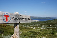 Signs are helpful and convenient, but no substitute for a map and compass. Raggsteindalen in Buskerud.
- It is easy to get lost at ridiculously short distances in unfamiliar terrain. Take a careful look even if you are going only for a minute. Dense forest, fog and open plateaus with no clear landmarks are the most difficult.
- Always take a map and compass with you when leaving the immediate vicinity of your camp (electronics is no substitute, only a supplement – instead of checking battery status you should create a good mental map). Learn to use a compass for navigation and learn to match your map with the terrain.
- If you do get lost, admit it and stop immediately. A few minutes of good rest is surprisingly effective at making you think clearly again. Lines in the terrain can be used to find way back, for instance rivers (rivers can lead you to settlements or to lakes and other points that can be identified on the map), power lines and slopes. But beware of slopes making you change direction and leading you only to a local depression, rivers leading you to hard-to-walk wet terrain, etc. Check the map for what lines are usable.
- Bugs そして 動物
- Mosquitoes and black flies are a nuisance in June and July, especially in Lapland and Finnmark. They do not carry diseases, but repellents, long sleeves, long pants and perhaps a mosquito hat in the worst areas are recommended. Avoid keeping doors and windows open in the evening.
- ダニ can carry Lyme disease and TBE in some areas (especially south Norway to south-west Finland). The risk is small for a casual visitor, but you may want to take precautions.
- There are big predators like bears, wolves, lynxes and wolverines in the Nordic countries, but they are generally no threat to people, as they will flee in most circumstances once they smell or hear humans. Back out if you encounter bear cubs, as their mother will protect them. Also musk oxen, elks and boars can be dangerous if you go too close.
- If you are hiking in the hunting season (the autumn), in areas where hunting is allowed, you should wear some orange or red clothing. Ask for local advice about whether any areas should be avoided. Hunting season varies by species. Moose hunting is common in the forest areas of Sweden, Finland, East Norway and Trøndelag. Red deer hunting is common in West Norway. Reindeer hunting occurs mostly in the barren mountains.
- Be careful in sun
- Clear Nordic air, high altitude and snow patches can multiply the effect of the sun, which hardly sets during the Nordic summer. Snow blindness is a serious risk, so bring UV-resistant sunglasses, and preferably mountain goggles. Bring sun cream or sun block (sun protection factor). Light can be strong in the highlands even if the sun is not visible.
- Glaciers
 Do not go on your own. ヨステダール氷河 glacier.
- Glaciers are one of the most dangerous places for visitors to the Norwegian outdoors. Never underestimate the power of the glacier. Observe warning signs. Never approach the front of the glacier. A glacier is not a stable piece of ice, it is constantly moving and huge chunks regularly fall off. Snowbridges can obscure crevasses.
- The sun's rays get reflected from the white snow, so it necessary to use sunscreen and sunglasses to protect your skin and eyes. Bring warm clothes for tours on the glacier.
- 行う ない enter a glacier without proper equipment and a skilled local guide.


Rules of mountain conduct
Norway's trekking association has compiled a set of rules or guidelines for sensible hiking, "fjellvettreglene":
- Don't go for a long hike without training.
- Tell where you are going.
- Respect weather and forecast
- Be prepared for storm and cold weather even on shorter hikes. Bring a rucksack with the kind of gear needed.
- Listen to experienced hikers.
- Dont hike alone.
- Use map and compass
- Turn back in time, it is nothing to be ashamed of.
- Don't waste your energy. Dig into snow if necessary.
Volcanic eruption

Out of the Nordic countries, Iceland is the only one with active volcanoes.
As a precautionary mesure carry a cell phone and a battery powered radio, and heed to warnings from the Icelandic civil protection about hazardous areas. Listen to either the radio station Rás 1 or Bylgjan. Rás 1 is on the LW frequencies 189 kHz and 207 kHz. For the FM frequencies see the frequency map of Ras そして frequencies of Bylgjan。 Pay attention to any SMS messages you get, as the Icelandic civil protection does send out SMS messages in Icelandic and English to phones in hazardous areas.
Should an eruption occur the ash can spread throughout the whole country depending on the wind direction. Eruptions increase the chance of lightnings and a glacial eruption will generate n flood in rivers with sources at the melting glacier.
Regardless of where you are in the country during an eruption, consider the wind direction and consider whether the wind can spread the ash to you. As an alternative you can use the mobile website of the Icelandic met office。 If so, walk high up in the landscape to avoid poisonous gases, cover your nostrils and mouth with a cloth. Should the ash get thick or if you have an asthma, go into the next day or wilderness hut, close windows on the side that the wind blows at, close the chimney and stay there until the wind direction changes.
Should you be in close proximity of an eruption walk opposite to the wind direction to get out of the area. If you have concerns that you cannot abandon a hazardous area in time, do not hesitate to call the emergency number 112.
尊敬

Many people you meet on remote trails are there to be with nature only. They might not be interested in socializing and will probably frown upon noisy behaviour. It is common, though, to stop and exchange a few words, e.g. about the terrain ahead, and at least some kind of greeting is usually expected when you meet people on (or off) the trail. Some might of course be interested in where you come from. People are often less reserved with strangers when they are in the wilderness.
Smoking is disliked by many and can be a serious hazard. In hot and dry periods a cigarette butt can cause a forest fire (even if "extinguished"), so just like with other litter, avoid leaving them in nature. Smoking indoors is mostly prohibited. Where locals smoke you might follow their example, but otherwise try to be a good example yourself.
Even if there is right of access, wilderness is often privately owned. In Norway only barren high mountains are public (government) property. Trails and bridges are usually maintained by volunteers (the trekking association for instance) or by landowners for the visitors' benefit. あなたは誰かの私有地のゲストであることを忘れないでください。邪魔されてはならない放牧動物や大物がいる可能性があります。ゴミを残さないでください。荒野、岩の多いビーチ、峠に石のケアンを建てることは、訪問者の間でますます人気があります。石のケアンはトレイルをマークするために使用され、実際にはハイカーに誤解を与える可能性があります。ケアンを建てる訪問者は、石の柵から石を選ぶことがよくあります。その中には、実際には文化遺産であるか、使用されているものもあります。単純な岩だけでも、このように自然を変えることは違法です。
同様の考慮事項が公有地にも当てはまります。サーメ人が同じ所有権の概念を持っていなかったため、ラップランドのほとんどは政府所有です。住民は、まるで土地を所有しているかのように、荒野に依存しています。そして、施設が納税者のお金によって維持されている場合、それらは共通の意志の結果であり、それは私的な寄付と同様に考慮されるべきです。
地名と役に立つ言葉
地図や標識の名前は通常地形を示しているので、いくつかの風景の言葉を理解することは役に立ちます。事前に大縮尺の地図を調べる可能性がある場合は、最も頻繁に使用される接頭辞と接尾辞の意味を確認することをお勧めしますが、いくつかはここにリストされています。彼らはしばしば、地形の特徴について地図から明らかでないことを伝えたり、その地域の歴史についてのヒントを与えたりします。
サーメ地域では、地名は通常サーメ語に由来しますが、これが明らかでない場合も同様です。例えば。 レメンヨキ もともとは「暖かい川」(サミから:leammi;フィンランド語:lämmin)であり、「愛の川」(フィンランド語:lempi、lemmen)ではありません。この地域の地形は、サーメ語で呼ばれることがよくあります(例:「jåkk」、 johka、ストリームのスウェーデン語の代わりに)。
関連する言語は複合名詞を使用します。名前は通常、単語を組み合わせて作成されます。最後の部分は、それがどのような景観機能であるかを示します。例えば ヨステダール氷河 から作成された名前です ヨステダール (ジョステバレー)と bre (氷河)言い換えれば、ヨステダール氷河。多くの場合、フィンランド語とサーミ語では、単語が複数形および/または属格であり、単語をわずかに変更しますが、必ずしもわずかではありません。
さらに、ノルウェー語とスウェーデン語では、定冠詞( "the")が接尾辞として表示され、単語に統合されます。 ブリーン 手段 氷河.
いくつかの異なるサーミ語があり、それらの正書法はほんの数十年前に標準化されました。つまり、どの言語が関係しているかに関係なく、スペルの違いもあります。
スウェーデン語の文字äとöはアイスランド語でæとö、ノルウェー語でæとøと書かれています。 åはフィンランド語とほとんどのサーミ語で書かれています。スウェーデン語のäはeの近くで発音されることが多く、多くの場合、ノルウェー語でeと書かれています。スペルや発音のこれらやその他の多かれ少なかれ体系的な違いを認識することは、サーメ語地域のjoki /jåkk/jåkkå/ johka(フィンランド語、スウェーデン語、サーメ語のスペル)など、他の言語から知っている単語を理解するのに役立ちます。
スウェーデン語とノルウェー語

- カート/カルタ
- 地図
- fjell、fjäll
- 山、頂上、山頂(樹木限界線より上に伸びる風景を指し、特定の頂上または一般的に山を指す場合があります)
- vidde
- 高く開いた高原(樹木限界線より上)
- innsjø、vann、vatn、sjö
- 湖、池
- tjern、tjärn
- 池、小さな湖、タルン
- skog
- 森、森
- myr、kärr
- mire、bog
.jpg/220px-Besseggen_Hike,_Norway_(14673663307).jpg)
- ur、taluskon
- ガラ場、タルス鉱床
- bre /glaciär、fonn、skavl
- 氷河、雪の漂流
- ダル
- 谷
- ユベントス、kløft/ klyfta、ラヴィン
- 峡谷、峡谷、峡谷
- elv、bekk /älv、å、bäck
- 川、小川、小川
- bro / bru、sommarbro、helårsbru
- 橋、冬に撤退した橋、通年橋
- vad
- フォード
- stuga / stue、hytte
- 小屋、キャビン
- förfallen
- 腐敗
- snaufjell /kalfjäll
- 不毛の山々
- tregrense /trädgränsen
- 樹木限界線
- skyddsområde
- 保護地域
- sti / stig
- パス、トレイル
- ruskmärkning
- 雪の中の枝の形のマーキング
- øy/ö、holme、skär
- 島、島
- foss / fors、vattenfall
- 滝、急流
アイスランド語

- コルト
- 地図
- 落ちた、fjall
- 山
- heiði
- 高原高原
- vatn、tjörn
- 湖、池
- ミリ
- mire、bog
- fjörður
- フィヨルド、ベイ
- jökull
- 氷河
- dalur
- 谷
- gjá、gljúfur
- 峡谷、峡谷、峡谷
- á
- 川
- フォス
- 滝
- eyja、sker
- 島、島
フィンランド語とサーミ
- カルッタ
- 地図
- vuori、tunturi / tuodtar、vaara /várri(várre、várrie、vaerie、vare)
- 山; vuoriはフィンランド語の一般的な単語であり、tunturiとvaaraはそれぞれ樹木限界を超えて伸びていませんが、Sámiのvárriは丘や山(多くの場合、大きく急なもの)の一般的な単語であり、しばしばvaaraとして「翻訳」されます。 tunturi / duottarmailbmiは、樹木限界より上のすべての地域でも使用されます
- カイサ/ガイッサ; kero /tseärru; oaivi; kielas / gielas、kaita /skäidi; rova / roavvi
- さまざまな形の山々:高い雪に覆われた山頂。樹木限界の上の山の形をした山。樹木限界の上の丸い山(「頭」);海嶺;まばらな森の石の丘
- čohkka(tjåhkkå、tjåhkka、tjahkke、tjåkkå)
- ピーク、サミット
- mäki、kallio、harju / puoldsa
- 丘、(の丘)固い岩、エスカー
- skäidi、selkä/ cielgi
- 尾根、分水界(セルカも海または大きな湖の広がり)/白樺のある尾根、山のそば
- pahta / pahte
- 高く急な丘の中腹
- järvi/jávri(jávrre、avrre、havrre、jávrrie、jaevrie、jävri、jäu'rr、jauri、jaure、jaur)
- 湖、池
- vesi
- 水、名前で「湖」を意味することが多い
- lähde、kaltio / galdu
- 春
- ランピ
- 池、小さな湖、タルン
- lahti / luokta(luoktta、loekte)
- ベイ
- niemi /njárga(njárgga、njarka)
- ケープ

- suo、rahka、räme、aapa / aaphe、jänkä/jeäggi、vuoma / vuobme
- mire、bog; suoは一般的な単語であり、他のさまざまなタイプです。 vuoma / vuobmiも谷
- パルサ
- フロストマウンド(マイアまたは沼地)
- jäätikkö
- 氷河、雪の漂流
- ラークソ
- 谷
- rotko、kuru / autsi、ävdzi、gorsa
- 峡谷、峡谷、峡谷
- joki / johka(jåhkå、juhka、johke、jåkkå、jåkk)、eno /eädnu、puro、oja /ája、
- 川、小川、小川; joki / johkaは一般的な言葉で、enoはかなり大きい、puroは小さい、ojaは小さい
- kahlaamo
- フォード
- metsä; kuusikko、männikkö、koivikkoなど。
- 森、森;異なる樹種の後者の森(kuusi = spruce、mänty= pine、koivu = birch)
- ラジャ
- 国境、制限
- puuraja
- 樹木限界線
- rajavyöhyke
- ボーダーゾーン
- kuusimetsänraja
- (北部)トウヒ(「kuusi」)森林の制限
- polku、reitti
- パス、トレイル
- mökki、pirtti、tupa; kammi / gamme
- コテージ、小屋;芝小屋
- siida
- サミ村またはコミュニティ

- seita / sieidi
- 精神、聖なる物
- サーリ、ルオト
- 島、島
- koski、niva、kurkkio、kortsi / gorzze
- 急流、後者は急で石です
- スヴァント、サブ
- まだ水(急流の下)
- köngäs
- 急流、小さな滝
- (vesi)putous
- 滝
- latu(pl。ladut)/láhtu
- スキーコース
接続する

郵便物
ショップや観光事業で利用できるメールボックスや切手があるかもしれません。郵便局留めの代わりに、適切なものを使用することをお勧めします c / oアドレス。 地元の慣習について尋ねます。
電話
北欧諸国では一般的に携帯電話のカバレッジは良好ですが、必ずしも必要な場所ではありません。一部の荒野の小屋には緊急電話用の電話があります(フィンランドではもうありません。スウェーデンでは一般的であり、緊急時だけでなく、遅れていることを知らせたり、必要に応じてアドバイスを得るのにも使用する必要があります)。
山岳地帯では、谷に信号がないことがよくあります。遠隔地では、落ちた頂上を除いて信号がない場合があります。事前に低速接続(9600ビット/秒でも)で重要なインターネットサービスをテストすることをお勧めします。 SMS気象サービスがあります。 3Gは、以前は大きな町や重要な観光地の近く、およびいくつかの主要道路沿いでしか利用できませんでしたが、現在はフィンランドの荒野の多くでも利用できます。
対象範囲はプロバイダーによって異なります。会社に複数の電話(SIMカード)がある場合は、別のプロバイダーが必要になる場合があります。最良の信号は隣国からのものである可能性があるため、電話にプロバイダーを選択させると、国内のSIMカードを使用しても国際電話の料金を支払う必要がある場合があることに注意してください。
信号が悪い場合は、電話をかけないでください。SMSを使用してください。メッセージには数秒間だけ信号が必要であるため、信頼性が高く、消費電力も少なくて済みます。
スマートフォンを乾いた状態に保ちます。信号が悪い場所では、バッテリーの使用速度がはるかに速いことを忘れないでください。ほとんどの場合、スマートフォンの電源を切ってください。電気は通常、バックカントリーでは利用できません。必ずしもコテージや家でも利用できません。
緊急通報
ザ・ 緊急電話番号112 北欧のすべての国で働いています。一部の緊急事態には特別な番号があるかもしれませんが、 ☏112 それらすべてを処理できます。 112への通話は無料で、ほとんどの電話のロックに関係なく機能します。番号を入力するか、緊急ボタンを使用するだけです(一部のスマートフォンでは)。実際、SIMカードを取り外して、電話が利用可能な最良の接続を使用していることを確認したい場合があります。残念ながら、Swedish 112は、「5」を押すまでSIMレス通話を保留にします。フィンランドでは、そのような電話は、応答される前に約30分間保留されます。
にとって 衛星電話 緊急サービス番号は ☏ 46 63-107-112 (スウェーデン)、 358 9 2355-0545 (フィンランド)、 354 809-0112 (アイスランドチェック!)。インマルサット-14衛星は、南の地平線からわずか約15度上にあるため、より高い地形やその他の障害物によって簡単にブロックされます。イリジウムにはこの問題はありません。
緊急事態につながる可能性のある問題については、遠慮なく救急隊に連絡してください。また、安全であることを伝えるために電話をかけるようにしてください。同様に、遅れて誰かが救助活動を開始するために電話をかける場合もあります。費用は簡単に5桁の数字になります– 1時間あたりのユーロ(通常は納税者のお金で支払われますが、システムを悪用したくない)。
場所はETRS89 / WGS84座標として最もよく伝えられる場合があります(それがマップで使用されているものであるかどうかを事前に確認してください)。よく知られている場所や地図上の任意の座標系からの方向と距離も使用できます。間違いを避けるために、位置の近くにもいくつかの名前を教えてください。 360°と数ミルのシステム(円の場合は60、63、または64ヘクトミル)の両方がコンパスで使用されていることに注意してください。 アイリガス (「聖なる堕落」)、あいまいです。フィンランドでは、救急隊が自治体と住所を尋ねる場合があります(彼らは広大な地域にサービスを提供しています)が、あなたが知らないことを彼らに伝えるとき、それらは合理的です。
衛星ナビゲーター (GPSなど。スマートフォンに含まれることが多く、カメラに含まれることもあります)は非常に多くの電力を使用するため、ほとんどの場合はオフにしておくのが最適ですが、緊急時に正確な座標を提供できることがよくあります。彼らが衛星を見つけるのに少し時間がかかり、それまで彼らは間違った座標を与えるかもしれません。それらの設定と動作を理解していることを確認してください。
対処
無駄
小屋、避難所、キャンプファイヤーの場所にはゴミ箱がよくあります。特に道路がない場合は、これらの使用を避け、代わりに梱包する必要があります。バックカントリーでゴミ箱を空にすることは、不必要で費用のかかる交通を意味します。食品くずなどは、すぐに空になることがわかっている場合を除いて、ゴミ箱に入れないでください。生ごみなどの少量の有機性廃棄物は、ピットトイレ(およびより高度なコンポストトイレ)に入れることができます。いくつかの場所に別々の作曲家がいます。リサイクルポイントでは、紙、金属、ガラスを別々に処理することができます。トレイル外では、必要に応じて有機性廃棄物を埋めることもできますが、特に泥炭や樹木限界より上では、分解に何年もかかる場合があります。純粋な紙はキャンプファイヤーやストーブで燃やすことができますが、金属またはプラスチックで覆われた紙を梱包する必要があります。他の人が燃やすために廃棄物を残さないでください。
トイレ
トレイルに沿って、小屋にトイレがあり、多くの場合、避難所やキャンプファイヤーの場所にトイレがあります。これらのサービスを使用する場合は、通常、より大きなニーズに十分対応できます。それらは通常乾式トイレです:ベンチに穴のある離れ家と泥炭、おがくず、またはあなたの糞便を覆うための同様のものが入ったバケツ。あなたはあなた自身のトイレットペーパーを使わなければならないかもしれません。手を洗うことは通常あなた自身の問題です(人々が彼らの飲料水を飲む場所から上流で、または飲料水バケツの近くでそれをしないでください)。トレイル外や小屋の間、 痕跡を残さないキャンプ 従うことができます。
洗浄
国のほとんどの地域には小川や湖、または海岸がたくさんあるので、自分で洗うための水を見つけることはめったに問題になりませんが、特に北部では、7月から8月を除いてほとんど涼しいです。それに慣れるか、サウナを使用してください。手を洗うには、ストーブで少量の水を温めることができますが、多くの場合、冷水で十分です。多くの場所で、湖や川で汚れや石鹸を手に入れないようにし、ほとんどの場合、土地で洗濯をする必要があります。バルト海では海水はあまり塩辛くなく、フィヨルドではめったにありません。
シャワーは通常、荒野の小屋では利用できませんが、一部のキャビンや実際のキャンプ場でシャワーを浴びることができます。代わりに、かなり多くの小屋や小屋にあるサウナを使用してください。のために サウナ 手順については、その記事を参照してください(フィンランドにいない場合は、期待される動作が異なるかどうかを確認してください)が、適切な洗浄は通常、洗面器で温水と冷水を混合して使用することです。すすぎのために新しいセットを1つか2つ混ぜます。