周りをドライブする ノルウェー 都市の外にあり、公共交通機関が限られているか、頻度が低い場所に移動します。ノルウェーの自然の風景に興味があるなら、これは旅行に良い方法です。交通は安全で、速度は控えめで、ほとんどの道路は交通量が少ないです。ドライバーは、ドライブや頻繁な観光の停車に十分な時間をとる必要があります。特に南北方向と複雑な中を長距離 フィヨルドの風景、運転に時間がかかることを意味します。たとえば、の全範囲に沿ったドライブ 道路E6、ノルウェーの主要道路は、約1週間かかります。
理解する


ノルウェーのトップアトラクションは、公共交通機関が限られている主要都市の外にあります。セルフドライブにより、訪問者は自由に立ち寄ったり、混雑していない場所を訪れたり、計画を変更したり、公共交通機関が限られているかまったくない遠隔地の風光明媚な道路を訪れることができます。ノルウェーの最大の魅力である絶え間なく変化する険しい風景は、のんびりとしたペースで動き回ることによって最もよく体験されます。自然の光景は一般的に特定の場所に限定されません。いくつかの町はクルーズポートとして広く知られていますが、他の地域も同様に素晴らしいです。ほとんどの道路は、車の窓から周囲の風景の良いまたは素晴らしい景色を眺めることができます。高速道路はほとんどなく、ほとんどの道路は通常の2車線の分割されておらず、簡単に引っ張って休憩することができます。夏の間はどこでもほぼ24時間の日光があり、北では太陽が沈むことはなく、訪問者はいつでも観光ドライブを行うことができます。
ノルウェーはイギリスよりも広く、ドイツとほぼ同じ面積ですが、南北間の距離ははるかに長くなっています。 フィンマルク、ノルウェーの最北端の地域はデンマークよりも広く、フィンマルクを通るドライブはロンドンよりもグラスゴーまで長くなっています。 E6、ノルウェーの主要道路は2600 km以上あり、ロシアを除くヨーロッパの1つの国で最長の道路です。ノルウェーでの通常の休暇中は、通常、ノルウェーの一部を車で回る時間しかありません。
ヨーロッパのほとんどのように、ノルウェーは右ハンドルです。ノルウェーのほとんどの車は、伝統的にマニュアル(「スティックシフト」)トランスミッションを備えていました。 2015年以降、電気自動車やコンピューター化されたドライバーサポートとオートマチックトランスミッションを搭載した自動車への移行が比較的急速に進んでいます。 2020年の時点で、事実上すべての新車にオートマチックトランスミッションが搭載されています。 2020年の全車の約10%がバッテリーで走行しています。予約時に特にオートマチックを要求しない限り、レンタル会社はマニュアルトランスミッション車を割り当てることができます。ほとんどの道路は2車線に分割されておらず、オスロ周辺には限られた高速道路網があります。一般的な制限速度は時速80kmで、道路状況により速度が遅くなることがよくあります。
車は鉄道がなく、公共交通機関が限られている遠隔地に行くことができますが、一般的に主要都市内では車は必要ありません。駐車場は主要都市では課題であり、高額になる可能性があります。ノルウェーはさまざまな景色の良いドライブを提供しており、道路当局はいくつかの景色の良いドライブを選択しています 国定観光路線 特にお勧めです。これらのルートに沿って、訪問者にとって旅行をより楽しく実用的にするための施設が設置されています。

ガソリン(ガソリン)は重く課税されるため、高価です。ノルウェーはメートル法と摂氏を使用しています(マイル、ガロン、華氏は不明です)。特に主要都市に入るときは、いくつかの有料道路があります。通行料は一般的に車で移動する総費用のほんの一部です。
高速道路では適度なスピード違反が一般的ですが、交通量が少なく、ほとんどのドライバーは規律があり、法律を順守しているため、運転は一般的に簡単です。ただし、一部の市内中心部(ベルゲンやオスロなど)では、一方通行の道路が多いため、初めての訪問者をナビゲートするのが混乱する場合があります。交通量が多いことはめったになく、主に「ラッシュアワー」の前後です オスロ (道路E18とE6)、およびイースター休暇前後のオスロからの金曜日の午後。都市の外では、幹線道路でも交通量が少ないことがよくあります。のようないくつかの人気のある目的地で ガイランゲル 日中はまだ狭い道路の交通量が多い可能性があります。
ノルウェーの一部の地域では、次のガソリンスタンドが100km以上離れている可能性があります。小さな村は、たとえ離れた場所にあったとしても、必ずしもガソリンスタンドがあるとは限りません。時間内にタンクをいっぱいにし、人口の少ない最北端の地域を旅行するときはジェリカンを持参することを検討してください。
ノルウェーは冬のシーズンが長く、多くの道路は何ヶ月も氷や固い雪に覆われていますが、交通はほとんど途切れることなく走っています。いくつかの主要道路に沿って、気温は-20°Cまたは-30°Cに下がる可能性があります。 10月から4月下旬に車でノルウェーに入る訪問者は準備が必要です。訪問者は冬の運転の難しさを過小評価してはいけません。毎年冬の幹線道路は、雪や氷の上を運転するための適切なスキルや設備を持たない外国人ドライバーによって何時間も通行止めになっています。毎年冬の警察と道路当局は、準備ができていない多数の外国人ドライバーのノルウェーの道路へのアクセスを拒否しています。
ノルウェーの国道 品質はさまざまです。主要道路は、番号の前に「E」が付いているヨーロッパの高速道路です。例えば E6 スウェーデンからオスロを経由してノルウェー北部の最東端にあるキルケネスまでの南北の主要な回廊です。も参照してください スウェーデンとノルウェーを経由するE6。ヨーロッパの高速道路は、都市、地域、国を結んでいます。 E18 クリスチャンサンと南ノルウェーの町をオスロとスウェーデンに接続します。 E16 ベルゲンとオスロを(FlåmとVoss経由で)接続します。道路7は、ベルゲンへの代替ルートです(Hardangervidda経由)。 E39 クリスチャンサンからスタヴァンゲル、ベルゲン、オーレスンを経由してトロンハイムに至る沿岸の幹線道路です。 E-roadsはナビゲーションに最適です。他の主要道路(国道、「riksvei」)は1桁または2桁の数字が低く、これらの中で最も重要なものは、緑の背景に白い数字で示されます(ほとんどの高速道路の白地に黒ではありません)。ただし、道路の重要性は品質を示すものではないことに注意してください。Eでも、セクションが狭くて遅い場合があります。ノルウェーの高速道路のほとんどはE6とE18にありますが、E6の高速道路は10%未満であり、E18の高速道路はほぼ50%です。
ノルウェーの道路のアスファルトカバーは通常粗く、他の国で経験されているように濡れても滑りにくくなっています。ただし、スタッズ付きの冬用タイヤは冬の間アスファルトを食べる傾向があり、深い跡(または溝)が残ることに注意してください。これにより、特に高速で車が横に不安定になる可能性があり、水で満たされるとタイヤが水に浮き、車の制御が困難になる可能性があります(氷や雪の上を運転しているように)。急な山道を下り坂で運転するときは、低速ギアを使用してエンジンに速度を制御させるのが最善です。ブレーキが過熱してブレーキフルードが沸騰する可能性があります。

- よくある間違いは次のとおりです
- 日中はヘッドライトをオフにして運転する(ヘッドライトは必須)
- 前方の車に近づきすぎて運転している(最低3秒、冬はそれ以上)
- トンネル内で過度に減速する
- 距離と運転時間を過小評価している
- 限られた時間でカバーしすぎようとしています
- 長い下り坂でブレーキが過熱している
- ポイントからポイントへと急いで(ドライブは絶えず変化する風景を提供します)
距離
訪問者はしばしば過小評価します 距離と運転時間 ノルウェーの風景の中で。ノルウェーの多くの地域では、訪問者は平均時速60 km(1 kmあたり1分)を超えることを期待すべきではありません。一部のオンラインマップサービスと衛星ナビゲーション(GPS)は、運転時間を過小評価する傾向があります(キロメートルは正確です)。フェリーの横断、休憩、写真撮影の時間は、ここで提案されているおおよその時間に追加する必要があります。車での主要距離:
| To-From | キーロード | キロメートル | 必要な時間 | ノート |
|---|---|---|---|---|
| オスロ–ノールカップ | 2200 | 35時間ネット 睡眠を含む約1週間 | フェリー | |
| オスロ–ボーデ | 1200 | ネット20時間 睡眠を含む3日間 | ||
| オスロ–ベルゲン | 500 | 8時間 | ||
| オスロ–クリスチャンサン | 320 | 4時間 | ||
| オスロ–スタヴァンゲル | 540 | 8時間 | ||
| オスロ–トロンハイム | 500 | 8時間 | ||
| Trondheim–Bodø | 700 | 12時間 | ||
| オスロ–ガイランゲル | 450 | 7時間 | ||
| オスロ–フローム | 350 | 5時間 | ||
| Bodø–Tromsø | 600 | 10時間 | フェリー | |
| Bodø–Nordkapp | 1050 | 16時間(2日) | フェリー | |
| ベルゲン–ガイランゲル | 400 | 7時間 | フェリー | |
| ベルゲン–フロム | 170 | 3時間 | ||
| ベルゲン–クリスチャンサン | 470 | 8時間 | フェリー | |
| オーレスン–トロンハイム | 300 | 6時間 | フェリー |
冬休み
周辺の人気のある道路を含むいくつかの峠 ガイランゲル 冬の間(通常は11月から5月)は完全に閉鎖されます。他の山岳道路は、悪天候時には短期間(数日または1泊のみ)閉鎖される場合があります。道路は通常、峠自体(恒久的な集落の間)のためにのみ閉鎖されます。休業時間は、天候や冬の積雪により大きく異なります。
| 道路 | セクション | 休業月(通常) |
|---|---|---|
| Skarsvåg–ノールカップ (北岬) | 10月〜4月(とにかく時々オープン) | |
| Gaularfjell | 12月〜5月 | |
| 道路51 | Valdresflya | 12月〜4月 |
| 道路55 | Sognefjell | 11月〜5月 |
| 道路63 | ガイランゲル–langvatn | 11月〜5月 |
| 道路63 | トロルスティーゲン | 10月〜5月 |
| 道路243 | アウルランド–レールダル (アウルランド峠) | 11月〜6月 |
| 道路252 | Tyin–Eidsbugarden | 10月〜6月 |
| 道路258 | Gamle Strynefjellsveg(古いStrynefjell道路) | 10月〜6月 |
| ロード337 | Brokke–Suleskard(アグデル) | 11月〜5月 |
| 道路341 | Smelror–Hamningsberg | 11月〜5月 |
| 道路355 | Melfjellet | 11月〜5月 |
| 道路520 | Hellandsbygd–Røldal | 11月〜6月 |
| 道路886 | Vintervollen–Grense Jacobselv(Jarfjordfjellet) | 11月〜5月 |
フェリー


現在、ノルウェーの公道には100をはるかに超えるフェリーの交差点があります。これらのカーフェリーは、フェリーの交差点が道路番号に含まれ、道路がドックにつながるなど、道路システムの不可欠な部分です。フェリードックは、多くの場合、可能な限り最短の交差点の遠隔地にあります。カーフェリーは、国の道路当局に代わって民間企業によって運営されています。価格は運輸省によって管理されており、ルートの長さにもよりますが、車の場合は50〜300 krですが、キャンピングカーの場合は2倍以上になる場合があります。幹線道路のカーフェリーは、日中は1時間に2〜3回出航し、夕方遅くに出航する頻度は低くなります。重要なフェリーの中には夜通し運行しているものもあれば、23:00または24:00(午後11時または深夜)まで運航しているものもあります。交差点は通常10〜30分しかかかりません。通常、自家用車の予約はできません。また、予約も必要ありません。車はドックに到着し、先着順で並んで待ちます。フェリーは通常、すべての待機中の車を乗せるのに十分な容量がありますが、まれに旅行者は次の出発を待たなければなりません。旅行者は、計画の際にフェリーの時間を追加することをお勧めします。フェリーの交差点は通常、フィヨルドを横切る点線として地図に表示されます。フェリーは一般的に避けられないか、(非常に)長い迂回路を通してのみ避けられます。レジャー旅行者にとって、フェリーは穏やかな休憩とフィヨルドを渡る楽しい旅行として経験に追加します。ほとんどのフェリーは保護された海域を航行しており、海の波の影響を受けません。フェリーには、コーヒーや軽食、場合によってはフルディナーを提供するカフェテリアが船上にあることがよくあります。
道路

道路網の分類:
- E-roads。国際E道路ネットワークの一部として番号が付けられた道路。国番号は追加されていません。標識は白地に緑です。

- 国道。 E道路に加えて、他の主要道路(「緑の道路」)は、緑に白の標識があります。

- 番号付きの道路。地域番号の付いた道路(道路標識に表示)、白地に黒の標識:

- その他の道路。地方および地方の道路。
このシステムは必ずしも道路自体の品質を示すものではなく、高速道路の接頭辞や番号付けシステムはありません。番号は主にナビゲーション用であり、番号による都市外のナビゲーションは、衛星ナビゲーション(GPS)やオンラインマップサービスよりも信頼性が高く、これらは時折ばかげたルートを示唆します。たとえば、E6は、オスロの南北数キロのところにある実際の高速道路として建設され、さらに北に行くと半高速道路になり、通常の2車線に分割されません。訪問者は、衛星ナビゲーション(GPS)よりも道路番号を信頼する必要があります。東西のE道路には偶数(たとえばE10)があり、南北のE道路には奇数(たとえばE39)があります。ノルウェーの南北の主要道路であるE6は、この規則の例外です。道路番号が重複している可能性があることにも注意してください。たとえば、道路の一部がE134と道路13の両方になる場合があります。
.svg/180px-Map_E6_(Norway).svg.png)
.svg/180px-Map_E39_(Norway).svg.png)
道路は急勾配(および狭い)または悪天候にさらされる可能性があるため(冬には数時間または数日間閉鎖されることがあります)、訪問者は峠に注意する必要があります。 4月下旬や9月下旬でも峠に雪が降る場合があります。まれに、夏でも最高のパスで雪や霜に遭遇することがあります。海面で気温が10°C未満の場合、1500メートルで気温は0°C前後になる可能性があります。
重要な道路
訪問者は、計画とナビゲーションのためのいくつかの重要な道路について知っておく必要があります。ザ・ E6 ノルウェーの南端から北端まで2600kmを走っているため、明らかに最も重要です。 E6は、オスロ周辺の4車線または6車線の高速道路から、遠隔地(狭い場合もある)で分割されていない通常の2車線まで、品質と交通量が大幅に異なります。 E6は19の郡のうち10を通過します。トロンハイムの北、それは南北の唯一の主要道路であり、実際にはいくつかの地域では のみ 通行止めの際にスウェーデン/フィンランドを経由して交通を迂回させる必要がある道路。オスロの北(ハマールまで)E6は、2015年まで、そしてそれ以降、特にアップグレードされました。 Gudbrandsdalen アップグレードが進行中です(2015年ごと)。それでも、E6はリンゲブとトロンハイムの間のローカルトラフィックにも対応しています。
ザ・ E39 クリスチャンサンからトロンハイムまで西部を一周する西部フィヨルドの幹線道路です。これは非常に複雑な道路で、品質は大きく異なり(ほとんどが2車線で分割されていません)、ノルウェーの象徴的なフィヨルドのいくつかを横断する約100のトンネル、浮き橋、8つのフェリーがあります。ソグネフィヨルドとフォルデの間には短い道路しか残っておらず、これらは数年以内にアップグレードされる予定です(2016年あたり)。この道路は長い景色が広がりますが、別のルートはさらに景色が良くなります。 SkeiとByrkjeloの間には、道路55(東ノルウェーへ)を経由する以外に実用的な代替ルートはありません。一部の代替ルート(道路51、55、63)は、冬季は4月または5月まで通行止めになります。
ザ・ E18 オスロと東/南の他の人口密集地を通る東西の動脈です。 E6がより速いオスロ東部郊外を除いて、ほとんど同じくらい広くて速い高速道路を建設しました。 E6と2回交差します。
| ルート | 説明 | 注目すべきmtパス | フェリー | 品質とトラフィック | 風光明媚な | 代替ルート |
|---|---|---|---|---|---|---|
| ノルウェーの幹線道路 ノルウェーでの運転に関する重要な参考資料です。から ハルデン スウェーデンとの国境で キルケネス ロシアとの国境では、合計2628 km(スウェーデンでは約500 km)です。 | Dovre、Saltfjellet(冬に荒天にさらされる人もいます) | フェリー1隻 | 高速道路ハルデンから ハーマル。ラッシュアワーと週末のオスロ近郊またはオスロ内の混雑。 | いくつかの風光明媚なストレッチ。 | ||
| 東西の幹線道路。 オスロを経由してØrjeでスウェーデンとの国境 クリスチャンサン. | (無し) | オスロとオスロクリスチャンサンの近く、特に週末と午後によく混雑します。オスロ周辺とクリスチャンサン近郊の高速道路。 | 風光明媚なストレッチ | |||
| ザ・ 西ノルウェー幹線道路、フィヨルドの国を通って1300キロ。 Kristiansand-Stavanger-Bergen-Ålesund-Trondheim。 | Romarheimsdalenなどの主に低パス | 8つのフェリー交差点(ヨーロッパの他のどの道路よりも多い) | ノルウェーで最も複雑な道路。小さな高速道路、いくつかは狭くて遅い。スタヴァンゲル周辺やベルゲン周辺で時折混雑します。 | 長い景色がフィヨルドエリアに広がっています。 | ||
| Haukeli-Haugesund道路 東ノルウェーから | Haukeli(冬は時々休業)。 | (無し) | 期間中の注目すべきトラフィック、ほとんどが中程度。 | 風光明媚なストレッチ。 | ||
| ドンボース-Romsdal-オーレスン 道路。への主要道路 ムーレ・オ・ロムスダル 郡。 | (無し) | 適度な交通量、高速道路なし | 記念碑的な谷を通り、大きなフィヨルドに沿って。 | |||
| ヘドマルク/Østerdalen 道路。 | (無し) | E6南北(オスロ-トロンハイム)のわずかに短い代替。 | 大きな川と大きな丘の景色ですが、E6ほど風光明媚ではありません | |||
| オスロ-ベルゲンの最速および最短の道路。 | ハルダンゲル高原(冬は閉鎖されることが多い) | (無し) | 通常の道路、特にオスロの近くでかなりの交通量の期間 | 非常に美しい、山の高原、急な谷、フィヨルドの景色 | ||
| E39に平行な「内側」。 | Vikafjell(冬に露出)、Gaularfjell(冬に閉鎖) | 2フェリー | 低または中程度のトラフィック。分割されていない2車線。部分的に狭いまたは急な。 | 象徴的なフィヨルド、滝、氷河に沿った風光明媚なドライブ。いくつかの峠。 | ||
| オッタダレン-ノルドフィヨルド道路。 E6を接続します(Gudbrandsdalen)から 北フィヨルド 領域。 | Strynefjell(冬は時々休業) | (無し) | 低または中程度のトラフィック。分割されていない2車線。 | 素晴らしい渓谷を通り、アルプスの山々を通り、美しい湖やフィヨルドに沿って風光明媚なドライブ。 | ||
| ロフォーテン 道路。国境から ナルビク に Å 私はロフォーテン諸島。 | スウェーデンとの国境で | (無し) | 風光明媚なドライブ。 |

オスロ-ベルゲン
オスロからベルゲンへの旅行は、ルート、運転条件に応じて7〜9時間かかり、ドライブに沿って停車します。冬には数時間の運転時間を追加する準備をしてください。そして、日光が何ヶ月も不足することを忘れないでください。オスロからベルゲンへのすべてのルートは峠を通ります。これらの条件に慣れていない場合は、冬のツアーで2日間を使用することをお勧めします。悪天候の氷のように暗い道路を12時間または14時間ドライブするのは、あまり良いことではありません。ノルウェーの多くの道路は、交通量が比較的少なく、気象条件が厳しいため、狭くて遅いことが多いことを覚えておいてください。オスロとベルゲンの間の最も直接的な道路は、困難でありながら風光明媚な風景を通り抜けており、11月から4月までの荒天の影響を受けることがよくあります。

| 名前(峠) | 旅程 | 説明 | ノート | 観光スポットと風光明媚な | 距離 |
|---|---|---|---|---|---|
| Filefjell峠。 | Filefjell峠を通る公式の幹線道路。 E16のアームはSandvikaでE18に接続します。メインはオスロ空港経由で イェブレ、スウェーデン。 | 他の山の交差点と比較して、気象条件のために急な通知で閉鎖される傾向が少ないため、冬の信頼性があります。主に交通量が少ない。 E16は長くて簡単なドライブで、 ヴァルドレス。レールダルからベルゲンまでの無数のトンネル(世界最長を含む)。レールダルと フロム、ラルダールトンネルを通り、世界最長の24.5 kmの道路トンネルは、トンネルの遅れた運転手が引っ張って休むことができる大きな洞窟によって6kmのビットに区切られています。 | 象徴的なフィヨルド、滝、山や湖、そして文化遺産(スターヴ教会)のある風光明媚なドライブ。ロマンチックを通して ヴァルドレス と野生 ソグネフィヨルド エリアから Voss とベルゲン。 | 513 km | |
| ヘムセダール峠 | 上記のE16の代わりに、いくつかの長い丘、E16と同じレールダルからベルゲンまで。 | トラック運転手が好む。強風(吹雪)の場合、冬に時折閉鎖されます。 | 風光明媚な ヘムセダール ウィンタースポーツリゾートで。 | 474 km | |
| ホル-アウルランドルート | 大きなハリンダル渓谷を通り、次に湖に沿って、そして長いトンネルを通って、E16に合流するアウルランドへの急降下まで。 | 部分的に野生で、急で狭く、トラックがほとんどまたはまったくありません。冬は休業することもあります。 | 風光明媚。でE16に参加 フロム. | ||
| ハルダンゲル高原ルート。 | Hardangerviddaplataeuを越えてHallingdal渓谷を通ります。 | ハダンゲル橋経由(有料)。 注意: 3500 kgを超える車両の通行料600NOK(2015年あたり)。 E16Voss-Flåmが閉鎖されている場合のメインルート。一部のトラックはこのルートを使用します。主に観光シーズン(夏休み)の交通量。ルート7Hallingdal-Hønefossは2014年頃に著しく改善されました。 | 象徴的なフィヨルド、滝、山、湖のあるとても景色の良いドライブ。多くの場合、吹雪の冬の間は閉鎖されます。 | 455 km | |
| ハウケリ峠 | の険しくロマンチックな風景を通して テレマーク. | Gjermundshamn-Årsnesでのフェリーの交差点が含まれます。 Jondal-TørrvikbygdとKvanndal-Utneでの代替交差点。 | 風光明媚なドライブは、氷河や湖、滝、フィヨルドを通過しました。 | 510キロ |
ベルゲン-トロンハイム
ベルゲン-トロンハイムは、5つの時間のかかるフェリーで海岸沿いを行くか、峠を通ります。
| 名前(峠) | 旅程 | 説明 | ノート | 観光スポットと風光明媚な | 距離 |
|---|---|---|---|---|---|
| 沿岸道路 | E39 | オーレスン-クリスチャンスン | このルートは主に海岸をたどり、5つのフェリーの交差点でいくつかのフィヨルドを横断します。フェリーは遅いだけでなく、待ち時間や乗降時間が含まれているため、有料で時間がかかります。ノルウェーの旅行者であるベルゲン-トロンハイムは別のルートを好むため、このルートの交通量も最も多く、これはローカルトラフィックです。 | Stryn周辺のフィヨルドは風光明媚です。ソグネフィヨルドはフェリーの下で1260メートルの深さです。 | 696 km |
| Strynefjell | E39-15-E6 | Stryn-Otta | このルートにはフェリーが1つあり、少なくとも夏の時間外はおそらく最速です。 | Stryn周辺のフィヨルドは風光明媚です。ガイランゲルへの迂回路はとても美しいです。ソグネフィヨルドはフェリーの下で1260メートルの深さです。 | 698 km |
| Sognefjell | E39-55-15-E6 | ソグナル・オッタ | このルートにはフェリーが1つあり、最短です。冬に通行止めになる厳しい山道である国道55号線が含まれています。 | 腕のあるソグネフィヨルドは風光明媚です。 Sognefjell山もあります。 | 652 km |
新旧の道路
ノルウェーの多くの道路は、岩が多いまたは山岳地帯を通ります。困難な場所に(多くの場合トンネルを通って)道路の新しいセクションが建設されるとき、または雪崩を避けるために、古い道路はしばしば放棄されるか、歩行者に任せられるか、または地方道路として使用されます。道路の古いセクションは、多くの場合、より興味深い風景を提供し、古い道路工学自体は、多くの場合、印象的または興味深いものです。道路7のTokagjeletストレッチは、訪れることができるそのような道路の1つです。道路E16の有名なStalheimskleivaは素晴らしいパノラマを提供し、運転するのがエキサイティングです。彼らは速い道に沿って急いでいるので、訪問者はしばしばこれらに気づいていません。

車両とギア

公道では夏に特別なことは何も必要ありません。冬には、最後の雪道を引き上げるのに四輪駆動が役立つかもしれませんが、一般的に公道では必要ありません。冬には、ノルウェーの車は北欧品質の冬用タイヤを使用します(スタッズ付きタイヤは11月1日から許可されます)。チェーンは一般的に普通の車では使用されず、通常はレンタル会社では許可されていません。衛星ナビゲーション(GPS)は、都市やオスロ周辺で役立ちますが、道路番号によるナビゲーションの方が信頼性が高くなります。 GPSとオンライン地図サービスは時々ばかげた選択をします。
ノルウェーではマニュアルトランスミッションが標準と見なされています。オートマチックトランスミッション付きのレンタカーをご希望の場合は、必ずレンタカー会社にご注文ください。ヨーロッパに住んでいる場合は、持参することを検討してください。ただし、冬(11月〜4月)に到着する場合は、冬用タイヤが必要であることに注意してください。雪や氷。冬用タイヤには、最低3mmの深さの溝が必要です。冬の間にスノーチェーンを運ぶには、3500 kgより重い車(車両グループM1、N1、3500 Kg)が必要です。雪や氷が予想される場合は、トラックや大型車には最低5mmのトレッドパターンの深さが推奨されます。ディーゼルやその他の液体も、冬に遭遇する可能性のある低温に耐える必要があります。
ノルウェーには、他のほとんどの国よりも多くの電気プラグインカーがあります。完全な電気自動車は、ナンバープレートに「EL」または「EK」と表示されます。
キャンピングカー/キャンピングカー
いくつかの会社は「設備の整った」キャンピングカー(ベッド、小さなキッチン、冷蔵庫、シャワー、トイレ、暖房など)を雇っています。大まかな目安として、リーズナブルなレンタカーとリーズナブルな配慮に費やす費用については、より多くの柔軟性。
多くの場合違法ですが、休憩所に一晩駐車するのが一般的です。キャンピングカー用に特別に設計された駐車場を探してください。土地は一般的に私有地であるため、道路沿いの野原に駐車したり、パッチを開けたりしないでください。森の中を歩き、テントで寝る権利(「すべての人の権利」)は、キャンピングカーでの車の運転や睡眠には無効です。
キャンピングカー(およびキャラバン、またはテント付きのキャンプ-いくつかは賃貸用の小屋があります)に対応する何百ものキャンプ場があり、これらはよく標識されています。すべてに基本的な設備(電気、トイレ、温水シャワー(分単位で支払う)、ほぼ平坦な地面)があり、一部はより設備が整っています(生鮮食品の購入、ボートのレンタル、共同キッチン、観光情報など)。
いくつかは「産業用」の種類(数百台のバン、きれいな施設、非常にまっすぐな道、草ではなく砂利、入るキーパッド、高速道路のすぐ横にある多くの厳格な規則)であり、その他はもっと...緩い-時折訪問者、支払いのための名誉システム、牧歌的な環境、たくさんの草とスペース。標識から見分けることは不可能なので、キャンプ場があなたの気分や好みに合っているかどうかを確認するためにドライブバイが必要になる場合があります。
大まかな目安として(2011年8月)、電気のあるキャンプ場での夜の費用は約200 krですが、範囲は120〜300krです。シャワーは通常4分間10krです。
すべての主要道路と多くのマイナー道路に多くの休憩所があり、特に壮観な休憩所(および施設)を備えた国定観光路線の素晴らしいシステムがあります。休憩所のほとんどにはトイレとピクニックテーブルがあります。
多くのキャンピングカーは比較的小さなエンジンを搭載しており、ノルウェーの多くの丘で他の車両よりも低速になることに注意してください。低速または特大の車両は、高速の車両を通過させるために引っ張る必要があります。このルールは、ある程度の柔軟性を持って適用する必要があります。あなたの鏡をチェックして、より速い車の列が集まっていて、そうでなければ彼らが追い越すことができないならば、引っ張ってください。
フェリーの価格は通常、自動車の2倍以上のモーターホームの価格であることに注意してください。 3.5トンを超える大型キャンピングカーの場合、道路通行料も2倍以上になります。
費用
レンタカーは高額なので、訪問者は何日、どの部分で車が必要かを検討する必要があります。中程度のエンジンを搭載したコンパクトカーは、大きなエンジンを搭載した重いSUVよりもはるかに安価であることがよくあります。公道の外での運転は違法であるため、大きな四輪駆動車は必要ありません。

通常、車両自体の日割りが主な費用です。ガソリンの価格はそれほど重要な問題ではありません。適度なエンジンを搭載したコンパクトカーが最も燃料効率が良いです。カーフェリーは追加料金であり、いくつかの道路(特に西部フィヨルドとノルウェー北部の一部)では避けられません。ほとんどのフェリーの交差点は比較的短く(10〜25分)、フェリーの料金はレンタカーの全体的なコストに比べて中程度です。注目すべき例外は、特別な観光フェリーGudvangen–KaupangerとGeiranger–Hellesyltです。ノルウェーにはいくつかの有料道路がありますが、ほとんどの有料道路は中程度です。たとえば、ベルゲンに入る場合は25 krですが、注目すべき例外は、道路13 /道路7の新しいハダンゲル橋の150krです。
風光明媚なドライブ
ノルウェーは数多くの風光明媚なドライブを提供しており、事実上すべての道路(特に西ノルウェー、山岳地帯、北ノルウェー)は風光明媚です。これらのいくつかは名前が付けられています 国定観光路線 特にお勧めします。
国定観光路線
国定観光路線は、ノルウェーの18の高速道路であり、その美しい景色と、休憩所や視点などの観光に適したインフラストラクチャで指定されています。これらのルートは合計1,850キロメートル(1,150マイル)をカバーし、西海岸沿い、西部フィヨルド、ノルウェー北部、ノルウェー南部の山々にあります。 2つのルートが国際E道路ネットワークの一部を構成しています。E10からロフォーテン、E75からバランゲルです。 Sognefjellsvegen、Valdresflye、Trollstigenなどの峠道は冬の間閉鎖されます。一部のセクションは狭く、急勾配であるため、ドライバーは事前に計画を立て、下り坂でローギアを使用することをお勧めします。
| 名前 | 道路番号 | 印象 | ノート |
|---|---|---|---|
| ガイランゲル-トロルスティーゲン | 道路63 | ハイシーズン中は正午(11時から14時)に交通量が多く、渋滞が発生しますので、早朝または夕方に運転してみてください。最高点1000メートル。 5月中旬まで休業。 | |
| ハルダンゲル高原 |  | 風や寒さにさらされる。 5月と9月は雪と霜が降ります。 | |
| ハーダンゲル | ハダンゲルフィヨルド周辺のクラシックドライブ | ||
| Gaularfjellet | 道路613および610 | BalestrandからJølsterへ | |
| Aurlandsfjellet | 道路5627 | 「スノーロード」 アウルランド-レールダル、冬季休業 | |
| Sognefjellet | 道路55 | 最高点1400メートル、冬季休業。 | |
| ロダン | フライア フォルダールへ | ||
| Helgelandskysten(ヘルゲラン海岸) | 道路17 | 630 km 6フェリー、南部の海岸 ヌールラン | |
| ロフォーテン | Raftsundet海峡からÅ村まで230km | ||
| バランゲル | Varangerbotn(E6)からHamningbergまで160 km、 フィンマルク、ノルウェーの最東端を含み、道路341は冬に閉鎖されます |
その他の観光ルート
風光明媚なストレッチのある他のルート:
| ルート | 旅程 | 印象 |
|---|---|---|
| リレハンメル-オップダールE6の一部 | ||
| ファーゲルネス-レールダル-フロム-Voss |  | |
| Aurland-Hol |  | |
| ソグナル-フォルデ | ||
| Byrkjelo-Sykkylven | ||
| Hellesylt-Ørsta |  | |
| リレハンメル-オンダールスネス-オーレスン |  | |
| ノートオッデン-ハウゲスン | ||
| クリスチャンサン-トロンハイム 西ノルウェー経由 |
コーニス
多くの道路がノルウェーの果てしない海岸線と無数の湖に沿って走っています。険しい風景のため、フランスやイタリアのリビエラに沿った道路と同様に、素晴らしいパノラマの長いコーニッシュドライブがよくあります。
いくつかの注目すべきコーニッシュ
| 道路 | 旅程 | 印象 |
|---|---|---|
| 650 | Sjøholt-ヴァルダル | |
| 60 | Utvik-ストランダ | |
| 79 | Eidfjord-Norheimsund(国定観光ルート) | |
| 13 | オッダ-エイドフィヨルド | |
| E16 | ベルゲン-ヴォス |
ヘアピンロード

ノルウェーには、特にオンダールスネス-ガイランゲル-ストリン周辺のノルウェー西部のフィヨルドの内部周辺に、いくつかの注目すべきヘアピン道路があります。
- トロルスティーゲン(道路63)-おそらく最も象徴的なヘアピン道路、壮大な環境
- ガイレンジャー道路(道路63)-印象的なデザインではありませんが、トロルスティーゲンよりも曲がり角が多い
- Ørnevegen(イーグルスロード、63)
- 象徴的なリーセフィヨルドのリーセフィヨルド道路、印象的で風通しの良い道路、27本のヘアピン
- TindevegenÅrdal-Turtagrø(プライベート、有料)
- ØvreÅrdal-最も気の利いたものの1つであるTyin(道路53)
- Strynefjell峠(旧道、258番)
- ヴォーリングフォッセン滝(道路7)のMåbødalen、このストレッチには360度のトンネルもあります
- ノルウェーで最も高い道路であるSognefjellet(道路55 Skjolden-Lom)は、海抜1400メートルまで上昇します。
- Stalheimskleiva(E16からの迂回路、VossとGudvangenの間のStalheimの古い道路)、非常にきつい曲がり、非常に急な
- Gaularfjell(道路13Balestrand-Førde)
おげんきで
ノルウェーでは運転基準が比較的よく維持されており、交通量は(統計的に)世界で最も安全なものの1つです。致死率は50年間着実に低下しており、2020年は、交通量が10倍であるにもかかわらず、第二次世界大戦以来、交通関連の死亡者数が最も少なかった。ノルウェーには曲がりくねった狭い山道が多く、野生動物や冬の天候はドライバーの注意を必要としますが、困難な状況下でも事故は比較的少ないです。

規制は厳格に施行され(特に飲酒、スピード違反、危険な追い越し)、安全な交通を維持するために制限速度は控えめです。制限速度は条件に合わせて微調整されているため、制限速度を選択する理由は常にあり、これがノルウェーの安全な交通の主な理由の1つです。ノルウェーでは、抑制された運転スタイルが一般的です。
冬
- 参照: 冬の運転
車を運転する 冬 conditions may be a real challenge without proper training and experience, this particularly applies to mountain passes all over Norway as well as other roads in Northern Norway. The golden rule for driving on snow, ice and slush: don't rush。 Braking distance increases dramatically, increase distance to the car in front of you from the standard 3 seconds to a 5–6 seconds or more. Inexperienced drivers should drive very carefully until they get used to the conditions and the car; experienced drivers always "feel" the contact between tires and road. Powerful acceleration or hard braking quickly tells you how slippery the road is. Do a "brake test" frequently to get precise information on the road surface.

Several main roads such as E6, E16, road 7 and E134 run through mountain passes or other places exposed to wind/snow. During winter (October–April) drivers should plan well and get specific information for critical stretches of road included in the trip. A handful of mountain roads are frequently closed temporarily during bad weather, and the authorities routinely issue road information on radio, TV and the インターネット;コール ☏175, 47 815 48 99 for details, given in Norwegian only on the internet map page.
Convoy driving During blizzards on some roads you are only allowed to drive in a line behind a heavy snowplow, convoy driving, a method called kolonnekjøring in Norwegian. Drivers are then obliged to wait at a gate or sign until the snowplough arrives. Always obtain specific information about mountain roads the day and hours before going. Don't hesitate to ask locals or call the numbers above for last minute information. News reports routinely mention where convoy driving is in operation with road number and name of mountain pass (or other stretch) as key information. There are waiting points with gates and signs at either side of the mountain pass.  "Stop. Wait for snow plough". Convoy driving waiting point on road 7. There are precise rules for convoy driving that must be followed:
|
Some main roads, such as E6, E16 and road 3, also pass through the coldest areas in Norway, these are often much colder (often 10–20 °C, even 30 °C colder) than departure and destination points – drivers should make sure that the car is prepared for very low temperatures (for instance filling up the right diesel quality). Always bring enough clothes and food, always calculate plenty of time. Be prepared to cancel or postpone trips in winter.
Appropriate tires are required on winter roads – the driver is responsible for having the right tires for the conditions, do not try to drive with poor tires. Nordic type winter tires (studded or un-studded) are strongly recommended; these are much better fitted to Norwegian winter conditions than general winter tires. During winter (after November 1) tires of any type are by law required to have a minimum of 3 mm tread depth, while in summer 1.6 mm is legal. Heavy vehicles (over 3,500 kg) must bring chains in winter and minimum tread depth is 5 mm.
トンネル

Norway's roads have many tunnels, some very long. Tunnels are generally very safe places to drive. In case of fire or smoke in the tunnel note the following: Use the emergency phones inside the tunnel (rather than your mobile phone) as this will inform traffic control exactly where you are. In case of fire, use the fire extinguisher inside the tunnel as this will alert traffic control and the fire brigade.
Never enter a tunnel if there is a red light. All tunnels have names that can be used to inform the police and fire brigades. Keep radio on inside tunnels as traffic control can send emergency messages. Long tunnels have signs indicating distance to exit in either direction. People inside the tunnel are expected to try to get out of the tunnel on their own. In case of fire or accident traffic control should be notified immediately via emergency telephones inside the tunnel. Use fire extinguisher to kill small fires and leave if not possible.
In case of fire in a one-way tunnel:
- Do not turn the car around; this is extremely dangerous.
- Leave the car with emergency lights on.
- Go to the nearest emergency exit.
In case of fire in a two-way tunnel (traffic in both directions):
- If possible, turn the car around, drive out and alert oncoming traffic.
- If it is difficult or dangerous to turn around, leave the car with emergency lights on and 歩く to the exit.
- Walk in the opposite direction as the smoke.
動物
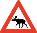
Roads are generally not fenced and animals may stray onto all sorts of roads. You need to look out for deer and moose - a moose collision in particular is very dangerous as these are tall and heavy animals. In the north you will also have to watch out for reindeer.
Moose/elk ("elg") and red deer can run onto the highway particularly at dusk and dawn so take extra care if driving at those times, particularly through forest. Red deer can also jump onto the highway without warning, particularly in Western Norway during late autumn and winter, special "crossing points" have been constructed several places, be aware. Reindeer may happen to walk on the road in Northern Norway. Note the warning signs. The elk, the most dangerous animal on the roads, is most active at full moon, after heavy snow fall and at dusk/dawn.Be extra careful to wild animals on the roads under these circumstances:
- Dusk/dawn.
- Springtime (as moose reject last year's calves and give birth to new ones).
- Edge of forests.
- Bridges across streams.
- Full moon
Several roads pass through pastures with grazing livestock and there may not be any fence to the road. Sheep, cows and goats may stroll on the road. A cattle grid ("ferist") or warning sign typically marks the start of such areas.
道路状況

Norwegian roads have varying quality. All public roads have asphalt and are generally well maintained, but some popular roads are narrow, with many curves and steep hills. The main roads are the European highways indicated with an "E" in front of the number.例えば E6 is the main north-south corridor from Sweden via Oslo to Kirkenes in the very east of Northern Norway. European highways connect cities, regions and countries. The E-roads are excellent for navigation. Other main roads (national highways, "riksvei") have low one- or two-digit numbers. Note however that the importance of the road does not indicate quality: even the E's may have narrow and slow sections. The E6 is only partly designed and constructed as motorway. Road qualities indicated by signs or markings:
| サイン | マーキング | ノート |
|---|---|---|
| Motorway or controlled-access highway (also known as A-class motorway). Grade-separeted crossings, wide shoulder and mechanical median barrier. Speed limit 80, 90, 100 or 110 kmh. Some stretches around Oslo and main cities only. | ||
| Semi-motorway or two-lane expressway (previously B-class motorway), speed limit 80 or 90 kmh. | ||
| Two-lane undivided is the standard road quality, narrow or no shoulder. Indicated with a median strip (centre line), sometimes with rumble strip. | ||
| Warning signs and/or no center line indicates a road narrower than two full lanes. |
Driving a car in 冬 conditions may be a real challenge without proper training and experience, this particularly applies to mountain passes all over Norway as well as other roads in Northern Norway. The golden rule for driving on snow, ice and slush: don't rush。 Authorities routinely issue road information on radio, TV and インターネット。 Always obtain specific information about mountain roads the day and hours before going. Don't hesitate to ask locals or call ☏ 47 815 48 991, 175 for last minute information. Always bring enough clothes and food, always calculate plenty of time. Be prepared to cancel or postpone trips in winter.

Some mountain passes, including popular roads around Geiranger are totally closed during winter (typically Nov-May). On the highest mountain passes, such as Sognefjell (road 55), winter conditions can occasionally occur in May and September. Some exposed mountain passes can be closed for some hours or days in winter during strong wind.
Convoy driving ("kolonnekjøring") can also be used. When convoy driving is in effect vehicles have to wait for the snow plow and then drive in a line (convoy) behind the snow plow through the mountain pass or other difficult section. Convoy driving is slow and waiting times can be several hours. Convoy driving procedure:
- Make sure to a have full thank of fuel, there are no petrol stations on convoy stretches
- Bring rope, flashlight and shovel
- Bring food and warm drink
- Bring winter clothes and shoes
- Flash the emergency light when the convoy starts moving
- Keep close to the car ahead
- Stay in the convoy, keep a steady speed
- Don't leave the convoy or try to turn back
- Stay in the car if the convoy halts
- Don't stray from the car if you to stop
トンネル

Any driving in Norway is not complete without tunnels. There are thousands of them, and they are fascinating to those unfamiliar with them. Most of the tunnels are in Western Norway and Nordland county. The longest is 24 km, but 1–3 km is more common. Road E16 has over 60 tunnels, covering 15% of the entire road. E6 has over 80 tunnels, E39 has over 100 tunnels.
Almost all are lit with "street" lighting, but may be narrower than the regular roads. Driving out from a tunnel, over a bridge spanning a deep gorge, back into a tunnel, then down a 12% gradient is something to be remembered. Some tunnels, particularly underwater tunnels, are relatively steep. Tunnels are generally safe and Norwegian drivers keep the same speed in tunnels as in the open, the main challenge is adapting to the darker tunnel during bright sunshine. Temperatures inside tunnels are usually different than outside, causing ice taps to form on road surface and in ceiling; condense on car windows may also be a problem. Animals may seek shelter inside tunnels. Length of tunnel is indicated at the entrance and for the longer tunnels kilometers to exit is also indicated inside the tunnel. Each tunnel has a name and drivers should use the name to inform the police in case of emergency.
Note that overtaking in a tunnel is dangerous and forbidden in many tunnels.
Rules and regulations

Rules and road signs are generally the same as in the rest of Europe. Virtually all signs use standardised symbols (pictograms), explanatory text in plain Norwegian used occasionally as supplement. Foreign visitors should be aware that police controls are common and that fines are very high. Traffic enforcement cameras are common. Jail sentence and suspension of licence is used for the most serious offences.
道の右側
- Traffic from right hand has right of way (unless signs or lights). You must yield to traffic from any road to your right, except from separate areas such as parking lots, market square, pedestrian zone, and petrol stations.
- Turning vehicles must yield to pedestrians and bicycles that proceed straight ahead on road or shoulder.
 Traffic on roads with the standard "Yellow Diamond" sign has the right of way. This is widely used for main roads. Traffic from connecting roads will then see the give-way (yield) or stop sign.
 Universal give way (yield) sign.
 Give way for vehicles located within a roundabout.
 Buses have right of way when leaving a bus stop where the speed limit is 60 km/h or less.
 Trains, trams and light rail have right of way even from the left hand side.
- Traffic downhill is expected to yield to traffic uphill if road is too narrow for two cars (important in winter).
 Pedestrians have the right of way at all marked crossings with no traffic lights. You are required to stop even if the pedestrian is not yet in the crossing, only showing intention to cross. You may be severely fined and your driver's licence may be suspended if you don't. This rule is strictly enforced.
 Emergency service vehicles with flashing 青 light (red light not used) has absolute right of way. Note: Emergency light is blue, silent response very common (no siren).
 Right turn on red is illegal even if road is clear.
- Opposing traffic must if necessary slow down or pull over on the right hand side (particularly applies to narrow mountain roads).
- Funeral processions have the right of way. People are required to yield, and not interfere or cause an obstruction.
Use of equipment
- Headlights are mandatory even during daylight. If you drive without lights you may find other drivers flashing their headlights at you to inform you.
- An EN standard hazard waistcoat is required in the vehicle, reachable from the driver's seat.
- Using a mobile phone when driving is forbidden.
- Wearing a seat belt is mandatory, also in back seats.
- Winter tires must have a minimum depth of tread of 3 mm. Cars (Vehicle group M1) heavier than 7500 kg (Vehicle group N1 over 3500 Kg) are required to carry snow chains during winter and whenever snow or ice can be expected. A minimum of 5 mm depth of tread is recommended for trucks and heavy cars.
- Using a vehicle's horn is considered impolite and may result in a fine unless used for an emergency.
制限速度

 The general speed limit is 80 km/h in the countryside/on highways. Because 80 is the default speed limit, the 80-sign is rarely used and 80 is instead implied.
 50 km/h in urban/built-up areas, usually indicated with signs.
- Other speed limits are always indicated with signs; for instance, speed limits on motorways (controlled-access highway). The motorway sign does not imply any particular speed limit.
- Note that there are no specific rules for change of speed limit (as in some other countries) when driving conditions change. The driver is by law required to adjust speed downward to a safe level in, for instance, fog, heavy rain, or snow.
- Norway has some of the highest speeding fines in the world, including confiscating your driver's license and/or jail time (even for foreigners). There are speeding cameras frequently on major roads, and it's not uncommon for unmarked police cars to pull you over. It is highly recommended to use your car's cruise control system to stay at the speed limit.
- Vehicles pulling trailers, and vehicles over 3,500 kg, must not drive faster than 80 km/h ( except motorhomes up to 7500 Kg that can follow the speed limit up to 110 Kmh ), even on motorways with a higher speed limit.
- Speed limits are fine-tuned to conditions for maximum safety, so be aware that speed limits may adjusted slightly for a few kilometers only. For instance some good two-lane undivided roads in sparsely populated areas may have 70 kmh speed limit because of moose hazard or frequent icing.
- The highest speed limit is 110 kmh and used only on short stretches of the best motorways.
事故
- Every person is by law obliged to help and assist at site of accident, even if not involved or guilty.
- Call the police (emergency 112) if persons are injured or killed. Police should also be contacted if animals are injured or killed.
- If no persons are harmed, police should not be called, but drivers involved should resolve the situation themselves (exchange full contact information).
その他
- Don't drink and drive. Your blood alcohol concentration must not exceed 0.2 ‰. One small beer can be enough. This rule is strictly enforced and violators risk a huge fine, a long (or even indefinite) suspension of the driver's licence, and prison time.
- New law from 2013: If you take medications (opiates, benzodiazepines or other narcotics) you are NOT allowed to drive unless you are taking them every day (long-term) for at least 14 days. Even if you have prescription you are not allow to drive if you use them “now and then”. All police checkpoints now check you for drugs as well as alcohol and they have their own “limit table” that if you are over “0,002%” you will go to jail and get your license confiscated (Even with prescription which only says “when needed”). Tourists should be very aware of this, so if you need to take a e.g painkiller you must wait until ALL of the drug has leaved your system.
- On typical Norwegian two-lane road with a narrow shoulder, overtaking is only allowed on long straightaways with plenty of visibility. Drivers are not expected to use the shoulder to facilitate overtaking. Overtake only if really necessary; consider alternatives like taking a short break.
- Overtaking is generally forbidden at crossroads.
- Off-roading is generally forbidden. Motor vehicles must stay on public roads.
 Where a road is not wide enough for two cars to meet, blue signs with a large M indicate passing points (M for "meeting" point).
Signs and markings

ラウンドアバウト

Yield (give way)

Stop (and give way)

Crossroad on priority road

Give way to oncoming traffic

Oncoming traffic must give way

立入り禁止

Speed limit (km/h)

Right turn mandatory


While road markings are informative, they are often covered by snow and ice in winter. Unlike other European countries, in Norway yellow lines separate opposing traffic, and white lines separate traffic in the same direction. In general yellow lines should be on your left hand side, while white lines should be on your right hand side. Caution: Yellow lines on your right hand side means you are heading in the wrong direction!
| マーキング | 説明 | 目的 | ノート |
|---|---|---|---|
| Yellow line, Double line | Lane divider for opposing traffic | Crossing illegal | |
| Yellow line, continuous | Lane divider for opposing traffic | Crossing illegal | |
| Yellow line, long dashes, short gaps (warning line or hazard warning line) | Lane divider for opposing traffic | Crossing (overtaking) legal, but risky | |
| Yellow line, short dashes, long gaps (Lane line) | Lane divider for opposing traffic | Crossing legal (good visibility) | |
| Combined line (hazard warning line and lane line) | Regular overtaking hazardous | Observe the line closest to you | |
| Combined line (continuous line and lane line) | Lane divider for opposing traffic | Crossing illegal | |
| (no median/lane marking).These road have punctuated edge lines. | Road too narrow for lane marking | Caution, slow down for opposing traffic | |
| White line, short dashes, long gaps | Lane divider for traffic in same direction (motorways) | Crossing legal, low risk | |
| White line thick, dash and gaps same | Lane divider for special purpose lane (notably bus lane) | Driving in bus and taxi lanes and in high-occupancy vehicle lanes is only permitted as indicated by official traffic signs. Motorcycles, mopeds, bicycles or marked emergency vehicles may also use such lanes. | |
| Hatched area, yellow or white | Used to separate and guide the traffic instead of traffic islands. | It is forbidden to drive on hatched areas |
パーキング

Parking is generally forbidden if speed limit is over 60 km/h. Parking in inner city is often difficult and usually strictly regulated or expensive. Within downtown ベルゲン parking is generally forbidden except on parking meters or within parking facilities. Parking on meters in Oslo and Bergen is relatively expensive. Electric cars can park for free on parking meters in public streets (applies to all of Norway), while "hybrid" cars including "plug-in hybrids" must pay (as of 2016). "Mot avgift" means that there is a fee for parking. While parking on public streets in Oslo is generally allowed, gradually fewer places are available as streets are redesigned. Illegally parked cars will be fined and in some cases towed at the expense of owner (clamps are not used). Note the use of parking zones where sign applies until invalidated (unlike the basic rule that signs are in force until next cross road).
通行料
![]() There are toll roads in Norway; most of these are part of AutoPass (automatic number plate recognition). Visitors in their own car can register their numberplate for the duration of their visit only, pre-buy kr. 300 worth of tolls, and directly debit their (European) bank account or credit card for top ups. Any un-used funds are returned within 90 days. For rental cars, follow the rental company procedure. Occasionally, it may be necessary to stop and pay for tolls (notably on the small number of private roads), but most are automated (numberplate is photographed while driving under a gantry over the road).
There are toll roads in Norway; most of these are part of AutoPass (automatic number plate recognition). Visitors in their own car can register their numberplate for the duration of their visit only, pre-buy kr. 300 worth of tolls, and directly debit their (European) bank account or credit card for top ups. Any un-used funds are returned within 90 days. For rental cars, follow the rental company procedure. Occasionally, it may be necessary to stop and pay for tolls (notably on the small number of private roads), but most are automated (numberplate is photographed while driving under a gantry over the road).
Motorhomes up to 7500 Kg has the same toll charge as a car under 3500 Kg on roads using Autopass.
用語集
- For more information on Norwegian glossary, see the Norwegian phrasebook 論文。
_(36359101261).jpg/220px-Hardangerfjorfd_in_a_Nutshell_(42)_(36359101261).jpg)


- anleggsarbeid
- road works/construction ahead
- beiteområde
- grazing livestock
- bensin
- ガソリン
- bomvei/bompenger
- toll road/toll
- dekk
- tire/tires
- ディーゼル
- ディーゼル
- fotgjengere
- pedestrians
- ゲート
- 通り
- gjelder ikke buss
- does not apply to buses
- gjelder høyre felt
- applies to right hand lane
- venstre
- 左
- gågate
- pedestrian zone
- høyre/høgre
- right hand (side)
- km/t
- kilometers per hour
- kjettinger
- chains
- kjør forsiktig
- drive carefully
- kjørelys
- headlights
- kolonnekjøring
- convoy driving
- lys
- 光
- vent på brøytebil
- wait for snowplow (snow removal vehicle)
- kuldeport
- tunnel closed with gate to keep frost out
- lengde
- 長さ
- olje
- 油
- omkjøring
- diversion, detour
- over 1 time
- more than 1 hour
- opphøyd gangfelt
- raised pedestrian crossing
- piggdekk
- studded tires
- stengt
- 閉まっている
- stopp ved rød blink
- stop if red light signal
- særlig stor elgfare
- extraordinary moose hazard
- strekningsmåling
- speed camera for stretch of road
- telehiv, teleskade
- frost bulges, frost heaves, frost cracks
- tele
- frost in ground
- trekkrok
- tow bar, tow hitch, tow hook
- ulykke
- 事故
- vei/veg
- road
- vegen
- the road
- ventetid
- waiting time
- vinterdekk
- winter tires, snow tires (same thing)
旅程
