シュトルーヴェジオデティックアーク は ユネスコ世界遺産 に ノルウェー, スウェーデン, フィンランド, ロシア, エストニア, ラトビア, リトアニア, ベラルーシ, モルドバ そして ウクライナ.
理解する

シュトルーヴェの弧は 調査三角測量のチェーン ノルウェーのハンメルフェストから黒海まで、10か国、2,820km以上に渡って伸びています。これらは、1816年から1855年の間に天文学者フリードリッヒゲオルクウィルヘルムストルーブによって実施された調査のポイントであり、子午線の長いセグメントの最初の正確な測定を表しています。これは確立するのに役立ちました 私たちの惑星の正確なサイズと形 そして、地球科学と地形図の開発における重要なステップをマークしました。これは、さまざまな国の科学者間の科学的協力、および科学的目的のための君主間の協力の並外れた例です。元の円弧は、265個のメインステーションポイントを持つ258個のメイン三角形で構成されていました。ザ・ 上場サイト 34の元のステーションポイントが含まれ、さまざまなマーキングがあります。つまり、岩に開けられた穴、鉄十字、ケアンズ、または構築されたオベリスクです。
刻まれたサイトの多くはフィールドの小さな投稿であり、訪問に報いることができない場合があります。ただし、弧の焦点は、のドルパット天文台です。 タルトゥ、エストニア。
歴史
地球の形と大きさは、時代の初めから議論されてきました。それにもかかわらず、長い間、機器と方法は正確な測定には不十分であり、次のような状況に至りました。 クリストファー・コロンブス スペインから西に向かって航海することで、インドは「もうすぐ」だと信じているだろうか、 マゼラン 彼が想像したよりも数倍大きかった太平洋を渡る旅行をかろうじて生き残った。
三角測量 距離を測定する新しい方法として17世紀に発明されました。一連のポイントが三角形の構成でランドスケープに配置されました。 2点間の距離を測定する必要があります。その後、各ポイントから、そのポイントから見ることができる他のすべてのポイント間の角度を、 セオドライト。セオドライトは基本的に三脚に取り付けられた望遠鏡で、回転した位置を正確に示す目盛りと、方向を微調整するための十字線とノブが付いています。
当時、地球は完全な球体ではないことが知られていましたが、それが極上で平らにされたのか、赤道に沿って平らにされたのかについての議論がありました。地球の円周は360°と定義されていましたが、正確には1度はどれくらいの長さでしたか?縦弧の長さを測定するために、特にラップランドとペルーへのいくつかの遠征が開始されました。前の遠征はフランス人が主導しました ピエール・モーペルトゥイス 1730年代に、ストルーフェの測定は1世紀後に同じ線を使用しました。アイデアは、地球の形についてのアイデアを形成するために、さまざまな緯度で縦方向の弧を測定することでした。それにもかかわらず、弧はシュトルーヴェ弧に比べてかなり短かった。
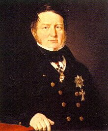
後に ナポレオン戦争、ヨーロッパの王や国は、将来の戦争で成功するには、より正確なマッピングと測定が必要であることに気づきました。より正確には、マップを描画できるフレームワークまたはグリッドです。ドイツ生まれの天文学者 フリードリッヒ・ゲオルク・ヴィルヘルム・フォン・ストルーブ (1793–1864)、ドルパット大学で働いています(市の現代名は タルトゥ)、そして1812年以来、リヴォニア(現在のエストニアとラトビアの国境地帯)で三角測量調査を担当し、1819年にロシア皇帝にこのプロジェクトを提案し、1820年代に最初の測量はゴーグラント島と イェーカブピルス (当時のヤコブシュタット)。アークの基準点としてドルパット大学が選ばれました。これは、最近の三角測量と一致しています。 ビリニュス 沿って カール・テナー (1783–1859)と、ストルーフェが認識し、組み込むことを計画していたトルネ川渓谷でのモーペルトゥイスの作品。
ストルーフェが率いる三角測量作業は、1831年までにゴーグラント島に北上し、 トルニオ 1851年までに、しかし彼だけがプロジェクトを率いる人ではなかったでしょう。テナーは、1816年から28年、1835年から40年、1846年から51年の3段階で、イェーカブピルスから黒海への三角測量を主導しました。北部では、スウェーデン語-ノルウェー語の土壌で、 ニルス・セランダー (1804–70)トルニオから カウトケイノ 1845–52および クリストファー・ハンステーン (1784–1872)カウトケイノから フグレネス 1845–50.
結果は1860年に発表されました。多くの国で弧が交差し、これは今後数十年間の調査システムのバックボーンであり、1858年から1880年の地球の形に関する英国の測地学者AlexanderClarkeの計算で使用された弧の1つです。当時利用可能だったツールを考えると、その正確さは印象的でした。ストルーフェの計算によると、赤道半径は6,378,360.7 mですが、衛星ナビゲーションを使用した現代の測定では、半径6,378,138.8 mが得られました。これは、約224mまたは735フィートの差です。
2005年、10か国の当局による数年にわたる研究プロジェクトの後、ユネスコはアークを世界遺産として設立しました。約200年前に岩に開けられた穴で構成された調査の物理的な遺跡は、あまり見るべきものではないかもしれませんが、個々のポイントから風景の素晴らしい景色を眺めることができ、その一部には印象的な記念碑が建てられています。さらに、多くのポイントに到達することは、今日でもまだ冒険のようなものであり、多くの(すべては言うまでもなく)ポイントを訪れると、馬とカートの時代に実行されたプロジェクトの広大さが本当に魅力的なものとして外れる可能性があります北ヨーロッパと東ヨーロッパのこの一連の場所について。
準備する
この旅程のすべてのポイントを訪問する最も実用的な方法は、 車。それは世界の本当に遠隔地を通過しませんが、特に旅行の北では、サービス間の距離が長くなる可能性があり、ルートの全体的な距離を考えると、あなたの車が良好な状態にあることを確認する必要があります。さらに、特に旧東側諸国では、マイナーな道路の状態が悪い場合があります。
あなたが旅を旅行することにした場合 公共交通機関、道路の隣にある場合でも、最も遠い地点への長いハイキング、ヒッチハイク、またはタクシーの旅に出かける可能性があります。あるいは、それらをスキップすることもできます。旅全体を 自転車または足 時間とスタミナがあれば、少なくとも理論的には可能です。 公共交通機関でポイント間を移動する手順は、以下のイタリック体で書かれています。この情報は、2021年3月現在のインターネット調査に基づいています。最新のスケジュールと利用可能なルートに関する便利なWebサイトは、この記事のトークページ、または旅程が通過する国や都市の記事の移動セクションにあります。
ポイント間を快適に移動する場合でも、ポイントの中には到達するのにある程度の努力が必要なものがあることに注意してください。たとえば、フィンランド南部のTornikallioは、駐車場からの上り坂のハイキングを伴い、岩や木の根を横切る小道があり、身体的または視覚的に障害がある場合、アクセス可能であると正確に説明することはできません。
入れ
弧のポイントは2,820kmを超えています。北極圏の上から黒海まで、世界遺産リストで最も長い碑文の1つになっています。距離が非常に長いため、それを見るには非常に多くの方法があります。
広い地域に広がっていることに加えて、この世界遺産の構成要素の多くは主要な都市や町の外にあります。 A 車 妥当な時間枠内でできるだけ多くのポイントを訪れたい場合は、おそらく最善の策です。フィンランド湾にあるポイントは、まだアクセスに問題があります。
ノルウェー、スウェーデン、フィンランド、エストニア、ラトビア、リトアニアは、 シェンゲン圏 ベラルーシ、モルドバ、ウクライナはそうではありませんが、別々になっていることを意味します ビザ 政権。ほとんどのEU国民は、この旅程でシェンゲン協定国以外の国への比較的手間のかからないアクセスを楽しんでいますが、それでもパスポートを取得する必要があります。ベラルーシは過去に悪名高い「閉鎖」ビザポリシーを持っていましたが、それ以来、EU市民に対する規則を大幅に緩和しました。ゴーグラント島のシュトルーヴェ弧のロシアの部分は観光客がアクセスできないため、この部分をスキップしてフィンランドからエストニアに直行する必要があります(またはその逆)。詳細については、各国の記事を参照してください。
行く

ノルウェー
北端はあなたがヨーロッパで得ることができるのとほぼ同じくらい北にあります。ここにたどり着くには、 E6からスウェーデンとノルウェー スカイディへ。旅の一部の代替ルートは次のとおりです E45, E4 または E8 南への旅では後者に沿って運転しますが、すべてあなたがどこから来たかによって異なります。スカイディから、ハイウェイ94でハンメルフェストに到着します。
何よりも、あなたは飛び込みたいと思うかもしれません。 トロムソ はこの地域の主要なハブであり、そこからハンメルフェストに飛ぶことができます。ハンメルフェスト空港は、フグレネスから徒歩1km強です。 フッティルーテン ハンメルフェストにも寄港します。港からフグレネスまでは湾から約2.5kmです。
- 1 Fuglenes、 ハンメルフェスト, フィンマルク –フグレネス、「鳥の半島」は、北極海を望む丘の上のハンメルフェストのフグレネス地区にあります。ポイントは花崗岩の台座の上に立っている緑の地球によってマークされています、この記念碑は呼ばれています Meridianstøtten.
Skaidiに戻り、E6に沿って南西にドライブしてAltaに向かいます。アルタ川を渡る前に、左折してカイスクルへの小さな道を進み、ライパスへと進みます。
残りの旅程と比較して、あなたはアルタに行くという選択に甘やかされています。バス、ボート、飛行機の中から選ぶことができます。アルタに着いたら、ウォーキングシューズを履きましょう。つまり、下記の駐車場への公共交通機関はありません。港、空港、最寄りのバス停は市の東にあります。バスで行く場合は、アルタのダウンタウンまでは行かないでください。バスがアルタエルバを横切る前に、E6のストレン停留所で下車してください。空港と港から、E6に沿ってその川を渡って歩いて戻ります。 E6から、Kjosveienという名前の道路がRaipasに通じており、登山口まで3.5kmあります。
- 2 ライパス、 アルタ, フィンマルク –カラスが飛ぶように、ライパスポイントはアルタからそれほど遠くありませんが、そこの道路はアルタエルバの反対側(アルタ川)を通り、ライパスの集落に向かいます。道路の隣に駐車場があり、そこから数キロの上り坂をハイキングして、約250 mASLのLilleRaipasの頂上まで行きます。アルタには、E6沿いの町のすぐ西にある先史時代の岩の彫刻という別の世界遺産もあります。
アルタから、E45を南にカウトケイノ方面に進みます。

ノルウェーの他の2つの地点を訪れる予定がある場合は、E6に戻り、そこからバスでアルタ中心部に行き、そこからカウトケイノ行きのバスに乗ることができます。それぞれにかなりのハイキングが必要であることに注意してください。さらに、フィンランドへのバスがこれ以上ない場合もあるため、バスでアルタに戻るか、エノンテキエまで80kmのハイキングまたはヒッチハイクを行う必要があります。次の地点に行くには、Suolovuopmi fjellstue(Suolovuopmi lodge)で下車します。そこから、砂利道に沿って約10 km、さらに3kmの地点まで下車します。ロッジに戻りましょう。テントを持っていない限り、ここはこの辺りで寝る場所です...
- 3 Luvdiidčohkka、 カウトケイノ, フィンマルク –Luvdiidčohkka(LohdizhjokkiまたはLodikenとしても知られています)638 m ASLの頂上にある、訪問するのが最も難しいポイントの1つ(次のいくつかのポイントも同様)。から E45、北に向かう砂利道があり、普通の車には荒すぎるかもしれません。その砂利道の最も近い地点(道路の右側に赤い小屋があります)から、頂上への道に沿って約3kmのハイキングがあります。

バスでカウトケイノまで進みます。町の南から、道路は以下のようにAvziに分岐します。カウトケイノからアヴジまでは約11km、さらに5kmのハイキングです。
- 4 Baelljasvárri カウトケイノ, フィンマルク –カウトケイノの町から、小さな道が東に向かってアヴジの村に向かいます。そこから、スノーモービルトレイルとしてマークされた小道または砂利道が幹線道路から分岐します。 Baelljasvárriは585mASLであり、ポイントに到達するために再び数キロのハイキングがあります。
E45に沿ってフィンランドに進みます。
ライパスを訪れた後、数ポイント先をスキップするか、上記のポイントの後にアルタから続けるには、アルタから西に向かうバスがないようです。空港に向かい、トロムソに飛んで、フィンランドのバスに乗ってロヴァニエミに向かいます。 。それはSkibotnに戻り、E8に沿って南東に進みフィンランドに進みます。
フィンランド行きのバスがない場合は、ヒッチハイク、非常に長い散歩、または一連のフライトを利用できます。後者は、アルタからオスロへ、そしてそこからヘルシンキへ、キッティラへ、ストックホルムへ、そしてキルナへ、またはルレオ経由でパヤラへと飛ぶことを意味します。
スウェーデン そして フィンランド 国境に沿って
荒野は、カウトケイノとエノンテキエの国境近く(東側から入る)またはカレスバント近く(南西側から入る)から入ることができます。シーボットン方面からお越しの場合、バスはカレスバントに停車します。スウェーデンの次のいくつかのポイントを訪れる予定がある場合は、ここでバスを降りる場所でもあります。または、バスでロヴァニエミまで行き、アーバサクサまたはトルニオポイントまでスキップすることもできます。
エノンテキエ中心部(ヘッタ)に到着した場合は、バスでキルピスヤルヴィに向かってカレスバントに行くか、ロヴァニエミに向かいます。
- 5 Stuorrahanoaivi、Tarvantovaara荒野エリアの北 カレスバント、で エノンテキエ, フィンランドのラップランド -カウトケイノ-ヘッタ高速道路のパロヤルヴィの集落から約29kmの、タルバントヴァアラ荒野エリアの真ん中にある、はるかに遠い地点。ここにリストされている他の「リモート」ポイントへの行き来には、通常、数時間かかりますが、この場合、問題は約2日です。ポイントまでマークされたトレイルはありませんが、ノルウェーの国境に続くスノーモービルトレイルに沿ってPalojärviから始めることができます。 Salvasjärviには、フィンランドの森林管理局が運営する荒野の小屋があります。ある地点(GPS機器と地図を持参)で、トレイルから南南西に数キロ進み、その地点に到達します。あなたはアウトドアでいくらかの経験を持ち、そこに冒険する前にあなたの機器を整えておくべきです-私たちのを見てください 北欧諸国でのハイキング そして 北欧諸国でアクセスする権利 紹介のための記事。
フィンランドのハイウェイ93としても番号が付けられているE45は、南に向かってヘッタの町まで続き、西にパロヨエンスーまで続き、その後、ハイウェイ8およびE8と合流して北西に向かっています。 カレスバント/カレスアンド 交差点。スウェーデンに入った後、スウェーデンの高速道路99に沿って南にドライブします。次のいくつかのポイントはこの道路の近くにあります。
カレスバントから、橋を渡ってツインタウンに向かい、スウェーデンの道を綴りました。スウェーデン側の川に沿って南にバスがないので、Tynnyrilakiは車なしで訪問するのに挑戦しています。下記の砂利道の終点は、カレスアンドの南30km以上にあります。
- 6 「Pajtas-vaara」:Tynnyrilaki、 キルナ市、Norrbottenslän -国境のスウェーデン側。あなたはで国境を越えることができます カレスバント/カレスアンド または ムオニオ 国境を越えてスウェーデンの高速道路99号線に沿って移動します。 Paittasjärvi湖の南東端(西岸に同じ名前の集落があります)では、マークのない狭い未舗装道路が湖の東岸に沿って北に向かっています。それに沿って運転できる可能性があります。約3〜4 km曲がると、右に曲がる交差点があります。約1.5 km後、右に曲がって、Tynnyrilakiとしても知られるPajtasvaara丘(445 m ASL)に続く小さな道があります。 Tynnyrilakiはフィンランド語で「バレルトップ」を意味し、その名前は、ストルーフェのチームが最後にバレルを備えた測定ポイントでロッドを上げたという事実に由来し、このセットアップは次の測定ポイントから見えました。
川沿いにはバスがありませんが、カレスアンドからキルナ行きのバスがあります。ビッタンギまで移動し、別のバスでパヤラに行きます。カレスアンドから入ってくる高速道路99との交差点で、町の前で下車します。ジュプッカの丘は、高速道路99に沿って北に約3kmです。

- 7 「ケロジュプッカ」:ジュプッカ、 パヤラ, Norrbottenslän -同じ高速道路を南に進み、パヤラの少し手前で、標高277 mの丘、ジュプッカ自然保護区の中点であるジュプッカの近くを通過します。高速道路から駐車場への道標のある小さな道があり、そこから頂上までの急な小道があります。
ジャンクション、またはさらに南に5kmほど離れたパヤラまでハイキングします。パヤラから、この一連のポイントの終わり近くにあるボスニア湾のハパランダに向かう4つのバスが平日にあります。 Pullinkiポイントまでのスキーリフトは、高速道路の隣にあるSvansteinの村から約3kmです。
- 8 「Pullinki」:Pullinki、 エベルトーネオー, Norrbottenslän -この点とそれに続く点は、少しアクセスしやすいです。 Pullinkiの丘(335 m ASL)は スキーリゾート、スキーリゾートの本館から山頂までの小道に加えて、山頂までのスキーリフトがあります(スキーシーズン中に運行している可能性があります)。ここはスキーリゾートであるため、森林は伐採されており、アーバサクサを含むトルネ川渓谷とフィンランドの素晴らしい景色を眺めることができます。プルリンキと川の谷のさらに南にあるストルーフェのいくつかの地点は、地球が完全な球体ではないことを証明したフランスの科学者ピエールルイモーペルトゥイスによって、1730年代にすでに同様の測定に使用されました。
エベルトーネオーからフィンランドに戻り、E8を過ぎてロヴァニエミに向かって数キロ進み、左折します(標識にはAavasaksanvaaraと書かれています)。
スウェーデンのバスでさらに南に行き、エベルトーネオーのバス停で下車し、橋を渡ってフィンランドのエベルトーネオーのアーバサクサ村に向かいます。ハイウェイ8を横断する場所までは約2.5km、ロバニエミに向かって東に2.5 km進み、そこから道路がアーバサクサまで上り、さらに頂上まで2.5kmです。スウェーデンのポイントをスキップしてロバニエミから出発した場合は、アーバサクサ村への直通バスがあり、そのジャンクションで下車できます。

- 9 アーバサクサ、 エベルトーネオー, フィンランドのラップランド
 -フィンランドのアーバサクサは、エベルトーネオーとエベルトーネオーの国境橋の真向かいにあり、ほぼ1世紀半の間観光地として利用されてきました。フィンランドがロシアの州だった1881年、ロシア皇帝アレクサンドル2世は、訪問と大きな丸太小屋を計画しました(ケイサリンマジャ)はサミットで彼のために建てられました(彼が暗殺されたので旅行は決して起こりませんでした)そして今日それはAavasaksaの魅力の1つです。ここには、モーペルトゥイスの遠征の記念碑や、側面にストルーフェの飾り板が付いたレンガで作られた展望塔もあります。アーバサクサはフィンランドの国家景観の1つであり、頂上(242 m ASL)までは運転可能な道路があります。
スウェーデンに戻り、ハイウェイ99に沿って南に進みます。
ペラヴァーラポイントを訪れるには、エベルトーネオーバスステーションに戻り、カルンギまで南下するバスに乗ります。歩いていると、リストの説明のように森全体を一周する代わりに、カルンギの村からポイントにたどり着くことができるかもしれません。カラスが飛ぶように、カルンギからの距離は4 kmであり、 北欧諸国でアクセスする権利 適用されますが、そこからマークされたパスがない可能性があるため、ナビゲーションが問題になる可能性があります。
ペラヴァーラをスキップして徒歩を節約するために、アーバサクサからトルニオへの直通バスがあります。または、ロヴァニエミ経由で移動することもできます。
- 10 「ペラヴァーラ」:ペラーヴァーラ、 ハパランダ、Norrbottenslän --Perävaaraはスウェーデン側にあり、トルネ川のさらに下流にあります。地形は海に近づくほど平坦になり、わずか89mのASLペラヴァーラはまだ周囲よりも高くなっています。森の真ん中にあり、カールンギの村の近くにあり、元のマーキングが保存されているスウェーデンで唯一の場所です。森にはたくさんの小道がありますが、ノルボッテンの地方行政は、カールンギから南に約10 kmの高速道路99に沿って、次に地方道路730(スウェーデンではそのような道路は番号が付けられていないことが多い)に沿ってビョルクフォルスに向かって1km運転することを提案しています。次に、林道に沿って北に1 km進み、指定された駐車場に向かい、そこから林道に沿って5 km歩いて、頂上に至る小道に向かいます。
幹線道路に戻り、南に向かってハパランダまで進み、フィンランドのトルニオに渡ります。ケミに向かってドライブすると、鉄道橋の下を通過します。次の交差点で右折し、Röyttäntieに沿って南に進みます。川の支流を渡った後、次の道を右折すると、道の左側に教会が見えます。
カールンギからハパランダまで(または上記のように、アーバサクサから)バスに乗ると、トルニオ-ハパランダバスステーションに停車します。理論的には、ここから次の地点までの最短の道は、川を下り、鉄道橋を渡ってフィンランド側に行き、教会のほぼ隣に着陸することです。時折の貨物輸送に使用される橋ですが、電車に遭遇するリスクは低いですが、ほぼ間違いなく違法です(人々ができるとしても) 国の間を自由に横断する)。そのため、駅からトルニオに歩いて行き、歩道橋でトルニオ川の本流を渡り、Länsipohjankatuまで下流に歩き、鉄道の下を渡り、Röyttäntieを南に進み、川の支流を渡る橋を渡る必要があります。 Parasniementieに右折し、鉄道の下を通過すると、教会はすぐ左側にあります。このハイキングは約4キロです。あるいは、トルニオには公共交通機関があります。ミニバスが平日に毎日数回市内を周回しており、バス停からRöyttäntie/ Parasniementieの交差点まで行くことができます。

- 11 Alatornion kirkko、 トルニオ, フィンランドのラップランド -アラトールニオ教会は、アクセスしやすい場所の1つです。少なくとも1316年以来、おそらくそれ以前にも、この場所にいくつかの教会が立っています。現在の教会の塔(1797年に完成)は、ストルーフェのチーム、以前の教会の塔、そしてモーペルトゥイスによって三角測量の塔として使用されました。
次の地点に行くには、幹線道路に戻り、ケミまで車で行き、そのまま進みます。 ハイウェイ4 ユヴァスキュラへ、そしてタンペレへ。
歩行者はRöyttäntieに戻り、それを北に向かってほぼ高速道路29まで、つまりPutaankatu通り(約2 km)まで進むことができます。ジャンクションのすぐそばにバス停があり、そこからバスに乗ることができます。 ケミ またはケミトルニオ空港へ(フィンランドのポイントをスキップするためにヘルシンキに飛んだり、タルトゥに飛んだりしたい場合)。ケミからバスでオウル、ユヴァスキュラ、ヤムサに向かって進み、オラヴィヴオリポイントに到着します。または、電車に乗ってヘルシンキまで行き、フィンランドのポイントをスキップして陸路を進みます。
フィンランド中部と南部
バスは高速道路9に沿って移動します。ユヴァスキュラから約35km、プオラッカ道路のジャンクションでバスを降り、9km歩くとオラヴィヴオリに到着します。
- 12 Oravivuori、 コルピラハティ, 中央フィンランド —Jyväskylä–Jämsä道路9 E63から、Jyväskyläから来る場合はPuolakkaに向かって、Tampereから来る場合はSaalahtiに向かってオフにします。これらは、同じ道路の終点です。右側の駐車場にあるストルーフェチェーンの標識が見えるまで、約10km進みます。そこから1kmの上り坂のハイキングがあります。塔からのパイヤンネ湖の眺めは素晴らしいですが、ユネスコのマーカーがある地点では、松によって視界が遮られています。 Oravivuoriは193mASLです。
幹線道路に戻り、ヤムサとラハティ、そしてラハティを過ぎてハイウェイ4に進みます。ラハティの南の交差点で、167号線をオリマティラとミュルスキュラまで進み、174号線をアルトヤルヴィ方面に少し進み、1751号線をポルラムミ方面に進みます。

Oravivuoriから、同じ方法で高速道路に戻り、バスに乗ってJämsä、Lahti、さらにはヘルシンキまで行きます。ヘルシンキに着いたら、別のバスに乗って コウボラ Lapinjärviの直前で下車します。最初はポルラムミまで、次にミュルスキュラに向かって、そしてトルニカリオへの小さな道に沿って、約14kmの距離を歩きます。田舎道沿いにバス停がありますが、どうやらサービスはありません。
- 13 Tornikallio、 Lapinjärvi, ウーシマー — Porlammi–Myrskylä道路から駐車場への標識に従います。その後、道路に沿って最初の200 mのバックトラックを行い、約400mの上り坂をハイキングします。冬にはおそらく良い考えではありません。ピュハ湖の素晴らしい景色が見渡せますが、ユネスコのマーカーがある地点では、ほとんどが松で遮られています。 Tornikallioは98mASLです。
Porlammi経由でLapinjärviとHighway6まで進みます。次のポイントに到達するのは難しく、非常に困難です。それらをスキップしてエストニアのポイントに到達するには、フェリーでヘルシンキに向かいます。それ以外の場合は、Lapinjärvi中心部から167号線が下がっています。 Lovisa。 Mustaviiriへのボートを手配できる場合は、LovisaまたはPyhtää/ Pyttisが出発点になる可能性があります。もう1つのオプションは、陸上でそれに近づくことです。その場合は、街をドライブして(または観光のために立ち寄って)、左側にUngernの要塞が見えたら、右に曲がってHästholmenに向かい、道を最後まで進みます。 Söderbyの集落。島は南南東10km未満です。
Tornikallioから、同じようにHighway6とLapinjärviに戻ります。ここからいくつかのオプションがあります。エストニアのポイントを求めてヘルシンキに戻るか、同じバスでVanhakylä(Gammelby)に向かい、高速道路の下を渡り、別のバスでLovisaとKotkaに向かいます。同じ視点にたどり着くには、ロビサを通過した後、バスを降ります。 Söderbyへの田舎道に沿って約23kmあります。それをスキップしたいが、ゴーグラントを見るためにコトカに行きたい(またはロシアに行きたい)場合は、バスにとどまります。または、代わりにLapinjärviからKouvolaまでバスに乗り、Kotkaまで電車で行くこともできます。
ロシア
ロシア当局はゴーグラント島を「国境地帯」と宣言しているため、外国人が特別な許可なしに島に旅行することは許可されていません。これにより、海外からの観光は一度に1つずつ許可される小グループに制限されます。ゴーグラントには2つのシュトルーヴェジオデティックアークポイントがあります。 15 「ホグランド、Z」 そして 16 「Mäki-päälys」.
ゴーグラント島へのツアーに参加できた場合、旅行はロシアで始まる可能性が高いので、東に向かいます。それにもかかわらず、島は海岸から40 km離れていても、ある意味ではそれほど遠くありません。ゴーグラントはフィンランド語でSuursaari(「ビッグアイランド」)と呼ばれ、フィンランド湾の真ん中にあるかなり大きなものです。南北11km、最も広い地点で幅3 km、100 mを超える丘がいくつかあり、海抜173mの最高地点があります。そのため、海岸の特定の場所から(途中に他の島がない場合)、またはのハウッカヴオリ展望台から見ることができます。 コトカ.
エストニアのポイントに行くには、ヘルシンキとタリンフェリーに向かいます。ゴーグラント島を訪問する許可を得て、ロシアでその旅行を開始する場合、ヘルシンキからサンクトペテルブルクへのバスはしばしばコトカに停車します。または、ロシア行きの電車が行くコウヴォラまで電車に乗って、そこから東に電車に乗ることもできます。
エストニア
フィンランドからエストニアに行くには、頻繁に利用することができます フェリー ヘルシンキからタリンに渡ります。これらのフェリーは、フィンランド人が楽しみのために南に行き、エストニア人が仕事のために北に行くのにかなり人気があります。
タリンから、ハイウェイ1(E20)を東に約100 km進み、 ラクヴェレ、市の環状道路に沿って、市道22号線の南西からヴァイケマージャまで、町を過ぎてエバヴェレまで。次に、109号線に沿ってシムナ方面に曲がります。ロシアからゴーグラント島を訪れた場合は、E20をエストニア国境まで行くことができます。 イヴァンゴロド/ナルバ、Rakvereに進み、上記のように続行します。
タリンのフェリーを降りて、タリンの鉄道駅であるバルティジャームに向かい、タルトゥ行きの電車に乗ります。ラッケまたはタムサルで下車します。そこから、シムナまたはヴィヴェーレまで行くことができるさまざまなルートを利用するローカルバスがあります(他の場合は、シムナからそこを歩いてください。北西に約4 kmです)。次のポイントは村のすぐ東です。
ロシアからお越しの場合は、サンクトペテルブルク-タリンの電車でラクヴェレまで行き、そこから同様のローカルバスの1つでシムナまで行きます。
- 17 「Woibifer」:Võivere、 Avanduse、レーネヴィル -Ebavere-Simuna道路の隣の畑の真ん中に、Võivere邸宅の左側にある唯一の建物が立っています。三角点として機能し、現在はビジターセンターに復元された風車です。風車の隣には、ガラスケースで保護された地面のマーカーがあります。
- 18 「カトコ」:シムナ、アヴァンデュース、レーネヴィル -次のポイントは前者からそれほど遠くありません。Paasvereへの道に沿ってSimunaのすぐ東にあり、Simunaラインの終わりを示す小さな石の柱がフィールドにあります。

Simunaから、道路124をRakkeとHighway 22まで進みます。標識にはすでにTartuと書かれており、ルートは高速道路22、39、3に沿っています。
タリン-タルトゥ線の鉄道駅の1つにローカルバスの1つに乗り、次にタルトゥへの電車に乗ります。
- 19 「ドルパット」:タルトゥ天文台、 タルトゥ -タルトゥの古い天文台はシュトルーヴェ弧のポイントナンバーワンであり、この旅程の中心と見なすことができます。タルトゥは何世紀にもわたって大学都市であり、天文学者が住み、働き、三角測量調査を指揮したのはここでした。古い天文台には天文学の展示があり、ここでは無料の公開観測の夜が開催されます。
ラトビア
地図またはGPSナビゲーターを取り出して、道路標識の少ない森や野原を通る未舗装の(場合によっては狭い)道路で長いセクションを運転する準備をします。
タルトゥから、ハイウェイ3に沿ってドライブして バルガ/ヴァルカ エストニアとラトビアの国境で二分され、P24以降 スミルテン。 Smilteneから、P27に沿ってGulbeneに向かって進みます。道路に沿って約16kmのĶeņģiの集落で、右折してJaunpiebalgaに向かい、そこからP33をVecpiebalgaに向かって進み、Ērgļiに進みます。 ĒrgļiからP79をIrši方面に進みます。マーカーはこの道路に沿って南に約8kmです。
バスまたは電車でヴァルガまで進み、そこから別の電車(またはバス)でリガに向かいます。エストニア側に鉄道駅がある分断された都市です。バスで続行したい場合は、ヴァルカに渡る必要があります。次のポイントは、車なしでアクセスするのがやや難しいです。スキップするには、リガまで続きます。それ以外の場合は、ツェーシスで下車します。ツェーシスからイェーカブピルス、ダウガフピルスまで、毎日早朝に出発するバスが1本あります。 Ērgļiから、1日2本のローカルバスで、Sestukalnsポイントからそれほど遠くないBarkaiziバス停に行くことができます。または、エルグリから歩いて行くこともできます。ポイントは、街の南約7kmです。

- 20 「Sestu-kalns」:Ziestu、 Sausneja、地域 マドンナ --Sestukalnsマーカーは、やはり市街地から少し離れていますが、車を持っている場合はアクセスするのはそれほど難しくありません。 P79道路から森へと約100mのところにあり、丘(216.5 m ASL)は現在Ziestuと呼ばれています。
次の世界遺産に登録されている地点に直行するには、Iršiまで進み、番号のない道路を東にP78まで進み、南にPļaviņasまで行きます。そこから高速道路A6からイェーカブピルスまで、ダウガヴァ川をたどります。
あるいは、今が国のハイポイントを訪れるチャンスです。 Ērgļiに戻り、そこから南東にP78を少し進み、次にP81をマドナに向かって進みます。 In the village of Vestiena, road signs show the way to Gaiziņkalns, at 312 m ASL the highest hill in Latvia. The hill wasused by Struve's team for triangulation and there's also a marker here (although not part of the world heritage site). From Gaiziņkalns, continue along the same unnumbered road to Bērzaune, by P37 to Pļaviņas and A6 to Jekabpils.
From Ērgļi, catch the same bus you traveled on from Cēsis to get to Jēkabpils. If you've started this leg in Riga (skipped the last point), you can get to Jēkabpils by bus or to Krustpils on the other side of Daugava by train. In the latter case, there's a 5 km walk to get from Krustpils railway station to the point.
- 21 "Jacobstadt": Jekabpils, Region Jekabpils - This marker, unlike the former, is in an urban environment (and one of those easily accessible without a car), in a park nowadays named Struves Parks bordering Daugava.
リトアニア

From Jēkabpils, continue along P75 towards Nereta. From Birži, drive along P72 and P74 to Aknīste. Turn to an unnumbered road leading to Juodupė in Lithuania, and another unnumbered one to Rokiškis. Then continue west along road 122 towards Kupiškis.
Looking at a map, it would seem logical to travel to Daugavpils and towards the Lithuanian points from there. However, public transport across the border from Daugavpils and in northeastern Lithuania are surprisingly scarce. Therefore it's easiest to head up to Riga, take a bus towards Lithuania as far as Panevėžys (stay on the bus to Vilnius if you wish to skip the two next points). Continues by bus or train (one each daily) towards Rokiškis until Panemunėlis. The point is next to the highway and the nearest bus stop, Baltakarčiai, is less than 1 km from the point, whereas there's about 4.5 km of walking from Panemunėlis railway station.
- 22 "Karischki": Gireišiai, Panemunelis, Northern Lithuania - Right next to the road between Rokiškis and Kupiškis, the place is more visible than other rural points as there's a fence around the marker, and elevated viewpoint to have a look around the fields, a little playground and a big parking area.
Continue for a few kilometers further along the road, then turn to a smaller road going south to Kamajai. From there, road 120 southwest to Svėdasai, then road 118 southeast to Utena. Then, the trip continues for almost 70 km along a major road, highway A14 towards Vilnius. Turn west towards Paberžė - the marker is signposted from the main highway.
To continue, you may be in for a walk of around 10 km to Rokiškis. From there, there are a couple of daily buses to Vilnius, and the following point is near the highway. Nevertheless, make sure that the bus stops at the Naujasėdžiai bus stop near the point, apparently buses from as far as Rokiškis skip stops closer to Vilnius. Otherwise you should change buses along the road, for instance in Molėtai. Once off the bus, the point is about 1 km off the highway towards Meškonys and into the woods.
- 23 "Meschkanzi": Meškonys, Nemencine, Eastern Lithuania - This marker is in the hamlet of Meškonys, there's a small parking pocket next to the road and from there a path goes for 200 m slightly uphill through the meadow to the marker.
Continue along the highway to the Lithuanian capital ビリニュス, whose old town is on the world heritage list. A few kilometers after leaving the marker you will pass another monument next to the highway marking the center of Europe (according to one calculation).If you're collecting world heritage sites, and want one more, don't head straight to Vilnius but turn right to Maišiagala along road 108 and on to Dūkštos and from there towards Kernavė along road 116. Kernavė is an archaeological site and the former capital of Lithuania and features pre-Christian grave mounds. Backtrack to Dūkštos, continue in the same direction via Sudervė, Avižieniai and highway A2 to get to Vilnius.

From Vilnius, head east towards the Belarusian border along Highway A3. When the exit says Naujoji Vilnia, get off the highway and drive northeast passing under the highway. Immediately turn right towards Rukainiai and drive parallel to the highway for 1.5 km or so, then there's a sign guiding you to turn left to get to the next Struve point along gravel roads.
Walk back to the highway and take a bus to Vilnius. The following point is in the eastern outskirts of the Lithuanian capital and is accessible by city bus. Bus 14 takes you to 1-asis Didžiasalis, from the bus stop you should walk east for about 2 km to the hamlet of Paliepiukai where the point is.
- 24 "Beresnäki": Paliepiukai, Nemežis, Eastern Lithuania - This marker sits in the middle of a field just outside Vilnius. This point is fairly simple, an information sign and a bench, but on the upside you can get right next to it by car.
The marker in Paliepiukai is the last one in the Baltic States, and indeed the European Union and Schengen area. To cross into Belarus most nationalities will need a visa and a green card for your car - see our ベラルーシ 詳細については記事をご覧ください。 Somewhat less bureaucracy is needed to enter Ukraine and Moldova (e.g. western nationalities can generally enter visa-free), so if you want to avoid that you could head west to Marijampolė and Poland, drive via Białystok and Lublin and then turn east to enter Ukraine. Nevertheless if you have your papers in order, get back on the highway and head for the Belarusian border, which isn't that far away. If you want to visit another country high point, this is possible through a short side trip: turn right towards Mednininkai just before the border and drive past the village. Follow the signs to Juozapinės kalnas, to get to Aukštojas, at 294 m ASL the highest point in Lithuania.
ベラルーシ
From now on be prepared for a different driving experience, much of the rest of the itinerary will take you along rural side roads in comparatively poor countries. The fun doesn't end there; place names in Belarus are often transcribed to Latin letters in more than one way, and may have Russian name with usually with a few vowels and "s" sounds changed which also may be transcribed in different ways.
.jpg/220px-Цюпішкі._Дуга_Струвэ._Пункт_«Тупішкі»_(01).jpg)
After crossing the border, continue towards Minsk (Мінск) along M7. At the town of Kreva (Крэва), get off the highway and drive west along P95. After some 14 km on the road, turn right towards the hamlet of Ciupiški (Цюпішкі).
To get into Belarus, take train from Vilnius towards Minsk. The first point is another one that takes some effort to access by public transit. One option would be taking the train to Smargon (Смаргонь), and from there a bus (there are two daily, leaving early and late in the morning) towards Grodno (Гродна). These go via Halshany (Гальшаны) and stop at the junction to Tyupiski (Цюпішкі) too from where there is about 2 km to the point. If you travel by bus to Minsk, the highway passes Ashmanyany (Ашмяны), from where there might be buses towards Halshany from where you need to walk a bit back towards Tyupiski. To skip this point, remain on the train until Molodechno (Маладзечна) and change to a train going towards Grodno (Гродна).
- 25 "Tupischki": Tupishki, Oshmyany, Grodno Oblast - About 500m southwest of the hamlet lies the marker; apparently at a height of 311 m ASL. It's marked by a small black obelisk with a globe representing the Earth on the top of it.
Get back on the road and continue in the same direction to Haĺšany and on (the road is now numbered P48) to Iuye (Іўе). Take P5 south for a few kilometers to Highway M6, and continue west past Lida (Ліда, a somewhat bigger city) towards the regional capital of Grodno. At Vialikaje Mažejkava (Вялікае Мажэйкава), also known by the Russian name Bolshoe Mozheikovo, turn off the highway to the southeast and drive south to the town of Zhaludok (Жалудок). Continue west along P141 to Rozhanka (Ражанка) and after a little more than 10 km the Lopati marker is right next to the road, on the left-hand side.
Catch the next bus (or stay overnight in Halshany or take a taxi) to get to Lida. From there, continue towards Grodno (Гродна) by train - the same which you would travel on if having skipped the previous point - and travel to Rozanka (Ражанка). The Lopati point is about 6 km east of Rozanka railway station.
- 26 "Lopati": Lopaty, Zelva, Grodno Oblast - The Lopati marker is easily accessible in the middle of a field right next to the P141 road.
After Lopaty, turn back and drive east along the P141 to Belitsa (Беліца). Just before the town, turn to the M11 and drive south past Dziatlava (Дзятлава) and スロニム (Слонім) to the southern end of the road, then Highway M1 southwest towards Brest (Брэст) for about 10 km. At Ivatsevitsy (Івацэвічы), turn southeast to the P6 and drive almost all the way to Pinsk (Пінск). Just after crossing Yaselda River, the road makes a sharp bend to the left, and there's a junction going straight ahead and another one immediately afterwards turning right - turn off here and drive northwest parallel to the river towards Motal (Моталь) for a little more than 20 km, just past the village of Moladava (Моладава) to get to the first of a set of three points quite close to each other.
Walk back to Rozhanka. From here you can board the Grodno-Gomel (Гомель) nighttrain, that has cars going to Brest (Брэст) (going back west from Luninets). Travel on that train to Pinsk (Пінск) (no, not Minsk), and from there there are a few daily local buses to Motal. Get off just before Motal (Моталь), in Molodovo (Моладава) or Osovnitsa (Асаўніца), as the point is between these villages, a few kilometers along paths off the road.
- 27 "Ossownitza": Ossovnitsa, イヴァノヴォ, Brest Oblast - The point is in a field, about 500 m south of the road between Moladava and Osovnitsa/Asaunitsa. Nevertheless the paths from the road zigzag back and forth so the distance is almost certainly longer. This is again a black pedestal with a black globe on top. Next to it there's a tripod with a "barrel" a few meters above ground.
Continue to Motal (Моталь), and turn south towards Ivanovo/Ivanava (Іванава). After about 13 km, turn right to a smaller road towards the hamlet of Shchekotsk (Шчакоцк), and after 100 m a road or path veers off to the right into the forest to the next marker.

Some more walking is required to get to the next point; 3 km to Motol (Моталь) and another 13 km south towards Ivanovo (Іванава) and a few hundred meters into the forest to get to Chekutsk (Шчакоцк). As there will be even more walking from there before public transportation is available, this is another point people who aren't fans of that may want to skip it. To get directly to the next point, return to Pinsk by bus, and continue west by train to Yanov-Polesski (Янов-Полесский), the station serving Ivanovo.
- 28 "Tchekutsk": Chekutsk, イヴァノヴォ, Brest Oblast - Similar in design to the other two points in the region, this marker is in the middle of a pine forest a few hundred meters from the Motal-Ivanava road.
Continue towards Ivanava (Іванава), and when you come to the last town before Ivanava, Lyaskovichi (Ляскавiчы), turn left at the Pereluok Yubileynii (переулок Юбилейный, "Jubileum street"), the 6th street on the left and drive it to the end. The street will first have one-family homes at both sides, then it will change name to Ulitsa Beryozovaya (улица Берёзовая) and there will be houses on the left and forest on the right. The street will end at a field or meadow, with another street or path going to the left. The marker is in that field, more or less straight ahead.
It's 5.5 km to the town of Lyaskovichi, more exactly to the junction of Pereluok Yubileynii (переулок Юбилейный, "Jubileum street") which you should walk east for 1.5 km to the end to get to the next point, which is in the middle of a field.
If you've stepped off the train in Yanov-Polesski (Янов-Полесский), cross over the railway to Ulitsa Chapayeva (вуліца Чапаева), walk it one block to the east and head north on Polevaya Ulitsa (Палявая вуліца) past some industrial plants. After these, turn right and walk Ulitsa Gagarina (улица Гагарина) to its end, turn right again and walk Ulitsa Sovietskaya (улица Советская) to the M10 highway. Cross it and walk along the path with the field on your right side (forest on your left), after a while there's another path veering off right leading to the marker.
- 29 "Leskowitschi": Leskovichi, イヴァノヴォ, Brest Oblast - In a field, reportedly it's good to rubber boots when walking here to avoid getting your feet wet. It's again a black marker and a barrel on a tripod.
Get back to the main road, and continue south to Ivanava (Іванава), and get on P144 south towards Rudsk (Рудск) and the village of Kalena (Калена) and through the Mokhro (Мохро)-Dolsk (Дольськ) border crossing into Ukraine.
From the Leskovichi marker, head down to the Yanov-Polesski railway station like in the description above but in the opposite order.
ウクライナ そして モルドバ
After the border, the road will get the Ukrainian number P14. Keep going all the way to ルーツク (Луцьк), with more than 200,000 inhabitants the biggest city on this itinerary since Vilnius. From there, take Highway M19 to Dubno (Дубно) and on to another relatively big city, Ternopil (Тернопіль) (no, not Chernobyl - that's a few hundred kilometers northeast ). From Ternopil, turn east along Highway M12 E50 and drive almost to the next large city, Khmelnytskyi (Хмельницький). About 20 km before, turn north on a smaller road numbered T2302 (though may not be signposted as such) towards Vodychky (Водички). Drive along that road for about 20 km to the twin towns of Maryanivka (Мар'янівка) and Chornyi Ostriv (Чорний Острів) bisected by a railway, and continue north towards Antonivka (Антонівка). Just outside town, take the road that forks off left to the hamlet of Katerinovka (Катеринівка), drive past the hamlet and the point is in the field to the right at some distance from the road.
Take a train to Brest (Брэст). As there does not seem to be any train services into Ukraine, you need to take the bus to Kovel (Ковель). From there, ride the train to Kiev (Київ) until Rovno/Rivne (Рівне) or Shepetivka (Шепетівка) and take a bus to Khmelnytskyi (Хмельницький). This city can serve as a base for exploring three points around it - each of which will entail long walks. To get to the Katerinovka point, take a local train northwest to Chorni Ostriv (Чорний Острів). From the station, walk north halfway to Antonivka (Антонівка), then take the road left to Katerinovka (Катеринівка), walk past the hamlet and the marker is on the right-hand side, about 11 km from the station. Then, backtrack to Chorni Ostriv and Khmelnytskyi.

- 30 "Katerinowka": Katerinowka, Antonivka, Khmelnytskiy 領域 - The Katerinowka marker is about 500 m northwest of the rural road north of Katerinovka. There is a straight path from the road to the point, which is made up of a black stone a bit reminiscent of a gravestone with an inscription in Ukrainian describing Struve's measurement project. Next to it there's a tripod with a small disk on the middle rod.
The last points in Belarus were a set of three close to each other, and the first ones in Ukraine is also a set of three fairly close to each other (though not as close as the Belarusian ones). Backtrack to the M12, drive back 1 km towards Ternopil (Тернопіль) and turn south towards Gvardyiske (Гвардійське). Past that small town, the following point is near the road.
There are (not that frequent) local buses from Khmelnytskyi driving a circular route to Yarmolintsy (Ярмолинці), Gorodok (Городок), past the Felschtin point and back to Khmelnytskyi. Another option are buses west along the M-12 to the Klimkyvtsy (Климківці) bus stop among several gas stations. From there it's a 10 km walk down past Nemichintsy (Немичинці) and Gvardyyske (Гвардійське) to the marker.

- 31 "Felschtin": Felschtin, Hvardiiske, Khmelnytskiy 領域 - Like many other markers in the southern part of the world heritage, this one is also in a field on a little elevated point and is one of those where little hiking is required as it is almost next to the road. Again it is a black stone, a bit larger than the last one, has a tripod setup and a white Orthodox Christian cross next to it.
Continue along the same road to the next bigger town, which is Gorodok (Городок). For a sidetrip to another world heritage site, drive west along P50 to Sataniv (Сатанів), and from there P48 south for some 15 km, after which you should turn west to Ivankivtsi (Іванківці). Just south of that village is the Satankivski botanical garden, listed under the name Satanivska Dacha as one of the components of the Beech forests of Europe 地点。 After this natural visit, drive back to Gorodok (Городок). From Gorodok, take P50 east to Yarmolitsi (Ярмолинці), and from there road H03 towards Khmelnytskyi. Just after Yarmolitsi, turn right on a smaller road to the village of Sutkivtsi (Сутківці). Continue along the same road to the village of Baranivka (Баранівка), the point is on the left side of the road just before that village.
From Khmelnytskyi there are local buses to the hamlet of Baranovka (Баранівка) right next to the point; but apparently there are no buses in the other direction - they continue to Krutye Brody (Круті Броди) and from there somewhere without passengers. From the point, there's about 12 km back to the Khmelnytskyi-Yarmolintsy highway, and if you can't flag down a bus back to Khmelnytskyi there, another 3 km to central Yarmolintsy.
- 32 "Baranowka": Baranowka, Baranivka, Khmelnytskiy 領域 - About 100 m off the road in a field surrounded by some trees, this is a simpler marker comprising a black stone with inscription in Ukrainian.
The itinerary will again go along smaller roads for quite some distance. Past Baranivka (Баранівка), in the same direction, the road gets a bit narrower and zig-zags south through the fields, eventually connecting to T2315 (probably unnumbered on signs) between Solobkivtsi (Солобківці) and Zinkiv (Зіньків), head east to the latter, and on to Vinkivtsi (Віньківці). From there, continue east along T2305 to Yaltushkiv (Ялтушків), T0610 to Bar (Бар) and just before that town, turn to T0229 southeast eventually taking you to M21 E583 heading south to Mohyliv-Podilsky (Могилів-Подільський), where the Dnestr river is crossed into Otaci in Moldova. From Otaci, drive along R9 towards Soroca. Some 20 km along that road, the road passes near the village of Rudi with the only point in Moldova on the right hand side of the road.
Moving on from the region around Khmelnytskyi, you can take a train or bus to Vinnytsya (Вінниця), and from there a bus to Mogliv-Podilsky (Могилів-Подільський) on the Dnestr river. Cross the border to Otaci in Moldova and take a bus towards Soroca. It will stop at Rudi, if the bus stops at the junction from the highway that'll be right next to the point, if in the village, you need to walk 2.5 km to the point.
- 33 "Rudy": ルディ, Soroca Judetul - The marker is near the Otaci-Soroca highway. A smaller road leads off the highway and then there's a path to the white pedestal with a while globe on the top of it, a marker stone in the ground, and an information sign.

The highway continues to Soroca, from there take Highway M2 down to Orhei と首都 Chisinau。 From there, follow Highway M3 via Comrat and further south. Just before the town of Vulcănești, the road will pass right next to a border crossing back into Ukraine. Turn left, cross the border and drive a short distance to the next town, Bolhrad. From there, south to イズマイール (Ізмаїл) at the Danube Delta. A few kilometers to the east is the small town of Stara Nekrasivka (Стара Некрасівка), with the final point in this itinerary.
Continue by bus to Soroca, and on to Chisinau where you probably will arrive at the northern bus station. The southern bus station where buses to Izmail depart from is southeast of the city, some 6.5 km from the northern station. There are city buses going there, if you're not in the mood for a walk, that is. From Chisinau, the bus goes to the south of the country, crosses back into Ukraine and to Izmail (Ізмаїл). From Izmail bus station, there may be local buses to Staro Nekrasivka, other than that it's a 7.5 km walk. Walk east along Pushkina Vulitsya (Пушкіна вулиця) until it ends at a church, walk one block south and then turn left to continue east along Lysova Vulitsya (Лісна вулиця). That street turns into a straight road leading out of Izmail, across a field and into the town of Stara Nekrasivka (Стара Некрасівка) becoming its main street. Almost through the town, turn right at Lenina Vulitsya (Ленина Вулиця) and walk one block south. There it is; the southernmost point.
- 34 "Staro-nekrassowka": Stara Nekrasivka, Nekrasivka, オデッサ 領域 - This point is unusually set among single-family homes in the southeast of the town, south of the main road. It's the grandest of the rather modest Ukrainan markers and made up of a black obelisk with inscriptions including the Russian imperial eagle on the top. It's right at the corner of Lenina Vulitsya (Ленина Вулиця) and Poshtova Vulitsya (Поштова вулиця) so no hiking is required.
For where to head next you have more option in this end of the arc than in the top of Europe. The same goes if you're doing the trip in reverse, starting from the south. To get in to Stara Nekrasivka from Northern, Western or Central Europe, head towards Vienna, Budapest, Cluj-Napoca, Brasov and Galati. From further south, you could head towards Trieste, Zagreb, Novi Sad, Timisoara, Brasov and Galati. From the southern Balkans head towards Bucharest and to Galati. There's no road crossing from Romania to Ukraine, so you need to cross into Moldova from Galati and on to Ukraine, alternatively cross the Danube by ferry domestically, drive to Isaccea and take another ferry across to Ukraine. From eastern Europe, you could drive in via Kiev and Odessa.
Getting out (or in if you start here) from the southernmost point means getting back to Izmail. From there you can take a train to Odessa, or stay on the same train all the way to Kiev. Backtracking to Chisinau is another alternative. Romania is close by, you need to travel through Moldova to get there.
おげんきで
Consult the individual country articles for safety precautions.
Some of the points are hard to access and entail hiking uphill or through difficult terrain.
次へ
Stretching along most of Europe from north to south, there are several places worth visiting near the route of the arc.
If you are at the northern end of the Geodetic Arc, Nordkapp, the northernmost point in Europe reachable by car, isn't far away. Or you could explore Finnmark or travel the Norwegian coast with フッティルーテン.
In the southern end, you're already in the ドナウデルタ, the Black Sea metropoles of オデッサ そして コンスタンツァ are relatively nearby as is the great city of ブカレスト。 The other "end" of Europe (in a sense), is イスタンブール, a few hundred kilometers south and on the way there you can explore coastal ブルガリア.