この地域のダイビングガイドは、すでに資格のあるダイビングガイドを提供することを目的としています スキューバダイバー 地元の住民であろうと訪問者であろうと、ケープ半島とフォールスベイの海でのダイビングを計画するのに役立つ情報が含まれています。情報は偏見なく提供されており、正確または完全であるとは限りません。ご自身の責任で使用してください。可能な場合は、展開または修正してください。
記載されている地域は、大部分から道路で日帰り旅行内にあります ケープタウン、 の中に 西ケープ の州 南アフリカ 位置が記録されている280以上の名前付きダイビングサイトが含まれています。これは、単一の目的地にとっては多くのことです。
個々のダイビングサイトの詳細情報は、からリンクされているサブ記事に記載されています。 ダイビングサイト セクション。サイトの説明にある情報は、サイトについて何がわかっているかに応じて、表面的なものから非常に詳細なものまでさまざまです。地図があるかもしれません。 SURGMAPによる水深図は、新しい調査データが収集されると更新され、GPSブイを曳航する等高線を泳ぐことによってマッピングされます。それらは適度に正確であり(通常は数メートル以内)、表示されている内容に対して信頼性がありますが、完全なものはめったにありません。いくつかの背の高い頂点が見落とされている可能性は十分にあります。ボートで叩いて発見されないという保証はありません。もしそうなら、私たちに知らせてください。
場合によっては、ダイビングサイトのサブ記事に、近接しているいくつかのサイトが含まれます。これは、情報の多くがそれらすべてに共通しているためです。その他の場合、通常は難破船のサイトが関係し、2つの隣接するサイトにはそれぞれ独自のサブ記事がありますが、2つ以上の難破船が同じ位置にあるか、実質的に重複している場合は、同じサブ記事に記載されます。
理解する


一般的な地形
ケープタウン市は、ケープタウンの北端に設立されました。 ケープ半島、幅が最大11 km、長さが50kmをわずかに超える狭い山岳地帯。北の国境はテーブルベイの海岸で、単一の島がある大きなオープンベイです。 ロベン島、その口の中で。
不規則な海岸線は、大西洋に沿った西の境界を示しています。海岸沿いにはたくさんの小さな湾があり、大きな湾が1つあります。 ハウトベイ、途中で。さらに南に行くと、半島はケープポイントで終わるまで狭くなります。北端に1,085メートルのテーブルマウンテンがある一連の山々が半島のバックボーンを形成しています。南半島の最高点は、サイモンズタウン近くの678mにあるスワートコップです。半島は海岸の大部分に沿ってかなり急な斜面を持っており、南端の西側を除いて比較的平坦な土地の非常に狭い領域があります。
急な東側はフォールス湾に隣接しており、この海岸線には小さなスミッツウィンケル湾、サイモンズ湾、フィッシュホーク湾があり、両側の海岸の間に低地が広がっています。ミューゼンバーグでは、海岸線は比較的低く砂浜になり、南の境界を越えて東に曲がっています。 ケープフラット ゴードンズベイに向かい、フォールスベイの北の境界を形成します。から ゴードンズベイ 海岸線はほぼ南に揺れ、ホッテントットのオランダ山脈の麓に沿ってジグザグに進み、ケープポイントとほぼ同じ緯度にあるハンクリップ岬に向かいます。こちら側の最高峰は1,269mのコーゲルベルクです。
平面図では、湾はほぼ正方形で、縁がぐらぐらしていて、北から南まで東から西(30 km)とほぼ同じ範囲で、南側全体が海に面しています。フォールスベイの面積は約1,090km²と測定されており、その体積は約45km³(平均水深約40 m)です。土地の周囲は、1:50,000の縮尺の地図から116kmで測定されています。
フォールス湾の底の形態は一般的に滑らかでかなり浅く、北から南に向かって緩やかに下向きに傾斜しているため、口の中心の深さは約80mです。底は非常に粗いものから非常に細かいものまでの範囲の堆積物で覆われており、ほとんどの細かい堆積物と泥は湾の中央にあります。主な例外は、ストランドの沖から南方向に伸び、スティーンブラス川の河口とほぼ同じ高さになる堆積岩の長い尾根です。この尾根の南端はSteenbrasDeepとして知られています。
湾には真の島が1つあります。それは、長さ約200 m、面積約2haの花崗岩の不毛で石の多い露頭であるシール島です。 Strandfonteinの南約6kmにあり、最高点で海抜10m未満です。最高水位標より上に伸びる小さな岩の島や、水面に近づく他の岩や浅瀬もたくさんあります。これらのほとんどは花崗岩です 半島 プルトンですが、シール島の東では、それらは一般的に砂岩であり、おそらく タイガーバーグ 湾内での形成。 テーブルマウンテン シリーズ。これらのサンゴ礁地域の最大のものは、花崗岩の水中の丘であるホイットルロックです。これは、表面から約40mから5m以内、直径約1kmの砂底から上昇しています。
湾の外にあるが、その中の波のパターンに影響を与えているのは、広大なサンゴ礁であるロッキーバンクです。 テーブルマウンテン 上部の深さが20〜30 mの砂岩礁で、南に100mを超える深さまで傾斜しています。
厳密に言えば、フォールス湾はアガラス岬まで広がる大西洋の一部ですが、ケープタウンでは、大西洋は一般にケープ半島の西海岸を指し、東側はフォールス湾、またはサイモンズタウン側。この規則は、このガイド全体で使用されます。
地域の地形
地域の地形に最も強い影響を与えるのは地域の地質です。シルト、砂、砂利の未固結堆積物はかなり平坦になる傾向があります。鉄片と小さな岩はより急に傾斜する可能性があり、岩盤と大きな岩は周囲の固まっていない底からわずかに高くなっているものから、崖の面やトーアに張り出しているものまであります。岩石の種類、および堆積層の場合、傾斜と走向は、可能なサンゴ礁の形態の範囲に大きな影響を及ぼします。
現在のサンゴ礁構造は、海抜の氷河期に地形として発達し、花崗岩のサンゴ礁は、さらに長期間にわたる地下の風化過程によって大部分が形作られました。花崗岩はかなり古く、地殻変動の力によってかなり結合されており、亀裂の端は地下水によって化学的に侵食されて角を丸め、深い隙間や溝を形成し、後で侵食によって露出されていました。サプロライトの、そしてコアストーンとトーアとして知られている構造への露出した表面の風化と侵食によってさらに修正されました。同様に、露出した堆積岩は地上に露出している間に侵食されました。氷河の融解中に海面が上昇したとき、これらの地形は単に氾濫し、以前の形態と特徴の多くを保持しています。それ以来、海岸侵食は、十分に高いエネルギー波の作用にさらされた地域のサンゴ礁を改変し、波と海流によって堆積物の動きが発生します。
気候、天候、海の状態

西ケープ州の気候
南西ケープ州の気候は、夏の降雨地域である南アフリカの他の地域とは著しく異なり、12月から2月の夏の間はほとんどの降雨があります。南西ケープ州は地中海型の気候で、6月から9月までの冬の間はほとんどの降雨があります。
夏の間、この地域の天気を決定する主な要因は、ケープコーストの西にある南大西洋上に位置する大西洋高と呼ばれる高圧地帯です。このようなシステムから反時計回りに循環する風は、南東からケープに到達し、最大数日間の強風と晴天の期間を生み出します。これらの南東の風は、地元ではケープドクターとして知られています。それらは地域を比較的涼しく保ち、汚染された空気を工業地帯とケープフラットから海に吹き飛ばすのを助けます。その南向きの側面のために、フォールス湾は特に西側でこれらの風にさらされていますが、テーブル湾と半島の西海岸は洋上風力を経験しています。この風のパターンは、強風が吹き込む可能性がある範囲で、地形の影響を局所的に受けます。 ゴードンズベイ 、約10km離れた部分 サマセットウエスト 蒸し暑くて風のない日があるかもしれません。
南西ケープ州の冬は、周極の偏西風の乱れが特徴であり、その結果、一連の東向きに移動する前線の低気圧が発生します。これらは北西から涼しい曇りの天気、風、雨をもたらし、その後気温が下がり、前線が通過するにつれて南西風にシフトします。南大西洋の南の偏西風は、冬の数ヶ月に典型的な南西のうねりを生み出し、露出した大西洋の海岸線とフォールス湾の東側を打ち負かします。ケープ半島の山々は、フォールス湾の西側でこの風と南西の波からの保護を提供します。これは、シモンファンデルステル知事がオランダ東インド会社の冬の停泊地としてサイモン湾を選んだことに影響を与えました。ケープタウンに向けて発送します。北西の冬の嵐は、何世紀にもわたってテーブルベイに停泊している多くの船を破壊してきました。今日でも、技術の進歩と天気予報の改善にもかかわらず、これは以前ほど頻繁ではありませんが、依然として発生しており、最近では救助活動が成功することが多くなっています。
天気
一般的な傾向として、天候は西から入り、前線システムとともに東に移動しますが、雷雨(まれ)や「ベルク」風など、より多くの局地的な気象現象が発生する可能性があります。内陸からの山。一般的な傾向は似ているかもしれませんが、このガイドの対象となる地域のさまざまな場所の間で、いつでも気象条件にかなりのばらつきがある可能性があります。たとえば、午前中にケープ半島に雨が降り、午後までにこれらの状態がフォールス湾の東側に移動し、北西から南西への大幅な風向の変化で半島が晴れている可能性があります。風の強さの局所的な変動は極端であり、信じがたいこともあります。1つの場所に落ち着きがあり、数キロ離れたところに遠吠えする風があるからです。南東風と北西風の両方にさらされることで知られている場所があり、南西風がほとんどの場所を吹きますが、通常はまったく同じ極端ではない一方で、どちらか一方から保護されている場所もあります。これが実際に意味することは、あなたが特定の時間にいる気象条件は、その日の少し遅いダイビングサイトの気象条件とは大幅に異なる可能性があるということです。
ベルグ風は、通常冬に、大きな断崖の上の寒くて乾燥した中央高原地域での高地の内陸の高圧と、海岸でのより低い気圧によって引き起こされます。風は断崖を流れ落ち、圧縮によって加熱されます。温度上昇はかなりの期間である可能性があります。この熱く乾燥した風は沖合にあり、ダイビング条件に大きな影響を与えませんが、通常、雲、霧、霧雨の少ない冷たい陸上風が続き、冬の西からの寒冷前線の接近に関連することがよくあります。強い偏西風とかなりの前線雨をもたらす可能性があります。
海の状態
波とうねり
フォールス湾とケープ半島の海岸に到達する波は、局所的な風の波と遠方の波源からのうねりの組み合わせと見なすことができます。うねりは、一般的に大陸の南にあり、時にはかなり離れた気象システムによって生成されます。その中で最も重要なのは南大西洋の前線システムであり、風波を生成します。限目。長周期の波はより速く、より多くのエネルギーを持ち、短周期の成分よりも先に移動するため、最初に海岸に到達する傾向があります。これはサーファーにはパルスとして知られており、一般的には徐々に短いパワーのうねりが続きます。
局地的な風も波を発生させ、その効果とうねりを組み合わせます。フェッチ(風が水に吹く距離)は通常小さすぎて高さや長さが大きい波を発生させることができないため、原則として沖合の風は海を平らにします。一方、陸上の風は、十分に強い場合、短くて厄介なチョップを生成し、出入りを不快にし、水面での水泳やボートの乗り心地を不快にする可能性があります。
ダイビングを計画するときは、うねりと風の波の組み合わせを考慮する必要があります。これには、これらの条件に関する知識が必要です。これらの条件は、多くの組織によってさまざまな精度で予測され、場合によっては7日以上先に予測されます。精度は通常、予測の間隔に反比例します。通常、2、3日先を見てもかなり信頼できますが、1週間以上かかると少し不安定になる可能性があります。天気はそんな感じです。
湧昇
ケープ半島の西側とフォールス湾の東側の沖合と海岸に沿って吹く南東の風は、エクマン輸送のために海岸の西に沖合の地表水の移動を引き起こします。海岸から離れるこの水の動きは、より深い水の湧昇によって補償されます。
西海岸の湧昇水は冷たく比較的澄んでいるため、これらの湧昇はダイバーにとって非常に興味深いものです。しかし、湧昇水は栄養分が多いため、湧昇は「赤潮」と呼ばれるプランクトンブルームの前兆であることが多く、視界が大幅に低下します。水温は西海岸の湧昇時に12°C未満に下がる傾向があり、時には肌寒い7°Cに達することもあります。
フォールス湾の東側では、湧昇が視界不良を引き起こすことがよくあります。これは、湾のその側、特にゴードンズ湾近くの浅い部分でよく見られる非常に微細で低密度の堆積物を乱す可能性があるためです。水も比較的冷たいですが、通常は半島の西側ほど冷たくはなく、気温は1日か2日で約19°Cから12°Cに下がる可能性があります。
潮汐
局地的な潮汐は月が支配的で、半日周期で、比較的弱く、大西洋岸やフォールス湾には強い潮流はありません。結果として生じる潮の流れはダイバーにほとんど影響を与えません。主な影響は、ダイビングサイトの深さのわずかな変化と、表面近くの昆布の葉によって提示される障害物の変化です。これは、昆布を通過するために必要な労力に影響を与える可能性があります。表面。この点で、それは満潮時に一般的に簡単です。
一部の船台でのボートの打ち上げは干潮時に困難になる可能性があり、ボートのダイビングスケジュールに影響を与えることがあります。また、春の低気圧はおおよそ最初の打ち上げ時(およそ09:00〜09:30)です。
ケープタウンの最大潮位範囲は約1.86m(春の潮汐)、サイモンズタウンの最大潮汐範囲は1.91 mで、両方の場所の最小潮汐範囲は約0.26 m(小潮)です。
水温
ケープ半島沖の大西洋の夏の平均表面温度は10°から13°Cの範囲です。底部の温度は数度低くなる可能性があります。最低気温は約8°Cですが、最低6°、最高気温は約17°Cと主張されています。
ケープ半島沖の大西洋の冬の平均表面温度は13°から15°Cの範囲です。沿岸の海底温度はほとんど同じです。
フォールスベイの冬の平均表面温度は約15°Cで、底部の温度はほぼ同じか少し低いです。フォールスベイの夏の平均表面温度は約19°Cです。底の温度は一般的に冬より1°から3°C低くなりますが、10°から12°Cは不明ではありません。
カレント
この地域のほとんどのダイビングサイトでは、通常、海流は問題とは見なされていません。浅い地表流は、短期間で強風によって発生する可能性があり、沖合に沈むと不便になる可能性があります。流れの深さは風が吹いている時間によって異なり、ダイビング中に突然の風が吹くと、流れは浅くなり、ダイバーは流れの大部分より3〜6m下の深さで岸に戻る可能性があります。潮流はごくわずかであり、次のようないくつかの孤立したダイビングサイトでのみ発生します。 風車ビーチ、うねりが走っている春の潮の間に。コリオリ効果により、風によって駆動される表面電流が風向の左側に流れ、深さとともに角度が大きくなり、強度が低下することに注意してください。
大きな流れを経験する可能性のある2つの場所は、フォールスベイの河口にあります。 ロッキーバンク そして ベローズロック、アガラス海流からの渦が頻繁に軽度から中程度の強さの流れを生成し、ベローズロック周辺の浅瀬でダイバーに不便をかけるほど強い可能性があります。フォールスのオフショアダイビングサイトでは、時折、最大約1ノットの流れが発生しています。サイモンズタウンの南、ダイカーポイントとロベン島の近くの大西洋岸にある湾。これらの電流は通常、底部でかなり弱く、ダイバーにとって通常はそれほど困難ではありませんが、安全停止を伴う通常の上昇でもかなり長い距離をドリフトできるため、浮上にDSMBを使用することがより重要になります。 。これらの表面流は、ダイビングの開始時にさらに不便になる可能性があります。下降についてプロンプトが表示されない場合は、ショットラインを通過するため、ラインが表示されたらすぐに実行する必要があります。また、ショットラインのたるみにもよりますが、ブイは風下にあり、マークが数メートル下がっています。有能なスキッパーは、ある程度の余裕を持って、ブイの上流にダイバーを落とします。
気象データ
フォールスベイのリアルタイムの気象データは、 気象ブイ 観測海洋学センターが運営しています。現在および7日間の履歴データは、気温と海面水温、風の強さと方向、気圧について表示されます。ブイの位置は異なる場合がありますが、2012年10月の時点では、南緯34度11分19秒、東経18度27分03秒でした。 (サイモンズタウン港の東約700m)
天気と海の状態を予測する
この地域のダイビング条件の予測はかなり複雑です。次のようなウェブサイトがあります ブイウェザー, サーフ-天気予報 そして ウィンドグル 風とうねりについてかなり信頼できる予報を提供します。これを水温と視程の最近の状態に関する情報と組み合わせると、数日前の状態のかなり信頼できる予測が可能になります。地元の Wavescape ウェブサイトとサーフレポートも南アフリカ独特の雰囲気を持つ貴重な参考資料ですが、他の人と同様に、主にサーファーを対象としており、ダイバーは少し補間する必要があります。
大西洋岸では、海流と比較的粗い堆積物のために、視程が非常に速く(一晩)晴れることがあります。フォールスベイの西側では少し遅く、堆積物が細かくて軽いベイの東側では数日、場合によっては数週間かかることがあります。
衛星の海面水温とクロロフィルのデータもインターネットから入手でき、地表の状態を予測するのに役立つかもしれませんが、海底の状態をどの程度予測するかは不明です。
この手順の感触をつかむまでは、経験のある人や組織からセカンドオピニオンを得ることが役立ちます。
地元のダイビングチャーターオペレーターの中には、他のオペレーターよりも天気予報の評判が良い人もいれば、ほとんどの場合、状態が良好である、または良好であると主張する人もいます。ザ・ ブルーフラッシュ 週刊ニュースレターは他のニュースレターと同じくらい良く、多くのものよりも優れています。これは、フォールス湾の西側を含むケープ半島沖の優先地域を指します。フォールスベイの東側については、インディゴダイバーに電話してみてください。
海洋生態系

バイオリージョン
ケープ半島の先端にあるケープポイントは、南アフリカの5つの沿岸海洋生物地域のうちの2つの境界と見なされています。ケープポイントの西には、涼しい温帯から冷たい温帯のケープ南西部の沿岸バイオリージョンがあり、東には、より暖かい温帯のアグラス沿岸バイオリージョンがあります。ケープポイントブレイクは、バイオリージョンの比較的明確な変化であると考えられており、これは、半島の大西洋岸とフォールス湾の間の海洋生物の違いからはっきりと見ることができます。
生息地
この地域の海には、基質の性質によって区別される4つの主要な生息地が存在します。基質、またはベース材料は、生物がそれ自体を固定できるベースを提供するという点で重要です。これは、特定の種類の場所にとどまる必要がある生物にとって非常に重要です。岩の多い海岸やサンゴ礁は、しっかりと固定された基質を提供します。動植物の付着に。これらのいくつかは、波の影響を減らし、広範囲の生物に食物と避難所を提供する昆布の森を持っているかもしれません。砂浜と底は比較的不安定な基盤であり、昆布や他の多くの底生生物を固定することはできません。最後に、基質の上に、生物が漂流または泳ぐ必要がある昆布の森のない開放水域があります。上記の生息地を組み合わせた混合生息地も頻繁に見られます。生息地については、次のセクションで詳しく説明します。
岩の多い海岸とサンゴ礁

地元の海で人気のあるダイビングサイトの大部分は、岩礁または岩と砂の混合底にあり、生息地の分類のための岩礁に相当するかなりの数の残骸があります。一般に、海洋生物は特に気になりません。テクスチャと強度が適切であり、毒性がない場合は、基板の材料。多くの海洋生物にとって、基質は別の種類の海洋生物であり、いくつかの層が共存するのが一般的です。この例としては、通常スポンジ、ホヤ、コケムシ、イソギンチャク、腹足類がちりばめられている赤い餌のさや、周囲の岩に見られるものと同様の海藻で覆われているアワビがあります。海藻に。
サンゴ礁の岩の種類は、地域の地形の可能性の範囲に影響を与え、それが提供される生息地の範囲に影響を与え、したがって住民の多様性に影響を与えるため、ある程度重要です。
花崗岩のサンゴ礁は、一般にセンチメートルからデシメートルのスケールで比較的滑らかな表面を持っていますが、メートルのスケールで目立つことが多いため、比較的水平な上面、垂直な側面の近くから、張り出し、穴、トンネルまで、生息地にマクロ変動をもたらします。岩や露頭と同様の規模で。全体の表面積と比較して、小さな隙間は比較的少ないです。
砂岩やその他の堆積岩は侵食と天候が大きく異なり、傾斜と走向の方向、および傾斜の急勾配に応じて、比較的平坦から非常に目立つ、小さな隙間でいっぱいのサンゴ礁が生成される場合があります。これらの特徴は、海岸線と波面に対してさまざまな角度にある可能性があります。砂岩礁には小さな洞窟やスイムスルーははるかに少ないですが、多くの場合、深くても水平に近い隙間はたくさんあります。一部の地域では、サンゴ礁は主に波状の中型から小型の岩です。この場合、岩の種類はほとんど重要ではありません。
この地域の海岸線は、最近の氷河期にはかなり低く、ダイビングサイトの詳細な地形は、海抜の露出期間中に大部分が形成されました。その結果、ダイビングサイトの特徴は海抜に最も近い風景とほとんど同じです。
水の上下の岩が異なるタイプであるという注目すべき例外があります。これらは主にスミツウィンケル湾の南にあるフォールス湾にあり、花崗岩のサンゴ礁のある砂岩の海岸があります。
昆布の森

昆布の森は岩礁のバリエーションです。昆布には、昆布の植物を引きずる繰り返しの波の負荷に耐えることができる、かなり強くて安定した基質が必要です。海の竹 エクロニアマキシマ ガスで満たされた縞模様で表面に到達するのに十分浅い水中で成長するため、葉は表面のすぐ下に密な層を形成します。短いスプリットファン昆布 Laminaria pallida 海の竹との競争があまりない、より深いサンゴ礁で主に育ちます。これらの昆布種は両方とも、他のさまざまな生物に食物と避難所を提供します。特に、さまざまな着生植物の基盤である海の竹は、より多くの生物に食物と避難所を提供します。
膀胱昆布 Macrocysta angustifolia また、主にロベン島の近くのいくつかの場所で見つけることができます。これは、同じ場所に3属の昆布が見られる世界でも数少ない場所の1つです。
砂浜と底 (貝殻、小石、砂利の底を含む)
砂底は一見、かなり不毛な地域のように見えます。これは、サンゴ礁に基づく壮大な種の多くを支える安定性に欠けており、大型生物の種類が比較的少ないためです。砂は、気象条件とその地域の露出に応じて、多かれ少なかれ、波の作用によって絶えず動き回っています。つまり、固着生物は、比較的緩い基質の領域に特に適応して繁殖する必要があり、砂や砂利の底に見られる種の多様性は、これらすべての要因に依存します。
これらの理由から、砂や砂利の底は通常、より壮観な場所に魅了される初心者や訪問者には人気がありませんが、さまざまな海洋環境に興味のあるダイバーには、さわやかで魅力的なバリエーションを提供できます。これらの底のタイプにのみ見られる生物がたくさんあるので。ほとんどの場合、サンゴ礁エリアに隣接して見つけることができますが、主に砂浜であるサイトがいくつかあります。
砂底には不安定さに対する重要な補償が1つあります。動物は砂に潜り込み、その層内を上下に移動することができます。これにより、餌を与えたり、捕食から保護したりできます。他の種は、避難するための穴を掘ったり、トンネルから引き出された水をろ過したり、この機能に適合した体の部分を砂の上の水に伸ばしたりすることで餌を与えることができます。
赤潮
半島の西海岸と、それほどではないがフォールス湾の東側では、南東の風が深く、冷たい、栄養豊富な水の湧昇を引き起こす可能性があります。これは一般的にこれらの風が最も強い夏に起こり、これは強い夏の日光と組み合わさって植物プランクトンの急速な成長を助長する条件を提供します。湧昇の後に微風または陸上の風が続くと、植物プランクトンの一部の種が非常に密に咲き、水を着色します。最も顕著なのは、赤潮として知られる赤みまたは茶色がかった色です。
関係する種によっては、これらの赤潮はさまざまな理由で海洋動物に大量の死をもたらす可能性があります。場合によっては、生物は利用可能なすべての栄養素を消費して死に、腐敗した残骸を残して酸素の水を枯渇させ、動物の生命を窒息させることがありますが、他の生物は単に密度が高くなりすぎて海洋動物のえらを詰まらせることがあり、同様の効果があります。 3番目のグループは本質的に毒性があり、ろ過摂食種の中には毒素に免疫があるが組織に蓄積し、それを食べる人間には毒性があるため、これらは特に問題となる可能性があります。
赤潮はまた、視界を低下させるダイビング条件により直接的な影響を及ぼします。視界の低下は、表層での軽度の影響から、かなりの深さまでの視界の大幅な低下までさまざまです。
赤潮は小さく、局地的で、通常は数日間続きますが、極端な場合、ドリンバイからケープタウンの両側に数百キロ離れたアガラス岬まで広がり、分散するのに数週間かかることが知られています(2005年3月)。
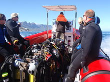
装置
標準装備
この地域のダイビングサイトのほとんどは比較的浅く、通常のレクリエーションダイビング機器を使用して空中で行うことができます。これには次のものが含まれます。
- 厚さ5mm以上のフルウェットスーツ、フード、ブーツ、手袋。
- ハーネス、レギュレーター、水中圧力計を備えたシリンダー。
- 浮力補償装置(BCD)。
- マスクとシュノーケル。
- フィン。
- 残りの機器用に正しく校正された捨て可能なウェイトシステム。
- ダイブコンピューターまたはデプスゲージとタイマー、減圧テーブルとダイブプラン。
これに追加できます:
- 二次レギュレーター、低圧BCDインフレーター、ナイフなど、お客様またはお客様の認証機関が義務と見なす可能性のあるその他の機器。
- カメラ、信号装置、リストスレート、ドライスーツ、リールおよび表面マーカーブイ、代替ガス供給、コンパスなど、個人の好みに応じて携帯または使用するすべての機器。
推奨事項
- フィンにフルフットポケット(かかとが閉じている)があり、ウェットスーツのブーツの靴底が柔らかい場合は、ショアダイブの入り口に行くために靴を履く必要があるかもしれません。この地域のほとんどのショアダイビングでは、オープンヒールフィンとハードソールブーツをお勧めします。地面が荒れる傾向があり、ダイビングから戻ったときに靴が残った場所に残っていない可能性があるためです。
- 標準的な表面マーカーブイは、昆布の成長が激しい場合はお勧めできません。頻繁に引っ掛かり、際限のない不快感を与えるからです。展開可能な、または「遅延した」表面マーカーは、そのような場所で優れており、ボートダイビングで運ぶのに常に良いことです。
- 上記の項目のいずれかを除外することは、ご自身の責任で行ってください。フードや手袋、ブーツを履かないダイバーや、シュノーケルやBCは必要ないと感じたり、3mmのスーツでダイビングできるダイバーもいます。最初に簡単なダイビングでこれを試してください。すぐに外に出ることができます。それはあなたのために働くかもしれません-これらのケースのそれぞれで管理するダイバーがいます、しかしあなたは警告されました。
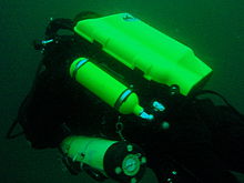
Additional equipment

For each dive site there may be additional or alternative equipment required or recommended, which may improve the dive experience or improve safety at that site. The most commonly recommended items are:
- 方位磁針
- Dry suit
- 光
- Nitrox
- Reel with DSMB
Use of a compass is recommended wherever it may be desirable to swim back to shore below the surface to avoid wind or boat traffic, or to keep below the kelp fronds. It is required for the compass navigation routes.
A dry suit is recommended for most dives on the Atlantic seaboard, or in general if the dive is deeper than about 20 m and the water is colder than 13°C. An appropriate undergarment is required for the dry suit, at this is what provides the insulation. With a suitable combination it is possible to enjoy an hour's dive in comfort at a water temperature of 8°C, when most of the divers in 7-mm wetsuits are cold after 30 minutes. If your face and head are particularly sensitive to cold, a full-face mask will keep your face warm.
Recommendations for a light are for daytime dives, as lights are considered standard equipment on night dives. Backup lights should be carried on night dives from a boat. Underwater flashers may not be well received by the other divers as they are extremely annoying. If you feel you must use one, warn the others and stay away from those divers who do not wish to have a light continually flashing in their peripheral vision and distracting them. A strobe which may be switched on in an emergency is another matter entirely, and is accepted as a valuable safety aid.
The equipment recommendations are for divers who are competent to use those items, and if you are not, you should consider whether your competence is sufficient to dive the site without this equipment.
No recommendations are made regarding equipment for wreck penetration dives and deep dives. If you do not know exactly what equipment is required and have it with you, or are not competent in its use, you should not do the penetration. Depth, wrecks and caves are nature’s tools for culling reckless divers.
Recommendations for gas mixtures are generic. You must choose the appropriate mixture based on your qualifications, competence and the dive plan. Nitrox mixtures are generally recommended to increase dive time without obligatory decompression stops, and Trimix to reduce narcotic effects. Nitrox is available from many of the dive shops, and charter operators will usually provide cylinders filled with the blend of your choice if given sufficient notice. Trimix is more difficult to arrange, as not many filling stations keep Helium in stock, so it may require a bit of shopping around.
Decompression dives should generally only be planned by divers who are familiar with the site, and are competent and properly equipped for the planned dive. Recommendations in this regard are outside the scope of this article, and it will be necessary to discuss any planned decompression dives well in advance with the dive operator, as only a few of them are competent and willing to support planned decompression dives, and those will usually require strong evidence of your competence to do the dive, and advance notice of your dive plan.
Exotic equipment

Diving equipment other than open circuit back mounted scuba with half mask and mouth-grip demand valve is considered to be exotic for this section.This would include surface supplied breathing apparatus and full face masks, used as standard equipment by commercial divers, and rebreathers, seldom used by commercial divers, but frequently used by military divers and gaining popularity with Technical recreational divers.
Also considered as exotic equipment is side-mount scuba and diver propulsion vehicles (scooters), as they are not used by many recreational divers.
Generally speaking, any use of surface supplied diving equipment will require special preparation and logistics, which are not available from the listed service providers, but are perfectly legal for use and technical support is available from the suppliers to the commercial diving industry in Cape Town.
Rebreathers are relatively uncommon, but are used by a few local aficionados, and sorb is available over the counter at a few suppliers. There is even one charter boat which regularly runs dives for mainly rebreather divers. Expect to be checked out for skills and certification before being allowed to join these dives, so it would be advisable to make prior arrangements. Technical support is available for a limited range and parts will usually only be available from overseas agencies. Most of the local dive sites do not really justify the expense and relative risk of rebreathers, and they are mostly used by divers who also use them in other places where they are more of an advantage, and by those who just enjoy the technology. They are not available for rental, except in some cases as part of a training package.
Full-face masks will not be a problem, provided you can show your ability to provide buddy support if diving with a partner (some charters will insist that you dive with a buddy). Technical support and parts are available from local agencies for most of the more popular models used for commercial and technical diving, but you may have to wait some time if parts are not in stock. The use of a full-face mask can be a particular advantage when the water is cold, and if you have one and prefer to use it, by all means bring it to Cape Town.
Side mount scuba is relatively uncommon in Cape Town, but there should be no problems if you chose to use it. Do not expect boat crews to know how to help you kit up, but they will probably respond well to explanations. There is a growing number of local side-mount aficionados, including several instructors for side-mount.
Diver propulsion vehicles (scooters) are rare but not unknown. Check with the charter boat whether will be space on board for your unit, and don't expect to find one for rental.
Decompression and bailout sets are not considered exotic, but are not easily available for rental. Bring your own, or ask around. Some of the service providers carry a small range of cylinders suitable for sling mount, but may not have the gas mixture you want in stock. Almost all the local divers that carry decompression or bailout cylinders routinely have their own equipment
ダイビングサイト


The dive sites described in these articles include some which are well known favourites and have been dived frequently and by many divers for decades, and also newly described sites, which may only have been dived a few times, and by a few divers. There are also sites which have been known for years, but seldom dived due to their relative inaccessibility, and a few which are basically not particularly interesting, but have been included in the interests of completeness, as the information is available, and occasionally people want to know what they are like. With a few exceptions, the information provided is based on personal observation at the sites by Wikivoyagers. All photos of marine life and features of interest were taken at the listed site.
Geographical information is provided in as much detail as is available. Sites are geolinked, which allows them to be identified on various internet map systems. Positional accuracy is usually good. The maps provided should be usable, to scale, and accurate, but are not guaranteed either to be correct in all details or complete. Clicking on the thumbnail will open a link to a higher resolution image.
Atlantic coast of the Cape Peninsula

Introduction and some tips on diving the Atlantic coast.
This coastline from Table Bay to Cape Point is exposed to the south westerly swells generated by the cold fronts of the Southern Ocean. The continental shelf is narrow in this part of the coast and swells are not greatly influenced by the narrow band of shallow water, so they retain most of their deep-water energy. These swells pound this coast most of the winter, and to a lesser extent in summer, so diving in this region is mostly a summer activity, and the frontal weather patterns far to the south are more important than local weather for swell prediction.
North westerly winds are a feature of the approach of a cold front, and in winter they can be very strong for a few days before swinging to southwesterly as the front passes. These north westerly winter storms were responsible for many shipwrecks in Table Bay and other parts of the west coast, and the associated wind waves can be severe. However the fetch is short and these onshore wind waves do not last long after the storm. They do mess up the visibility though, and this effect lasts for some time after the waves have dissipated.
The south easterly winds are longshore to offshore in this area and tend to knock the swell down a bit. They also cause an offshore displacement of the surface water, which results in deeper water rising to take its place. This upwelling brings colder, initially cleaner water to the inshore areas, and can produce conditions of 20 m visibility and temperatures down to 8°C, though more usually 10° to 12°C. The diving is wonderful if you are sufficiently insulated. Out of the water, however, it is commonly fine and hot, with blazing sunshine high ultraviolet levels and air temperatures in the high 20 and 30° Celsius. This means you will be overheating until you get in the water, hence the comment that summer diving in Cape Town is one easy step from hyperthermia to hypothermia.
There is no escaping the need for a well-fitting, thick (preferably 7 mm), wet suit or a dry suit with an adequate undergarment for these conditions if you intend to stay for more than a few minutes. Carrying a bottle of water with your equipment to wet the outside of your suit before or after putting it on will help keep the temperature down due to evaporative cooling, specially on a windy day. Overheating after leaving the water is seldom a problem. The alternative option of kitting up at the water’s edge requires a shore party to look after your clothes, etc., while you dive, so it has become less common. Do not leave equipment unattended if you wish to see it again.
An upwelling is frequently followed by a plankton bloom, often called a red tide. This will reduce visibility considerably, particularly near the surface. Often the water will be much clearer below the surface layer, though the light levels may be a bit dim and the colour relatively green, or even brownish. The phytoplankton will bloom while the sun shines, so it is much more developed in summer.
The south-easter is an offshore wind at some sites, and besides its influence on temperature and visibility, it also affects the swim back to shore after the dive. The south-easter can appear seemingly out of nowhere on a previously cloudless and windless day, and build up to near gale force in the time you are underwater on a dive, though it is usually predictable, so take note of weather forecasts, and in any case, allow sufficient reserve air to swim back a few metres below the surface. A compass is extremely useful if you do this as it allows you to swim shallower, which is good for air consumption, decompression and warmth. A depth of 3 to 5 m is recommended for a long swim home. The strong south-easter in these cases produces a short, steep wind chop with white-caps which does not penetrate to any significant depth, but the constant slapping of waves and the spray in the air can make snorkelling unpleasant and difficult. There may also be a shallow offshore wind drift (surface current), but this takes some time to develop and gets rapidly weaker with depth and is not usually a problem below about a metre depth inshore. Further offshore the wind induced current can take you several hundred metres during a decompression stop, at a rate of about 0.5 to 1 kph.
When boat diving a deployable surface marker buoy (DSMB) is useful to both facilitate controlled ascent and accurate decompression or safety stop depth, and as a signal to the boat that you are on your way up. In strong wind conditions it will also improve your visibility on the surface, specially if your equipment is all black, so it is worth carrying even if only as a signalling device. Bright yellow has been shown to be best for all round visibility at sea, but orange and red are fairly good too.
Robben Island

These sites are all boat dives. There is no other practical way to get to them, as they are all several kilometres from the mainland across major shipping lanes.The waters around Robben Island were proclaimed a Marine Protected Area in 2019, so a permit is required to dive there. The boat operator will have to have a permit for the restricted area. Details of how this will be done are not yet known.
Local geography:Robben Island is a low, rocky shored island in the mouth of Table Bay. The island and surrounding reefs are rock of the タイガーバーグ series of the late Precambrian Malmesbury group. These are folded sedimentary rocks, frequently with very steep dip, which often weather to form rather jagged outcrops.
The sites include:
- 1 MV 宝: S33°40.45' E018°19.95' (approximate)
- Wreck dive. Boat access only. Depth: 30 to 50 m
- On 23 June 2000 the damaged Panamanian registered bulk ore carrier sank off the coast of South Africa approximately 7 nautical miles north of Robben Island.
- The vessel lies upright on a fairly level bottom at about 50 m depth. The superstructure was removed shortly after the sinking by sawing it off at about 30 m depth with a cable towed by tugs as it was a hazard to shipping.
- 2 Robben Island steamer wreck: S33°49.886', E018°21.524' (approximate centre of wreckage)
- Wreck dive. Boat access only. Depth: 30 to 36 m
- Unidentified wreck of a steel steamship about 48 m long in reasonable structural condition.
- 3 MV Afrikaner: S33°50.012' E018°20.686'
- Boat access only. Deep wreck dive. Depth 43 to 50 m
- The 61 m fishing vessel struck Whale Rock in 1993 and sank while being towed away from the rock.
- 4 Whale Rock: S33°50.112' E018°22.858'
- Reef dive. Boat access only. Depth: Mostly less than 10 m
- A large shoal area of rocky reef, usually with a break over the pinnacle, which is the last resting place of a few ships.
- 5 SS ヒュパティア: S33°50.10’ E018°22.90’ (Turner 1988)
- Wreck and reef dive. Boat access only. Depth: Shallow, maximum probably about 15 m
- British Houston Line steamer of 5 728 tons, built in 1902. Wrecked on Whale Rock in Table Bay on 29 October 1929 in fog while on a voyage from Beira to New York with a cargo of blister copper and chrome ore.
- 6 MV Daeyang Family: S33°50.388' E18°23.133
- Wreck and reef dive. Boat access only. Maximum depth about 15 m
- A large Korean ore carrier which was wrecked on Whale Rock on 1 March 1986 when anchors dragged in heavy weather. The wreckage lies at a depth of about 15:nbsp;m
Table Bay

- 7 MV Winton: S33°52.1514' E18°29.1828 (Engine block)
- Wreck dive. Boat access, though shore access is feasible. Close to surf line. Maximum depth about 6 m.
- Wreck of a small steel freighter on a flat sand bottom.
- 8 MV Gemsbok: S33°53.0' E018°20.5'
- Boat access only. Deep wreck dive. Depth about 57 m on the sand.
- The 50 m 313 tonne buoy tender MV Gemsbok capsized and sank about 4 km from Green Point Lighthouse on 2 Seprember 1975 while transferring an anchor chain of a cargo vessel. The chain snagged and the weight of the chain caused the vessel to capsize and sink within minutes. The wreck lies on its starboard side.
- 9 Highfields: S33°53.13’ E018°25.83’ (Bow)
- Wreck dive. Boat access only。 Close to major shipping lane at harbour mouth. Maximum depth 24 m.
- Wreck of a steel barque which sank after a collision in 1902.
- 10 SS Cape Matapan: S33°53.233' E018°24.533' About a kilometer north of Granger Bay harbour
- Wreck and reef dive. Boat access only。 Maximum depth 25 m. The wreck is close to the shipping lane and there are no landmarks nearby.
- Wreck of a steel fishing boat which was sunk in a collision in 1960 in heavy fog.
- 11 RMS アテネ: S33°53.85’ E018°24.57’
- Wreck and reef dive. Shore or boat access. Maximum depth about 7 m
- Union Company iron steam screw barque of 739 tons, built in 1856. Wrecked between Mouille Point and Green Point on 17 May 1865 during a north-west gale while trying to steam out of Table Bay. The site can be identified by the remains of the engine-block, which is visible above the water.
- 12 SS SA Seafarer: S33°53.80’ E018°23.80’
- Wreck and reef dive. Boat access recommended. Depth: Fairly shallow. Mostly between 5 and 9 m.
- The 8000-ton Safmarine freighter SS South African Seafarer was wrecked in a north westerly gale on 1 July 1966, and lies in front of the Green Point lighthouse.
- 13 Two Oceans Aquarium: S33°54.476’ E018°25.074’
- Shore access only. Confined water. Maximum depth 6 m
- Visitors may dive in the Predator tank, which is a large oval tank, or the Kelp Forest tank, which is roughly square. There are large windows, almost full height on one side, through which you can observe the other visitors watching you if you get bored with the fish.
Sea Point

Local Geography:There is a narrow coastal plain at the base of Signal Hill and Lion’s Head. The contact zone between the intrusive granites of the 半島 pluton and the sedimentary greywackes and shales of the タイガーバーグ formation of the Malmesbury series is in this area.The northern sites are on the タイガーバーグ rocks, which are steeply dipped and form parallel ridges and gullies, while Bantry Bay is on the granite, and has the characteristic corestone topography of rounded boulders and outcrops with sand bottom in deeper areas.
The sites include:
- 14 スリーアンカーベイ: S33°54.36’ E018°23.85’
- Reef dive. Shore access. Depth: Shallow
- A small sand bottomed bay with reef to both sides. Easy access.
- 15 シーポイントリッジピナクルズ: S33°54.905' E018°21.421'
- Reef dive. Boat access. Depth: 17 to 27 m
- An isolated pair of corestone pinnacles on a low granite ridge.
- 16 バントリーベイ: S33°55.56’ E018°22.65’
- Reef dive. Shore or boat access Depth: Less than 10 m
- This little bay is at the southern end of Sea Point, towards Clifton.
クリフトン

Clifton Rocks is generally considered a shore dive, but the Paws are quite a distance offshore and are only dived from boats. Parking in Clifton is often a problem, particularly in the kind of weather in which you may wish to go diving. Weekdays will be better and early morning will help. The offshore dives avoid this problem by using boats from Oceana Power Boat Club slipway, which has its own parking problems, though not quite as serious.
Local geography:The suburb of Clifton is built on the rather steep slopes of the base of Lion’s Head above Clifton Bay. There are four beaches in the bay which are famous for white sand, shelter from the south easter and cold water. North Paw is offshore of the headland to the north, and South Paw is offshore from Clifton Rocks, on the south headland. Access to the area by road is from Sea Point to the north and Camps Bay to the south.
The reefs of Clifton are granite corestones of the 半島 冥王星。 In this area the granite base of the mountain extends to approximately the height of Signal Hill, and is capped by sandstones of the Graafwater and Table Mountain formations. Occasional rounded granite outcrops can be seen on the mountainside, which is mostly deeply weathered granitic saprolite, with some sandstone scree.
The sites include:
- North Lion’s Paw: S33°55.854’ E018°21.849’ (Exposed Rock)
- Reef dive. Boat access only. Depth: 15 to 23 m.
- A spectacular site in good conditions. A popular part of the site is the cave rock, which is slightly offshore from the exposed rocks.
- 17 ノースライオンの足ノーザンピナクルズ
- 18 ノースライオンの足モンティの頂点
- 19 ノースライオンの足東ピナクル
- 20 ノースライオンの足バリーの頂点
- 21 ノースライオンの足の洞窟の岩
- 22 ノースライオンの足のメインリーフ
- 23 サウスライオンの足: S33°56.308’ E018°21.890’
- Reef dive. Boat access only. Maximum depth about 20 m.
- An extensive reef of granite corestones marked by the large outcrop which extends above the water.
- 24 クリフトンロックス:S33°56.346’E018°22.222 ’
- Reef dive. Shore or boat access. Maximum depth about 14 m.
- A large area of granite corestones, bounded to the north by sand bottom. The reef extends to seaward from the shoreline at the point.
- 25 クリーブのトンネル: S33°56.540' E018°21.894'
- Reef dive. Boat access. Maximum depth about 20 m.
- A large corestone pinnacle with a long low tunnel
Camps Bay
Local geography:Camps Bay is in the corner made by Lion’s Head and Table Mountain. Access is over Kloof Nek from the city bowl, and round the coast from Sea Point via Clifton to the north, and from Hout Bay via Oudekraal to the south
The reefs of this area are like those of Clifton.
The sites include:
- 26 バコベンロック: S33°57.555’ E018°22.204’
- Reef dive. Shore or boat access. Maximum depth 17 m.
- This site is generally considered a shore dive. Parking is limited so it is most conveniently dived during the working week when there is less competition for space, otherwise get there early.
Oudekraal

This area includes some of the best and most popular shore dive sites on the Atlantic seaboard. Most can also be dived from a boat, and this is of particular importance to divers with restricted mobility on shore, as there is generally a rugged bit of coast to negotiate and in some cases a long climb. There is also a moderate to long swim at some of the sites, and at some states of the tide, heavy kelp inshore.
Local geography:The coastline at the base of the Twelve Apostles range just south of Table Mountain is steep, and south of Camps Bay, virtually undeveloped. Fortunately for divers, the coastal road is not far above sea level in the north of this area, and though there are not many off-road parking areas, the road is wide enough to park along the side.
This is an area of pale grey 半島 Granite corestone outcrops and boulders with some Table Mountain Sandstone boulders which have rolled down the mountainside to the water’s edge. The mountainside below the sandstone cliffs is deeply weathered granite saprolite with occasional corestone outcrops. The cuttings at the roadside display the granular yellow-brown saprolite with a thin soil covering. The underwater topography is almost entirely corestones exposed by erosion, surrounded by samd, and is a continuation of the granite boulders and outcrops at the water’s edge.

North Oudekraal
The sites include:
- 27 Dreadlocks Reef: S33°58'22.05" S18°21'42.59"
- Reef dive. Boat access. Depth: 1.5 to 20 m.
- A relatively new site. First survey 30th January 2010. This granite ridge peaks about 1.5m from the surface at low tide, but the tip is small and seldom breaks. Bottom on low granite at about 20m. Colourful and diverse invertebrate cover, and notable for the relatively large colonies of Dreadlock hydroids.
- 28 Geldkis Blinder: S33°58.67’ E018°21.62’
- Reef dive. Boat or shore access. Maximum depth about 20 m.
- A relatively infrequently dived site. The highest rock on the reef is a blinder beyond Geldkis rock which occasionally breaks the surface at low tide. Huge boulders and outcrops, and a few swimthroughs.
- 29 Strawberry Rocks: S33°58.725’ E018°21.658’ (approximate)
- Reef dive. Shore or boat access. Maximum depth about 15 m.
- The two smaller rocks to the north of Geldkis rock. Several small caverns and swimthroughs.
- 30 Geldkis: S33°58.73’ E018°21.61’
- Reef dive. Shore or boat access. Maximum depth about 15 m.
- A large group of rocks with lots of overhangs, swimthroughs and chimneys. The Dutch East Indiaman Het huys te Craijestein was wrecked on the rocks in the bay at Oudekraal on 27 May 1698 in thick mist. Three chests of treasure disappeared and the name "Geldkis" (money-chest) appears on maps of the area and is now applied to the offshore rocks.
- 31 会議室: S33°58.761’ E018°21.151’
- Reef dive. Boat access, though possible from shore. Maximum depth about 21 m near the pinnacle, but deeper water nearby. about 10 m on top.
- A very large boulder with a large swimthrough cave and a large overhang in an area of high profile boulder reef.
- 32 Het Huis te Kraaiestein: S33°58.85’ E018°21.65’
- Wreck and reef dive. Shore access. Maximum depth 10 m.
- Remnants of the Dutch East Indiaman Het Huis te Kraaiestein of 1,154 tons, which was wrecked in the bay at Oudekraal on 27 May 1698 in thick mist while trying to find the way into Table Bay. Some cannon, anchors and a few baulks of timber are all that are usually visible above the sand.
- 33 Mushroom Pinnacle: S33°58.781’ E018°21.521’
- Reef dive. Shore or boat access. Maximum depth 17 m.
- A submerged granite tor (stacked group of large corestones) between Geldkis and Justin’s Caves. The pinnacle is surrounded by lower outcrops separated by sandy gullies.
- 34 Sandy Cove: S33°58.90’ E018°21.65’
- Reef dive. Confined waters. Shore access. Maximum depth 4 m
- A shallow sheltered cove at Oudekraal, suitable for open water training exercises, refresher courses and testing equipment when you don’t need depth. Entry area for several other sites.
- 35 Justin’s Caves: S33°58.85’ E018°21.50’
- Reef dive. Shore or boat access. Maximum depth about 13 m.
- A group of big granite corestone outcrops and boulders with several swimthroughs, overhangs, caves and deep narrow gaps between the rocks. Spectacular in good visibility, colourful reef life.

Central Oudekraal
The sites include:
- 36 Antipolis: S33°59.06’ E018°21.37’ (Bow section)
- Wreck and reef dive. Shore or boat access. Maximum depth about 10 m.
- The tankers "Romelia" and "Antipolis" were under tow on 28 July 1977 during a north westerly gale when the tow cable to the "Antipolis" snagged on the sea bed. In the ensuing confusion the cables broke and the two ships were driven aground by the wind. The "Antipolis" ran aground at Oudekraal and was later cut down to water level.
- 37 Klein Pannekoek: S33°58.91’ E018°21.09’
- Reef dive. Boat or shore access. Maximum depth about 15 m.
- A group of large fairly low and flat rocks visible offshore to the west of the "Antipolis" and north of Coral Gardens.

South Oudekraal
The sites include:
- 38 Groot Pannekoek: S33°59.13’ E018°20.75’
- Reef dive. Boat or shore access. Maximum depth about 15 m
- A large flattish outcrop of granite, which extends a short way above the sea level at all tides. Some overhangs, crevices and small caves.
- コーラルガーデン (Oudekraal): S33°59.270' E018°20.782' (The pinnacles)
- Reef dive. Shore or boat access. Maximum depth 17 m
- A spectacular dive in good conditions. Huge granite boulders in groups with open patches between them. There are overhangs, small caverns, a few swimthroughs, and many deep gaps and crevices. Extensively covered in colourful reef life. Possibly the best shore dive on the Atlantic side of the Cape Peninsula on a good day.
- 39 コーラルガーデン
- 40 Coral Gardens Offshore Pinnacle
ランディドノー

These sites can be accessed from the shore or by boat. Parking is limited, but the area is reasonably secure. Some walking is required, but no serious climbing as the parking is near the sea level.
Local geography:The small residential suburb of Llandudno is built on the moderately steep slopes of the Cape Peninsula below the peak of Klein-Leeukop, where the coast road (M6 – Victoria Drive) from Camps Bay crosses over the neck to Hout Bay. There is only one way into Llandudno by road, which is from the M6 near the top of the pass.This is an area of granite corestone reefs with sand bottom.
The sites include:
- 41 13th Apostle: S33°59.486' E18°19.922'
- Reef dive. Boat access. Depth: 10 to 24 m.
- A large granite pinnacle on an area of low granite reef with occasional sand patches.
- 42 Llandudno Reef: S34°00.037' E18°19.897'
- Reef dive. Boat access. Depth: 10 to about 30 m, on sand
- An unsurveyed granite reef, with several pinnacles, outcrops and gullies.
- 43 Logies Bay: S34°00.25’ E018°20.53’
- Reef dive. Shore access. Maximum depth probably about 10 m.
- A small rocky cove to the north of Llandudno beach.
- 44 MV Romelia: S34°00.700’ E018°19.860’ approximately
- Wreck and reef dive. Shore or boat access. 最大深度約24メートル。
- The tankers Romelia そして Antipolis were under tow on 28 July 1977 during a north westerly gale when the tow cable to the Antipolis snagged on the sea bed. In the ensuing confusion the cables broke and the two ships were driven aground by the wind.ザ・ Romelia ran aground at Sunset Rocks, Llandudno, where its back was broken by the heavy surf and the ship split in two. Later the bow section sank, leaving the stern mostly above sea level on the rocks. Over the years the stern section has also broken up and is no longer visible above the water.
Oude Schip headland
Local geography:Oude Schip headland lies at the foot of the Karbonkelberg between Sandy Bay to the north and Leeugat to the south, It is a low rocky headland of Peninsula granite, with several reef dives and one known wreck. It is a fairly exposed section of coast but protected from the south easterly winds by the mountain. The sites are only accessible by boat as there is no road access to this part of the shore, and most are too far offshore to safely swim.
This is an area of granite bedrock of the 半島 pluton, The reefs are exposed corestone outcrops and boulders, with sand patches in the deeper areas
The sites include:
- 45 手順: S34°01.330’ E018°18.600’
- Reef dive. Boat access only. Maximum depth about 20 m.
- An area of high granite reef with deep gullies. Not actually in Leeugat, but just north of Oude Schip headland.
- 46 MV Harvest Capella: S34°01.600’ E018°18.750’
- Wreck dive. Boat access only. Maximum depth about 15 m.
- An area of mostly flattish granite reef with a few ridges and some wreckage of a steel motor fishing vessel, some of which has washed up onto the point and is visible from a distance. Not actually in Leeugat, but on the north shore of Oude Schip headland.

The Blue Flash Reefs
- 47 Rachel's Reef: S34°01.431' E018°18.151'
- Reef dive. Boat access only. Depth between about 3 and 21 m.
- Rachel's Reef is a compact granite pinnacle with surrounding high profile reef.
- 48 Humpback Ridge: S34°01.548' E018°18.142'
- Reef dive. Boat access only. Depth between about 4 and 21 m.
- A fairly massive granite pinnacle in the middle of a more extensive north-south ridge rising to about 12 m. Humpback whales have been seen near these reefs on several occasions.
- 49 Wilhelm's Wall: S34°01.502’ E018°17.931’
- Reef dive. Boat access only. Depth between about 12 and 31 m.
- A granite ridge somewhat more than 50 m long with sheer faces to the north and south, a flattish bottomed gully to the south, and another, more broken ridge south of the gully. Colourful sessile invertebrates on the sides and seaweeds on top.
The Middelmas reefs:
- Hakka Reef (Middelmas): S34°01.747’ E018°18.328’
- Reef dive. Boat access only. Maximum depth about 21 m.
- 50 Die Middelmas is a rock that projects several metres above the water at all tides, to the west of the Oude Schip peninsula.
- 51 Hakka Reef Southeast pinnacles is off this rock.
- 52 Hakka Reef Sven's Caves pinnacles is nearby at a set of pinnacles near a sand patch.
- 53 Twin Towers: S34°01.920’ E018°18.330’
- Reef dive. Boat access only. Depth about 20 m at the tops of the pinnacles to 34 m on the sand.
- A small but tall double-peaked granite pinnacle on a narrow base reef and surrounded by sand.
Leeugat (Maori Bay)

.jpg/220px-Gelderland_(1).jpg)
Although several of the sites are quite close inshore, this area is in practice only accessible by boat, as the distance to the nearest parking is too far to carry dive gear (about 3 km as the crow flies, more on foot).
Local geography:Leeugat, also known to divers as Maori Bay, lies at the foot of the Karbonkelberg, between the northern headland of Oude Schip, and Duikerpunt to the south. It is a small bay, but fairly deep close inshore, which in combination with the partial barrier afforded by the reefs at the headlands, has provided the wrecks in Leeugat bay with better protection from wave action than those on more exposed parts of the coastline. This means that not only have they lasted well for their ages, but conditions are suitable for diving more often than for many other wrecks on the Atlantic seaboard of the Cape Peninsula.
This is an area of granite bedrock of the 半島 pluton, The reefs are exposed corestone outcrops and boulders, with sand patches in the deeper areas
The sites include:
- 54 MV Keryavor and the Jo May: S34°02.037’ E018°18.636’
- Wreck and reef dive. Boat access only. Depth: Not available, probably between 25 and 30 m.
- These two wrecks lie next to each other approximately between the マオリ そしてその ヘルダーラント。ザ・ Jo May sank first and not much of her wooden structure remains.ザ・ Ker Yar Vor was a steel lobster fishing vessel and several chunks of hull structure and twisted sections of plating remain.
- 55 SS Maori: S34°02.062’ E018°18.793’ (Machinery)
- Wreck and reef dive. Boat access only. Depth: 6 to 21 m
- SS マオリ was a typical British steam cargo vessel of the early 1890s. The ship was wrecked in the bay between Oude Schip and Duikerpunt on 5 August 1909 in thick fog and drizzle while on a voyage from London to New Zealand.
- 56 SAS Gelderland: S34°02.070’ E018°18.180’
- Wreck and reef dive. Boat access only. Depth: 30 to 35 m
- The Ford class Seaward Defense Boat SAS ヘルダーラント was scuttled on 21s ecember 1988, north west of Duiker Point, as demolition trials.
- The vessel was about 40 m long but the main part of the wreckage is now only about 20 m long as the bow and stern sections were blown right off.
- Plan B pinnacle is just to the south of the southernmost wreckage.
- 57 SS Oakburn / MV Bos 400: S34°02.216’ E018°18.573’
- Wreck and reef dive. Boat access only. Depth: Maximum 22 m
- The "Oakburn", a British cargo steamer of 3865 tons, was wrecked on the north side of Duikerpunt in fog on 21 May 1906, on a voyage from New York to Sydney. The Oakburn has pretty much fallen apart, and on 27 June 1994, the French pipe-laying crane barge Bos 400, broke its towline and stranded virtually on top of the older wreck. The Bos has started to break up, and two large sections have collapsed into the sea, though the main crane section is still firmly stuck on top of the rocks.
Outer Hout Bay


This area includes the dive sites between Duiker Point and Duiker Island and the extensive reefs to the south as far as Vulcan Rock and Tafelberg Reef. All of these are only accessible by boat. There are a number of sites being explored in this area: the reefs between Kanobi’s wall and Stonehenge, and a wreck of a lifeboat which was used to salvage materials from the Boss 400 and which lies between Stonehenge and Duiker Island are among these. There are several unexplored pinnacles in the region identified on the SAN charts as bakleiplaas, where the sea is often very lumpy due to the influence of the underwater topography on the swell.
Local geography:The suburb of Hout Bay lies in the valley between the Constantiaberg to the east and the peninsula formed by Karbonkelberg and its lesser peaks to the west. One of these peaks, the Sentinel, gives its name to a dive site at its foot. At the mouth of the valley is the business area of Hout Bay, with its small commercial fishing harbour and marina, and a public slipway used by dive charters and private dive boats for access to most of the southern peninsula dive sites on the Atlantic coast. The slipway is in good condition, wide and accessible, and has a large parking area, which on occasions can be crowded due to heavy use by commercial fishing skiboats.
The bedrock of this area is granite of the 半島 pluton, and most of the sites are on corestone reefs of this rock.
The sites include:
Duiker Point sites:
- 58 Die Perd: S34°02.282’ E18°18.324’
- Reef dive. Boat access only. Depth: Not available, maximum probably about 20 m
- This rock off Duiker Point extends above the water and is surrounded by rugged reefs of high outcrops and deep gullies.
- 59 Kanobi’s Wall: S34°02.365’ E018°18.138’
- Reef dive. Boat access only. Maximum depth about 25 m.
- This blinder off Duiker Point is a good site with rugged topography, good biodiversity and large depth variation. Huge boulders are stacked, with tunnels, overhangs and caves of various sizes, and lots of vertical walls, some probably 10 m or more in height.
- 60 SURG Pinnacles: S34°02.375' E018°18.015'
- Reef dive. Boat access only. Depth 9 to over 30 m.
- A group of steep granite corestone pinnacles, probably mostly huge boulders, with walls, overhangs and a swimthrough. Deep narrow cracks divide the pinnacles. Spectacular topography, covered with lots of sea urchins and vast numbers of hairy brittlestars, a moderate variety of sponges, noble corals, gorgonians, and patches of cauliflower soft coral. Red bait and Laminaria on the tops of the pinnacles. Surge can be strong when a long swell is running.
- Star Wall: S34°02.466' E18°18.087' (pinnacle)
- Reef dive. Boat access only. Depth: 6 to 32 m.
- This site has the tallest and longest wall known in the Cape Town area and is a dive site well worth visiting. A massive and continuous granite wall of about 25m almost vertical height, extending for a length of 100 m on the south face and 50 m on the south-east face. Very diverse and colourful invertebrate cover on the wall face. The sites are:
- 61 Star Wall
- 62 Star Wall - M&M Cave
- 63 Star Wall - Lollipop Pinnacle
- 64 Sunfish Pinnacle: S34°02.475' E18°18.290' (pinnacle)
- Reef dive. Boat access only. Depth: 7 to 26 m.
- A fairly large pinnacle on a rocky bottom on the way to Duiker Point from Hout Bay harbour, which has been picked up quite frequently on the echo sounders of dive boats passing over it. It has now been dived, and to some extent mapped. The site is quite pretty and should make a pleasant alternative site. Topography is rugged, with high vertical walls on two sides of the pinnacle.
Stonehenge sites:
- 65 Canyon: S34°02.595’ E018°18.073’
- Reef dive. Boat access only. Maximum depth about 35 m.
- The area is named for a gully between rows of pinnacles. Big boulders and rock outcrops cover an extensive area.
- ストーンヘンジ: S34°02.838’ E018°18.316’
- Reef dive. Boat access only. Maximum depth about 22 m.
- The area is named for a group of tall rocks which break the surface. Big boulders and rock outcrops cover an extensive area. High profile in the deeper areas, with swimthroughs, holes and overhangs. Heavy kelp in some areas. Included in this area, Stonehenge Blinder, a pinnacle that approaches the surface and breaks in a large swell or at low tide.
- 66 Stonehenge Dusky Pinnacles - Coral Pinnacle
- 67 Stonehenge North
- 68 A-340 Pinnacle
- 69 Stonehenge Central
- 70 Stonehenge South
- 71 Stonehenge Blinder
- 72 Stonehenge Wreck
Seal Island sites:
- 73 シール島 (Duiker island): S34°03.458’ E018°19.562’
- Reef dive. Boat access only. 深さ:浅く、ほとんどが6m未満。
- ドゥイケレイランドとして地図や図表に記されている小さな岩の島は、アザラシのコロニーが観光名所になっていることから、シール島として知られるようになりました。と混同しないでください シール島 フォールスベイで。
バルカンロックサイト:

- 74 ディの亀裂:S34°03.855’E018°18.400 ’–大きな14mの頂点-サンゴ礁の上にある岩。バルカンロックの北西約300 m(328°磁気)
- リーフダイビング。ボートアクセスのみ。 深さ:10〜30メートル。
- 視界が良ければ壮観なダイビング。たくさんの壁と張り出し、スイムスルー、深くて広い亀裂。豊富な無脊椎動物のカバー。劇的な広角の風景写真に適したサイト。
- 75 バルカンロック:S34°03.967’E018°18.582 ’
- リーフダイビング。ボートアクセスのみ。 最大深度は岩の近くで25メートル以上です。
- バルカンロックは大きな花崗岩のリーフの最高点であり、潮のいくつかの状態で表面を破壊します。低くて平らです。視界が良ければ壮観なダイビング。
タフェルバーグリーフサイト:
- 76 タフェルバーグリーフ:S34°04.22’E018°18.93 ’
- リーフダイビング。ボートアクセスのみ。 深さ:8〜30メートル。
- 険しい花崗岩の露頭の広大な地域で、西に約29mの高浮き彫りと砂底があります。深い隙間と峡谷。オーバーハングはあまりありませんが、垂直面がたくさんあります。視界が良く、非常に頑丈で壮観な地形。
- 77 クレインターフェルバーグリーフ (サラダボウル、ヨットの難破船):S34°04.442’E018°19.191 ’
- リーフダイビング。ボートアクセスのみ。 深さ:14〜36メートル。
- 大きな岩のある巨大な花崗岩の露頭。より深い領域の砂底。険しく壮観な地形。 GRPヨットの残骸は、頂点の側面のくぼみにあります。サンゴ礁の東側の砂浜から40〜45 mのダイビングを行い、北西に向かってサンゴ礁を泳ぐことは可能ですが、そこまで行くと減圧が必要になる可能性があります。浅い頂点。
- タフェルバーグディープ:
- リーフダイビング。ボートアクセスのみ。 砂の上での最大深度は約40mです。
- 低から中プロファイルの花崗岩の露頭、に向かって傾斜 タフェルバーグディープピナクル クレインターフェルバーグリーフの頂点の南。 50 mのダイビングをしてリーフを泳ぐことは可能ですが、ある程度の減圧が必要になります。
- 78 タフェルバーグディープ
- 79 タフェルバーグディープピナクル
ハウトベイ


このエリアには、センチネルとチャップマンズピークの間のサイトが含まれます。これらのほとんどはボートダイビングです。唯一の例外であるセンチネルは、陸路で簡単にアクセスできますが、セキュリティ上の問題があります。
センチネルは花崗岩の海岸線の典型的なエリアで、海岸に沿って多数の岩があり、通常の丸みを帯びたプロファイルのコアストーンリーフがあります。アスターとカツマルの残骸は平らな砂底にあり、ダイジョシーのサイトはローワーチャップマンズピークの崖のふもとにある比較的風化していない花崗岩
サイトは次のとおりです。
- 80 センチネル:
- リーフダイビング。海岸またはボートへのアクセス。 深さ:ほとんど10メートル未満。
- これは、30mの深さの等高線が海岸に最も近い大西洋岸の場所です。
- センチネルは、垂直の崖の下の領域であると考えられており、昆布やハコクラゲ、そしていくつかの大きな岩がたくさんある平らなサンゴ礁の領域です。
- ピナクルズは、ハウトベイ港のすぐ外、下水処理場の近くの海岸近くの岩のグループです。
- 81 MVアスター:S34°03.891’E018°20.955 ’
- レックダイビング。ボートアクセスのみ。 最大深度28メートル。
- 340トン、長さ27mのモーターフィッシング船「アスター」は、南アフリカで登録されたロブスター漁船で、ダイバーに優しい人工魚礁として、構造物の開口部を掃除して切り込み、難破船の近くのハウトベイで沈没しました。 1997年8月9日付けの「MVカッツ丸」。難破船侵入訓練場として利用されています。船は底が直立していて、壊れ始めています。
- 82 MV勝丸:S34°03.910’E018°20.942 ’(難破船の真ん中)
- レックダイビング。ボートアクセスのみ。 最大深度約30m。
- 日本のトロール船「勝丸#25」が未確認飛行物体を海上で殴り、左舷に穴をあけた。ハウトベイに曳航されている間、船は氾濫し、1978年8月7日に湾に沈んだ。難破船は砂底の右舷側にある。
- 83 ジョシー死ぬ:S34°04.497’E018°21.256 ’
- リーフダイビング。ボートアクセスのみ。 深さ:7〜17メートル。
- ハウトベイハーバーに近く、ナイトダイビングに適したチャップマンズピークの下の浅いサンゴ礁。サイトの上の崖から見ることができるように、花崗岩が風化によって丸みを帯びていない数少ないエリアの1つ。
大西洋南半島

この地域には、ノールドフックの南にある半島沿岸のすべてが含まれます。良い打ち上げ場所から遠く離れており、良いダイビング場所があまり知られていないため、レクリエーション目的でダイビングすることはあまりありません。このエリア、特にアルバトロスロックス/オリファンツボスパントにはいくつかの難破船があります。確実に特定された残骸はごくわずかです。
サイトには以下が含まれます
- 84 SSクランモンロー:S34°08.817'E18°18.949 '
- レックアンドリーフダイビング。ボートアクセスのみ。 深さ:4〜8メートル。
- KommetjieのSlangkop灯台の少し北で破壊されました。めったにダイビングしませんでした。サンゴモがちりばめられた残骸のある浅い平らな砂岩礁。
- SSトーマスT.タッカー:
- レックアンドリーフダイビング。ボートアクセスのみ。 深さ:浅い
- この船は岩の上で大破し、残骸の一部が岸に見えています。残骸のほとんどはかなり浅い水にあります。
- 85 アフリカの星:
- レックアンドリーフダイビング。ボートアクセスのみ。 奥行き:最大約27m。
- 86 SSビア:ボウセクション:S34°16.140'E018°22.812 'メインセクション:S34°16.217'E018°22.638'
- レックアンドリーフダイビング。ボートアクセスのみ。 深さ:3〜8メートル。
- 87 SSウムラリ:S34°16.435'E18°22.487 '
- レックアンドリーフダイビング。ボートアクセスのみ。 深さ:5〜8メートル。
- 88 アルバトロスロック:S34°16.495'E18°22.197 '
- リーフダイビング。ボートアクセスのみ。 深さ:おそらく岩の近くで15メートル未満。
- サウスウェストリーフ:
- リーフダイビング。ボートアクセスのみ。 深さ:不確か。
- 半島の先端の西にある浅いサンゴ礁と昆布のベッドの広大なエリア。それは槍漁師とザリガニ捕手の出没地であり、スキューバでは未踏です。
ケープ半島のフォールスベイ海岸


ケープ半島のフォールスベイ海岸(サイモンズタウン側)でのダイビングの概要とヒント
他の地域とは異なり、フォールス湾の西側は冬の偏西風から保護されていますが、その見返りとして南東に向かいます。この結果、この地域は通常、南東部が長時間または大きな力で吹くことがめったにない冬に潜水します。
南極海の冬の前線の嵐は、大陸棚によって減速され、ケープ半島の周りで屈折および拡散するうねりを生成します。そのため、それらは海岸線にほぼ平行に伝播し、に向かって曲がるまでにエネルギーの多くを失っています。海岸。ここの不規則な形の海岸はまた、他の地域よりもいくつかの地域を保護しています。一般的に言って、北西から南東方向に走る海岸の部分は、北から南の部分よりも南西のうねりからよりよく保護されているので、ダイビングサイトの選択は最近の気象パターンに依存します。
南東部がより頻繁に、より長く、そして一般的に激しく吹く夏の間、このエリアはしばしばダイビング可能ではなく、他の条件が適切であっても、視界は一般的に冬よりも劣ります。
この地域の冬の間の水温は、一般的に夏の大西洋岸よりも暖かいです。これは、日照時間が短く、しばしば寒くて雨の天気を補うものです。
水温は深さによって異なる場合があります。通常、夏には水温躍層があり、水温躍層の下で視認性が大幅に変化する場合があります。表面は18または19°Cで、底部は10または11°Cですが、差は5°C以下である可能性が高くなります。深さの状態は簡単に予測することはできず、表面近くよりも良くも悪くもなります。表層にプランクトンの異常発生があり、冷たい底水では3m以下から10mを超えるまで視程が急激に改善する可能性があります。水温躍層の深さもあまり予測できませんが、夏の終わりには12〜20mになることが知られています。
冬には、水は上から下まで同じ温度になる可能性があり、植物プランクトンのアオコに電力を供給する日光が少ないため、光が少なくても視界と自然光が良くなります。
寒い前線と雨の多い前線の間では、風がほとんどまたはまったくなく、穏やかな日差しから暖かい日差しがあり、水が平らで澄んでいてダイビングが素晴らしい日が多く、場所が多いためにどこに行くかを決めるのが難しいです。選択肢はたくさんあります。ここアフリカの終わりでは厳しい生活ですが、誰かがそれをしなければなりません。
冬の水温は通常13°Cから17°Cの間ですが、11°Cまで下がることが知られているので、ここでも良いスーツが必要です。夏には気温が20°Cを超える可能性がありますが、17°Cから19°C程度になる可能性が高くなります。
ほとんどのショアダイブは比較的浅く、最大深度は8mから15mのオーダーですが、700 mの水泳で行けば、30mのショアダイブを行うこともできます。浅瀬はドライスーツの利点を少なくしますが、夜の風雨でウェットスーツから抜け出すことは、望ましいオプションとしてドライスーツを再び押し上げます。選択肢があるのは素晴らしいことであり、多くの地元のダイバーは、計画されているダイビングに応じてウェットスーツとドライスーツを交換します。
ミューゼンバーグからカルクベイ

これらのサイトは、フォールスベイの西側の最北端のサイトです。それらは浅く、南東の風と波にさらされているので、一般的に冬のダイビングと見なされます。
地域の地理:山腹と海の間には、セントジェームスとカルクベイの郊外が占める狭い土地があり、その南端にはトラッピースコップと呼ばれる小さな丘があります。この時点で、海岸線はフォールスベイにカーブしてから、フィッシュホークベイを形成するために戻ります。カルクベイの小さな商業漁港はこの入り江に建てられています。
これは、海岸線がテーブルマウンテンシリーズの砂岩であり、傾斜が南に約7°でほぼ水平である領域です。結果として生じる海岸線は一般に岩が多く、いくつかの砂地があり、山腹の急勾配を考えると驚くほど浅いです。砂底はデールブルックで約5mの深さから始まり、港で9m近くになります。
サイトは次のとおりです。
- 1 ミューゼンバーグトロール船の残骸
- レックダイビング、ボートアクセス。 最大深度約18m。
- 1970年代頃に爆撃の練習のために撃墜された2隻の鋼製トロール船。それらはかなり無駄になっていますが、船体の構造は適度に無傷で、無脊椎動物によって大きく生い茂っています。
- 2 デールブルック:S34°07.436’E018°27.154 ’
- リーフダイビング。ショアアクセス。 最大深度約6m。
- この場所は、海洋生物の多様性について科学文献でよく知られており、長い間聖域でしたが、スポーツダイバーがダイビングすることはめったにありません。浅い深さと多種多様なサンゴ礁の生活のためにシュノーケルサイトとして理想的であり、穏やかな条件で非常に快適なスキューバダイビングです。半島の東側にある市内のほとんどから道路にアクセスするのに最も近い場所です。
- 3 カルクベイハーバーウォール:S34:07.787’E018:26.967 ’
- リーフダイビング。ショアアクセス。 最大深度約10m。
- 底に砂と低い岩礁があるコンクリートの港の壁。ボトムレリーフはそれほど高くありません。砂岩の低いサンゴ礁、小石と砂のパッチが約8〜9mにあります。
フィッシュフックとグレンケーン
これらの比較的浅い場所は南東の風とうねりにさらされており、一般的に冬のダイビングと見なされます。フィッシュホークリーフとクォーリーバージは、岸からの長い泳ぎがあるため、通常はボートダイブとして行われますが、すべてをショアダイブとして行うことができます。この地域では、ホオジロザメがクルージングしているのが見られます。
地域の地理:フィッシュフックの低く横たわっている比較的平らな谷は、南側がブラックルーフラントとエルスピークの急な斜面に囲まれています。エルスピークも東の海に向かって急傾斜しています。
フィッシュホークリーフはビーチから少し離れたところにあり、このエリアの他のダイビングサイトはこの短い岩の多い海岸線に沿っています。サイモンズタウンへの幹線道路、M4、および鉄道路線は、狭い海岸線を共有しています。サニーコーブには数軒の家が入るスペースがあり、採石場を過ぎたところにあるエルス川がフレンカールンビーチのある小さな谷を切りました。言及されている採石場は、その名前のダイビングサイトのすぐ北にある道路の上の山腹にある使われなくなった砂岩の採石場です。
これは、障害が原因で発生した領域です。 テーブルマウンテン 海面下に広がる砂岩。ストライキは一般に東西で、傾斜は浅く、サニーコーブの約7°(南)から採石場の約10°(南)までです。ただし、接合はほぼ北西/南東です。
サイトは次のとおりです。
- 4 フィッシュホークリーフ:
- リーフダイビング。ボートまたは海岸へのアクセス。 最大深度約15メートル。
- 5 サニーコーブ:S34°08.68’E018°26.30 ’
- リーフダイビング。ショアアクセス。 最大深度約11m。
- 敷地内の駅にちなんで名付けられました。中程度の起伏のある砂岩の岩、尾根、峡谷が約10mの砂に棚を下っています。
- 6 採石場:S34°09.390’E018°26.157 ’(入口/出口棚)
- リーフダイビング。ショアアクセス。 最大深度約10m。
- 少し北の道路の上の丘の中腹にある古い砂岩の採石場にちなんで名付けられました。テーブルマウンテン砂岩の傾斜した傾斜路のような尾根で、海岸線にほぼ垂直で、時折砂のポケットがあります。プロファイルはそれほど高くありません。
- 7 採石場のはしけ:S34°09.395’E018°26.474 ’(概算)
- レックアンドリーフダイビング。ボートまたは海岸へのアクセス。 深さ12〜14メートル。
- 鋼のはしけの小さな残骸。船体はかなり無傷で、サンゴ礁の間の砂地に直立しています。 2つのホールドは上からアクセスでき、側面のオーバーヘッドはわずかです。
- 8 グレンケアンファンガーデン:S34°09.418'E018°26.412 '(概算)
- リーフダイビング。ボートへのアクセス。 深さ12〜14メートル。
- 砂岩のパッチがある低から中程度のプロファイルの砂岩礁のかなり広い領域、および多数のゴルゴニアン海のファン、主にパルメート海のファンだけでなく、適度な数のシヌス海のファンと少数のホイップファン。
- 9 P87レック:S34°09.570’E018°26.420 ’
- レックダイビング、ボートアクセス。 深さ:約15メートル。
- 小さな木製の海軍哨戒艇の残骸。その位置は、SAN1017で、採石場のはしけの南南西1/4 nm(15 m)として示されています。
サイモンズタウン


ケープ半島の東側にあるサイモンズベイとして知られる小さな湾は、フォールス湾の海岸線の南西のうねりから最も保護された部分であり、海岸のこの部分の他の場所よりも南東のうねりから保護されています。 。
テーブルベイのケープの主な停泊地は冬の北の西の嵐にひどくさらされており、ハウトベイは南の西のうねりに開いているので、サイモンズベイはケープタウンから妥当な距離内にある唯一の合理的に安全な代替の停泊地でした。これらの理由から、ケープの最初のオランダ知事であるサイモンファンデルステルが、ケープのオランダ東インド会社の冬の停泊地として選ばれました。
この停泊地で発展した町はサイモンズタウンとして知られるようになり、停泊地はイギリス海軍の南半球の本部と造船所に発展し、後に南アフリカ海軍の本部と造船所に発展しました。
町への陸路のアクセスは比較的貧弱で、フォールスベイ海岸に沿った曲がりくねった狭い幹線道路、平行なボーイズドライブと鉄道線、大西洋岸のさらに曲がりくねったチャップマンズピークドライブ、オールドケープロード( Ou Kaapseweg)、半島の真ん中の山を越えてかなり急で曲がりくねった道。いずれも風光明媚なルートですが、大量の交通に適したルートはなく、ラッシュアワーの時間帯に混雑する可能性があります。サイモンズタウンに到着する直前に、すべてがフォールスベイ沿岸道路に合流します。
ダイビングサイトは南東の風とうねりからかなり保護されており、ロングビーチではさらに南にあり、冬のほとんどと夏の一部の時間にダイビングできます。
地域の地理:町は沿岸の山々のふもとにあり、斜面のふもとはかなり急で、適度に平らな地面はほとんどありませんが、湾は浅く、ほとんどが砂底で、西側に長い砂浜があります。海軍造船所の東側では、海岸線が再び岩になり、Seaforthに花崗岩のコアストーンが露出しています。
この地域には砂岩の海岸線があり、おそらく Graafwater シリーズですが、ほとんどが砂底にあるダイビングサイトではサンゴ礁はあまり露出していません。
サイトは次のとおりです。
- 10 SSクランスチュアート:S34°10.303’E018°25.842 ’
- レックダイビング。ショアアクセス。 最大深度9m。
- 1914年11月21日、3500トンの英国砲塔汽船「クランスチュアート」が南東の強風で錨を引きずって座礁しました。船のエンジンブロックはまだ水面を破壊しています。
- 11 ブランズウィック:S34°10.880’E018°25.607 ’
- レックダイビング。海岸またはボートへのアクセス。 深さ:4〜6メートル。
- インド洋でフランスのリノア提督に捕らえられ、サイモンズタウンに運ばれた1200トンのイギリス東インド人。 1805年9月19日、南東の強風で3つの錨を失った後、サイモンズタウンで座礁した。残骸はあまり残っていません。
- 12 HNMSバト:S34°10.998’E018°25.560 ’
- レックダイビング。ショアアクセス。 深さ:3〜4 m
- 800トンと74門のオランダ軍艦。この船は、サイモンズベイで浮き砲台として数年間使用されていました。 1806年1月8日、ブローバーグの戦いが始まったのと同じ日に、火をつけてサイモンズタウンのロングビーチから沈んだ。残骸はあまり残っていません。
- 13 長い砂浜:S34°11.239'E18°25.559 '
- レックダイビング。水中航路。ショアアクセス。 最大深度約9m。
- 長い砂浜にちなんで名付けられました。一見当たり障りのないものですが、注意深く調査すると、興味深く多様な生活が明らかになります。これは、他の場所で状態が悪いときに行く場所です。非常に人気のあるトレーニングサイトであり、新しい機器構成を整理するのに最適です。
- コンパスのナビゲーションルートで訪れることができるいくつかの小さな難破船があります。
- 14 サイモンズタウン桟橋
- 人工魚礁ダイビング。ショアアクセス。 深さ約2メートル。
- コンクリート杭の小さな桟橋。非常に簡単にアクセスでき、非常に保護されています。
- 15 フォールスベイヨットクラブ係留
- 人工魚礁ダイビング。ショアアクセス。 最大深度約8m。
- 小さなサンゴ礁といくつかの残骸があるヨットクラブマリーナ。いくつかの残骸がまだ浮かんでいるサイモンズタウンの港の壁まで伸びています。
ローマンロックエリアリーフ

ローマンロックの近くのオフショアダイビングは、南東のうねりに比較的さらされていますが、より深いので、深くなると影響はそれほど深刻ではありません。強い南東風とチョップはボートトリップを不快にする可能性があるので、これらのサイトは視界が悪いことが多い夏にダイビングされることはあまりありません。
地域の地理:この地域の海底はほとんどが非常に緩やかに傾斜した砂で、ダイビングサイトである巨大な花崗岩の露頭があります。砂はサンゴ礁から離れるとかなり細かくなりがちで、岩の根元近くに粗い貝殻の砂があります。
ローマンロック、ランブラーロック、キャスターロックのオフショアサイトは、 半島 冥王星。
サイトは次のとおりです。
- 16 ターゲットリーフ S34°10.619’E018°27.226 ’
- リーフダイビング。ボートアクセスのみ。 深さ6〜22 m
- 使用されていないコンクリートの艦砲のターゲットベースを備えた小さな花崗岩と瓦礫のリーフ。
- 17 リビングストーンリーフ:S34°10.605'E018°27.571 '
- リーフダイビング。ボートアクセスのみ。 深さ14〜23 m
- 適度なサイズの花崗岩のコアストーンリーフで、浮き彫りがよく、無脊椎動物が多様です。
- キャスターロックリーフ:S34°10.74’E018°27.61 ’
- リーフダイビング。ボートアクセスのみ。 深さ:4〜20 m
- 花崗岩の広大なサンゴ礁。基本的に非常に大きな露頭で、時折高い領域、小さなガリー、岩、小さな隙間、張り出しがあります。リーフトップは適度なレリーフで、比較的浅い砂のガリー、小さなオーバーハング、ボルダーがあり、エッジに急なエリアがいくつかあります。
- 18 キャスターロック-ノーザンピナクル メインリーフの北にある狭い砂底の隙間を横切っています。
- 19 キャスターロック-セントラルピナクル メインリーフにあります。
- 20 ワンダーズピナクル キャスターロックの南葉の西側にあります。
- 21 ローマの休息 キャスターリーフの南葉の東端にあります
- ローマンロックリーフ:S34°10.87’E018°27.60 ’
- リーフダイブ。ボートアクセスのみ。 最大深度21メートル。
- このエリアは、砂底で区切られた花崗岩の露頭のクラスターで構成され、その最大のものに灯台が立っています。
- 22 ローマンロックノース:灯台のほぼ北西にあるかなり大きいが比較的低いサンゴ礁の広がりで、特別な関心は知られていない。北西の砂の上で約11m、約18mの最も浅い地点。
- 23 ローマンロック:サイモンズタウンハーバーの近くにある同じ名前の灯台が目印になっているので、簡単に見つけられるダイビングサイトです。東端の20mから灯台の岩の周りの表面までの深さの大きな花崗岩の岩礁。
- 24 タカアシガニ礁:ローマンロックの西にある2つの小さな平行なサンゴ礁で、砂から約21mから最も浅い地点で16mまで上昇しています。それらは狭い砂の隙間によって隔てられており、適度な視界で互いに見ることができます。
- 25 ローマンロックサウス:灯台の南西約100 mのメインリーフに平行なリーフの小さなセクションで、砂から約21mの高さからおそらく約18mの頂上まで上昇しています。
- 26 チボリピナクルズ。 S34°10.892’E018°27.765 ’:ローマンロック灯台に対して301°の磁気を帯びた約250m。
- リーフダイビング。ボートアクセスのみ。 深さ10〜22メートル。
- ローマンロックの東にあるコンパクトで目立つサンゴ礁。
- フリスキーピナクルズ
- リーフダイビング。ボートアクセスのみ。 深さ12〜22 m
- キャスターロックリーフの東に少し離れたところにある、尖塔の高い2つの小さなリーフ。
- 27 フリスキーピナクル:S34°10.778’E018°27.822 ’、大きくて浅い、南、そして
- 28 ノースフリスキーピナクル 北に向かって、より小さく、より深く。
- ランブラーロックリーフ
- リーフダイビング。ボートアクセスのみ。 深さ10〜22メートル。
- サイモンズタウンハーバー沖のローマンロック灯台の東にある高い花崗岩の岩礁。このサイトには4つの主要な岩のグループがあります。
- 29 ランブラーロック北西の頂点:S34°10.924’E018°27.899 ’
- 30 ランブラーロック北東リーフ:S34°10.916'E018°27.996 '
- 31 ランブラーロックサザンピナクルズ:S34°11.011’E018°27.918 ’
- 32 Hotlipsピナクル:S34°11.145'E018°28.091 '(Hotlips Pinnacle)
- 33 ドームロック:S34°11.119'E018°27.776 '(ドームロックの頂点)
- リーフダイビング。ボートアクセスのみ。 深さ16〜25メートル。
- ローマンロック灯台の南、ランブラーロックリーフの南部の西にあるコンパクトな花崗岩のリーフ。
- ランダムロックリーフ
- リーフダイビング。ボートアクセスのみ。 ランブラーロックスの南にあるサンゴ礁の小さなグループ。
- 34 ルディのランダムロック:S34°11.329'E018°28.037 '(南端のピナクル)深さ21〜26m。コンパクトな花崗岩のリーフ。
- 35 名前のないサンゴ礁(小さな頂点):S34°11.365'E018°28.055 '(ピナクル)部分的に調査された範囲不明のサンゴ礁で、おそらくかなり小さい。
SeaforthからFroggyPond


これらの場所は、サイモンズタウンの海軍造船所の東と南にあります。それらは適度に浅く、南東の風とうねりにさらされているので、一般的に冬のダイビングと見なされます。
地域の地理:これらの場所はすべて花崗岩のコアストーンリーフの領域ですが、砂岩の岩が時折ある場合もあります。
Seaforthサイトには次のものが含まれます。
- 36 弾薬バージ:S34°11.408’E018°26.985 ’
- レックダイビング。ボートまたは海岸へのアクセス。 深さ:8〜10メートル。
- フェニックス浅瀬の西にある2つの小さな鋼製のはしけ。それらは大きく生い茂り、かなり壊れています。
- 37 フェニックスの浅瀬:S34°11.388'E018°26.898 '
- リーフと難破船のダイビング。ボートまたは海岸へのアクセス。 最大深度10メートル。
- 「フェニックス」は1810年に建造された500トンのイギリス船でした。1829年7月19日にサイモンズベイのフェニックスショールの海側に少し難破しました。サンゴ礁に鉄バラストの一部が見られ、幹は横たわっています。砂に埋もれている。
- ノアの箱舟と箱舟の岩の残骸:S34°11.533’E018°27.232 ’
- 難破船とリーフダイビング。ボートまたは海岸へのアクセス。 最大深度14メートル。
- SANチャート上の同じ名前の大きな岩にちなんで名付けられました。岩のすぐ南にはしけの残骸があり、西には小さな蒸気動力船の残骸があり、北西にはおそらく「パラナ」と思われる大きな鉄鋼船があります。未知の蒸気船または蒸気船の孤立したボイラーの形の残骸は、はしけの残骸の南と東にあります。南には使われなくなった海軍の消磁範囲から残っているコンクリートの柱の配列と、岩の東にある別の小さな鋼の残骸もあります。
- 38 ノアの箱舟
- 39 アークロックバージ難破船
- 40 アークロックボイラー難破船#1
- 41 アークロックボイラー難破船#2
- アークロックボイラー難破船#3a
- 42 アークロックボイラー難破船#3b
- 43 パラナ難破船、メインセクション
- 44 パラナの残骸、小さなセクション
- 45 ノアの方舟-2列のコンクリート柱
- 46 ノアの箱舟-一列のコンクリート柱
- 47 ノアの方舟-東部の難破船
- 48 ノアの箱舟-熱交換器
- 49 ノアの箱舟-ツインバージ
- 50 ペンギンポイント (ボルダー):S34°11.889’E018°27.254 ’
- リーフダイビング。ショアアクセス。 最大深度8メートル。
- ペンギン保護区にちなんで名付けられました。これは、シーフォースのボールダーズビーチの南東端にあるポイントと沿岸のサンゴ礁です。
- メードストンロックリーフ:S34°11.581'E018°27.466 '
- 54 写真家のサンゴ礁 (JJMリーフ):S34°11.839’E18°27.434 ’
- リーフダイビング。ボートまたは海岸へのアクセス。 深さ3〜14メートル。
- このサンゴ礁は、SANチャートで写真家のサンゴ礁としてマークされています。 1980年代にJJMリーフとしてダイビングしたダイバーにも知られています。南の下部リーフはJJMジュニアです。この地域には他にもいくつかの孤立したサンゴ礁があり、ほとんどが小さく、かなり低く、名前もありません。
- 55 トーチリーフ:S34°11.700’E018°27.960 ’
- リーフダイビング。ボートアクセスのみ。 深さ:20〜30メートル。
- これは、フォトグラファーのサンゴ礁の東にある小さなサンゴ礁です。このサイトで最初に記録されたダイビングの1つで、ダイバーがトーチを失い、名前が付けられました。
- 56 アウターフォトグラファーズリーフ:S34°11.778'E018°27.898 '
- リーフダイビング。ボートアクセスのみ 深さの範囲は20〜30mです。
- トーチリーフから南西に約140mのフォトグラファーズリーフの東にある大きな孤立した花崗岩の露頭。フラットトップと薄手の壁。

ウィンドミルビーチとフロギーポンドのサイトは次のとおりです。
- 61 風車ビーチ:S34°12.06’E018°27.40 ’
- リーフダイビング。ショアアクセス。 最大深度約8m。
- 非常に保護されたビーチの出入り口エリアがあるショアダイビング。大きな花崗岩の露頭と巨礫のある砂底。一部は非常に浮き彫りになっており、平らな砂から表面の近くまたは上まで伸びています。ゆっくりと棚に立つビーチ。人気のトレーニングサイト。
- 62 凍った池:S34°12.22’E018°27.40 ’
- リーフダイビング。ショアアクセス 深さ:10メートルより浅い。
- この小さな湾は、この地域の公式地図や海図では実際にはフロギーポンドと呼ばれています。その名前にもかかわらず、これは海のダイビングであり、カエルはいないでしょう。浅瀬に岩がある砂浜。海岸線でかなり急な棚。両側に岩礁。
- 63 フィッシャーマンズビーチ:S34°12.357’E018°27.497 ’
- リーフダイビング。ショアアクセス。 深さ:10メートルより浅い。
- FroggyPondの南にある次の入り江。それははるかに長いビーチを持っています。
オートランズポイント

オートランズポイントは、フロギーポンドエリアの南にある最初のポイントです。幹線道路の海側には小さな家があり、山側にはさらに多くの家があります。それは、沖合にある大きな平らなトッピングの花崗岩の岩によって簡単に認識されます。
地域の地理:オートランズポイントは、南半島の最高点である678mのスワートコップピークの麓にあります。山腹はかなり急で、家々は海岸沿いのかなり狭い帯にあります。これは、30 mのアイソバスが海岸に最も近いポイントにあり、海岸でのダイビングにアクセスしやすいフォールスベイの一部です。
これらの場所はすべて花崗岩のコアストーンリーフの領域ですが、砂岩の岩が時折ある場合もあります。海岸沿いの小さな岩は砂岩であることが多く、何年にもわたって山腹を下って移動し、波で丸みを帯びてきました。
サイトは次のとおりです。
- 64 フレーム (オートランズポイント):S34°12.484’E018°27.662 ’
- リーフダイビング。ショアアクセス。 最大深度約10m
- シンプルなポストに置き換えられた三脚ビーコンにちなんで名付けられました。ビーコンは、海洋保護区の境界マーカーの1つです。この場所はまた、水面から数メートル上に伸びる巨大な花崗岩の露頭によって特徴づけられています。北には砂底があり、サンゴ礁が低く、大きな岩があり、一部は表面を壊し、いくつかのスイムスルーがあります。中程度の高さの尾根は大きな岩を越えて伸びており、海側の端に頂点があります。南にはより多くの露頭があり、砂底を挟んで小さな岩や露頭が散在しており、岸に向かって岩が多くなっています。
- 65 Dフレーム (オートランズリーフ、ウェーブロック):S34°12.378’E018°27.996 ’
- リーフダイビング。ショアアクセス。 深さ:15〜30メートル。
- これは、フォールス湾の西側で、30mの等高線が海岸に最も近い地点です。 30メートルのショアダイビングをしたいダイバーはここでそれを行うことができます。
- サンゴ礁は、間に砂底がある花崗岩のいくつかの大きな露頭で構成されています。表面から約4mまで上昇し、両側でほぼ垂直に14mまで下がるポイントが1つあります。ほとんどの部品はこれほど高くはありません。サウスリーフには、「ウェーブロック」として知られる岩の露頭が突き出ています。
ロックランズポイント

オートランズポイントの南では、海岸が急になり、家はあまりありません。道路は海岸線に沿って曲がりくねっており、ミラーズポイントに向かってわずかに標高が高くなっています。ロックランズポイントは、スペインのロックによって道路から認識できます。沖合約100mの中程度の大きさの花崗岩で、この地域で最大の目に見える岩です。
ロックランズポイントの海岸はかなり急で、すぐ近くに家はありません。ロックランズブラインドとスペインロックの沿岸には、浅い岩礁の広大なエリアがあります。スペインの岩の南、そしてスターンリーフとして知られている南の目隠しまで伸びているのは、散在する花崗岩のサンゴ礁の領域で、ほとんどが低いですが、かなり高い露頭がいくつかあります。このエリアは複雑で、まだマッピングされていません。
北と南のサイトと同様に、これは砂底にある花崗岩のコアストーンの領域ですが、砂岩の岩は水際によく見られます。
サイトは次のとおりです。
- 66 狂気のサンゴ礁:S34°12.817’E018°28.044 ’
- リーフダイビング。ボートへのアクセス。 深さ:2〜14メートル。
- かなり平らな砂底に大きな花崗岩のコアストーン露頭と岩があります。サンゴ礁はかなり小さく、壊れていますが、コンパクトで、すべての岩が接近しています。北端には巨大な岩があり、露頭で支えられて、約4つの入り口がある小さな砂底のスイムスルーを形成しています。
- 67 ロックランズブラインダー (シールコロニー):S34°12.9’E018°28.0 ’
- リーフダイビング。海岸またはボートへのアクセス。 深さ:3〜13メートル。
- 主なサンゴ礁は、北東の砂浜の約13 mから、頂上に約3〜4mの深さまで上昇する花崗岩の大きな露頭です。沿岸側は、多くの小さな岩と低い露頭に向かって徐々に傾斜しています。小さい方のセカンドリーフは高く、砂底にあります。
- 68 スペインの岩:S34°13.03’E018°28.03 ’
- リーフダイビング。海岸またはボートへのアクセス。 最大深度13m。
- スペインの岩は、水面から数メートル上に伸びる砂底の高い頂点です。隣接する低いサンゴ礁は北にあります。西側には、大きなコアストーンの露頭と巨礫のグループで構成される別の頂点があり、そのうちの1つは時折表面を破壊します。
- 69 アルファリーフ (スペイン外):S34°12.987’E018°28.184 ’
- リーフダイビング。ボートへのアクセス。 深さ2〜15メートル。
- このサイトは以前はアウタースペイン人として知られていましたが、現在はアルファリーフがより一般的に使用されているようです。 The reef is an outcrop of granite corestones in two main sections divided by an east-west gulley.
- 70 オメガリーフ: S34.21426 E018.47412
- Reef dive, Boat access. Depth 15 to 25 m.
- A granite corestone reef about 220 m long from NW to SE, and about 80 m wide. Not often dived.
- 71 スターンリーフ: S34°13.164’ E018°28.032’
- Reef dive. Shore or boat access. Maximum depth about 14 m.
- An extensive area of high to low relief granite corestone outcrops on a sand bottom, marked by a rock which breaks the surface at some states of the tide.

ミラーズポイント

Local geography:This part of the peninsula coastline is a steep mountainside below the Swartkopberge. The mountainside is quite steep close to the shore, but on reaching the sea, the slope flattens out dramatically. The small rocky peninsula of Miller’s Point juts out rather abruptly into the bay and provides a sheltered site for the slipway from which most of the boat launches in this area are made. There is sufficient reasonably level ground for extensive parking areas off the main road, including boat trailer parking.
This area is characterised by large areas of granite corestone reef interspersed with sandy patches, and relatively flat sand bottom further out. There are also sandstone boulders along the shoreline. Many of the reefs are fairly large areas of massive outcrops with ridges, gullies and boulders on top, some of which are very large.
The sites include:
- 1 SAS Pietermaritzburg: S34°13.303’ E018°28.465’
- Wreck dive. Boat access only. Maximum depth 22 m.
- This 1330 tonne minesweeper was launched in 1943 as HMS Pelorus, and was sold in 1947 to the South African Navy and renamed HMSAS Pietermaritzburg. It was scuttled by explosive charges on 12 November 1994 to form an artificial reef. The wreck lies upright on the sand and is slowly collapsing.
- キャラバンリーフ including PMB Pinnacles, North Caravan, Central Caravan, South Caavan, Inner Caravan.
- Reef dive. Boat access only. Depth: 3 to 22 m
- This site is offshore of the caravan park at Miller’s Point, which may be the origin of its name. Extensive granite reefs on sand bottom. The reef may extend continuously to Miller's Point.
- 2 キャラバンリーフ-PMBピナクルズ
- 3 キャラバンリーフ-ノースキャラバン
- キャラバンリーフ-キャラバンセントラル
- 4 キャラバンリーフ-サウスキャラバン
- 5 キャラバンリーフ-インナーキャラバン
- ミラーズポイント: S34°13.822’ E018°28.411’ (Slipway)
- Reef dive. Shore access. Depth: Shallow inshore.
- Fairly shallow rocky reef of granite outcrops and boulders, some smallish swimthroughs and quite a few overhangs and holes under boulders.
- 6 ミラーズポイント船台
- 7 ミラーズポイント潮溜まり
- 8 ミラーズポイント-ランブリーベイ
- 9 マーフィーの: S34°13.958' E018°28.988'
- Reef dive. Boat access. Depth: 14 to about 20 m.
- Small pinnacle with medium profile adjacent reef of boulders and outcrops over a fairly large area.
- 10 ボートロック (Bakoven Rock): S34°14.05’ E18°29.05’
- Reef dive. Boat access only. Maximum depth 22 m.
- Coarse shelly sand bottom at about 14 m with big granite boulders and reef. The rock that gives the site its name extends a few metres above sea level. High relief and a lot of small holes under rocks, mostly too small to swim through.
キャッスルロックス

This has been a marine sanctuary area for many years and as a result is one of the best sites for fish. There are several excellent dive sites accessible from a very limited amount of roadside parking, or by a short boat ride from Miller's Point.
Local geography:This part of the peninsula coastline is a steep mountainside below the Swartkopberge. There is very little ground along this strip which is not steep, but on reaching the sea, the slope flattens out and the small rocky peninsula of Castle Rocks juts out into the bay. There is sufficient reasonably sloped ground for a few houses above and below the main road.
This area is characterised by granite corestone reefs with sandy patches between them, and almost flat sand bottom further out. There will occasionally be the odd sandstone boulder which has made its way a short distance offshore with the assistance of wave action and gravity, and a lot of the smaller shoreline boulders are sandstone. Many of the reefs are fairly large areas of massive ridges, gullies with occasional loose boulders on top, and some of these boulders are huge.
The sites include:
- 11 ファンリーフ: S34°14.165 E18°29.260
- Reef dive. Boat access only. Depth: 25 to 30 m.
- A low granite outcrop at about 30 m maximum depth, with a large number of sea fans.
- 12 サメの路地: S34°14.21’ E018°28.60’ Estimated
- Reef dive. Shore or boat access. Maximum depth about 12 m.
- Named for the Cowsharks often seen at the site. Big granite boulders and outcrops with sand patches. Shark Alley is between the kelp forests on near-shore reef and the reef surrounding Pyramid rock.
- Pyramid reef
- Reef dive. Shore or boat access. Maximum depth about 12 m.
- Named for the pointed rock that marks the site. It projects above the water at all tides and is easily identified. Large granite boulders and outcrops with sand around them in deep areas and at the bottom of some gullies. Several small tunnels, caves and overhangs. Lots of fish.
- 13 ピラミッドロック: S34°14.225’ E018°28.698’
- 14 Castle Pinnacles: S34°14.356’ E018°28.826’ — A group of fairly tall pinnacles along the edge of the sand. One of them has a large swimthrough under it.
- Sansui Reef An area of picturesque small ridges and boulders on a rippled white sand bottom near the Castle Pinnacles.
- Castle Rocks and Parson’s Nose:
- Reef dive. Shore access. Maximum depth about 18 m.
- Castle Rocks applies to the point as a whole and the offshore rocks to the south east. The point is a small rocky peninsula that can be an island at high tide.
- The small headland just to the south of Castle Rocks is known as Parson’s Nose. Castle Pinnacles is actually part of the Pyramid Rock reef, though if dived from the shore, the Castle Rocks north entry is likely to be used,
- 15 キャッスルロックスノースサイドS34°14.322’ E018°28.65’
- 16 Castle Rocks Point Reefs (Outside Castle) S34°14.4’ E018°28.8’
- 17 内城 (South Castle) S34°14.46’ E018°28.674’
- 18 電話リーフ: S34°14.225’ E018°29.202’
- Reef dive. Boat access. Depth 15 to about 24 m.
- A small patch of granite reef east of Outer Castle and north of Giant's Castle. There is a compact group of tall outcrops to the east of the reef, with the top of the pinnacle at about 15 m depth, The reef is surrounded by sand bottom. There is some unsurveyed reef to the south.
- 19 ジャイアンツキャッスル: S34°14.362’ E018°29.225’
- Reef dive. Boat access. Depth 17 to about 30 m.
- A small patch of granite reef east of Outer Castle. The main feature is a compact group of tall outcrops with the top of the pinnacle at about 17 m depth, Below 24 m and the reef extends mainly to the east, and it is surrounded by sand bottom. There is a small low outlier to the north and Zigzag Reef reef is a short distance to the east.
- 20 Zigzag Reef: S34°14.362’ E018°29.275’
- Reef dive. Boat access. Depth 20 to about 33 m.
- A small patch of granite reef east of Giant's Castle. The main feature is a tall and massive but compact outcrop with the top of the pinnacle at about 20 m depth, Below 24 m the low reef extends mainly to the north-east, and it is surrounded by sand bottom.
- Pie Rock reefs:
- Reef dive. Boat access only. Depth: 5 to 25 m.
- Large granite corestone outcrops and boulders. There is a pinnacle to the east of the site, where it is generally deepest. Spectacular site in good visibility, and there are usually lots of fish.
- 21 アウターキャッスル (Blindevals): S34°14.320’ E018°29.002’ — Depth: about 3 to 33 m. A blinder off Castle Rocks, which breaks if there is much swell. It is marked on the SAN charts as “blindevals”. The main feature of the site is a huge granite boulder on a rock base standing on four points with a swimthrough gap underneath and a small air trap overhang. Part of the Pie Reef area.
- 22 ノースパイロックリーフ: S34°14.375' E018°29.090' — Two adjacent groups of pointy pinnacles rising to about 9 m
- 23 サウスパイロックピナクルズ: S34°14.445' E018°28.985' — A group of pinnacles on a lobe of reef extending southwards between two sand tongues.
- 24 ウエストパイロックリーフ: S34°14.396' E018°28.943' — A lobe of reef extending in a southwesterly direction.
フィンレイのポイントからパートリッジポイントへ
The stretch of coastline south of Castle Rocks to Smitswinkel Bay is not really accessible from the road, partly due to the higher altitude of the road in this area and partly due to the rather steep mountainside, so these dive sites, though mostly close to the shore, are almost always dived from a boat.
The stretch of coastline south of Castle Rocks to Smitswinkel Bay is not really accessible from the road, partly due to the higher altitude of the road in this area and partly due to the rather steep mountainside, so these dive sites, though mostly close to the shore, are almost always dived from a boat.
Local geography:There are two small points along this relatively straight coastline at Finlay’s Point and Partridge Point, where some very large granite corestones form reefs which extend some distance into the bay. A few of these project quite high above the water and are easy landmarks for the dive sites.
The shoreline is consistently rocky in this section, and is made up of granite corestones with sandstone boulders which have found their way down the mountainside over the years. Above the waterline, the lower mountainside is granitic saprolith with dense vegetation cover.

The Finlay's Point area sites include:
- 25 Finlay’s Point (Jenga Reef): S34°14.959' E018°28.611'
- Reef dive. Boat access. Shore access is possible but rather athletic. Maximum depth about 15 m.
- The last big boulders north of Partridge Point. Bottom is mostly low to moderate rocky reef of outcrops and boulders of assorted sizes, some pretty big, in chaotic arrangement. Directly off the big corestones of the point is an area of big boulders and rugged reef, with small patches of sand.
- Graeme's Spot and The Jambles
- Reef dive. Boat access only. Depth 9 to 24 m.
- Large granite outcrop and huge boulders on an extensive area of granite corestone reef bordered by sandy areas to the west, north and east, and Carnaby Street Pinnacle tom the south. Good biodiversity and reef cover and spectacular topography.
- 26 The Jambles: S34°14.885' E018°28.890' —
- 27 Graeme's Spot: S34°14.9029' E018°28.9170' —
- 28 Finlay's Pinnacle: S34°14.970' E018°28.780'
- Reef dive. Boat access only. Depth 9 to 18 m.
- Large granite outcrop and boulders on an extensive area of granite corestone reef bordered by a sandy strip to the south. Contiguous reef extends to The Jambles to the north and Carnaby Street Pinnacle to the east.
- 29 Carnaby Street Pinnacle: S34°14.980' E018°28.920'
- Reef dive. Boat access only. Depth 9 to 24 m.
- Large granite outcrop and large boulders on an extensive area of granite corestone reef bordered by sandy areas to the south and east, Graeme's Spot to the north, and Finlay's Pinnacle to the west.
- 30 Finlay's Deep (Mont Blanc): S34°15.005' E018°29.194'
- Reef dive. Boat access only. Depth: 20 to 30 m.
- This is a small granite outcrop reef on a sand bottom directly offshore from Finlay's Point on the 30 m depth contour. Rich in Gorgonian sea fans.
- 31 Atlantis Reef: S34°15' E018°29'
- Reef dive. Boat access only Depth 4 to 27 m.
- A pair of huge granite pinnacles (The Pillars of Hercules), on an extensive area of high and low profile reef. Excellent diversity of reef cover, shoals of fish and some exceptionally dense groups of gorgonian sea fans.
The Partridge Point area sites include


- 32 Sherwood Forest: S34°15.190' E18°29.010' (Pinnacle) between Atlantis and Partridge Point.
- Reef dive. Boat access only. Maximum depth about 30 m.
- Reported on Underwater Cape Town as newly discovered site on 3 May 2012. Lots of sea fans.
- 33 Fish Tank: S34°15.229’ E018°28.930’ (Pinnacle)
- Reef dive. Boat access only. Maximum depth about 21 m.
- Compact granite reef, Lots of sea fans.
- Partridge Point
- Reef dive. Boat access only. Maximum depth 26 m.
- The site known as Partridge Point includes the Big Rock group of rocks to the south, while Seal Rock (or Deep Partridge) is the reef offshore of the low rock to the east of the point. Peter's Pinnacle is the reef inshore and slightly south of the Big Rock. Very large granite boulders and outcrops, some extending above the surface by several metres.
- 34 Seal Rock: S34°15.3370' E018°28.8920' — A fairly large flattish rock used as a haulout rock by seals with fairly shallow reef around it.
- 35 Deep Partridge: S34°15.3500' E018°29.0000' — A lobe of high profile reef sloping down to a sandy bottom at about 27 m.
- 36 Dave's Caves: S34°15.3780' E018°28.7040' — An exposed rock with a little cave under it in a kelp forest
- 37 Partridge Point - Big Rock: S34°15.4650' E018°28.7880' — A large exposed rock marking a moderate depth area of high profile reef with a large swimthrough and a small air-trap overhang. Maximum depth about 21 m on the sand to the south and east.
- 38 Peter's Pinnacles: S34°15.5150' E018°28.6870' — A group of shallow pinnacles with a swimthrough cave. Sand depth about 15 m
スミッツウィンケルベイ

The wrecks of Smitswinkel bay are among the best known and most popular boat dives of the Cape Town area. The water is deep enough to reduce surge significantly and shallow enough for recreational divers. The wrecks are easy to find, large and sufficiently intact to be recognisable, and have also developed a thriving ecology which includes a few relatively rare organisms.
Local geography:Smitswinkel Bay is a moderately large bay on the east side of the Cape Peninsula. The coast road gains altitude as it winds along the mountainside south of Simon’s Town and turns inland at Smitswinkel Bay.
To the north of the bay, the exposed rock at sea level is 半島 granite, but on the south side the Graafwater sandstone extends below sea level. The bottom of the bay is flat sand.
The sites include:
- 39 SASトランスヴァール: S34°15.956’ E018°28.778’ (Bow)
- Wreck dive. Boat access only. Depth 27 to 34 m.
- Loch class frigate "HMSAS Transvaal" F602 was launched at Belfast on 2 August 1944. The ship was sold for scrap and scuttled by explosive charges in Smitswinkel Bay to form an artificial reef on 3 August 1978. The wreck lies upright on a sand bottom and has partly collapsed.
- 40 MFVオロタバ: S34°16.023’ E018°28.796’ (bow)
- Wreck dive. Boat access only. Depth 23 to 34 m.
- The "MFV オロタバ" was built in 1958. The trawler was donated to the False Bay Conservation Society along with the Princess Elizabeth by Irvin and Johnson. In August 1983 the vessels were towed out to Smitswinkel Bay and scuttled.ザ・ オロタバ is the larger of the two trawlers and lies on the sand heeled to port about 20°.
- 41 グッドホープリーフ: S34°16.049’ E018°28.899’
- Reef dive. Boat access only. Depth 30 to 35 m.
- A small granite reef with lots of gorgonian sea fans.
- 42 MFVエリザベス王女:S34°16.060’ E018°28.816’(bow) S34°16.068’ E018°28.839’ (stern)
- Wreck dive. Boat access only. Depth 22 to 36 m.ザ・ Princess Elizabeth was built in 1961. The trawler was badly damaged by a fire and was donated to the False Bay Conservation Society along with the オロタバ by Irvin and Johnson. In August 1983 the vessels were towed out to Smitswinkel Bay and scuttled.ザ・ Princess Elizabeth is the smaller of the two trawlers and lies on the sand with a slight list to starboard.
- 43 SASグッドホープ: S34°16.80’ E018°28.851’ (midships)
- Wreck dive. Boat access only. Depth 27 to 36 m.
- The Loch class frigate "HMSAS いい希望" was launched in 1944. The vessel saw service as a convoy escort during the closing stages of World War II and was for many years the flagship of the SA Navy. The ship was sold for scrap and scuttled by explosive charges in Smitswinkel Bay to form an artificial reef on 18 June 1978.
- 44 MVロックイーター: S34°16.135’ E018°28.855’ (Bow)
- Wreck dive. Boat access only. Maximum depth 34 m
- The 65 m "MV Rockeater" was built in New Orleans in 1945 as a coastal freighter for the United States Navy. The ship was bought by Ocean Science and Engineering (South Africa) in 1964 to be used for marine prospecting. The Rockeater was towed to Smitswinkel Bay on 15 December 1972 and scuttled.
- Smits Swim
- Wreck dive. Boat access only. Depth 22 m to maximum of 36 m
- It is possible to visit all five wrecks on a single no-decompression dive. This is occasionally organised for people who want to have been there and done that.
バチャータエリア

A small group of dive sites just to the south of Smitswinkel Bay. They are inaccessible by land due to the steep cliffs along the shore and lack of nearby roads.
Local geography:These sites are at the foot of Judas Peak, the mountain peak on the south headland of Smitswinkel Bay. Their position at the base of the steep cliffs gives them protection from south westerly winds and swell, but they will catch some of the north westerly wind which comes through the gap above Smitswinkel Bay. They are exposed to south easterly winds and waves.
The shoreline and shallow reef at Smits Cliff is テーブルマウンテン Sandstone, probably Graafwater series, while the offshore reefs at Smits Reef and Batsata Rock are 半島 Granite. The unconformity is near sea level in this area.
The sites include:
- スミットリーフ
- Reef dive. Boat access only. Depth 6 to 27 m.
- This is a very large area of granite reef extending north from near the Batsata Rock into the mouth of Smitswinkel Bay. It is a huge outcrop rising from coarse shelly sand bottom at about 27 m at the east side to 5 m on top. The reef has gradually sloping low areas and vertical walls, narrow deep gullies and ledges along jointing lines. Kreef Reef is a fairly large, relatively low profile outlying reef to the north.
- 45 Kreef Reef: S34°16.360’ E018°28.780’ — A fairly large, relatively low profile outlying reef to the north.
- 46 Horseshoe Reef: S34°16.410’ E018°28.940’ — The pinnacle on the northeastern ridge.
- 47 スミットリーフ: S34°16.4860’ E018°28.9290’ — The top of the main reef at about 5 m depth.
- 48 スミットリーフ-バチャータ迷路: S34°16.5170’ E018°29.0170’ — A group of huge boulders clustered together on the bedrock forming several small caves, gullies and swimthroughs.
- 49 スミットリーフ-ウェストピナクル: S34°16.495’ E018°28.863’ — A group of pinnacles rising to about 6 m at the south end of a large but relatively low outcrop to the west of the main reefs.
- 50 スミッツクリフ (Hell’s Gate): S34°16.48’ E018°28.41’
- Reef dive. Boat access only. Maximum depth about 16 m.
- The cliffs at the south side of Smitswinkel Bay are marked on the charts as Hell’s Gate. The site is not dived very often as there are more popular sites which are more accessible. As a result it is mostly unexplored and has not been mapped. The reef appears to be mostly sandstone.
- Batsata Rock Reefs
- Reef dives. Boat access only. A large area of mostly granite reef.
- 51 バチャータブラインダー: S34°16.553' E018°28.840' — The half-tide rock north of the exposed rock.
- 52 バタタロック: S34°16.602’ E018°28.830’ — Sandstone reef with granite substrate at greater depth. Fairly shallow around the exposed rocks, maximum depth not known.
- 53 バンギングロックスリーフ: S34°16.775’ E018°28.830’ — Granite corestone reef, depth 6 m on top of the pinnacle, 19 m on sand patch a few metres to the east.最大深度約24メートル。
バッフルズベイ
This site is inside the Cape Point National Park area. Access is controlled by the Parks Board and various fees are charged. A slipway at Buffels Bay is also controlled by Parks Board, and the facilities are usually in good condition, It would probably be more popular if access was allowed after 6 pm.
Local geography:Buffels Bay is the closest place to Cape Point where there is road access to a place sufficiently sheltered for a slipway to be viable.
The shoreline is sandstone in this area.
The sites include:
- 54 Bordjiesrif: S34°18.99’ E018°27.83’
- Reef dive. Shore access. Depth: Fairly shallow.
- Shallow sandstone reef in the Cape Point National Park area.
- 55 バッフルズベイ: S34°19.217' E018°27.73'
- Reef dive. Shore access. Depth: Fairly shallow, less than 10 m.
- Shallow sandstone reef in the Cape Point National Park area.
フォールスベイオフショア


Introduction and some tips on diving the Central False Bay sites.
All the sites in this area are fairly far offshore, and can only be done as boat dives. They are also relatively deep and because of the long boat trip and exposed positions, generally only dived when conditions are expected to be good.
This area is exposed to the same south westerly swells as the Atlantic coast, but they must travel over a much wider continental shelf, much of which is less than 100 m deep, so there is a significant dissipation of wave energy before it reaches the shoreline.
During summer the strong south easterly winds have sufficient fetch to produce sea states which are unpleasant and though the wave action may not produce a great deal of surge at the bottom, the surface conditions may be unsuitable for diving, and in winter the north-wester can have a similar effect.
As the area is affected by the winds and wave systems of both winter and summer, there is less seasonal correlation to suitable conditions, and it is simply dived when conditions are good, which is not very often, but may be more often than previously thought, and at some reefs the visibility may be better than inshore.
It is quite common for the surface visibility offshore to be poor, with better visibility at depth, but the reverse effect can also occur. These effects are often associated with a thermocline, which is associated with midsummer to autumn.
Water temperature can differ with depth in summer from 20°C on the surface to 9°C at the bottom at 28 m, sometimes with a distinct thermocline, though usually there is less of a change, and in winter the temperature may be nearly constant at all depths. A dry suit is recommended for any of these dives, but they are also often done in wetsuits.
There is often a surface current associated with wind at the offshore sites, which generally sets to the right of the wind direction.
サンゴ礁


These sites are not dived as frequently as the inshore reefs, as they are further from the launch sites and therefore take considerably longer to get to. They are also more exposed to the weather from all directions, so the trip is often bumpy. However, as they are relatively deep, and far offshore, the visibility can be very good, and may well be better than inshore areas at any given time, particularly with an onshore wind and swell. Unfortunately this is not reliably predictable.
Local geography:The topography of the reefs differs according to the geology of the area. As a result the character varies enormously.
Seal Island, Whittle Rock, Anvil Rock and Bellows Rock are granite outcrops, probably all part of the ケープ半島 冥王星。 Steenbras Reef is sedimentary rock, thought to be タイガーバーグ の形成 マームズベリー series, but looks more like sandstone than shale, and Rocky Bank is sandstone, probably of the テーブルマウンテン グループ。
The sites include:
- 1 Choirboys Reef: S34°08.005' E18°45.270'
- Reef dive. Boat access only. Depth 20 to about 26 m
- Hard sedimentary rock reef, in moderate to low profile ridges and gullies.
- 2 シール島: S34°08.25’ E018°34.95’
- Cage dive. Boat access only. Depth shallow — the cages are only about 2 m deep.
- These dives are for one purpose only: to see sharks. Other fish may be attracted to the bait, but that is not what you do this dive to see. Cage dives must be done through a licensed Shark Cage Diving charter.
- 3 East Shoal: S34°08'54" E18°38'47"
- Reef dive. Boat access only. Depth probably about 2 to 25 m.
- The reef is said to be テーブルマウンテン sandstone. A seldom dived site due to distance from launch sites, with an astonishing density of echinoderms.
- 4 ドロップゾーン: S34°08.561' E18°45.829'
- Reef dive. Boat access only. Depth probably from about 12 to 25 m.
- The moderate profile but extensive reef is sedimentary rock, either マームズベリー series or テーブルマウンテン sandstone. It was only dived by charter boats beginning in 2014. Colourful invertebrates, including large numbers of gorgonian sea fans.
- 5 Moddergat: S34°09.150' E18°49.650'
- Reef dive. Boat access only. Depth probably from about 13 to 16 m.
- The moderate to low profile but extensive reef is sedimentary rock, either マームズベリー series or テーブルマウンテン sandstone. It was only dived by charter boats beginning in 2014. Colourful invertebrates, including quite large numbers of nudibranchs. Also known as a fishing spot, but not many fish seen of a size worth catching.
- 6 Sterretjies Reef: S34°09.364' E18°45.039'
- Reef dive. Boat access only. Depth 16 to about 30 m
- Hard sedimentary rock reef, in moderate to low profile ridges and gullies.
- 7 York Shoal: S34°09.367', E018°35.583'
- Reef dive. Boat access only. Depth is between 4 and about 28 m.
- The reef is a hard sedimentary rock. It is near Seal Island where Great White sharks are a tourist attraction.
- Steenbras Deep Reef
- Reef dive. Boat access only. Depth 17 to 30 m.
- This site is at the southern end of a long ridge towards the east side of False Bay. The southern pinnacle is irregular in shape, with a large number of cracks, grooves and indentations, mostly not very deep. Sand is coarse and shelly with lots of bryozoan detritus at the edge of the reef. There is also a northern pinnacle, though both are relatively flat.
- 8 Steenbras Deep - North Pinnacles: S34°12.15’ E018°45.57’
- 9 Steenbras Deep - South Pinnacles: S34°12.642’ E018°45.498’
- 10 Off-Whittle Ridge: S34°14.364' E18°34.847'
- Reef dive. Boat access only. Depth 19 m to more than 30 m.
- An area of granite corestone reef nearly 2 km to the west-northwest of Whittle Rock. The pinnacle is in the form of a ridge running roughly north-south with a cluster of large boulders to the northeast, and is quite small. The topography is rugged in the ridge area, with a wall down to about 25 m on the west side.
- Whittle Rock
- Reef dive. Boat access only. Depth 4 m to more than 36 m.
- This is a large area of granite corestone reefs surrounded by sand. The topography varies considerably as it is such a large area. The top of the shallowest pinnacle is at about 4 m depth, and the surrounding sand is around 30 to 40 m.
- 11 Kelly's Anchor: S34°14.668' E18°33.646'
- 12 Riaan and Sven's anchor: S34°14.735' E18°33.590'
- 13 North-west corner pinnacles: S34°14.750' E18°33.482'
- 14 JJ's anchor: S34°14.756' E18°33.720'
- 15 September anchor: S34°14.762' E18°33.575'
- 16 Whittle Rock North-west Pinnacle: S34°14.765’ E018°33.622’
- 17 ユーフラテス川 アンカー: S34°14.776' E18°33.801' and S34°14.783' E18°33.795'
- 18 Little anchor: S34°14.785' E18°33.666'
- 19 Whittle Rock West Pinnacle: S34°14.844’ E018°33.682’
- 20 Whittle Rock: S34°14.846’ E018°33.714’ — (Shallowest pinnacle)
- 21 Whaleback Pinnacles: S34°14.850' E18°33.508'
- 22 Whittle Rock Western Reef Pinnacle: S34°14.856' E18°33.269' (inside the MPA)
- 23 Whittle Rock South-east Pinnacle: S34°14.887’ E018°33.775’
- 24 Whaleback Rock: S34°14.900' E18°33.635'
- 25 South-east pinnacle chain (Neptune's bath plug): S34°14.917’ E018°33.753’
- 26 Flash pinnacle: S34°14.931' E18°33.718'
- 27 Georgina's anchor: S34°14.935' E18°33.784'
- 28 M&M Tower (the Spark plug): S34°14.043’ E018°33.549’
- 29 Whittle Cave Complex: S34°14.943’ E018°33.616’
- 30 Bus Stop (the Gnarly wall): S34°14.945' E18°33.573'
- 31 Wreckless Rock and the Little Labyrinth: S34°14.949' E18°33.707'
- 32 Table Top pinnacle: S34°14.968' E18°33.668'
- 33 Grant's Spike: S34°14.991' E18°33.450' (South-western pinnacles)
- 34 ラビリンス: S34°15.004’ E018°33.580’
- Anvil Rock
- 35 Anvil Rock 3 m pinnacle: S34°22.218' E18°31.090'
- 36 Anvil Rock caves: S36°22.244' E18°31.068' — Approx 20 m deep, area of nice caves/swim-throughs:
- Reef dive. Boat access only. Depth 3 m to more than 20 m.
- The reef is Peninsula granite corestone.
- ロッキーバンク
- 37 36 m Pablo's steps drop: S34°25.160’ E018°35.571’
- 38 32 m drop: S34°24.994’ E018°35.463’
- 39 30 m drop: S34°24.957’ E018°35.473’
- 40 25 m drop: S34°24.906’ E018°35.478’
- 41 22 m drop: S34°24.820’ E018°35.473’
- Reef dive. Boat access only. Depth 22 m to more than 50 m on the south side.
- The reef is said to be テーブルマウンテン sandstone. It is a beautiful site with bright colourful reef invertebrates, but is seldom dived due to the distance from the nearest launch site. Visibility is often better than inside the bay.
難破船

There are a number of wrecks in central False Bay. Only the ones that are identified and dived are listed here. Exploration of previously undived wrecks occurs sporadically and the list is sure to increase over time. Most of these wrecks are relatively deep, and are all too far offshore to dive from the shore. Some of them are considered among the best dive sites of the Cape Town area, at least partly because of the difficult access and rarity value.
Local geography:The "Lusitania" is on a site where the granite reef is ruggedly spectacular and the boat trip provides a magnificent view of Cape Point.ザ・ General Botha, Bloemfontein そして Fleur are on the flat sand bottom of the bay and in these cases, only the wreck is of much interest.ザ・ Godetia is relatively shallow and on a mixed sand and sedimentary rock reef bottom.
The sites include:
- 42 ST Godetia: S34°6’ E018°44’
- Wreck dive. Boat access only. Depth: 15 to 17 m.
- SS Godetia was a steam trawler operated by Irvin and Johnson that was sunk for target practice by the SA Air Force. The wreck is very broken up and lies on a bottom of small patches of rocky reef and sand at a maximum depth of about 17 to 18 m. The single scotch boiler and engine block are the most prominent artifacts, and stand on top of a small section of reef, surrounded by fragments of various sizes. The propeller shaft and propeller extend slightly to the west.
- 43 SAS Fleur: S34°10.832’ E018°33.895’
- Wreck dive. Deep dive. Boat access only. Depth: 35 to 41 m.
- The SAS Fleur was a 'Bar' class boom defence vessel, formerly HMS Barbrake。 The wreck lies almost level embedded in the bottom as if floating in sand with the weather deck at about 35 m. Hull structure is collapsing.
- 44 SATS General Botha: S34°13.679’ E018°38.290’
- Wreck dive. Deep dive. Boat access only. Depth: 47 to 54 m.
- The River-Class cruiser HMS テムズ川 was built in 1886 and later purchased from the Royal Navy and donated to the South African Government as a training ship for seafarers. The vessel was renamed the "South African Training Ship (SATS)General Botha".
- ザ・ General Botha was scuttled by gunfire from the Scala Battery in Simon’s Town on 13th May 1947. The hull is substantially intact from the ram bow to some metres abaft amidships, approximately level with the aft gun sponsons.
- 45 SAS Bloemfontein: near S34°14.655’ E018°39.952’
- Wreck dive. Deep dive. Boat access only. Depth: 47 to 55 m.
- The SAS Bloemfontein M439 was a sister ship to the SAS ピーターマリッツバーグ and has similar dimensions and layout. This Algerine class Minesweeper was built as HMS Rosamund, and was scuttled on 5 June 1967.
- The ship lies upright on a flat sand bottom and is substantially intact.
- 46 SS ルシタニア: S34°23.40’ E018°29.65’
- Wreck dive. Deep dive. Boat access only. Depth: 35 to 40 m.
- Portuguese twin-screw liner of 5557 tons, built in 1906. Wrecked on Bellows Rock off Cape Point on 18 April 1911 in fog while on a voyage from Lourenco Marques (Maputo). The granite reef slopes down from Bellows Rock to the east, and drops off almost vertically from about 15 m to about 33 m, where the broken wreckage lies between the wall and some boulders further east. The wreck is very easy to find, and spread over a fairly large area down to 40 m.
- 47 ベローズロック
東部フォールスベイ海岸


Introduction and some tips on diving the Eastern False Bay coast from Gordon’s Bay to Hangklip.
This coast is exposed to the same south westerly swells as the Atlantic coast, but they must travel over a much wider continental shelf, much of which is less than 100 m deep, so there is a significant dissipation of wave energy before it reaches the shoreline. There are other influences, as some of the swells must pass over the shoal area known as Rocky Bank in the mouth of False Bay, and this tends to refract and focus the wave fronts on certain parts of the shore, depending on the exact direction of the wave fronts. As a result there is a tendency for some parts of the coast to be subjected to a type of “freak wave” which appears to be a combination of focused wave front, superposition sets and the effects of the local coastal topography. There are a number of memorial crosses along the coast to attest to the danger of these waves, though the victims are generally anglers, as divers would not attempt to dive in the conditions that produce these waves.
This area, like the Atlantic coast, is a summer diving area, though there will occasionally be conditions suitable for a winter dive.Even in milder conditions there tend to be more noticeable sets than on the Atlantic coast, and it is prudent to study the conditions for several minutes when deciding on an entry or exit point, as the cycle can change significantly over that time. Timing is important at most of these sites, and often when returning to the shore it may seem that the conditions have deteriorated dangerously during the dive. If this happens, do not be in a rush to exit, hang back for at least one cycle of sets, and time your exit to coincide with the low energy part of the cycle, when the waves are lowest and the surge least. When you exit in these conditions, do not linger in the surge zone, get out fast, even if it requires crawling up the rocks on hands and knees, and generally avoid narrow tapering gullies, as they concentrate the wave energy.
The local geology has produced a coastline with much fewer sheltered exit points on this side of the bay, adding to the difficulty, but there are a few deep gullies sufficiently angled to the wave fronts to provide good entry and exit points in moderate conditions. The most notable of these is at Percy’s Hole, where an unusual combination of very sudden decrease in depth from about 14 m to about 4 m, a long, narrow gully with a rocky beach at the end, and a side gully near to the mouth which is shallow, wide, parallel to the shoreline, and full of kelp, results in one of the best protected exits on the local coastline. As a contrast, Coral Garden at Rooi-els, which is about 1.7 km away, has a gully that shelves moderately, with a wide mouth and very small side gullies, which are very tricky unless the swell is quite low.
There is no significant current in False Bay, and this results in relatively warmer water than the Atlantic coast, but also there is less removal of dirty water, so the visibility tends to be poorer. The South-Easter is an offshore wind here too, and will cause upwelling in the same way as on the Atlantic coast, but the bottom water is usually not as clean or as cold, and the upwelled water may carry the fine light silt which tends to deposit in this area when conditions are quiet, so the effects are usually less noticeable. These upwellings are more prevalent in the Rooi-els area, which is deeper than Gordon’s Bay.
As in the Atlantic, a plankton bloom frequently follows an upwelling. This will reduce the visibility, particularly near the surface. It is quite common for the surface visibility offshore to be poor, with better visibility at depth, but the reverse effect can also occur, particularly inshore. These effects are often associated with a thermocline.
Surface water temperature on this side of the bay can range from as high as 22°C to as low as 10°C, and the temperature can differ with depth, sometimes with a distinct thermocline.
ゴードンズベイ

This area includes some of the best and most popular shore dive sites in the east side of False Bay. All can also be dived from a boat, and this is of particular importance to divers with restricted mobility on shore, as there is generally a rugged bit of coast to negotiate and in some cases a long climb. There are also sites which are only dived from boats as the shore access is too difficult or dangerous. The dive sites are all close inshore, as sand bottom is quite close to the shore in most cases, There is little or no kelp at these sites.
Local geography:The coastline from Gordon’s Bay to just north of Steenbras River mouth lies approximately north east to south west along the foot of the Hottentot’s Holland mountain range. This is a steeply sloping area with low cliffs along the shoreline and no level ground. The southern part of the Gordon’s Bay urban area is perched along the northern end of this strip above the Faure Marine Drive (R44), which is the access road for all shore dives in this area except Bikini Beach.
The dive sites from Bikini Beach to Lorry Bay are along this part of the coast, and are more sheltered from south westerly swell than sites further to the south as a result of the orientation of the coastline approximately parallel to the swell direction.
Further south the coastline curves to the south east, so the sites are more exposed to the swell. By Rocky Bay the swell approaches the coastline almost perpendicularly, which makes it relatively rough in any south westerly swell.
The shoreline topography of this area is generally low rocky cliffs with occasional wave-cut caves, gullies and overhangs. The underwater profile is usually quite steep with the flat sand bottom quite close to the shoreline. Maximum depth increases from north to south, reaching just over 20 m at Rocky Bay, where the rocky bottom extends much further out than at the more northerly sites.
The coastal formation in this area is mostly light grey to yellow brown quartzitic sandstones of the Graafwater 形成。 This directly overlays the greywackes of the Malmesbury group which form the coastline further north from Gordon’s Bay to the Strand. Higher up the mountainside are the rocks of the 半島 formation, which are light grey quartzitic sandstone, with thin siltstone, shale and conglomerate beds. The strike is roughly parallel to the coastline, approximately ENE, and the dip is steep SSW, nearly vertical in places.
The sites include:
- 1 ビキニビーチ: S34°09.923 E18°51.492
- Reef dive. Shore access. Maximum depth about 3 m.
- ゴードンズベイで人気のあるスイミングビーチ。一般的にダイビングサイトとは見なされていませんが、波が大きすぎない場合はトレーニングエクササイズに適しています。ビーチはサーフゾーンでかなり急に傾斜し、次に平らな砂底に小さな丸い岩が散らばっています。
- 2 レッジ:S34°10.193’E018°50.726 ’
- リーフダイビング。ボートへのアクセス。 最大深度約9m。
- 海側のランドマークである高水位の真上にある棚にちなんで名付けられました。棚の北東端には高い岩の露頭もあり、愛好家は数メートル上から水に飛び込みます。かなり平らな底で、小さな岩があり、時には砂が間にあります。
- 3 フォーゲルスティーン:S34°10.302’E018°50.355 ’
- リーフダイビング。海岸またはボートへのアクセス。 最大深度約12メートル。
- 海鳥が好む大きな岩にちなんで名付けられ、グアノで軽くコーティングされています。岸に近い適度な起伏がありますが、小さな岩と露頭だけでかなり平らです。岩だらけの沿岸地帯とさらに沖合の平らな砂底の間の小石、シルト、貝殻の層で注目に値します。ここには、多数のフォールスベイバローイングアネモネ(セリアンチド)が見られます。
- 4 牛と子牛:S34°10.310’E018°50.263 ’
- リーフダイビング。海岸またはボートへのアクセス。 最大深度約13m。
- 沖合にあるツインリーフにちなんで名付けられました。このリーフは、表面に近づき、時には表面を壊し、クジラの牛や子牛を彷彿とさせます。珪岩脈のある砂岩の頑丈なサンゴ礁。尾根は海岸線とほぼ平行です。底は岩と中小の岩で、隙間に小石、砂、貝殻があります。また:
- 5 ストーンドッグ
- 6 頂点:S34°10.468’E018°49.981 ’
- リーフダイビング。海岸またはボートへのアクセス。 最大深度約14メートル。
- 潮のほとんどの状態で沖合の表面を壊す岩の頂点にちなんで名付けられました。
- 背の高い尖塔、小さな洞窟、多数の峡谷と尾根、そしてたくさんの岩を含む砂岩礁の領域。狭い地域での無脊椎動物の多様性。
- 7 トニーズリーフ:S34°10.565’E018°49.745 ’
- リーフダイビング。ボートへのアクセス。 最大深度約14メートル。
- 中程度から大きな尾根と露頭がかなり急に傾斜して、殻のある小石地帯になり、最後に砂底になっている、かなり頑丈なサンゴ礁。
- 8 Troglodyteの入り江 (ケーブガリー):S34°10.828’E018°49.509 ’
- リーフダイビング。海岸またはボートへのアクセス。 最大深度約14メートル。
- この場所は、入り江の頭にある洞窟にちなんで名付けられました。この洞窟には、ごみや廃棄された道具の形で最近の居住の兆候が見られます。砂岩礁の尾根は海岸の形成とほぼ平行で、海岸線の外縁に非常に近い9 mに達し、その後徐々に14 mまで棚になり、それまでに細かい砂になります。高さ約3mまでのかなり大きな露頭と岩がいくつかあり、海岸線の近く、特に入り江にいくつかの張り出しがあります。
- 9 ローリーベイ:S34°10.955’E018°49.312 ’
- リーフダイビング。ボートへのアクセス。 最大深度約10m。
- まだ入り江にある自動車の小片にちなんで名付けられました。何年にもわたって湾の上の道路から数台の車両が出て、水に落ちました。平らな底、約10メートルの砂。湾の波の丸い岩の底。より頑丈で急な側面の近く。
- 10 フィルズベイ:S34°11.199’E018°49.133 ’
- リーフダイビング。ボートへのアクセス。 最大深度約14メートル。
- 約14mの砂底、その後、海岸線とほぼ平行に走る砂の隙間のある砂岩の岩や尾根の適度なレリーフリーフ。岸に近づくほど頑丈になり、沿岸にかなり近くなります。
- ロッキーベイ ノーブルリーフ:S34°11.585’E018°49.035 ’
- リーフダイビング。海岸またはボートへのアクセス。 最大深度20m以上。
- これは実際にはまったく湾ではありません。海岸線はこのダイビングサイトに沿って凸曲線を描いています。海岸沿いのリゾートはロッキーベイと呼ばれ、そこからサイト名が付けられています。 ノーブルリーフ ロッキーベイエリアの北西にある尾根です。
- 海岸線は非常に急で、波を壊すのではなく反射するため、うねりで停泊地は非常にでこぼこです。さらに底は徐々に傾斜しており、適度なサイズの尾根と露頭があります。さらに沖合では、岩礁や小石が低く、小さな岩があり、尾根が高くなることもあり、一般的に平坦になります。
- 11 ロッキーベイ:S34°11.585’E018°49.035 ’
- 12 ロッキーベイノーブルリーフ:S34°11.332’E018°49.123 ’

ルーイエルス
このエリアには、フォールスベイの東側で最も人気のある最高のショアダイビングサイトがいくつかあります。この地域での打ち上げへのアクセスは限られており、ゴードンズベイからは長距離ですが、すべてをボートからダイビングすることもできます。これらのサイトの多くには、交渉するための険しい海岸があり、場合によっては長い登りがあります。ダイビングサイトはほとんどが沿岸に近いですが、場合によってはかなりの距離に広がっています。これらの場所の浅い地域には通常昆布があります。ヒヒはルーイエルスでは迷惑になる可能性がありますが、ここではサイモンズタウンの南ほど問題はありません。無人の食べ物を開いたままにしないでください。また、ヒヒに餌を与えないでください。そうすると、さらに厄介になる可能性があります。
地域の地理:ルーイエルス湾の北側のサイトは、ルーイエルスベルク(636m)の麓にあり、北西側ではかなり急な傾斜がありますが、ルーイエルス河口のすぐ北側ではより緩やかな傾斜があります。南西のうねりからよく保護された砂浜です。ただし、Bloukransのサイトは、海岸線から非常に短い距離内で深さが約12 mに低下するPercy’s Holeよりも浅く、徐々に棚になっているため、水中の地形はこれと明らかに矛盾しています。
の暗い岩の露頭 タイガーバーグ Bloukransでの形成、砂岩の テーブルマウンテン さらに南のシリーズ。ストライキはルーイエルスの北東付近で、南東に約25°傾斜しています。
サイトは次のとおりです。
- 13 Blouklip (Bloukrans):S34°16.439’E018°50.163 ’
- リーフダイビング。海岸またはボートへのアクセス。 最大深度17メートル。
- の暗い岩の尾根にちなんで名付けられました タイガーバーグ エントリポイントでの形成。サイトの背後にある山脈はBlousteenbergeとして知られており、その真上の山はRooielsbergです。
- 沿岸のサンゴ礁は中程度の大きさの岩と露頭です。さらに外に出ると、10mでかなり平らな砂利床ができるまで低くなります。さらに露頭、いくつかの平らな頁岩礁、より多くの砂利床、そしてさらに多くの露頭があります。また、岩と砂利の間にいくつかの小さな砂のパッチがあります。
- 14 Blousteen Ridge:S34°16.497'E018°49.924 '
- リーフダイビング。ボートアクセスのみ。 最大深度は記録されていません。おそらく約18mです。
- このサイトは、Blouklipの南西数百メートルにあります。海岸線まで伸びていますが、道路からのアクセスは急で難しく、近くに駐車場はありません。
- 15 ワールプールコーブ:S34°16.97’E018°49.55 ’(概算)
- リーフダイビング。海岸またはボートへのアクセス。 最大深度約24メートル。
- 岩のグループと入り江の南端の間の乱流のギャップにちなんで名付けられました。これは、強いサージでいくつかの素晴らしい渦を生成します。底部は、さまざまなサイズであるが一貫した傾斜と走向の一連の平行な砂岩の尾根と峡谷で徐々に下降傾向にあります。
- 16 パーシーの穴:S34°17.350’E018°49.377’E。
- リーフダイビング。海岸またはボートへのアクセス。 最大深度約23メートル。
- これは、ルーイエルス地域で最も有名で最も興味深い場所の1つです。入り口のガリーは頭の間で14mまで下がり、南には階段状の壁があり、北には露出した岩の頂点(シールロックス)の沿岸を泳ぐ、目立つ岩礁があります。これらの高いサンゴ礁の海側では、底は砂底で23 mまで傾斜しており、北側には小さな洞窟があります。これは、さまざまな地形的特徴と豊かな生態系の多様性のある場所です。
- 17 クルイス (クロス):S34°17.431’E018°49.304
- リーフダイビング。海岸またはボートへのアクセス。 最大深度約22メートル。
- 近くで溺死したステレンボッシュ体育館の学長、J.F。マレを記念して建てられた十字架にちなんで名付けられました。入り江は、砂の底に達するまで、いくつかの砂のパッチがある、より深く目立たないリーフの広い領域にわたって北西に向かって徐々に傾斜します。入り口のガリーの海側には、かなり大きくて非常に浅いサンゴ礁があり、それは低く深いサンゴ礁に急降下します。
- 18 ルーイエルスポイント:S34°17.8’E018°48.8 ’
- リーフダイビング。海岸またはボートへのアクセス。 最大深度約20メートル。
- Rooi-elsのポイントは、ダイビングサイトとしては明らかな場所のようです。ポイントの北に伸びるブレークがあり、リーフが伸びていることを示しています。これらのサンゴ礁は、北にあるコーラルガーデンのサンゴ礁の続きであり、多くの点で非常に似ています。頑丈な砂岩の尾根と峡谷は、ほとんどがかなり壊れており、適度に一貫した底の深さで高さが変化します。
- 19 コーラルガーデン (ルーイエルス):S34°18.144’E018°48.795 ’
- リーフダイビング。海岸またはボートへのアクセス。 最大深度25m以上。
- この地域で見つかった豊富なゴルゴニアン、海のファン、ソフトコーラルにちなんで名付けられました。岩だらけの尾根は、ほぼ北東から南西に伸びています。大きな露頭と岩は険しい救済を行い、多種多様な無脊椎動物の生息地を提供します。高い尾根の最も遠い沖合に沿って3つの大きな頂点があります。これらの尾根の最南端には、高所のすぐ南にアーチの特徴があります。北の尾根には大きな岩の下に洞窟/スイムスルーがあります。
- 20 アンドレセガット:S34°18.25’E018°48.76 ’(推定)
- リーフダイビング。海岸またはボートへのアクセス。 最大深度は25mと報告されています。
- このサイトは、数年前にトレーニングや一般的なレクリエーションダイビングサイトとして使用されていました。
- 21 バルコニー:S34°18.454’E018°48.911 ’
- リーフダイビング。ショアアクセス。 最大深度約10m。
- このサイトは主にトレーニングサイトとして、または条件がわずかな場合に使用されます。それほど深くはなく、サンゴ礁はそれほど壮観ではありませんが、この地域のほとんどの場所よりもうねりから保護されています。低から中程度の砂岩礁は、砂底までかなり急に傾斜しています。
- 22 アンカー:S34°17.350’E018°49.377 ’
- リーフダイビング。ショアアクセス。 最大深度約20メートル。
- 2003年に取り壊されて再建された、入り江の上にそびえ立つ元の家にちなんで名付けられました。これは、比較的保護された出入り口のある場所です。
- 23 マイクのポイント:S34°18.75’E018°48.72 ’(推定)
- リーフダイビング。海岸またはボートへのアクセス。 最大深度約20メートル。
- これは、コンテナベイの北の岬にあるアンカーズから南に走るサンゴ礁の続きです。サイトはめったにダイビングされず、マッピングされていません。
- 24 コンテナベイ (マイクズベイ):S34°18.75’E018°49.05 ’(概算)
- リーフダイビング。海岸またはボートへのアクセス。 最大深度約14メートル。
- この場所は、数年前に岸に打ち上げられ、ほぼ完全に錆びてしまったコンテナにちなんで名付けられました。スキューバダイビングはあまりしません。アクセスは比較的良好です。
プリングルベイとハングクリップ
これらの地域は主にスピアフィッシャーによってダイビングされていますが、スキューバダイビングでダイビングされたことが知られています。残念ながら、この段階では情報はありません。
サイトは次のとおりです。
- リーフダイビング。ショアアクセス。
- リーフダイビング。海岸またはボートへのアクセス。
- ハンクリップリッジ:
- リーフダイビング。ボートへのアクセス。
淡水ダイビングサイト


この地域で一般に公開されている注目すべき淡水サイトは1つだけです。これは、ゴードンズベイ近くのサーロウリーズパスの下部にあるブルーロック採石場です。
サイトは次のとおりです。
- ブルーロック採石場:S34°07.536’E18°54.066 ’
- 採石場のダイビング。ショアアクセスのみ。 最大深度は少なくとも47m、場合によってはそれ以上。主に30メートルより浅い。
- 過去にここで採石された、濃い青灰色の建物の骨材にちなんで名付けられました。採石場は閉鎖され、現在は浸水しており、架空ケーブルシステムを使用したダイビングや水上スキーなどのウォータースポーツに使用されています。
- 1 ブルーロック採石場ディープエンド
- 2 ブルーロック採石場フローティング桟橋
- 3 ブルーロック採石場ウエストエンド
- 4 ブルーロック採石場ダイブアンドアドベンチャーコーナー
尊敬
岩礁でのダイビング
原則として、生物との接触は避けてください。これはケルプの森では明らかに不可能であるため、海の竹とスプリットファンケルプの両方が急速に成長し、丈夫であることは幸運です。実際、急上昇で身を固める必要がある場合、握る明確な基質がない場合は、他の生物よりも昆布の柄の下部を手すりとして使用することをお勧めします。嵐の中での激しい打撃に耐えなければならないので、それらは一般に基板に強く付着しているので、時折ダイバーが握るのは軽い負担のようです。場合によっては、小さな昆布植物が強いサージで剥ぎ取られることがあります。これがいつ起こりそうかを認識することを学び、それから別の計画を立てなければなりません。
私たちの地元の海洋生態系でダイバーが行った被害は、主にサーフゾーンの下で成長の遅い比較的壊れやすい生物によるもののようです。偽珊瑚(コケムシ)はより壊れやすいようであり、スクロールされ、毛穴がメッキされ、クワガタの偽珊瑚との接触はすべて避ける必要があります。ハードコーラル、ソフトコーラル、アネモネ、海のファンも非常に敏感なものとして扱う必要があります。スポンジはおそらく触れられても敏感ではありませんが、一般的にそれほど強くはなく、かなり簡単に裂ける可能性があり、保持するのには適していません。
赤い餌(非常に一般的で多産な大きなホヤ Pyura stolonifera)タフで弾力性があるようで、目立った害を及ぼさないように見えるので、手すりとして使用できます。これはすべてのホヤに当てはまるわけではなく、ほとんどがはるかに繊細です。赤い餌は、他のより繊細な生物の基質でもあることが多く、その場合、より繊細な種に適した注意を払って処理します。
サンゴ礁を蹴ったり、フィンで砂底をかき混ぜたりすることは、悪い形であり、熟練していないダイバーのマークと見なされます。中性浮力を維持し、周囲との相対的な位置を認識してこれを回避し、脚と腕の動きを適度に保ち、適切な体の向きになるように体を整え、サンゴ礁にぶつかったり物に引っかかったりする可能性のあるぶら下がっている機器を避けます。直接的または間接的な損傷を引き起こします。原則として、フィンを胴体の上に持ち上げた水平方向が適切であり、リーフを蹴ったり砂の雲をかき混ぜたりすることなく、フィンを使用して操縦することができます。
何人かの写真家は、写真の望ましい構図に合うように物事を移動させるという厄介な習慣を身につけたようです。これは非常に無責任であり、取り扱いは一部の生物にとって致命的である可能性があるため、実行すべきではありません。海洋保護区でも違法ですが、実際には施行することは事実上不可能です。
海洋生物の収集は、適切な許可なしに違法です。正当な目的で生物が必要な場合は、許可を取得してください。それ以外の場合は、邪魔されないようにし、収集する場合は、他の隣接する生物を不必要に邪魔しないでください。
スポーツダイビングがサンゴ礁の生態に与える影響について懸念があります。これらのいくつかは正当なものである可能性があり、これが実際の問題であるかどうかをテストするには、さらに調査が必要です。この地域でのダイビングの数はここ数年で大幅に増加していますが、利用可能な数値データはありません。サイトの数も増えているので、ほとんどのサイトでのダイビングの頻度は比例して増加していません。残念ながら、以前は海洋および沿岸管理として知られていた、現在は農林水産省の一部である政府部門は、スポーツ活動を妨害する機会を見出し、熱帯のサンゴ礁に関する調査を利用して、管理の取り組みを支援しています。ケープ半島周辺の温帯のサンゴ礁でのスポーツダイビングの様子。彼らの主張を正当化するために温帯のサンゴ礁の調査を行うことはできず、それらの干渉が生態学またはダイビング産業のいずれかに利益をもたらす可能性は低いようです。
海洋保護区


ケープタウンのダイビングサイトのほとんどは、テーブルマウンテン国立公園の海洋保護区またはロベン島の海洋保護区にあります。
MPAでスキューバダイビングをするには許可が必要です。許可証は1年間有効で、郵便局の一部の支店で入手できます。 1か月間有効な一時的な許可証は、ダイビングショップまたはダイビングボートのオペレーターから入手できる場合があります。許可はすべての南アフリカのMPAに有効です。
テーブルマウンテン国立公園の海洋保護区の境界が画像に示されています。この画像には、理論上、釣りや収穫の活動が許可されていない制限区域も示されています。これは密猟者を止めるものではありません、そしてあなたが政治的な引き金を持っているならば、あなたはいくつかの制限されたゾーンのために商業漁業許可を得ることができるようです。
ロッベン島海洋保護区にも適度に人気のあるレックダイビングがいくつかあり、ヘルダーバーグ海洋保護区はフォールスベイにありますが、その地域からのレクリエーションダイビングサイトは知られていません。
ケープ半島とフォールスベイ周辺でのレックダイビング
南アフリカの難破船でのダイビング は人気のある活動であり、歴史的な残骸は破壊行為や無許可の救助、採掘考古学から法的に保護されています。法律の特に論理的な結果ではありませんが、興味深いのは、残骸が破壊日から60年後に自動的に歴史的な残骸になり、誰でも自由に取り除くことができるさびたゴミの山が一夜にして貴重でかけがえのない歴史的遺物であり、国家遺産の一部です。通りに横たわっていても拾うためにかがむことのないアーティファクトを見つけることを期待して、難破船で熱心にスクラブルをするダイバーにも同様の効果があるようです。
それにもかかわらず、レックダイビングには魅力があり、ケープ半島とフォールスベイの海域には多数の難破船があります。この理由は、第一に、世界の主要な輸送ルートの1つがケープポイントを通過すること、そして第二に、この地域の天候と海の状態が非常に荒れる可能性があることです。テーブルベイの停泊地は、冬によく見られる北西からの風の場合、ほとんど避難所を提供しません。また、アンカーが引きずられたりケーブルが故障したりする冬の嵐の間に、多くの船がテーブルベイ内およびその近くに上陸しました。風下の岸を打ち負かすことができません。船がモーターを備えていたので、これはそれほど頻繁には起こりませんが、故障または無能のために、数年ごとに別の船がテーブルベイに上陸します。
残骸のリストは長いですが、ダイビングに便利なエリアの残骸のリストははるかに短く、おそらく便利なエリアにあると思われる残骸のかなりの数は見つかりませんでした。 —船舶が降下したときの正確な位置を記録することは、それが可能であったとしても、乗組員にとって優先度が高いことはあまりありませんでした。その結果、レックダイビング愛好家によるおおよその位置がわかっている難破船の調査と検索が続けられており、排他的なアクセスができるように難破船の場所に関する知識を嫉妬深く守っているオペレーターもいます。
多くの船は、損傷した地点をはるかに超えて沈没し、多くの船は深すぎて潜ることができないか、岸に直行し、その後波の作用によって少しずつ打たれました。他の人々は、平均的なレクリエーションダイバーが彼らを船の残骸としてほとんど認識しないほどに悪化しました。これらの要因の結果として、人気のあるダイビングサイトである難破船の数は、既知の総数の小さなサブセットであり、これらの多くは、もともと海軍の標的訓練または人工魚礁として自沈していました。これらの難破船は、条件が許す限り、かなり頻繁に潜水します。
助けを得ます
緊急の場合は
| 注意: National Hyperbaricsは、2011年1月から無期限に閉鎖されました。ケープタウンエリアでは、レクリエーションダイビング事故に利用できる減圧チャンバーはありません。追って通知があるまで、DANまたはMetroRescueに連絡してください。 |
避難時に生命維持が必要な場合は、ネットケア911などの救急隊員に連絡してください。ダイバーがDAN会員の場合は、少なくとも避難時にDAN(ダイバーアラートネットワーク)に連絡してください。さらに手配をします。非DANメンバーの場合は、救急医療サービスまたはメトロレスキューに直接お問い合わせください。
犠牲者を自分で輸送する必要がある場合は、 クレアモント病院救急医療ユニット まず、職員がダイビング事故について知っており、生命維持と適切な治療を提供できる場合。
ダイビンググループの誰かが救急車の犠牲者に同行し、できれば携帯電話を持って、事件に関する質問に答えられるようにすることを強くお勧めします。死傷者のダイビングコンピュータは、死傷者と一緒に輸送する必要があります。死傷者の同伴者がコンピュータからダイビング履歴を抽出する方法を知っていると便利です。
- DAN南部アフリカ24時間ホットライン, ☏ 27 82 810-6010, 27 10 209-8112、 無料通話: 0800 020 111.
- Netcare 911, ☏082 911(国内). 海の救助、ヘリコプター、救急車、高圧室、毒物、救急医療のアドバイスライン。
- メトロレスキュー, ☏10177(国内).
- 1 クレアモント病院緊急ユニット (幹線道路からのアクセス), ☏ 27 21 670-4333.
- 国立海難救助研究所, ☏ 27 21 449-3500.
- 山岳救助, ☏ 27 21 937-1211.
- 火, ☏107(国内).
- S.A.警察サービス, ☏10111(国内).
- 緊急通報が困難な場合, ☏1022(国内).
探し出す
- サザンアンダーウォーターリサーチグループ (SURG), ✉[email protected]. 海洋生物やフィールドガイドブックの識別に。 SURGに写真を送ると、彼らは生物を特定しようとします。
- iNaturalist南部アフリカ. 動植物の識別に。観察写真と場所をiNaturalistにアップロードすると、寄稿者の1人が生物を特定する可能性があります。自分や他の人の写真の主題を特定することで、知識を共有することもできます。
- 水中アフリカ. 「ダイビングのCPR」:保護、宣伝、表現。水中アフリカは、レクリエーションダイビングの成長と成功に影響を与える重要な問題を特定することにより、メンバーにサービスを提供しようとしています。スポーツを代表して話すのは団結した声であり、その運用機能は、レクリエーションダイビングと水中環境の両方にプラスの影響を与える焦点を絞ったプログラムを作成することです。具体的には、外国のパスポートで郵便局からダイビング許可を取得するのが難しい場合、または16歳未満の人の場合、一部の郵便局のスタッフが規則を十分に認識していないため、UnderwaterAfricaが問題を解決しようとします。
- SAHRAの海洋考古学者, 私書箱4637、ケープタウン, ☏ 27 21 462-4502, ファックス: 27 21 462-4509, ✉[email protected].
サービスを受ける
学ぶ
見る サービスディレクトリ 連絡先の詳細については。
ダイビングスクール:
- アルファダイブセンター
- ケープタウンダイブセンター
- ダイブアクション
- ダイビングとアドベンチャー
- ダイブインケープタウン
- ダイブ族
- インディゴスキューバダイビングセンター
- 天に向かって
- ジャストアフリカスキューバ
- 今日ダイビングすることを学ぶ
- マティーズアンダーウォータークラブ
- オーシャンエクスペリエンス
- オセアヌススキューバ
- オルカインダストリーズ
- 魚のダイバー
- スキューバスクール
- 水中探検家(技術のみ)
購入
見る サービスディレクトリ 連絡先の詳細については。
ダイビングショップ:
ダイビング器材専門の小売店が掲載されています。他のスポーツ用品店も限られた範囲のダイビング器材を供給している場合があります。
- ケープタウンダイブセンター
- ダイブアクション
- インディゴスキューバダイビングセンター
- 天に向かって
- オルカインダストリーズ
- 魚のダイバー
スキューバシリンダーの充填:
上場ディーラーは一般向けにシリンダーを充填します。他の一部のサービスプロバイダーは、メンバーのみ、または自分の学生やチャーター顧客のために記入します。詳細については、ディレクトリを参照してください。
- アルファダイブセンター:空気。
- ケープタウンダイブセンター:Air、Nitrox
- ダイブアクション:空気、酸素
- エグゼクティブセーフティサプライ(ESS):空気。
- Orca Industries:空気、酸素互換空気、ナイトロックス(連続および分圧すべてのパーセンテージ)、酸素。
- インディゴスキューバダイビングセンター:空気。
- イントゥザブルー:エア。
- Pisces Divers:空気、酸素適合空気、ナイトロックス(分圧すべてのパーセンテージ)、酸素
- リサーチダイビングユニット:空気、酸素適合性空気、ナイトロックス(連続および分圧)。
- スキューバスクール:最大300バールの空気、ナイトロックス
家賃
見る サービスディレクトリ 連絡先の詳細については。
一部のダイビングオペレーターは、一緒にダイビングするときに機器をレンタルします。予約時にご確認ください。記載されているオペレーターは、フルスキューバダイビング器材をレンタルしています。ほとんどのチャーターボートは、リクエストに応じてフルシリンダーを提供します。
- ケープタウンダイブセンター
- ダイブアクション
- ダイビングとアドベンチャー
- ダイブインケープタウン
- 天に向かって
- 魚のダイビング
- スキューバスクール
行う
見る サービスディレクトリ 連絡先の詳細については。
ボートダイビングチャーター:
専門のダイビングボートからのボートダイビング。通常、1回の旅行で1回、場合によっては2回のダイビングです。予約が必要です。ダイブマスターを提供するオペレーターもいれば、機器をレンタルするオペレーターもいれば、輸送のみを提供するオペレーターもいます。状況が悪化した場合、ダイビングはギリギリまでキャンセルされる場合があります。旅行がキャンセルされた場合、あなたは払い戻しを期待することができます。ダイビングがうまくいかないと思った場合はキャンセルするオペレーターもいれば、危険すぎると思われない限り打ち上げるオペレーターもいます。予約前に条件を確認してください。
このリストは、ボートを所有して運営しているオペレーターのものです。自分のボートを運営していないほとんどのダイビングショップや学校は、これらのボートでクライアントのためにボートダイビングを予約します。これは通常、機器を借りる必要がある場合や輸送が必要な場合に行く方法です。自分の機材をお持ちの場合は、直接予約が適切です。ほとんどのダイビングチャーターはシリンダーを借ります。
- アニマルオーシャン
- ブルーフラッシュ(技術に優しい)
- ダイブアクション(技術とリブリーザーに優しい)
- ダイビングとアドベンチャー
- インディゴスキューバダイビングセンター
- 今日ダイビングすることを学ぶ
- オーシャンエクスペリエンス
- 魚のダイバー
- 水中探検家(技術にやさしい)
ガイド付きショアダイブ:
ダイブマスターが率いるショアダイブ。通常、1回の旅行につき1回のダイビング。通常は予約が必要です。ほとんどのオペレーターは機器をレンタルし、一部のオペレーターは特定の組み立てエリア(通常はダイビングショップ)からサイトへの輸送を提供します。予約前に条件を確認してください
- アルファダイブセンター
- ケープRADD
- ケープタウンダイブセンター
- ダイブアクション
- ダイブインケープタウン
- インディゴスキューバダイビングセンター
- 天に向かって
- ジャストアフリカスキューバ
- 今日ダイビングすることを学ぶ
- オーシャンエクスペリエンス
- 魚のダイバー
- スキューバスクール
ダイビングクラブ:
ダイバーが集まってシリンダーを満たし、飲み物を飲み、ダイビングについて話し合う場所。クラブはまた、一般的にメンバーにトレーニングと機器のレンタルを提供し、空気と時々ナイトロックスとトリミックスのフィルを提供します。ここには、ダイビングスクールやダイビングショップと独占的に提携していないダイビングクラブのみが記載されています。一部のクラブはクラブダイビングの外出への訪問者を歓迎しますが、非会員は通常、独自の機器を提供する必要があります。
- アクアホリッククラブ
- ベルビルアンダーウォータークラブ
- ケープスキューバクラブ
- フォールスベイアンダーウォータークラブ
- マティーズアンダーウォータークラブ(ステレンボッシュアンダーウォータークラブ)
- オールドミューチュアルサブアクアクラブ
- ケープタウン大学水中クラブ
ケージダイビング(サメ)
少数の認可されたオペレーターが、自分の環境でホオジロザメに近づくためにオープンウォーターケージダイビングを提供しています。4月から9月は、南アフリカでホオジロザメを見るピーク時です。シール島への朝と午後の旅行があります。ここでは、フォールス湾の有名なホオジロザメの侵入やケージダイビングを一度に見ることができます。すべてのケージダイビングがスキューバダイビングで行われるわけではありません。実際、ほとんどは息止めで行われます。予約時に確認してください。
- アフリカンシャークエコチャーター
- アペックスシャークエクスペディション
- シャークアドベンチャー
- シャークエクスプローラー
修正
見る サービスディレクトリ 連絡先の詳細については。
スキューバ機器のサービスと修理:
- アルファダイブセンター
- ケープタウンダイブセンター
- ダイブアクション
- インディゴスキューバダイビングセンター
- オルカインダストリーズ。
- 魚のダイバー。
スキューバシリンダーの検査とテスト:ほとんどのダイビングショップは、テスト施設によるサービスのためにシリンダーを持ち込みます。ここにリストされているものが実際のテストを行います。
- エグゼクティブセーフティシステム。静水圧試験と目視検査
- オルカインダストリーズ。リクエストに応じて、アルミニウムシリンダーの「ビジュアルプラス」渦電流試験と酸素サービスクリーニング。
ドライスーツの整備と修理:
- ブルーフラッシュ。
- スティングレイ。
ウェットスーツの修理とカスタムフィッティング:
- コーラルウェツイット。
- リーフウェツイット。
サービスディレクトリ

- 2 アフリカンシャークエコチャーター, ショップWC13、サイモンズタウンボードウォークセンター、セントジョージズストリート、サイモンズタウン, ☏ 27 21 785-1941, 27 82 674 9454 (モバイル), ✉[email protected]. オフィス:午前9時〜午後6時. ホオジロザメの檻が飛び込みます。 ホオジロザメのケージダイブR1450-1750.
- アニマルオーシャンマリンアドベンチャー, モバイル操作-オフィスなし, ☏ 27 79 488-5053, ✉[email protected]. メールや携帯電話でいつでもご利用いただけます. シールシュノーケリング、オーシャンサファリ、ボートチャーター、イワシラン、専門の写真探検。 機器を除くローカルボートダイブR200、最低2名.
- 3 アルファダイブセンター, 96 Main Rd、Strand (駅の向かい), ☏ 27 21 854-3150, ファックス: 27 86 551 0702, ✉[email protected]. M-F 7:30 AM-6PM、Sa Su 7:30 AM-2PM. NAUI、PADI、DANのトレーニング。機器の販売とレンタル。空気が満たされます。規制当局とBCサービス。ボートとショアダイブ(ゴードンズベイ)。
- 4 アペックスシャークエクスペディション, Quayside Building、Shop no 3、Main Rd、Simon’s Town, ☏ 27 21 786-5717, 27 79 051-8558 (モバイル), ✉[email protected]. ホワイトシャークケージダイビング。
- 5 ベルビルアンダーウォータークラブ, ジャックミュラーパーク、フランスコンラディードライブ、DFマラン高校の向かい, ✉[email protected]. クラブナイト水曜日、午後7時から午後11時. CMAS-ISA、およびIANTDトレーニング。クラブはほとんどの日曜日にダイビングします。メンバーのための空気とナイトロックスの充填;レクリエーションおよびテクニカルダイバーのための社交クラブ。
- 6 ブルーフラッシュ, 5グレンブリーアベニュー、東海, ☏ 27 73 167-6677, ✉[email protected]. ドライスーツのサービス、修理、調整。新着 (ケープギア)および中古ドライスーツの販売。レクリエーションおよびテクニカルダイビングのチャーター。高速ボートトリップとマリンツーリング。新しい難破船とサンゴ礁の探検(ケープ半島)。毎週の電子メールニュースレターは、Webサイトで購読できます。 機器を除くローカルボートダイブR400.
- 7 ケープタウンダイブセンター, 122 Main Road、Glencairn Simon’s Town、7975 Western Cape, ☏ 27 84 290 1157, ✉[email protected]. 午前9時〜午後4時30分(場合によってはそれ以上). PADIトレーニングとスキューバダイビング体験の発見。すでに認定されている方は、ボートの打ち上げとショアダイブ。スキューバ機器の販売とレンタル、および機器のサービスと修理。
- ケープスキューバクラブ, ✉[email protected]. 毎週の懇親会. ケープスキューバクラブは、家族向けの楽しいスキューバダイビングクラブです。メンバーは以下を取得します:割引エアフィル、割引ボートチャーター、経験豊富なスキューバダイバーからのサポート、ナイトダイブ、レックダイブ、ボートダイブとショアエントリーを含む、経験豊富なダイバーが率いるケープタウンでの週末スキューバダイビング、週末スキューバダイビングツアー。
- 8 コーラルウェツイット, 60ホプキンスストリート、ソルトリバー, ☏ 27 21 447-1985, ファックス: 27 21 448-8249, ✉[email protected]. ストックとカスタムウェットスーツ。ウェットスーツの仕立てと修理。
- 9 ダイブアクション, 22カーライルストリート、パールデンアイランド。, ☏ 27 21 511-0800, ✉[email protected]. M-F 8:30 AM-5.30PM、Sa 8:30 AM-1PM. PADIおよびIANTDトレーニング(リクエストに応じてNAUI);レクリエーションおよびテクニカルダイビングのチャーター(ケープ半島);機器の販売とレンタル。空気、ナイトロックス、酸素、トリミックスが充填されます。規制当局とBCサービス。リブリーザーが充填され、吸着します。高速ボートトリップとツアー。 機器を除くローカルボートダイブR350.
- ダイビングとアドベンチャー, ゴードンズベイ, ☏ 27 83 962-8276, ✉[email protected]. CMAS-ISAトレーニング;用具のレンタル;ボートダイビングチャーター(ゴードンズベイ);空気が満たされます。小型ボートスキッパートレーニング。
- 10 DiveInnケープタウン (カレルファンデルコルフ), ☏ 27 84 448-1601, ✉[email protected]. プライベートPADI&RAIDスキューバダイビングトレーニング、裸鰓類ハンタースペシャリスト、労働省は、DANによる応急処置コース、機器のレンタル、ケープワインランド、ケープタウン市、ケープ半島へのプライベートツアー、ボートダイビング、海岸経由のプライベートスキューバダイビングを承認しました。 ウェイトとエアR380を含むショアダイブ.
- 11 エグゼクティブセーフティサービス (E.S.S.), 4 Dorsetshire St、パールデンアイランド, ☏ 27 21 510-4726, ファックス: 27 21 510-8758, ✉[email protected]. M-Th 8 AM-4PM、F 8 AM-3PM. スキューバシリンダーの目視検査と静水圧試験。ピラーバルブのサービス;空気は最大300barまで満たされます。
- 12 フォールスベイアンダーウォータークラブ, ウェットンロードブリッジの下、ウィンバーグ (入り口はキルダーレ道路から離れたベルパー道路にあります), ✉[email protected]. クラブナイト水曜日、午後7時から午後11時. CMAS-ISA、SSI、およびIANTDトレーニング。クラブはほとんどの日曜日にダイビングします。メンバー用の空気、ナイトロックス、トリミックスフィル。レクリエーション、技術、科学のダイバー、スピアロス、水中ホッケーのための社交クラブ。
- 13 インディゴスキューバダイビングセンター, 16ブルーガムアベニュー、ゴードンズベイ, ☏ 27 83 268-1851 (モバイル), ✉[email protected]. M-F 9 AM-5PM、Sa Sun 8:30 AM-2PM. SSIトレーニング;機器の販売とレンタル。エアフィル、機器の整備。ボートとショアダイブ。ダイビングチャーターとシーサファリ
- 14 天に向かって, 88b Main Road、Sea Point (シーポイントメインロードのピックンペイの真向かい), ☏ 27 21 434-3358, 27 71 875-9284 (モバイル), ✉[email protected]. M-Sa 9 AM-6PM. PADIトレーニング。用具のレンタル。ショアダイブは、条件が許せば週7日です。ボートダイブW、Sa、Su。サメダイビングの予約と輸送。市内中心部からの交通手段。 ボートダイブR280、フル装備レンタルR360 /日.
- 15 ジャストアフリカスキューバ, ユニット17、オールドケープモール、33ビーチロード、ゴードンズベイ (ローリーロード卿の角。ショップはモールの裏側にあります。), ☏ 27 82 598 1884, ✉[email protected]. M-F 8 AM-6PM、Sa-Su 8 AM-1PM. PADIトレーニング、海岸とボートのダイビング、アザラシ島のボートトリップ シリンダーを含むR300からのショアダイブ、シリンダーを除くR450からのボートダイブ.
- 16 今日ダイビングすることを学ぶ, 5 Corsair Way、Sun Valley、ケープタウン, ☏ 27 76 817-1099, ✉[email protected]. SDIおよびPADIスキューバトレーニング、ボートチャーター、ガイド付きボートおよびショアダイビング。学生のための機器レンタル。 DANビジネスメンバー。
- 17 マティーズアンダーウォータークラブ (ステレンボッシュ水中クラブ), ステレンボッシュ大学スポーツグラウンド、Coetzenburg、ステレンボッシュ. オープンメンバーシップレクリエーションダイビングクラブ。スキューバ、スピアフィッシング、水中ホッケー;メンバーのための機器レンタルとエアフィル。
- 18 オーシャンエクスペリエンス (OceanX), V&Aウォーターフロント、ショップ8、キー5、ケープタウン, ☏ 27 21-418-2870, ✉[email protected]. 毎日午前9時30分から午後6時. PADI 5 *スキューバおよびフリーダイビングセンター:トライダイブおよび初心者コースからプロレベルまでのスキューバダイビングコース、初心者から上級レベルまでのフリーダイビングコース。 Boat and shore entry dives. Boat dive charter trips out of the Cape Town V&A Waterfront on 8.5-m RIB or 40-ft catamaran. Snorkeling and scuba diving with Cape fur seals, scuba diving on shipwrecks, reefs and kelp forests. Adventure boat rides, Adventure combo packages with partner Cape Town Helicopters. Stand up paddle boarding lessons and trips in the V&A Waterfront Canals, Granger Bay & Windmill Beach. Surfing and Kitesurfing lessons.
- Oceanus Scuba, Mobile Operation (based in Tokai), ☏ 27795225903, ✉[email protected]. PADI training, guided dives (shore and boat), equipment rental & sales.
- Old Mutual Sub Aqua Club (OMSAC), Old Mutual head office in Pinelands. Thursday nights from 7PM. Air fills and equipment hire for members. Open membership recreational diving club.
- 19 Ollava, 122 Main Road, Glencairn, Simon's Town, 7975, ☏ 27 217861261, ✉[email protected]. PADI recreational and technical diver training, PADI emergency first response training, equipment sales and rental, Air and nitrox fills, equipment service See website.
- 20 Orca Industries, 3 Bowwood Road, Claremont, ☏ 27 21 671-9673, ✉[email protected]. M-F 8:30AM-5:30PM, Sa 8:30AM-1PM. Naui & CMAS-ISA training; equipment sales; air, nitrox and oxygen fills; regulator and BC servicing; scuba cylinder inspection and testing (Visual Plus); oxygen cleaning.
- 21 Pisces Divers, Goods Shed, Main Road Simon's Town, Cape Town, ☏ 27 21 7863799, 27 83 231-0240 (Mobile), ファックス: 27 21 7862765, ✉[email protected]. Tu-F 8AM-4:30PM, Sa Su 8AM-4PM, M closed. PADI training; dive charters (Cape Peninsula); equipment sales and rental; air and nitrox fills, regulator and BC servicing. Local boat dive R400 excluding equipment.
- 22 Reef Wetsuits, Royal Park, Percy Road, Ottery, ☏ 27 21 703-6662, ファックス: 27 21 703-6678, ✉[email protected]. M-Th 8AM-4:30PM, F 8AM-2:30PM. Stock and custom wetsuits, Wetsuit tailoring and repairs
- Shark Adventures, 11 Faure Street, Gordons Bay, 7150, ☏ 27 21 856-4055, 27 83 225-7227 (モバイル), ファックス: 27 86 627-0374, ✉[email protected]. White shark cage dives.
- Shark Explorers, ☏ 27 82 564-1904, ✉[email protected]. Shark, seal and kelp forest diving packages. Cage dives with Great Whites R1300 per person.
- The Scuba School, Western Cape, Independant, ファックス: 27 86 662-3989, ✉[email protected]. PADI recreational & technical diver training, EFR & DAN First Aid training, Sharklife training, air and nitrox fills, equipment rental, boat and shore dives.
- Underwater Explorers, PO Box 60604, Flamingo Square, 7439, Cape Town, ☏ 27 82 648-7261, ✉[email protected]. Rebreather diving and rebreather courses; Technical diver training; recreational and technical dive charters. DAN Diving Safety Partner. Local boat dive from R330 excluding equipment.
- 23 University of Cape Town Underwater Club (UCTUC), Lower Campus Sports Complex, off Woolsack Road, Rondebosch. Training, equipment rental and air fills to members.
移動する

Transportation to shore dive sites or boat launching sites is best done by road. In most cases there is no other option. The public transport in the region is not diver-friendly. Trains do not stop near most of the sites, Buses are infrequent, and also usually do not pass near the sites, and Mini-bus taxis are geared to maximising the number of passengers. If you are visiting for a short period and do not wish to rent a vehicle, it may be possible to arrange transport through a local divemaster or charter organisation. Ask if they have facilities for fetching you from your accommodation when you arrange a dive. Not all will offer this service, but it can be a great convenience if available. Some will even fetch you from the airport.
If travelling in your own or a rented vehicle, bear in mind that many dive sites, particularly on the Cape Peninsula, are notorious for theft from parked vehicles. Do not leave any items that may attract unwanted interest in the front of the vehicle, and ensure that the luggage compartment is secure. Dive clubs will sometimes arrange for an attendant to watch over parked vehicles during club dives.
ザ・ Street Guide to Cape Town, published by MapStudio and available at most book shops in Cape Town, is recommended for finding your way around to any of the sites north of Miller’s Point on the peninsula, and north of Steenbras river mouth on the east side of False Bay. This is adequate for most divers.
The map shows the most useful main road routes for getting around the dive sites. Road signs for these routes are as good as any in the region. The National roads are indicated with white numbers on blue signs and the prefix N。 Regional routes are white on green signs prefixed with R。 Main routes in the greater metropolitan area are prefixed with an M and are usually black on white signs.
Map links to Geocoded sites — Most of the dive sites, harbours and slipways featured in this guide are Geocoded 。 Look in the left hand sidebar 'toolbox' for a "Map" link. If you click on this a choice of on-line zoomable street maps will become available. The Google maps have the advantage that a photo-overlay is available as an option.
ボートダイブ
日帰り旅行

Most of the dive charter boats of Cape Town are large rigid hulled inflatable boats powered by twin outboard engines. These boats are usually launched from a slipway for the day’s dives and are transported to the slipway on trailers. The boats are usually from 6 to 7.5 m in length and are licenced to carry from 8 to 12 divers.
Bookings are made by phone, e-mail or in the shop. If you are not known to the operator you will be asked to present certification, and usually to sign a disclaimer.
Many of the dive charter boats in this area are purely transport facilities, leaving the responsibility for safety during the dive to the divers. If you want a guided tour, or need a buddy, check whether this is provided before booking.
Equipment is usually loaded onto the boats before launching or at a jetty near the slip. Diving suits are generally put on before boarding and worn during the ride, though occasionally jackets may be carried and put on at the site if the weather and sea conditions are suitable. Ask your skipper.
If you dive with unusual or specialised equipment such as large twin cylinders, side mounts, rebreather or bulky video equipment it is recommended that you clear this with the operator before booking. Similarly if you wish to dive solo or do scheduled decompression this should be cleared before booking, as some charter boats do not cater for these procedures.
ライブアボード
There are no liveaboard dive boats based in Cape Town. However there are a number of large motor and sailing yachts that may be chartered, and there is no fundamental reason why they could not be chartered for a dive trip. Enquire about diving equipment and compressor rental when booking, as these will generally not be included.
港と船台


Atlantic seaboard:
There is a beach launching area behind the point reefs at Melkbosstrand which is sometimes used for dives to the 宝。 Adequate parking, Restaurants nearby, Security dubious but probably better than on the southern Peninsula.
- 1 Melkbosstrand launch site: S33°43.705' E018°26.330'
Most launches for the Table Bay and north Peninsula sites are from the オセアナパワーボートクラブの船台 at Granger Bay, just west of the V&A Waterfront.
- 2 オセアナパワーボートクラブの船台: S33° 54.074' E018° 24.926'
The V&A Marina slipway near the Cape Grace hotel in the V&A Waterfront has also been used, but access is limited and parking can be a problem.
- 3 V&A Marina slipway: S33°54.570' E18°25.244'
The southern part of the Atlantic seaboard is served by the Hout Bay harbour and slipway
- 4 ハウトベイ港の船台: S34°03'01.76" E018°20'42.97"
The launching area at Kommetjie is only for vessels less than 5.8 m long. This is a beach launch into a protected gully. Parking is usually adequate except in Rock lobster season. Security unknown. There is a public toilet about 200 m back along the road you come in on.
- 5 Kommetjie launch gully: S34°8.406' E018°19.314'
- 6 Kommetjie parking: S34°8.496' E018°19.455'
The Peninsula south of Noordhoek is also served by the Witsand slipway at the Crayfish factory near Scarborough.
- 7 Witsand slipway: S34°10.692' E018°20.684'
False Bay coast of the Cape Peninsula:
Western False Bay launches are from the slipway at ミラーズポイント または slipway at the False Bay Yacht Club in Simon's Town.
- 8 False Bay Yacht Club slipway: S34°11'32.54" E018°26'0.22"
- 9 ミラーズポイント船台: S34°13'49.63" E018°28'25.12"
The municipal jetty of Simon's Town is also used for diver pickups, but it has no launching facilities and parking is limited. Long Beach is also sometimes used for diver pickup and drop-off, as it has fairly extensive parking, but no slipway. Boats can be launched at the False Bay Yacht Club by members or prior arrangement, or at Miller's Point slipway.
- 10 Municipal jetty parking: S34°11'33.56" E018°25'56.49"
- 11 Municipal jetty: S34°11'31.49" E018°25'58.06"
There is a slipway at バッフルズベイ, but that is seldom used by divers.
- 12 Buffels Bay slipway S34°19'15.24" E018°27'40.29"
Gordon's Bay:
On the east side of False Bay, there are two good slipways in Gordon's Bay: at the オールドハーバー とで ハーバー島.
- 13 Old Harbour slipway: S34°09'53.48" E018°51'33.90"
- 14 Harbour Island slipway: S34°09.132' E018°51.470'
Rooi-els:
There is a small and very shallow slipway at Rooi-els which can only be used by local residents who have permits, and is too small for the charter boats.
- 15 Rooi-els slipway: S34°17'56.27" E18°49'2.67"
Hangklip:
Lastly there is a slipway at Masbaai just east of Hangklip, which is open to the public, but is very shallow at low tide.
- 16 Masbaai slipway: S34°22'49.62" E18°49'51.70"
おげんきで
The regional and local hazards are of the following main types:
地形的特徴
Many of the local dive sites require some level of fitness and agility to access as shore dives. Research the site, ask the locals, but the final responsibility is with the diver to assess each site personally. Beware of loose rocks and slippery slopes.
Sea and weather conditions
These are variable, and even the experts get them wrong occasionally from forecasts and reports. You just have to estimate which area looks most promising, and go there to take a look. Be aware that a strong offshore wind can develop in a relatively short time, and plan accordingly. This is particularly prevalent in summer, when a strong South-easter can spring up from a quiet morning, and make a long surface return swim hard work.
Many of the shore dive sites have limited access areas, which may vary in suitability with changes in tide or weather conditions.
The air and water temperatures can also be considered as hazards, particularly in summer on the Atlantic coast, where on an extreme day it is possible for the air temperature to be over 30°C and the water below 10°C. Both hyperthermia and hypothermia are possible on the same dive outing.
Boats and shipping
Some areas are more heavily used by seaborne traffic than others. In this respect, shore dives are not generally a problem, except for a few of the deeper shore dives on the west side of False Bay, in the vicinity of Miller’s Point. It is recommended to tow a brightly coloured SMB with an Alpha flag if you dive Boat Rock, Outer Castle, Oatlands outer reefs, or Photographer’s Reef as a shore dive.
Bakoven is a launching site for the National Sea Rescue Institute, and divers are required to tow a SMB when diving there.
The Law requires all powerboats to be in the charge of a licensed skipper who is theoretically aware of the international regulations regarding divers in the water and keeping clear, but in reality there are a number of skippers who are either ignorant or don’t care. Look out for yourself and do not fasten the SMB to your equipment in an area of boat traffic, in case it gets hooked up on a boat and you get dragged up. Report incidences of dangerous boat-handling to Table Mountain National Park offices if in their jurisdiction, or to the nearest harbour master.
Incidences of dangerous or illegal boat handling can be reported to the SA Police Services Water Wing in Simon's Town, but it appears that they only work alternating weekends, so there is a 50% chance there will be no-one there, and the regular police charge office does not know how to deal with this class of offense. More action is likely if you report the problem to SAMSA, (South African Marine Safety Authority). Try to provide as much information as possible to identify the offenders. Ideally the registration number of the vessel should be included, and a photograph can be helpful.
Marine life forms


ザ・ Great White Shark is found in False Bay and is considered by some to be a danger to divers. This may be true, and it would be prudent to avoid them when possible. There are areas and seasons when they are more common. The west side of False Bay from Muizenberg to Simon’s Town seems to be the most popular inshore cruising ground, particularly in spring and summer, and Whittle Rock has also been reported to be a popular site for the sharks. Seal island is known as their main feeding area, and there are known cases of attacks on divers and close encounters of the terrifying kind from that area. If you want to see the sharks, do a cage dive with a licensed operator. If you do encounter one during a dive, try to avoid looking like a seal. Some divers suggest keeping close to the bottom, most recommend getting out quickly. Hanging around in mid-water or on the surface is not recommended by anyone. If there are Great Whites around, a safety stop may not be safe. On the other hand, if you do a cage dive, some cage operators will tell you that the noise of open circuit scuba keeps the sharks away, but this may be to save them money by not providing air and space on the boat for scuba equipment. Cow sharks are not kept away by scuba noise.
An analysis of sightings by shark spotter personnel has shown that some conditions are correlated to shark sightings:
- More sharks are seen in summer than in winter. This trend has been known for a long time, and is confirmed by the data.
- Sea surface temperatures of 16-20 °C increase the probability of a sighting — the probability of a shark sighting at Muizenberg is significantly higher when the water is warmer. This is thought to relate to the preferred temperature range of many of the shark’s prey species.
- There is a greater probability of shark sightings from 3 quarter (waning) to new moon than at full moon.
Bluebottles または Portuguese Man o’ War are often seen in the bay, and can give an unpleasant sting, which may be dangerous to sensitive people. A wet suit is good protection. Avoid contact with your face; hands can be used to cover the exposed parts, or dive below the trailing tentacles, which can be quite long. Box jellyfish are also reputed to sting. The stinging cells of bluebottles and jellyfish may become attached to your gloves or other equipment by contact during a dive, and may later sting you if they come into contact with unprotected skin. The triangular shaped leafed succulent beach groundcover creeper the 'Sour Fig' provides excellent treatment. Rub some of the leaf`s juice on the sting. Ammonia also works well as does Meat Tenderiser.
Cape Fur Seals are not considered a hazard, though they make some people nervous. If they are relaxed, there are probably no Great Whites hunting nearby. If you ignore them they will typically get bored eventually and go away. They are big, strong, fast and have large teeth with strong jaws, so don't molest them.
アカエイ are theoretically a hazard. If you walk on one it may swipe you with its tail barb. This does not happen here, as we don’t walk on them. If you don’t try to grab hold or harass them they will not sting you.
電気の or Torpedo rays may shock you if you touch them. This is unlikely to happen as they are shy and usually avoid divers, but it could happen that you might touch one inadvertently when it is buried under the sand. This is highly unlikely, and will probably not do any lasting harm. Don’t worry about it, and don’t touch any yellowish brown disc-shaped ray that your buddy suggests you handle.
Sea urchin spines are a real but minor hazard. Surge or inattention may result in you getting spiked by these. If they bother you, get medical attention, but usually they will dissolve or if large may work their way out in time. A few spines is not usually considered a reason to abort a dive. There are so many sea urchins that it is only a matter of time before you get spiked by one. It is no big deal, the local urchins have fairly short and non-venomous spines, but they will go right through most suits and gloves.
There are various polychaete worms with bristles that may be an irritant. Avoid touching them. Gloves which are recommended as thermal protection will also protect against these bristles.
赤潮 have occasionally produced irritant aerosols which can affect the respiratory passages. More often they do not and merely cause poor visibility, but bear this in mind. If by some chance you find yourself diving in waters where the air on the surface seems to be an irritant, breathe off your scuba gear until clear of the water. Associated toxins in the water may also produce a skin rash in these conditions, so get out as soon as possible.
Terrestrial life forms
Most of the terrestrial life forms in the Western Cape are not ordinarily considered a hazard to divers, though theft from parked vehicles at dive sites puts people at the top of the list.
Baboons in the southern peninsula and Rooi-els areas have become an occasional nuisance as they have learned to steal food from tourists, and as they are quick and strong and are armed with large teeth, they should be taken seriously. Some have learned how to open car doors and break into houses. Do not feed them, do not let them see that you are carrying food, and do not leave food where they can get to it. If you do you may be prosecuted, and will certainly be contributing to a problem that may result in serious injury to people and the necessity to kill the offending baboons.
There are a few species of venomous snake in the area, but mostly they are shy and keep away from people.
At some sites it is necessary to walk through bush with overgrown paths. Some of the bushes may have thorns. They will not usually penetrate a wet-suit, but be careful.
Microbiological hazards
These are not generally considered a problem in the region. There are no endemic parasite-transmitted diseases. The area is free of Malaria, Bilharzia, Sleeping sickness and other tropical diseases. Aids can be avoided by the usual precautions, and municipal water supplies are safe to drink. Sewage is treated before discharge to the sea, and the greatest hazard is probably storm water runoff from the Cape Flats after heavy rains. Most of the dive sites are in areas well clear of major storm drainage, and if the water looks clear it should be fine.
Marine filter feeders should not be eaten after Red tides, but anything served in a restaurant should be safe.
Artificial hazards
Unfortunately some of our citizens and visitors are complete slobs and dispose of their garbage illegally, and broken bottles and similar hazards may be encountered. This can happen almost anywhere, but is most common at the roadside within throwing distance and along the paths where you need to walk. Some places are worse than others, and you will just have to be careful. Wet-suit boots are not always sufficient protection. Areas controlled by SAN Parks Board are usually better than those theoretically maintained by the City Council. Areas outside the municipal and Table Mountain National Park area appear not to be maintained at all.
対処
Most divers will drive to the meeting point by car. Public transport is very limited and does not usually get you where you need to go. Uber and other taxi services will get you there, but at a price. It may be cheaper to rent a car. Minibus taxis are cheaper, but crowded, and are restricted to a route. Some dive operators will collect visitors from their accommodation by arrangement, but this should be negotiated as early as possible during the booking process. Make sure you know exactly where the meeting point is when making a booking. For shore dives, it is sometimes possible to just drive along the coast until you find a suitable parking place and find yourself a path to the shore and a suitable entry and exit point, but a lot of effort can be avoided by consulting local knowledge through a dive shop, a local diver, or a website. There are several websites provided by local dive shops, but they tend to tell you almost nothing about doing your own thing, as they would prefer you to pay them to take you diving, which is fair enough - that is their business. The sites that are more likely to provide practical information are those of dive clubs and Wikivoyage, which is particularly detailed for the sites around Cape Town.
Hazards of the parking lot

Security at parking areas in South Africa is unfortunately a big problem, and some of the worst places are harbours nominally under the control of the Department of Agriculture, Forestry and Fisheries, who pay no apparent attention to security, since the local fishermen and poachers are too much for them to handle. If they do show themselves, it is usually to be officious and harass someone unlikely to fight back, like tourists and divers. Sad, but that’s how it goes.
Parking attendants may improve security. They are a mild equivalent to a protection racket, but not organised. They are usually unemployed and what they get in way of tips is their income. However if a couple of Rand can reduce the risk of having your car broken into and the contents stolen it is a bargain. Car guards who have some form of a uniform are usually semi-official at least, and are less likely to turn a blind eye on vandals and thieves as their income depends on satisfied customers, and they could lose their spot. Don’t leave your car unlocked unless you are watching it. Some dive charters employ a person specifically to guard the customers' cars.
Parks Board controlled parking areas are usually acceptably secure, and most areas where you pay to get through the gate are not too bad (Hout Bay harbour excepted).Some south peninsula parking areas have an added hazard: Baboons are intelligent and have learned how to open unlocked car doors, and will do so on the chance there may be food inside. They will not intentionally steal anything else, but may damage and befoul anything that happens to be in the wrong place at the time. They are very strong, and have large teeth. Do not attempt to get between them and the only escape route. They will go right over you.
ショアダイブ
Getting to the water for shore dives

Most Cape Town shore dives are from rocky shores, or from beaches with some surf. These entries can be more physically challenging than the actual dive. In some places the parking area is about 50 m above sea level, with a scramble over boulders to get to the water, and occasionally a further scramble over boulders in the water. In other places there may be a surf line to cross.
Entry and exit
When you plan a shore dive there are a few complications that must be considered.
One is that you need to find your way back to a suitable exit point. Often this is the same place as the entry point, but not always. There are places where it is easy and convenient to get in, but not to get out. Be sure you can recognise the exit point from the sea, and find your way to it after the dive.Ideally you should be able to find the exit point while underwater, but at an unfamiliar site this is seldom possible, so make sure you know the landmarks which will be visible from where you are likely to surface. They will look different from the sea. Check them out before you descend, and take a bearing. Keep track of your movements underwater if you swim a long way, and try to keep a picture in your mind of where you are in relation to where you will need to be later.Another complication is that the conditions may change at the exit point while you are underwater, and it may not be so suitable when you get there. Have an alternative planned where this can happen.
お知らせ
When you do a shore dive it is a good idea to let someone on shore know your dive plan, so that they can start things happening if you are not back on schedule. This can be a hassle, but if you end up drifting out to sea in the wind at the end of a dive, you will have some idea of when the search party is likely to be notified.The other side of this is that if you don’t report in at the expected time, you may be sitting in the pub looking out to sea and wondering what all the fuss is about. This will not be appreciated by the rescue teams.
ボートダイブ
The joys of rubber ducks (not the bath-time version)


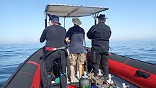
In South Africa, the standard dive boat is a large (6 to nearly 9 m) Rigid Inflatable Boat These are known as rubber ducks。 Power is generally twin outboard motors, which may be two-stroke and smoky, but are increasingly often either four stroke, or the improved two-strokes which are cleaner and quieter.
These boats are generally powerful and fast, but speed is usually limited by sea state. They have a wet ride in a bumpy sea or if there is a crosswind. You travel in your dive suit, quite often with your hood on, and sometimes with your mask on to keep the spray out of your eyes. It has been known for the occasional diver to also use a snorkel to keep out heavy spray in rough conditions. If you wear a hat to protect your head from UV, make sure the hat is a tight fit, and preferably with a lanyard. The combination of cool sea air, wind, spray and high levels of UV can grill you in quite a short time, even in winter. Wear a good blockout or other method of keeping the sun from your skin. Unfortunately some blockouts wash off easily, and others sting your eyes if water gets into your mask and sloshes around a bit. A ski-mask is considered slightly eccentric, but it does the job.
Preparing for the dive.

If using all your own equipment, pack it as you find convenient, and check that everything is in good working order before leaving home. It will be wet on the way home, a waterproof bag or bin will keep the water off the upholstery. If using rental gear, get to the shop early to make sure it fits and works properly. If you are an unusual shape or size you may have difficulty finding a suit which fits well.At some places you will kit up at the side of the road or in a parking lot, and at others there will be changing rooms provided by the dive operator. If this is an issue, find out before the dive, You might want to take along a small mat or towel to stand on while putting on your suit, particularly if the ground is sandy or muddy.Some operators provide facilities at the dive shop for the customers to change into their dive suits and assemble equipment and load the boat before leaving for the launch site. In these cases the heavy equipment is usually loaded by staff, and the divers carry their light equipment to the boat. Where the boat collects divers from a jetty, the divers are expected to get their own kit to the boat. Actual loading will usually be done or supervised by the skipper.You will almost always be expected to wear your dive suit on the boat trip. There is no space to put it on during the ride, which may be wet.
What to take
- A small bag is useful to carry items like sunglasses, sunblock, hat, etc. Cell phones and car keys are usually kept in a waterproof bag or box by the skipper, and stored in the console. Large boxes for underwater cameras or video equipment should be negotiated before the dive, as there may or may not be space for them on board. In summer sunblock is advised for most skin types. UV factor is generally high and reflection from the water grills you from below. A peaked or brimmed hat may help if securely strapped on against the wind generated by boat speed.
- Kit bags for dive gear are not usually carried, but a medium sized soft bag to hold fins and mask, and other dive accessories like DSMB, reel, computer, dive light etc. is OK.
- On a long boat trip a small bottle of water or other suitable rehydration drink is nice to have, specially for after a deep or long dive. Similarly a small amount of high energy food may be welcome after a cold dive. In Cape Town, many dive boats supply a small chocolate bar or other sweet (candy) to each diver after the dive.
- A light waterproof windbreaker jacket is useful if the wind is strong, the weather or water is cold, or the trip is long. This can reduce wind-chill, particularly after the dive if you wear a wetsuit.
- A small emergency supplies (dive saver) kit of spare O-rings, fin strap, etc is acceptable.
What not to take
- Don’t take anything that you do not intend to use on the trip. (emergency equipment excepted).
- Don’t bring anything that must not get wet unless you have a watertight bag or box for it. A towel is usually a waste of time, as it will probably get wet. The same goes for dry clothing.
- Space is limited and must be shared by all. Do not annoy everyone by bringing a huge bin for your kit and fighting with the skipper at boarding time. No-one will have sympathy when you are evicted.
Loading kit and getting into the boat


The boat may loaded before launching, except where the water at the slipway is too shallow, when the boat is not taken out between dives, or when the slipway is not at the same place where the divers will be boarding.Loading of the boat is usually done by the skipper and divemaster. You are usually expected to transport your own equipment to the boat and hand it over to the person who will stow it for the trip. The standard arrangement is to stack scuba sets along a centreline rack, and tie them in place. You will usually sit at your scuba set, so if you want to do pre-dive buddy checks, ask for your gear and your buddy’s to be stowed together.Weight belts and pockets may be stacked on deck or in a box at the front or back of the rack. They are handed out when the boat gets to the site, so be sure you can identify your weights.
Fins and masks are usually stowed by the diver. There are often no special places reserved for this purpose, and fins are generally stowed either behind a handrope along the inner side of the pontoons, or between scuba sets along the rack. Be careful how you do this, as simply stacking them on top of the scuba sets can sometimes result in a fin or two being blown overboard by wind. This can ruin your dive, and is usually expensive. Masks are commonly stored in the foot pocket of a fin. The deck is not a good place for fragile items.Large cameras with strobe arms should be carried in the smallest plastic bin or crate that will hold them. There will often be several divers with camera boxes contending for the same limited storage space. Do not expect special treatment unless you have specifically organised it with the charterer.Some crews will carry your scuba set to the boat, but don’t count on it. If you need help, say so. If you are renting gear from the same organisation that runs the boat, they will usually load it for you. Make sure you can identify your rented gear and that it has all been loaded.
Slipway launches


Slipway launches are standard in the Western Cape
Where launching is from a slipway the procedure is fairly relaxed, and much depends on how far the slipway is from the parking area, and whether there is a convenient jetty.In some cases, usually at low tide, the water may be too shallow to launch the boat loaded with kit, but more often the boat is loaded with most of the dive gear, but not the divers, before launching. The boat is then launched with usually just the skipper on board, and the divers either get in from shallow water or from a jetty, as described above.Sometimes there may be commercial ski-boat fishermen launching at the same slipway. There are exceptions, but the lasting impression is of a mob of hooligans with no respect for anyone. They are generally a law unto themselves, and you will not gain brownie points by pointing out the error of their ways, and are likely to be given a brief introductory course in local invective at no charge.
Getting into the boat will depend on the launch site. In most cases the boat will be launched with only a skipper on board. Divers will board from the jetty or from the water.
Boarding from a jetty
Boarding from a jetty is usually easy, unless the step down to the boat is high. The crew will help where necessary and direct boarding. Follow their instructions. Do not leap down onto the deck, as it may not be designed to take this kind of shock load, and the sound of cracking glass fibre will not bring a smile to the skipper’s face. Also don’t leap down onto the pontoon, as this is likely to be followed by an inelegant face-plant onto the rack of scuba gear. The owners may be more concerned with damage to their equipment than your injuries.
The roll bar at the stern is a good place to hold if you can reach it. The radio antenna, plastic windscreen and engine control levers are not.Try to avoid getting parts of yourself between the boat and the jetty. The pontoons are fairly soft, but the jetty usually isn't, and may be decorated by barnacles and other abrasive material.
Boarding from shallow water
If boarding from standing in the water, try to get in where the water is not too deep, as most divers do not have the agility and upper body strength to boost themselves in without fins or a jump. Ask for help if you need it, but your fellow divers are more likely to be enthusiastic than skillful at pulling you in, Say goodbye to dignity, and hope for a reasonably comfortable landing.
The stern of the boat (blunt end) is usually lower and therefore easier to get into. This is often combined with it being in the shallowest water, so get in and out of the way of the people who have to hold the boat while the rest are getting in.
If you are a gymnast or acrobat you may safely ignore this advice.
座席


Seating is almost exclusively on the pontoons, with your back to the water. This puts you in a position where losing your balance backwards will result in falling into the water, a manoeuvre most divers prefer to restrict to times when the boat is stationary at the dive site. To prevent unscheduled backward rolls, use the foot-straps and hand-ropes provided. As a general rule, sit opposite your scuba set, so you don’t have to move around when kitting up on site.
Occasionally there may be a seat across the stern in front of the motors. This will be the most comfortable place on the boat but may catch more spray in your face. The boat will bounce up and down as it hits waves. Bigger boats less so than small ones, and the part that bounces the least is the stern, so the most comfortable seating is as far back as you can get. This puts you close to the motors, and if they are two-stroke, closest to the exhaust smoke when the boat is not moving. You may not have much choice where you get to sit, but if you have a bad back or other disability which makes a rough ride a problem, mention this to your dive-master or the skipper as soon as possible. You will not be popular if the boat has to stop to re-arrange passengers. With practice it is possible to sit with one foot in a foot-strap (preferably the foot nearer the bow (pointy end)) and ride the bumps with very little effort. It is much like riding a horse, don’t fight the motion, absorb the bumps by relaxing a bit, and you will bounce less. A death-grip on the hand ropes will be exhausting if the ride is long.
Some boats have no footstraps. You will have to find something else to hold onto, or lean into the boat to keep more weight on your feet. Some divers may be seen comfortably sitting on the tubes, riding the waves with no obvious concern as the boat bounces along. They may not even need to hold on. They have done this before.
Moving around in the boat
If possible, don’t move around while the boat is moving, unless asked to trim the boat. You will be expected to sit where directed by the skipper, and unless there is a good reason not to, do as requested. Standing up when the boat is moving and there is nothing to hold onto can result in a fall and possible injury if the boat hits a wave or moves in an unexpected direction. If equipment comes loose under way, shout to the skipper, who will stop if it is safe, so that the equipment can be re-stowed.There may be cables and pipes in places on the deck. These are usually routed through areas where they are reasonably protected, but as a rule don’t stand on them or use them to hold on to. Batteries are often stored in plastic boxes near the transom, to keep the wires short. The lids are not usually load bearing structures, do not use them as steps.
Getting out of the boat

Getting into the water is usually done by a synchronised backward roll – falling into the water alongside your neighbour, neither on top nor underneath. Generally all the divers or a nominated group will roll off together, on a countdown from the skipper or divemaster. It is important to all roll together, as if you do not, the later divers may fall on top of the earlier ones, possibly casing injury or equipment damage. If you are not ready, or are not happy with this procedure, wait until the others are in and the boat is clear of them. The skipper will then let you roll in clear of the others, but you may have to fin a bit to get to them. This can be a problem if diving in a current. Some divers may not wish to backward roll with a large camera setup. 彼らは、水中にいるときにスキッパーにカメラを渡すように頼むことができます。この場合、彼らはボートの近くにとどまり、できればカメラが渡されるまでボートを保持する必要があります。
ショットラインとマーカーブイ

ケープタウンでのダイビングのほとんどは、サンゴ礁または難破船です。ダイバーが正しい場所に降りられるように、ダイビングの前にショットラインで位置をマークするのが通常です。表面にわずかな電流がある場合、ショットラインは風下にドリフトしてたるみを吸収します。この場合、通常、ブイの短い距離の上昇流で水に入り、流れに逆らって泳ぐ作業を最小限に抑えるために、ラインが水を通して見えるとすぐに降下を開始します。ブイまでずっと漂流するということは、流れに逆らって泳ぐ必要があることを意味します。ショットラインはアンカーではありません。ブイラインを引き下げると、ショットが引きずられる可能性があり、背後にいる他のすべての人と同様に、サイトの流れが下がってしまいます。ショットラインが短すぎると、ショットがブイによって持ち上げられてサイトから外れる可能性があるため、多少のたるみが必要です。電流は風下に直接流れない場合があります。それが風によって引き起こされた流れであるときでさえ、コリオリの力はそれを南半球の風向から反時計回りに相殺し、エクマン輸送として知られている効果をもたらします。効果は表面で約45°で、深くなるにつれて大きくなりますが、速度は遅くなります。
ショットライン上に表示するか、ショットラインから離して表示するかを選択できます。サイトがわからない場合は、戻る方法を見つけるのが難しい場合があります。これは通常問題ではなく、ほとんどのケープタウンダイバーは、ダイビングの最後にどこにいても上昇しますが、この場合、DSMBを展開して、自分のブイまたは仲間のブイに浮上させることを強くお勧めします。 DSMBはダイバーの存在を示し、そのエリアのボートがクリアに保たれるようにし、ダイビングボートのスキッパーが顧客が浮上する可能性のある場所を追跡できるようにします。

ボートの通行量が多いエリアでショットラインから離れて浮上する可能性が高い場合、ダイバーは浮上する前にDSMBを携帯して展開することが推奨されるか、必要になる場合があります。ダイバーがDSMBを運ぶ必要があるかもしれない他の場所は、はるか沖合の場所、または海の状態のためにダイバーを見つけるのが難しいかもしれないとスキッパーが考えるときはいつでもです。レクリエーションダイビングの場合、個人用DSMBの色とサイズの選択はダイバー次第です。黄色、オレンジ、赤が最も一般的ですが、明るいピンクも時々見られます。スキッパーに色の特別な意味を明示的に通知しない限り、自分の位置をマークする以外に特別な意味はないと見なされます。適度な距離から見ることができる限り、それがどれほど大きいかは誰も気にしません。反射ストリップ、点滅ライト、あなたの名前もオプションです。
ダイブマスター
ボートに乗っている人もいれば、いない人もいます。地元の人々に対応するボートは、学校に接続されているボートや、一般的に通過する貿易や訪問者に対応するボートよりも、ダイブマスターを提供する可能性が低くなります。誰かに案内してもらうことなくダイビングに自信がない場合は、予約時にそのことを伝え、オプションについて質問してください。
昆布ダイビング
昆布が重い地域では、ダイバーは通常、ダイビング中にSMBを曳航しません。幸いなことに、これらは通常、大きな電流が発生しない場所でもありますが、サージは強くなる可能性があります。ケープタウンの海岸線と沿岸のサイトの多くは、特に大西洋の海岸に重い昆布があります。これらのエリアでは、ダイバーはDSMBを携帯し、ショットラインから離れて浮上するときに使用することをお勧めします。これにより、スキッパーは誰もが浮上している場所を追跡でき、通過するボートは、誰かが気になっている場合にあなたを追い詰めるのを避けることができます。目を光らせておくために。 DSMBは、水面にいるときにボートに信号を送るのにも非常に効果的です。黒いウェットスーツを着た腕よりもはるかに効果的です。これは、ダイビング中に風が強くなり、表面が白い水で途切れ途切れになる場合に特に役立ちます。
ダイビング後、ボートに戻る


ルール1:はしごがない限り、水中でフィンを外さないでください。あなたはあなたを後押しするためにそれらが必要です。ほとんどのゴム製のアヒルは、搭乗はしごを提供していません。ボートはほとんどの場合ダイバーよりも風下に速くドリフトするため、ボートの風上側に搭乗している場合、これはさらに重要です。ボートに近づき、外側のハンドロープをつかみます。常にボートのグリップを維持し、キットを取り外すために絶対に必要な時間だけ放してください。保持していないときにボートが漂流する可能性があります。
いくつかのボートは、腕をすり抜けることができるループを備えた短いグラブラインを提供する場合がありますが、何らかの理由でこれは非常にまれです。さらに一般的ではないのは、クリップを外す前に機器に取り付けることができるクリップ付きのラインです。おそらく、これらのアイテムに対する顧客の要求はありません…あなたの機器は、乗組員または他のダイバーによって船上で持ち上げられます。
推奨される手順は、最初にカメラやその他の緩んだ機器を渡すことです。次に、離陸してウェイトを渡します。これにより、BCを取り外した後にフロートすることが保証されます。他の人がしっかりと握り、ウェイトベルトが非常に速く沈むことを確認するまで手放さないでください。スキューバセットを取り外し、これを乗組員に渡してください。セットを持ち上げるときにセットの下を押し上げ、DVとゲージがハンドロープに引っ掛からないことを確認することで支援できます。マスクとシュノーケルは、都合がよければいつでも手渡すことができます。付属のハンドルをしっかりと握るか、ポンツーンの側面をできるだけ高く手でロープで縛ります。浮力を得るには、できるだけ下に沈んでから、強く上向きにフィンを付け、腕を使ってできるだけ高く引き上げ、ロープまたはハンドルを押し下げながら、上半身をポンツーンに転がします。グリップを内側のハンドルまたはハンドラインに変更し、ボートに足を振ります。誰かがあなたのフィンを外している間ここで立ち止まり、座ってもう一方の足をボートに振り込むと便利かもしれません。優れたフィン、優れた技術、そして適度な強度があれば、このように快適で品格のある搭乗が可能です。この方法は、強風の風下側にある場合、はるかに困難です。

あなたが力を持っていない場合、手順は同様ですが、すでにボートに乗っている乗組員またはダイバーの助けを借りて、主力と彼らがつかむことができるものは何でもあなたを引き込みます。誰かを下品な暴行で非難する前に、彼らがつかむための合理的な代替の場所があったかどうかを検討してください。エレガンスはあなたのサイズと質量に反比例します。スーツの前に太もものポケットがある場合は、ポケットに壊れやすい機器やかさばる機器を入れて搭乗しないでください。サイドポケットは通常問題ありません。

いくつかのボートには、搭乗用のはしごを提供するという新しい傾向があります。 「クリスマスツリー」スタイルは、足にひれを付けて登りやすいため、比較的人気があります。ゴム製のアヒルでは通常、側面に掛けられ、硬い船体のカタマランではトランサムが好まれます。
ダイビング後のボートからの脱出

桟橋に出るのは通常簡単ですが、高い桟橋と干潮によって複雑になる場合があります。それが問題であるならば、乗組員は助けて、指示を与えます。あなたがあなた自身のことをするならば、桟橋から入るのと同じ警告が適用されます。特にボートと桟橋の間に身を置かないことについて。
ケープタウンではビーチに出るのは珍しいですが、比較的簡単です。ビーチを駆け上がるときにボートが傾いた場合は、通常、ローサイドで降りる方が安全で便利です。ハイサイドにいる場合は、スペースができるまで待ってローサイドに移動します。そうしないと、負荷が取り除かれるとボートがフロップバックするため、ハイサイドがローサイドになる場合があります。あなたが間違った場所にいて、ボートがあなたの上に転がり落ちた場合に備えて、ハイサイドでキットを降ろそうとしないでください。これは、ボートが波から完全に離れていない場合に特に発生する可能性があります。
見る

ケープ半島とフォールスベイの海域は、涼しい温帯の海洋生物の繁栄する生態系を支えています。それらの多くは南アフリカやさらに小さな地域に固有であり、魚は熱帯の海で見られるほど見事な色ではありませんが、多くはリーフを覆う非常に鮮やかな無脊椎動物の間で自分自身をカモフラージュするために非常にカラフルです。
海洋生物
この地域でのダイビング中に見ることができる海洋動物は多岐にわたり、ダイバーにとって可能な限り最も素晴らしく壮観な出会いがいくつか含まれています。
クジラとイルカ
フォールスベイはホエールウォッチングで有名な目的地です。毎年多くのミナミセミクジラが湾を訪れますが、ダイビング中にミナミセミクジラを見るのは珍しいことです。フォールスベイで時折見られる他のクジラ種は、ザトウクジラ、ニタリクジラ、シャチであり、これらはダイビング中に見られる可能性がさらに低くなります。ダイビング中にクジラに遭遇する運が良ければ、その巨大なサイズはダイバーが意図せずに怪我をするのを容易にするので注意してください。
イルカはフォールス湾や大西洋の海岸でも見られます。マイルカは数百から数千の学校を時々訪れますが、ダイバーにはあまり見られません。ハラジロカマイルカは少人数のグループで移動する傾向がありますが、安全停止場所でダイバーを調査する可能性も高くなります。他の種が時々訪れますが、ダイバーが水中で見た座礁事件でより注目されています。
サメ

フォールスベイは、ダイバーとしてはめったに見られませんが、ホオジロザメを見るのに最も信頼できる場所の1つであり、他のいくつかのサメ種も頻繁に見られます。セブンギルまたはカウシャークはいくつかの場所でよく見られますが、ガリーシャークとキャットシャークはより広く見られます。カラフルなモヨウウチキトラザメからはるかに大きなパジャマサメまで、地元には4つの一般的なキャットシャーク種があります。他の遠海サメは通常、南半島沖の沖合の「ブルーウォーター」ダイビングでのみ見られ、いくつかの大きな遠海魚種が同様の旅行で見られます。
遠海魚

一部のダイビングサイトでは、ブリの大きな群れが時折見られます。予測できない場合には、ダイバーは幸運にもマンボウ、ミナミセミクジラ、ザトウクジラ、バンドウイルカ、ハラジロカマイルカを見ることができます。
地元のラインフィッシング産業の要である一般的なスヌークは、非常に恥ずかしがり屋で、大量の群れをする習慣があるにもかかわらず、ダイバーにはほとんど見られません。
ペンギンとアザラシ

フォールスベイにはアフリカペンギンのコロニーがありますが、ダイビング中にそれらを見るのは非常に珍しいことです。一方、ケープオットセイはダイバーに好奇心が強く、恐れることなく、フォールス湾と大西洋の海岸の両方で非常によく見られます。ほぼ確実に見られる場所がいくつかあります。
サンゴ礁の魚

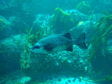


この地域のサンゴ礁の魚はフォールス湾で最も多様であり、密猟は依然として発生しており、執行は非常に信頼性が低いものの、数十年にわたって法律によって保護されている海洋保護区の制限区域で最も一般的です。珊瑚礁の魚のほとんどはある程度カモフラージュされています。至る所にあるホッテントット鯛、銀色のフランズマダム、スティーンジーのように、多くは銀色の灰色でカウンターシェーディングされています。他の種は、白い切り株、シマウマ、白いスティーンブラなど、昆布のプロファイルを分割するのに役立つ可能性のある垂直バーまたは暗いパッチを持っていますが、小さな種の多くは不可解な色であり、環境に非常によく溶け込んでいます。これらは一般的に、ほとんどの時間をサンゴ礁またはその近くで過ごす魚であり、それらの色は通常、生息地の典型的な色を示しています。これらには、さまざまな固有のイソギンポ、いくつかのブレニーとハゼ、フィンガーフィン、ケープトリプルフィン、スムーススキンスコーピオンフィッシュ、2種のウマ、ヨウジウオ、ロックサッカーが含まれます。非常に一般的なローマ人、あまり一般的ではない赤い切り株や赤いスティーンブラなど、かなり目に見える赤い魚もいくつかあります。言及されている魚のほとんどは孤独であるか、小さな群れで見られますが、かなり多くの群れをする傾向があるストリープやマースバンカーもあり、ホッテントットの適度に大きな群れが非常に頻繁に見られます。ガルジョーンはかなりまれで、通常、波の動きが多いサンゴ礁の上に小さなグループで見られます。似たような外観のケープナイフジョーは、岩の間のより深くて目立つサンゴ礁を好みます。 Seacatfishは恥ずかしがり屋で、日中は隙間や穴で過ごす傾向があります。
砂地

砂地には特徴的な魚も生息しており、数種のエイ、ソール、ホウボウ、フグ、日中は珍しく恥ずかしがり屋のビークドサンドフィッシュなどがありますが、夜になると多くの場所で見られることがあります。隠れている砂から出てきて、自由に泳ぎ回っています。いくつかの種のクリップフィッシュも砂に生息しており、さまざまな種が異なる密度の砂を好み、細かい砂を好むものはよりヘビのような体を持ち、粗い砂のものはより頑丈です。彼らの体のパターンは砂の種類にも一致する傾向があります。
サンゴ礁の無脊椎動物
底生無脊椎動物は、この地域のサンゴ礁に明るい色のほとんどを提供し、種の分布は、深さや水温と同様に、さまざまなサブ地域の特徴です。多様性は大きく、深さと地理的位置の両方で、支配的なサンゴ礁の被覆には大きなばらつきがあります。特徴的なサンゴ礁の生活はケープ半島の東側と西側でかなり異なり、これは南西ケープとアガラス岬の沿岸生物地域の境界として認識されています。垂直方向の帯状分布もさまざまなバイオリージョンの特徴であるため、さまざまなサイトで見られるものに非常に顕著な違いが生じる可能性があります。
リーフの特定の領域は、特定の生物種、たとえば、一般的な羽の星、赤い胸のナマコ、モーブのナマコ、赤い餌、またはウニによって支配される傾向があります。表面積の一部は優勢な生物によって覆われています。ほとんどのサンゴ礁には向きやしわに応じて生息地が広く、無茎性の生物は可能な場所に生息しているため、これは多様性がないことを意味するものではありません。これはプランクトンの幼生の場所に大きく依存します。足場を見つける。
ミッドウォーター
遠海性無脊椎動物は、そのほとんどが浮遊性であるため、いつどこで見ることができるかについては予測できません。それらには、数種のクラゲ、数種の有櫛動物、数種の散発的なクダクラゲ、サルパ、プテロポッド、そして小さすぎて簡単に気付かないものがたくさん含まれています。イカもいますが、とても恥ずかしがり屋で、日中はめったに見られません。
この地域で記録されたスポンジ、刺胞動物、有櫛動物、扁形動物、分節虫、節足動物、軟体動物、bryozoans、echinoderms、ascidians、魚、海鳥、海洋哺乳類は、 ウィキペディア:ケープ半島とフォールスベイの海洋動物のリスト。これらの多くは、レクリエーションダイバーに見られる可能性があります。
海藻
昆布の森
昆布の森はケープタウンで最も明白な海藻です。局所的に、時には近接して見られる3つの属があります。最も明白なのは海の竹です。これは完全に成長すると表面に到達し、上部にガスで満たされた空洞を備えた太い茎を持ち、光に最大限にさらされるように葉を表面近くに保ちます。この昆布は大西洋の海岸で非常に一般的であり、フォールス湾の両側にも見られますが、より一般的には湾の南部に向かっています。
小さいスプリットファン昆布は、より深いサンゴ礁で成長し、表面に到達しません。柄は短く、ガスで満たされた空洞がないため、葉は暗い海に沈んだままです。この昆布は、海の竹よりも深い水域にあり、地理的範囲も同じです。
3つ目は、長い細い茎のクラスターを持ち、長い葉と多数の小さなガスで満たされた膀胱を備えた膀胱昆布で、昆布を直立させ、葉を表面に保ちます。この昆布はフォールス湾には見られず、主にロベン島の近くで見られます。
藻類の芝生と昆布の森の下層植生。
昆布の葉の下では、十分な光がある浅い地域のサンゴ礁は、さまざまな海藻の下層植生で覆われている可能性があり、特定の種は、利用可能な光の量や水の量など、さまざまな要因によって異なります移動。原則として、緑と茶色の海藻は浅い場所で見られ、赤はより少ない光で生き残ることができるため、より深くなります。最も深いのはしばしば赤い珊瑚藻で、岩の上面に密な芝を形成する可能性があります。
サンゴモを覆う。
波が強すぎたり、光が薄暗すぎて他の海藻が生息できない場合でも、覆われたサンゴモは足場を見つけて繁殖する可能性があります。これらの紅藻は、サンゴ礁にかなり固くてしっかりと付着した地殻を形成し、「ピンクの絵の具」としても知られています。これは、その外観の公正な説明です。海藻のようには見えません。それらの範囲は、十分な光が透過し、サンゴ礁に他の居住者がいない地域のほぼどこにでもあります。
この地域では、約57の緑藻、49の褐藻、240の紅藻が記録されています。 ウィキペディア:ケープ半島とフォールスベイの海藻のリスト.
難破船

ザ・ ケープオブストームズ そしてその 喜望峰 どちらもこの地域の伝統的なアペラシオンであり、正当な理由があります。天候が非常に悪い場合があり、海岸は非常に露出しており、保護された港はほとんどありませんが、世界の偉大な海上貿易ルートの1つにおける重要な中間地点でもあります。その結果、地元の海岸線に沿って記録された難破船の数は膨大な数に上ります。
これらの残骸の多くは発見されたことがなく、他の多くは認識できないほど壊れているか、砂で覆われているか、テーブルベイの場合は埋め立てプロジェクトに埋葬されていますが、いくつかはダイビング可能な場所にあり、条件が適切な場合はダイバー。
潜水可能な難破船の深さは3メートルまたは4メートルから65メートル以上までさまざまであり、状態は木や鋼の半分埋まった破片から、元の構造と外観のほとんどを保持し、まるで深さから迫り来る船までさまざまです。砂底を航行します。
ほとんどは、浅瀬の海藻から深海の多種多様な色とりどりの無脊椎動物に至るまで、サンゴ礁の生物でひどく覆われています。また、さまざまなサンゴ礁の魚を保護し、予測できない機会に遠海魚が訪れる可能性があります。事実上、それらは人工リーフとして機能し、その結果、アーティファクトとして特に興味を持っていないダイバーにとっても一般的に興味があります。
地形的特徴
サイトの多くは、尖塔、峡谷、洞窟、スイムスルー、オーバーハングなど、興味深い地形的特徴を特徴としています。これらの特徴は、海の景観への貢献だけでなく、サイトで利用可能な生息地に大きな変化をもたらし、その結果、高い生物多様性と興味深い地形との間に強い相関関係があります。サイトの一般的な地形的特徴は地質に依存し、花崗岩のサイトは堆積性の砂岩や頁岩のサイトと即座に区別できます。花崗岩の岩は通常、同じ岩の露頭にコアストーンの岩として丸みを帯びて積み重ねられ、多くの場合、それらの間に白い石英砂があり、または徐々に傾斜した基盤として使用されます。さまざまなサイズの岩のこれらのスタックは、しばしば頂点を形成し、かなりランダムな方向にガリーを形成し、それらの間のオーバーハングと穴は、ダイバーが泳ぐのに十分な大きさである場合があり、壮大なサンゴ礁構造を提供します。
砂岩層は、局所的な傾斜と走向によって支配される地層を生成する傾向があり、これはより予測可能です。ただし、小規模な詳細では、花崗岩の領域よりも小さな穴、隙間、棚、尾根が生成される傾向があり、これらは原則としてそれほど壮観ではありません。例外があり、砂岩礁が非常にゴツゴツしていて、通常、傾斜は非常に急ですが垂直ではなく、海岸線は非常に急ですが、傾斜とは異なる平面にあります。
幸いなことに、「上記のように、以下のように」という古い口述は非常によく当てはまり、隣接する海岸線の風景を観察することで、サンゴ礁の特徴をかなり確実に予測できます。この規則の主な例外は、水面上に砂岩があり、下に花崗岩があるスミツウィンケル湾の南です。
この地域の地質構造と歴史は、 ウィキペディア:ケープ半島とフォールスベイの海洋地質
読んだ
ケープタウンの海域の生態に関する参考書:
から SURG、特にこの地域のダイバー向け: ケープタウンの厳選されたダイビングショップやブックショップから、SURGから直接入手できます。
- ジョーンズ、ジョージナ。 2008年。 ケープ半島の海洋動物のフィールドガイド、SURG、ケープタウン。 ISBN 9780620416399
- Zsilavecz、Guido。 2005年。 ケープ半島とフォールスベイの沿岸魚、SURG、ケープタウン。 ISBN 0620342307
- Zsilavecz、Guido。 2007年。 ケープ半島とフォールスベイの裸鰓類、SURG、ケープタウン。 ISBN 0620380543
他の出版社から、そしてより一般的なアプリケーションから:
- Branch、G。and Branch、M。1981、 アフリカ南部の生きている海岸、Struik、ケープタウン。 ISBN 0869771159
- ブランチ、G.M。グリフィス、C.L。ブランチ、M.Lおよびベックリー、L.E。 2010年、 二つの海–アフリカ南部の海洋生物へのガイド、デビッドフィリップ、ケープタウン。 ISBN 9781770077720
- ゴスライナー、T.1987。 アリカ南部の裸鰓類、Sea Challengers&Jeff Hamann、モントレー。 ISBN 0930118138
- Heemstra、P。およびHeemstra E. 2004、 南部アフリカの沿岸魚、NISC / SAIAB、グラハムズタウン。
- エド。スミス、M.M。およびHeemstra、P。2003 スミスの海の魚。 Struik、ケープタウン
- ステゲンガ、H。ボルトン、J.J。アンダーソン、R.J。 1997年、 南アフリカ西海岸の海藻。ボーラス植物園、ケープタウン。 ISBN 079921793X(かなり技術的)
ケープ半島の地質に関する参考書:
- コンプトン、ジョンS. 2004、 ケープタウンの岩と山。二階建て、ケープタウン。 ISBN 1919930701

![]()